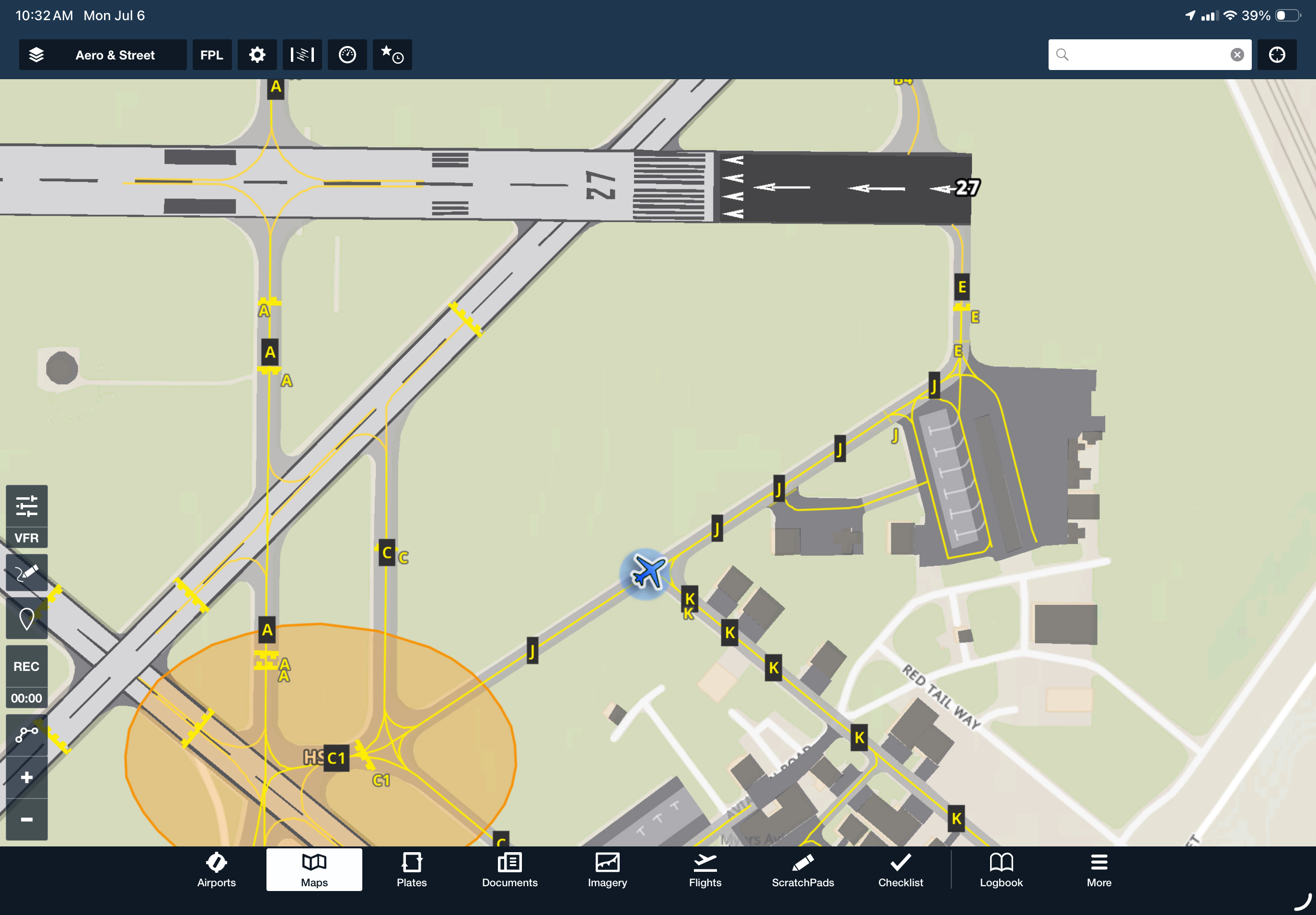
View enhanced airport diagrams directly on the Aeronautical Map layer at more than 1,200 airports worldwide. Zoom in to display additional ground detail, including taxiway centerlines, hold short bars, tie-down areas, and gate labels, helping you plan your taxi route and follow ATC ground instructions more easily.