Instantly declutter the map by filtering airports, airspace, airways, ARTCC boundaries, terrain, and roads directly on the Aeronautical Map layer. In addition, dynamic airspace altitude labels are now always visible along airspace boundaries.

Instantly declutter the map with filters for airports, airspace, terrain, and more directly on the Map Layer.

Instantly declutter the map by filtering airports, airspace, airways, ARTCC boundaries, terrain, and roads directly on the Aeronautical Map layer. In addition, dynamic airspace altitude labels are now always visible along airspace boundaries.
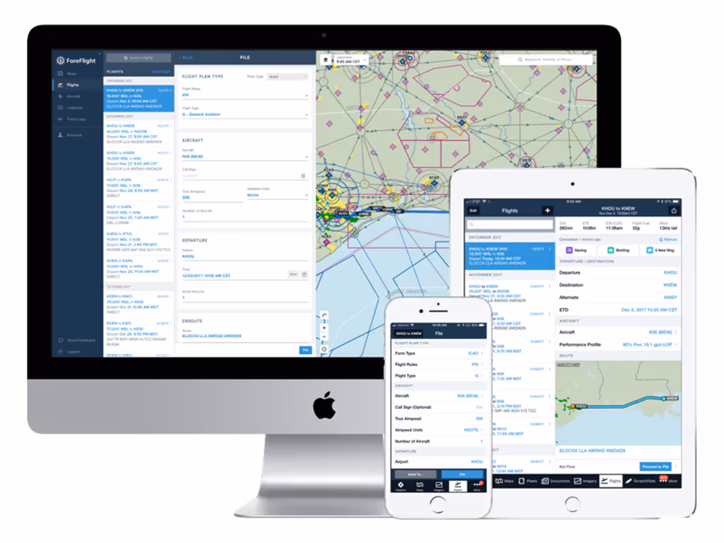
ForeFlight saves you time by automatically populating most of your planning details into the flight plan form.
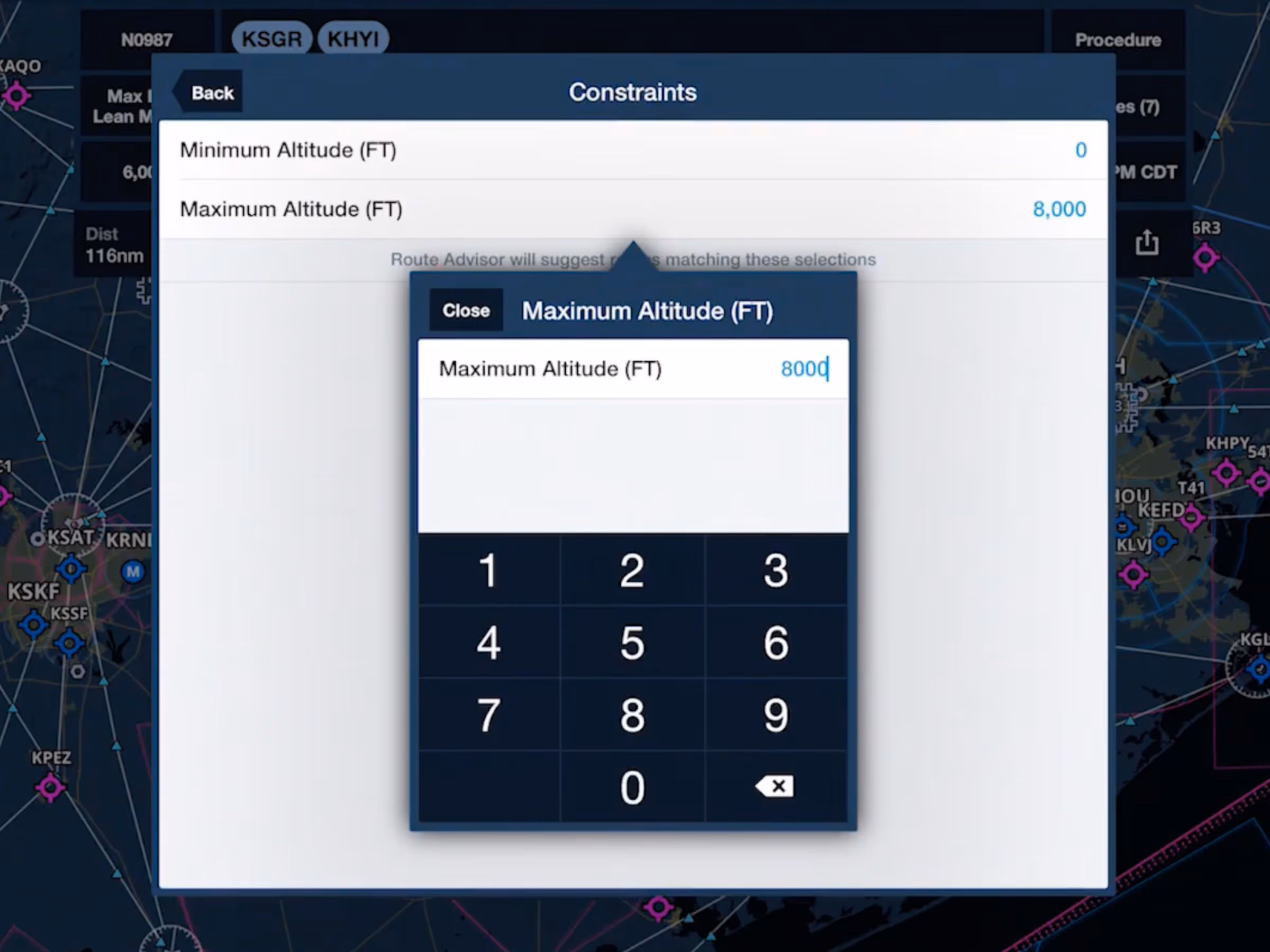
Graphical Route Advisor now supports user-defined minimum and maximum route altitudes.

File with ForeFlight and stay informed of flight delays with Expected Departure Clearance Time (EDCT).


