
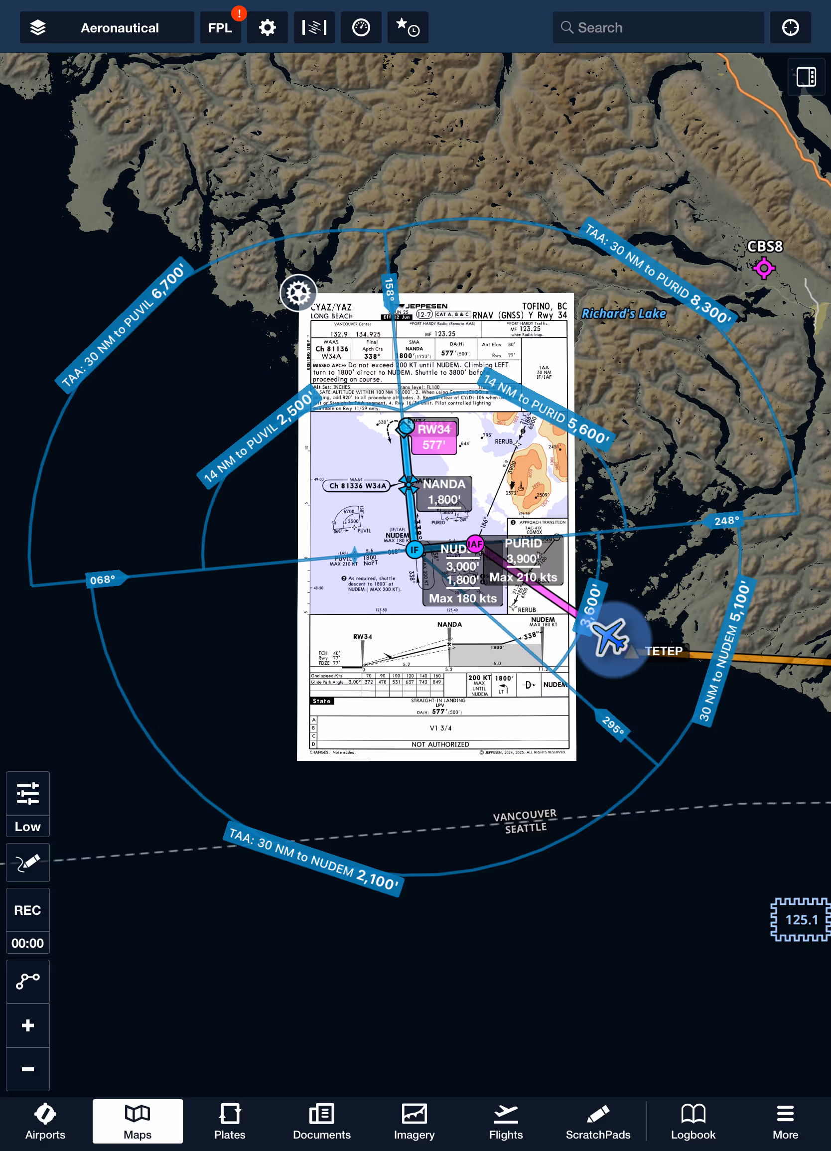
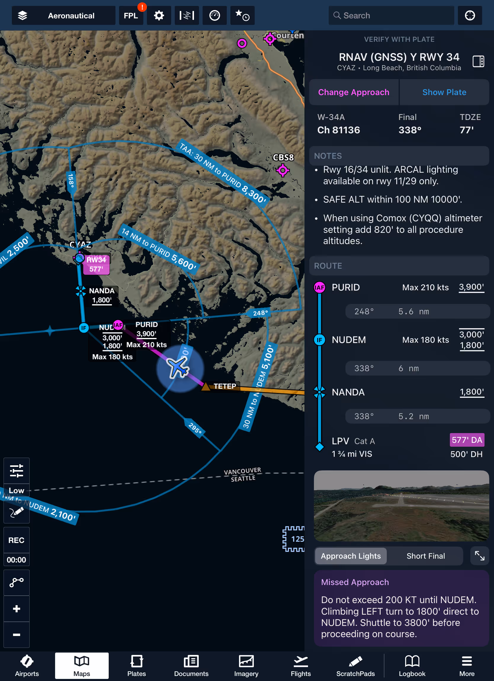
Easily find your approved descent altitudes on supported instrument approaches with TAAs now drawn directly on the map. Transition seamlessly from an enroute segment to the approach environment with minimal flipping between tabs. Add an instrument approach from Procedure Advisor to get started with Dynamic Procedures and access associated TAAs.
.avif)
.avif)


