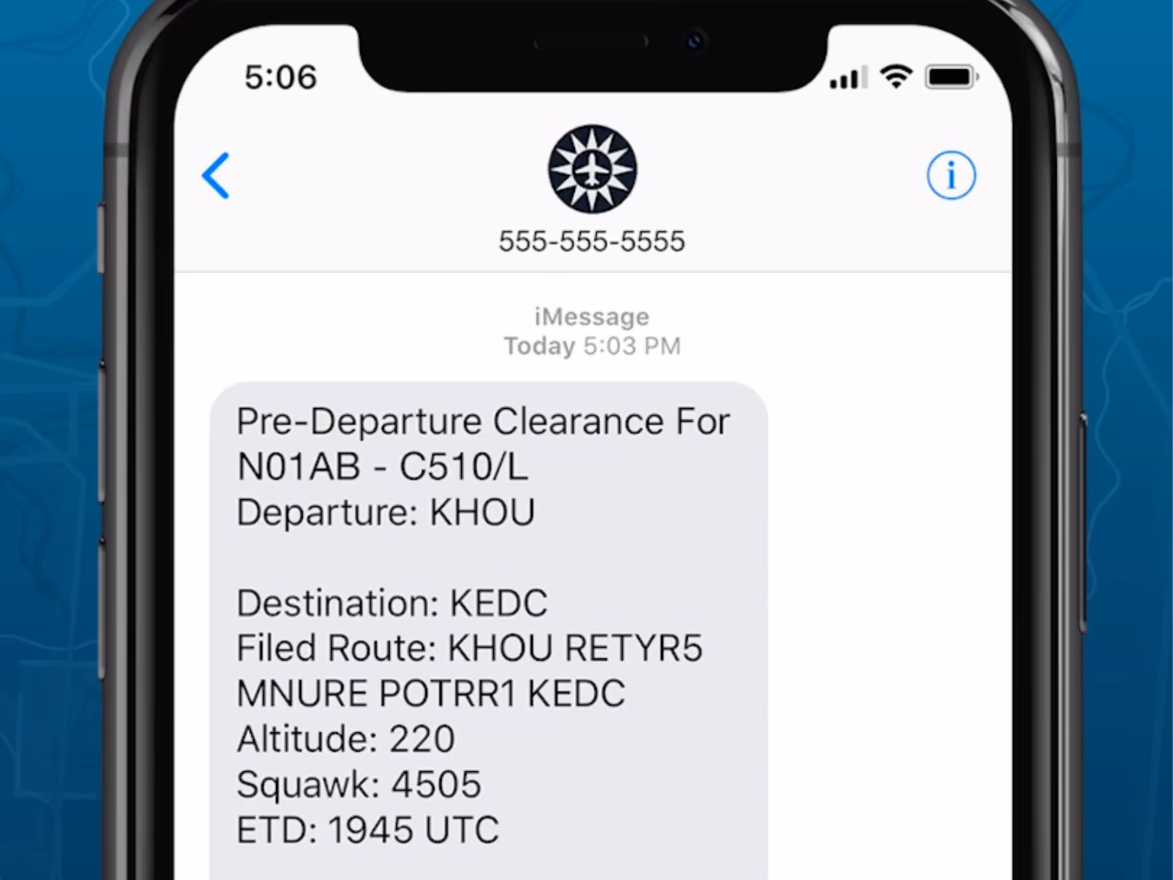
Pre-Departure Clearance (PDC) & D-ATIS Support
- ForeFlight now delivers your IFR clearance and ATIS via email and text message at over 70 major U.S. airports, simplifying your preflight workflow so you can get in the air faster. Register your aircraft to receive PDC by signing into ForeFlight’s website and viewing your aircraft profiles, or email team@foreflight.com.
- ForeFlight displays PDC badges throughout the app next to airports that support the service and next to aircraft that you’ve registered for PDC.
- In addition to sending the current D-ATIS via text and email, ForeFlight also displays the ATIS for all supported U.S. airports alongside the METAR on all Airport views for Premium customers.
- PDC and D-ATIS through ForeFlight are available at no extra charge with Premium and Business Performance subscription plans. Visit foreflight.com/pdc to learn more.
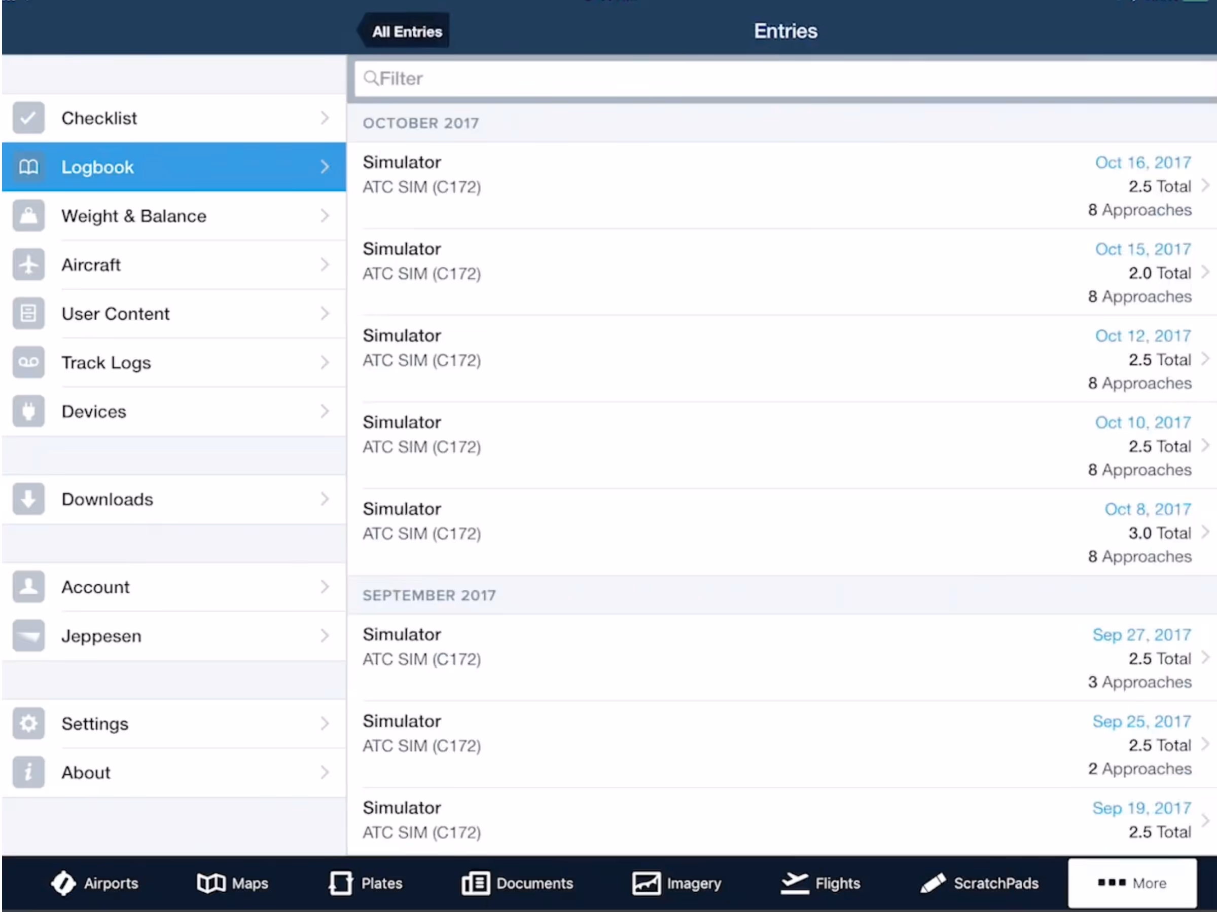
Simulator Support in Logbook
- ForeFlight Logbook now provides full support for flight simulators, making it easier for you to log time and update flight currency with an FFS, FTD, BATD, or AATD.
- Simulated flight time, approaches, and landings logged with a simulator appear in Logbook reports and count towards currency requirements for the simulated aircraft type. Visit foreflight.com/10-4 to watch our tutorial video about the changes.
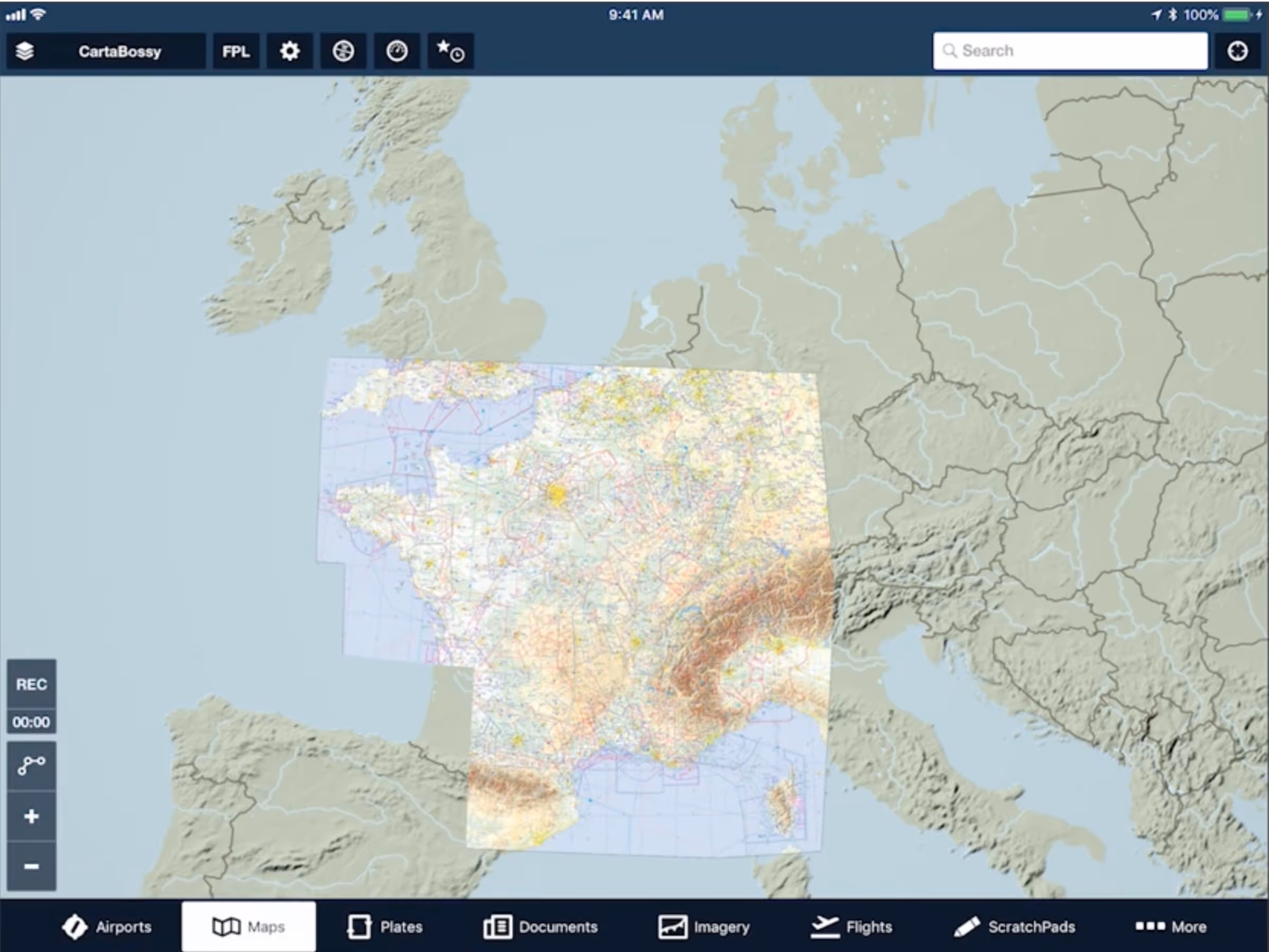
Additional Charts for France & Switzerland
- All European subscribers can now download AIPs for Switzerland and France, which include enroute charts, instrument approach charts, VFR approach charts (France only), airport diagrams, and documents, in addition to the Jeppesen VFR and IFR data already available.
- Enhance your VFR flying with a range of optional add-ons for both countries, available on ForeFlight’s website:
- IGN’s VFR ICAO chart (France)
- Skyguide’s VFR Guide (Switzerland)
- SwissTopo’s VFR ICAO chart (Switzerland)
- DFS VFR charts (North-East France & Switzerland)
- Cartabossy’s VFR weekday and weekend charts (France & Switzerland).
- Jeppesen VFR procedure charts (formerly known as Bottlang) are also available for both countries.
- ForeFlight already provides advanced flight planning capabilities for France and Switzerland, including fast autorouting and EUROCONTROL route validation, IFR and VFR flight plan filing, and helpful flight plan notifications like EUROCONTROL slot allocation messages, flight suspension and de-suspension notices, and calculated takeoff time (CTOT) messages caused by flight plan delays.
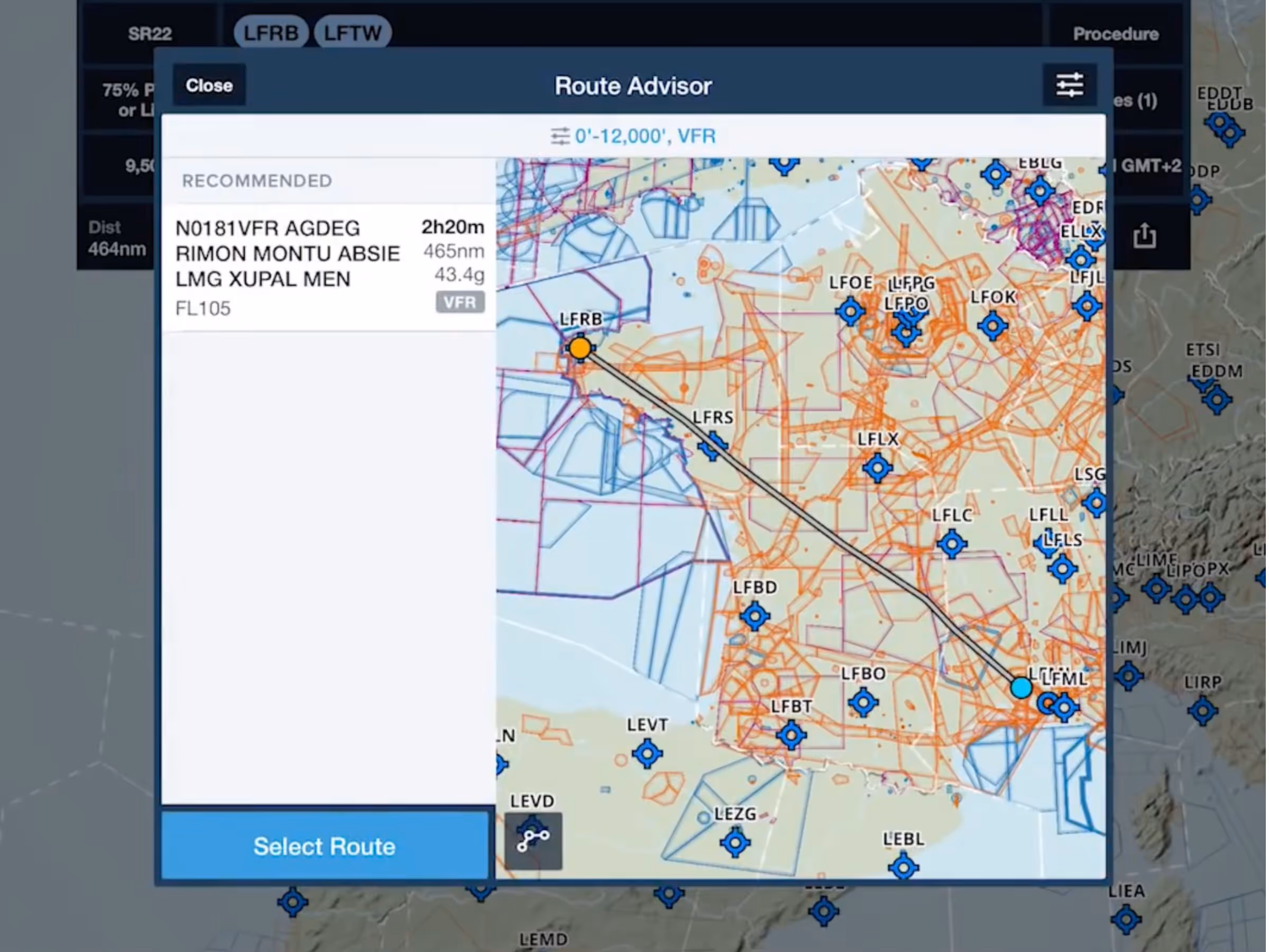
VFR Autorouting in Europe
- Route Advisor now generates VFR route suggestions for European subscribers, simplifying VFR flight planning.
- The VFR generated routes comply with standard AIP guidelines for VFR flights, such as keeping leg times below 30 minutes each, avoiding class A airspace, and placing waypoints on or near FIR boundaries to simplify border crossings.
- ForeFlight supports planning and filing VFR flight plans in all EUROCONTROL-administered countries.
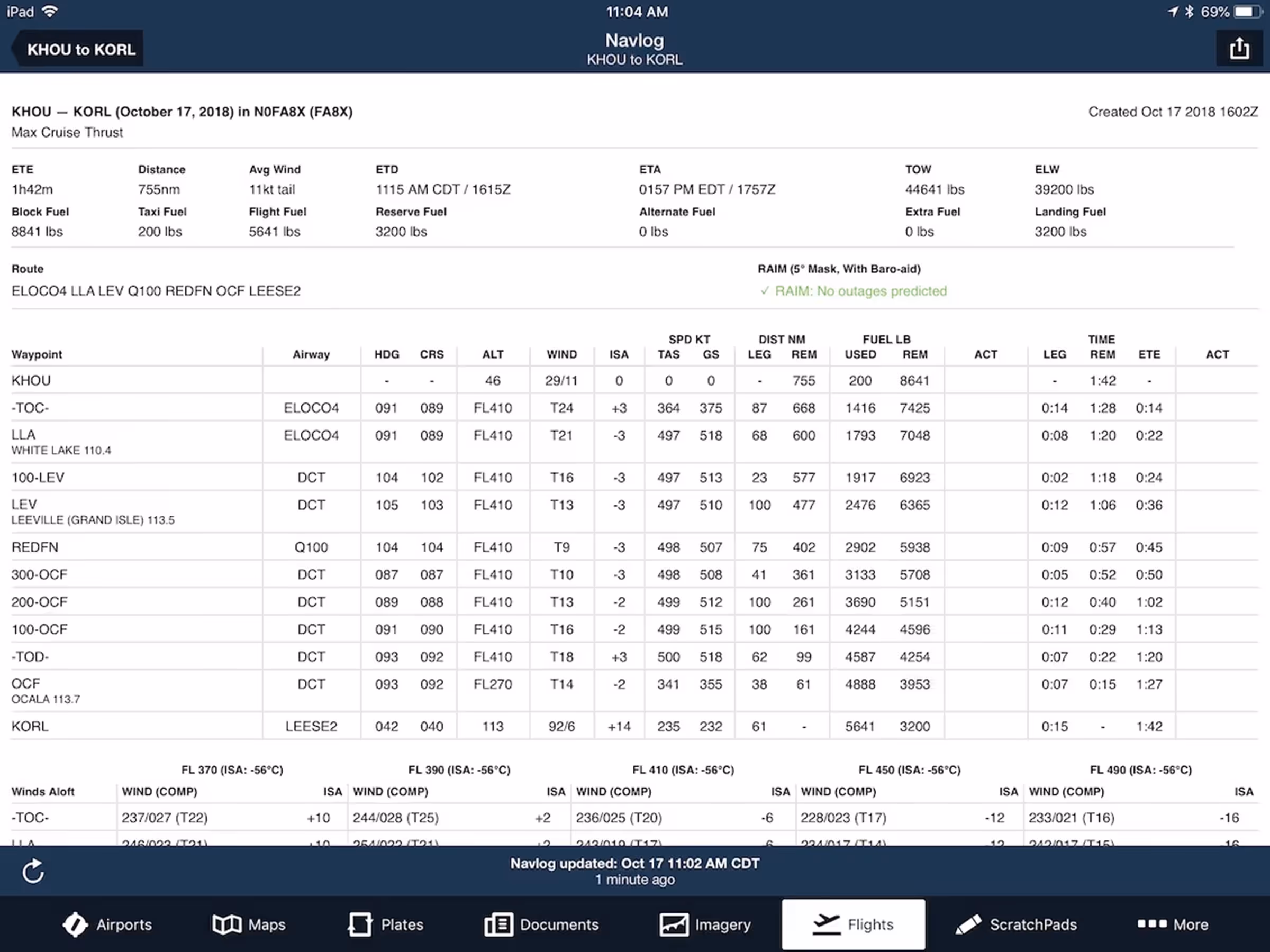
Improved Navlog & Briefing Views
- The app navigation tabs along the bottom of the screen are now available while viewing the Navlog and Briefing, allowing for faster inflight access.
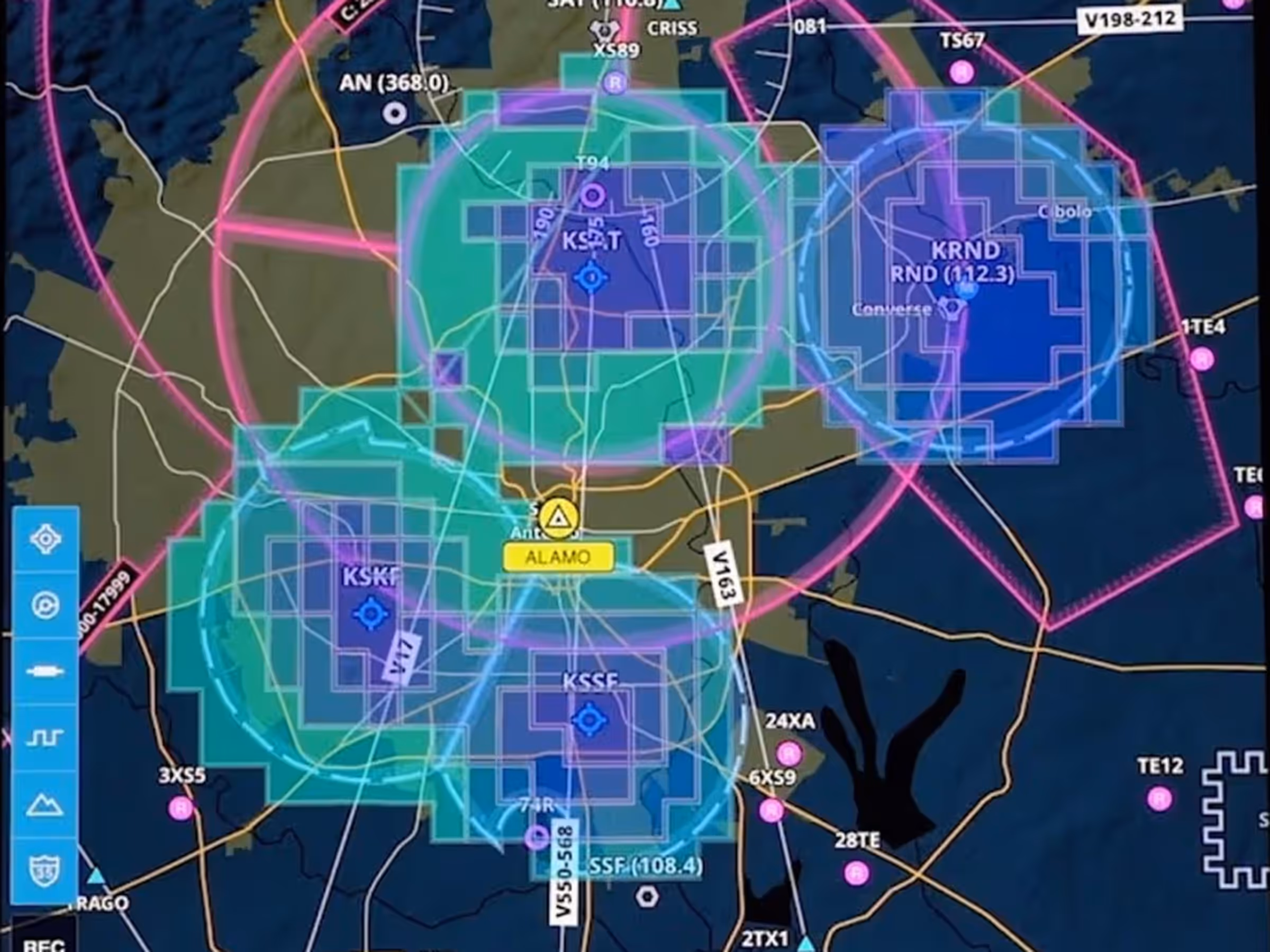
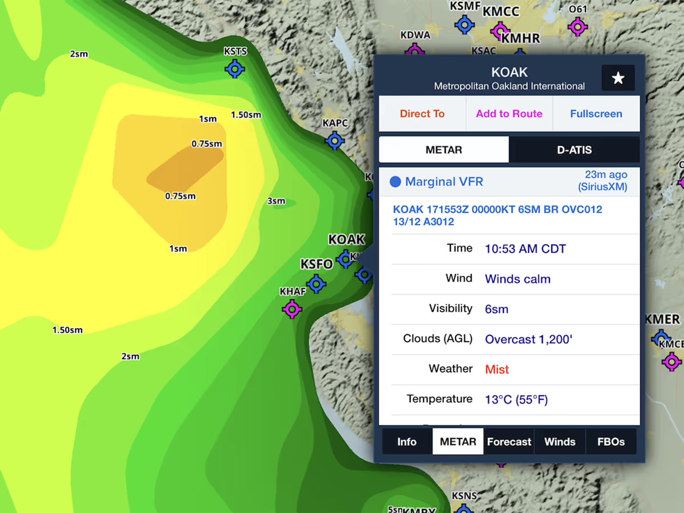
SiriusXM Surface Visibility
- Customers who fly with a SiriusXM-supported device, including the SXAR1 and Garmin’s GDL 51 and 52, can now access the Surface Visibility layer from the layer selector.
- See near-term forecasts of surface visibility that use colors to indicate distances ranging from 10 to 0 statute miles.
iPhone XS Max Support
- ForeFlight now supports the iPhone XS Max at its native resolution.
Map & Navigation Enhancements
- Tap on SID/STAR procedure bubbles in the Route Editor to find the new “Show Plate” action, which will open the plate in the Plates view or overlay it on the map if it supports geo-referencing and you have an Essential subscription or higher.
- You can now display multiple user content files on the map at once by selecting them from the Layer Selector, including .mbtiles user charts and .kml user map layers. Visit foreflight.com/user-content for more information on how to create and use these files.
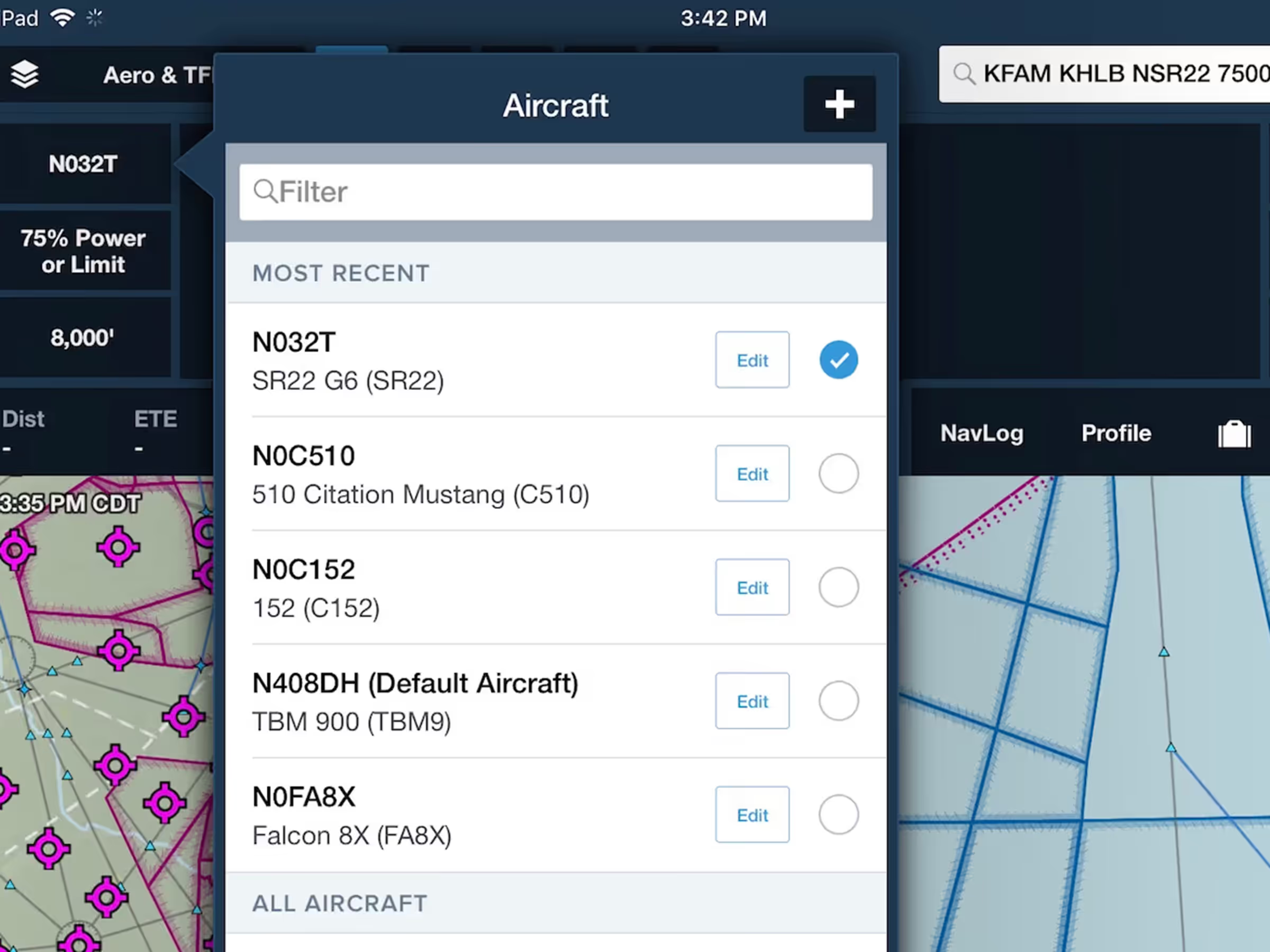
Recent Aircraft List
- ForeFlight now puts your five most recently-used aircraft profiles at the top of the aircraft list, making it easier to access and edit the aircraft you fly most often.
- The “Most Recent” section appears in all places where you can access your aircraft, including More > Aircraft and the aircraft selectors on Maps and Flights.
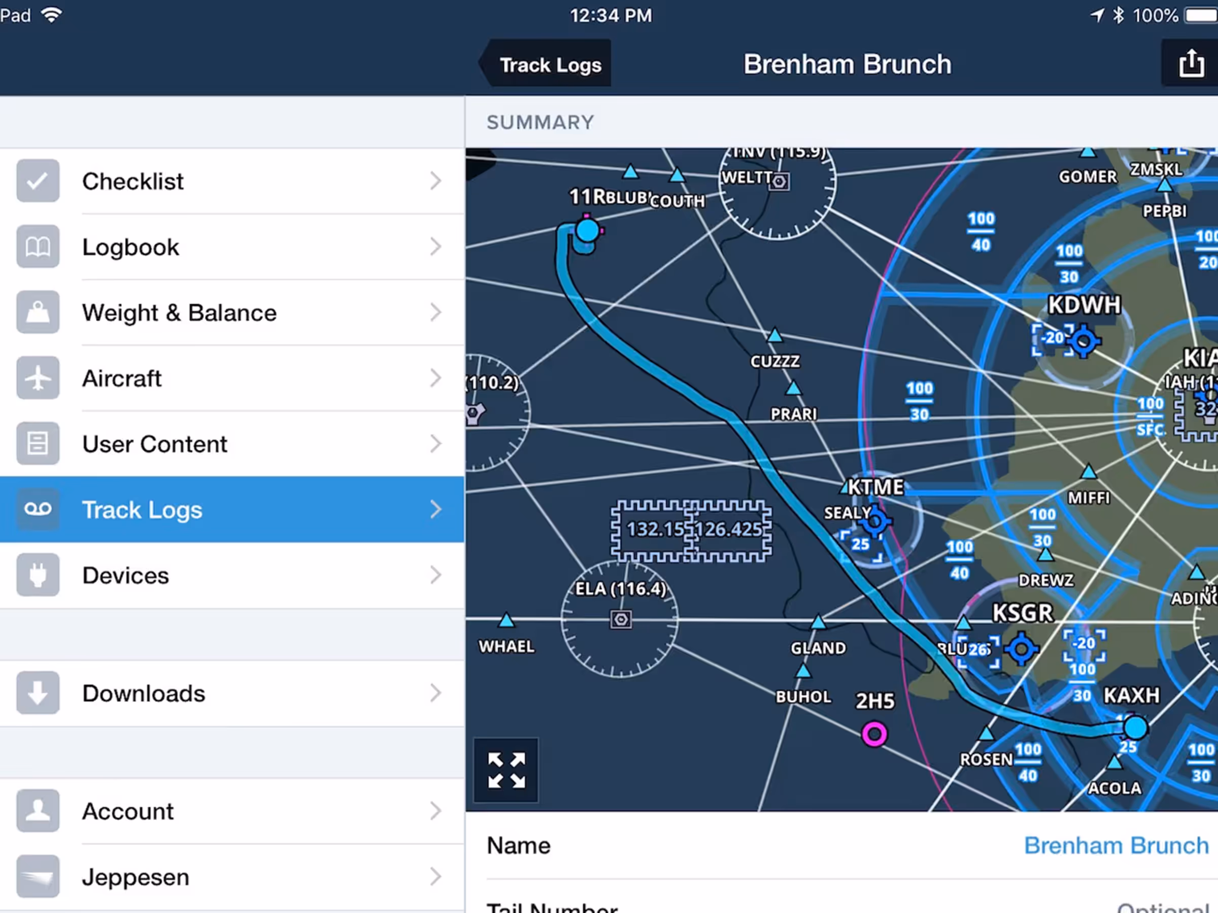
Integrated Maps in Track Log View
- View your recorded flight track on an interactive map inside the app. The Map shows the track on top of ForeFlight’s Aeronautical Map layer, including embedded airport diagrams so you can examine your taxi movements.
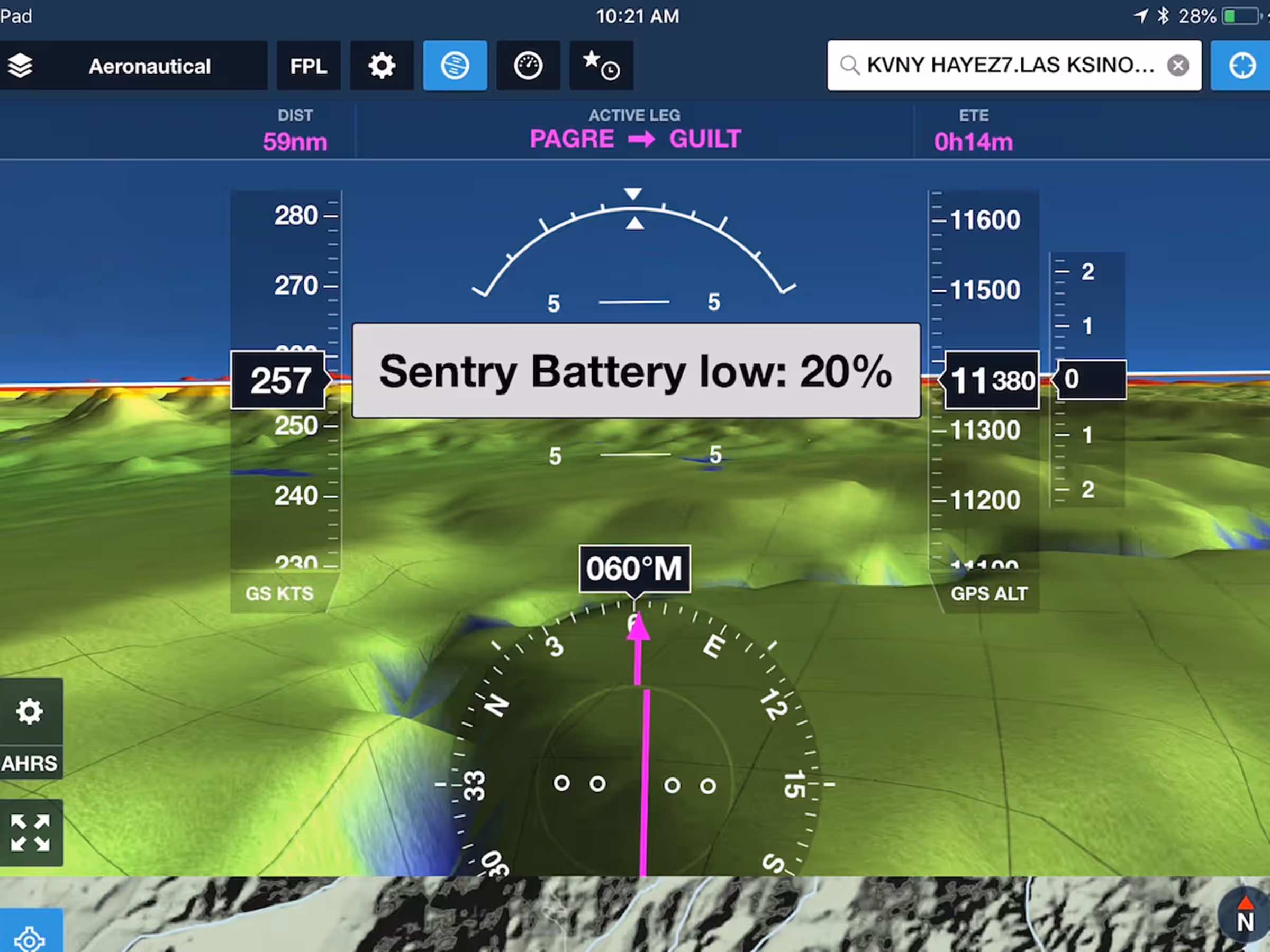
Low Battery Alert for Connected Portable Devices
- ForeFlight will alert you with a visual and audio warning when a portable device’s battery level reaches 20%, giving you ample time to supply power before it runs out.
- The alert is currently provided for Sentry, Stratus, all supported Garmin portables, and SiriusXM’s SXAR1.
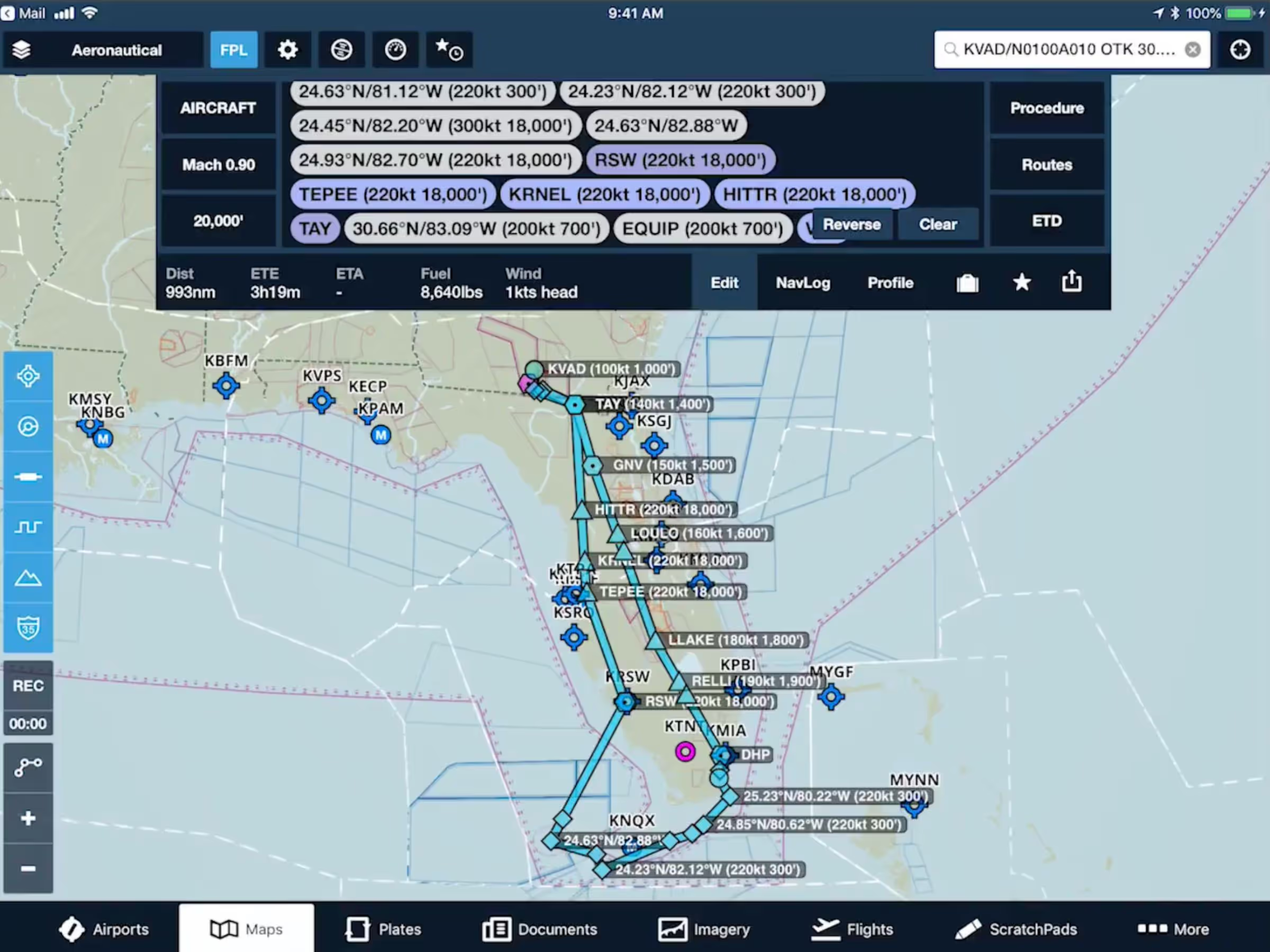
Military Flight Bag .CRD Support
- ForeFlight Military Flight Bag now offers an incredible integration for the military aviator: import your .CRD flight plan files from mission planning systems like JMPS, CFPS, and PFPS.
- View imported flight plans directly on the map, including speed and altitude notes attached to waypoints, and overlay .CRD routes onto JOG, TPC, ONC, and RANGE charts in ForeFlight for extended mission planning capabilities.
- Import .CRD files via email, AirDrop, and iTunes for added flexibility in all operational environments.
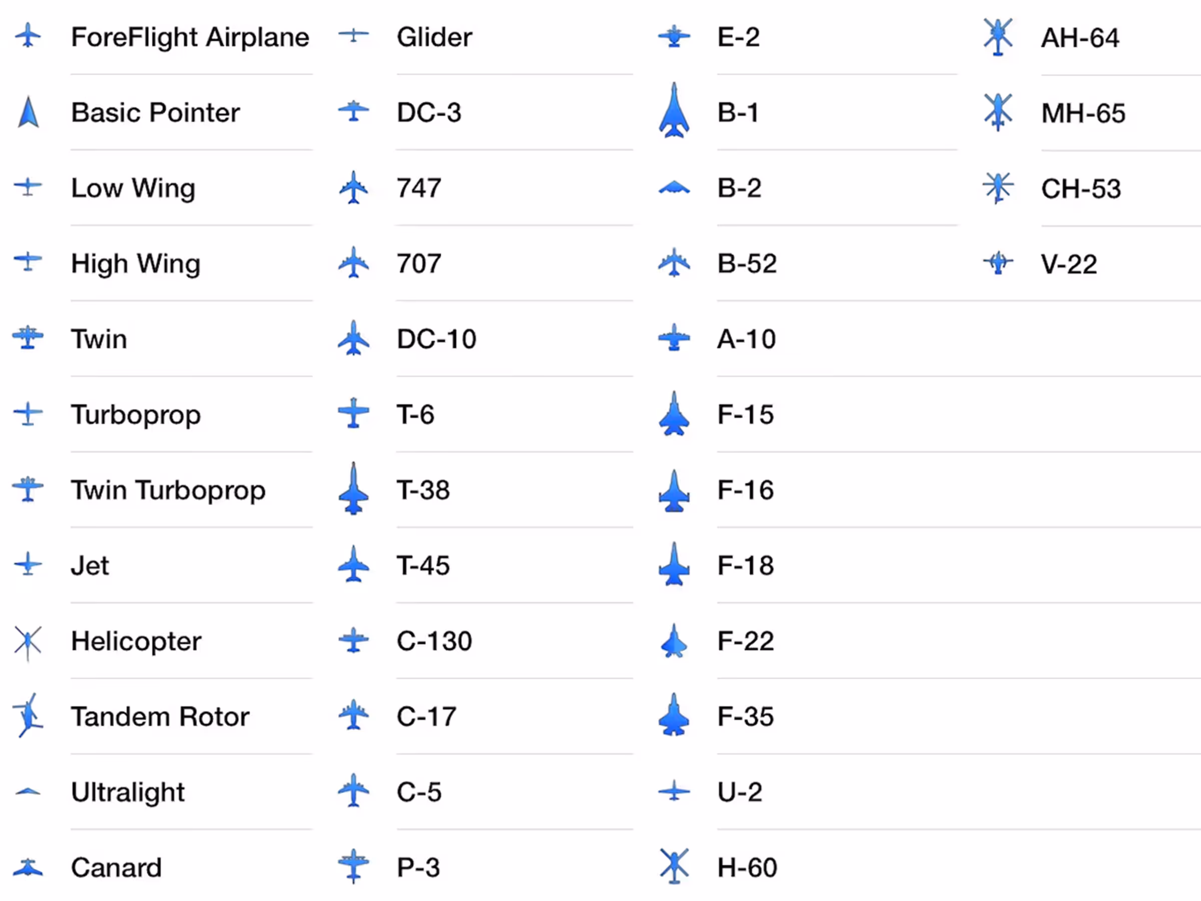
New Current Location Markers
- Customize your inflight experience with new icons for dozens of military airplane and helicopter types: B-1, B-2, T-6, C-130, A-10, F-15, U-2, AH-64, H-65, and many more.
- Find the new icons in More > Settings > Current Location Marker.