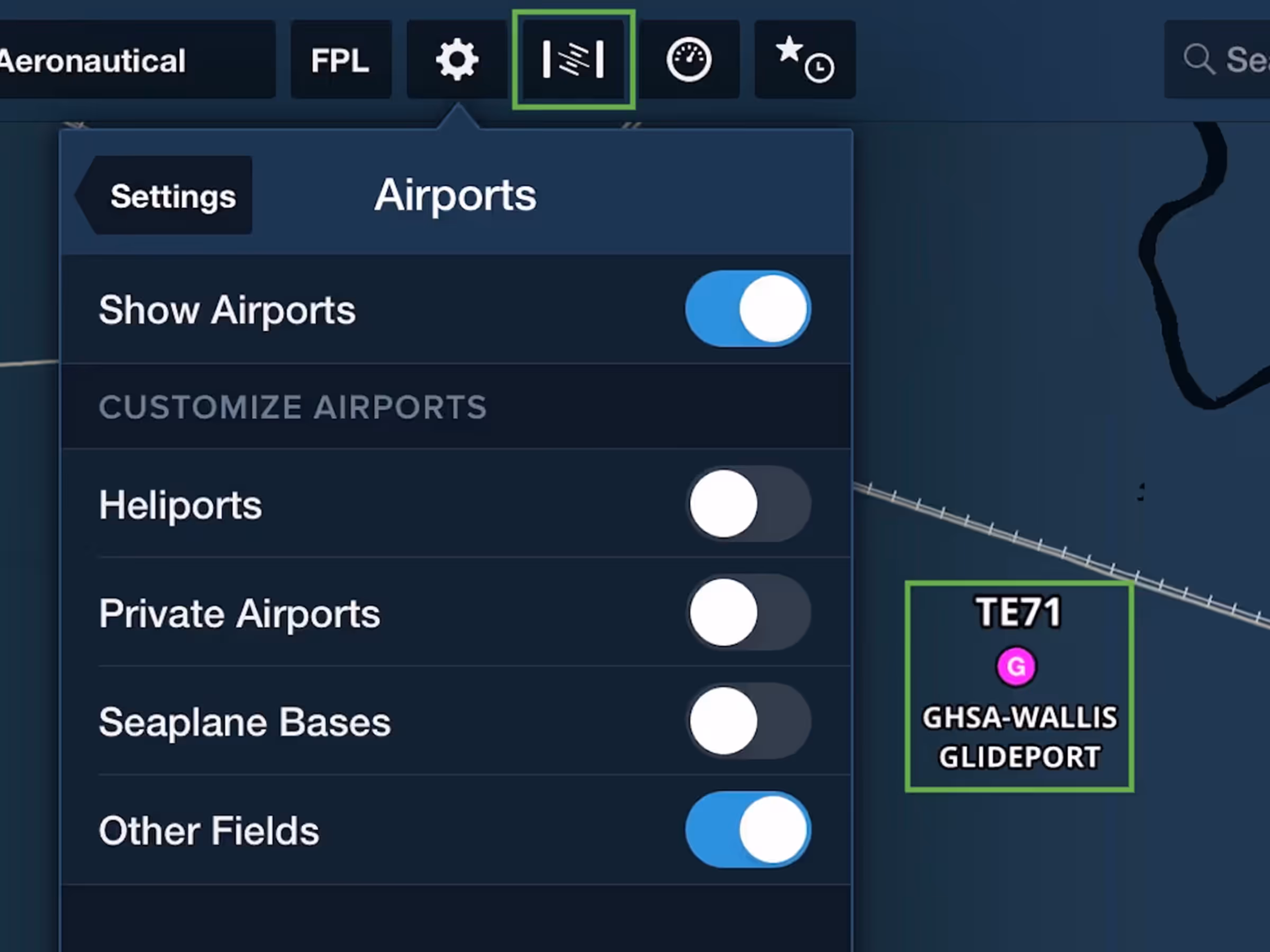
New Aeronautical Map Elements
- ForeFlight’s Aeronautical Map layer now supports additional types of airfield and navaid markers.
- Glider and balloon fields in the U.S. are marked on the map using magenta icons containing the letters G and B, respectively.
- Toggle these fields on or off using the “Other Fields” setting in Map Settings > Airports.
- TACAN navaids are also now shown on the map using a similar icon to VORTACs.
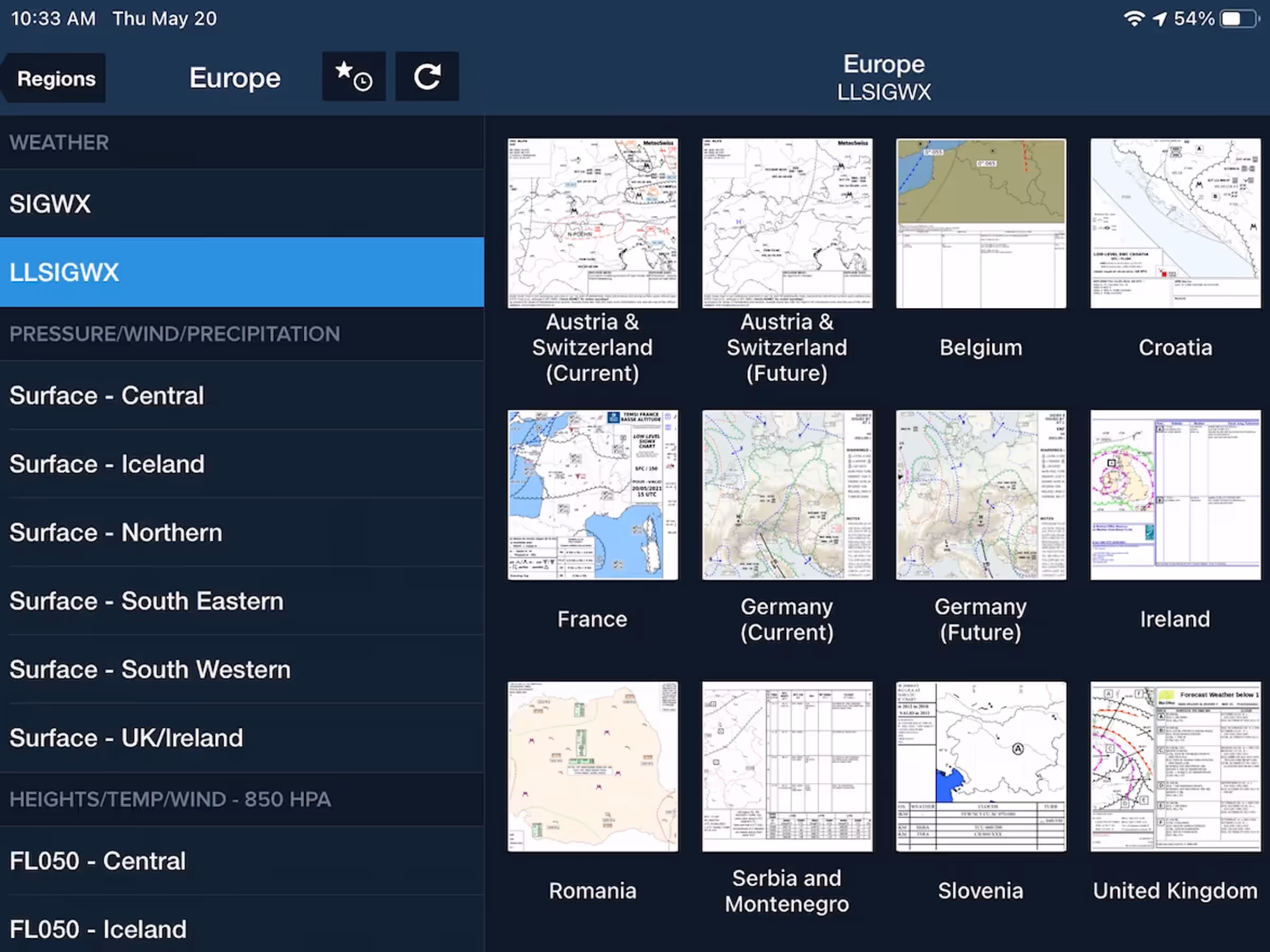
European Significant Weather Forecast Graphics
- The European section of the Imagery view on mobile and web now includes standard and low-level SIGWX charts containing valuable forecast information.
- Standard SIGWX charts cover all of Europe, while the low-level charts cover Austria and Switzerland, Belgium, Croatia, France, Germany, Ireland, Romania, Serbia and Montenegro, Slovenia, and the United Kingdom.
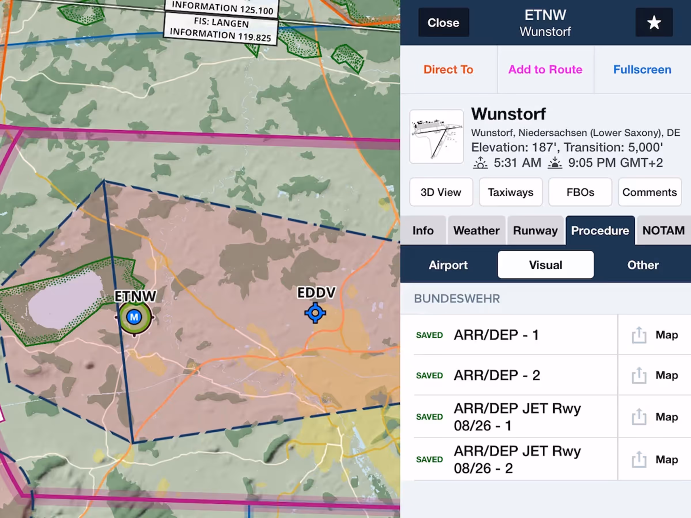
German VAD & VADJET Military Charts
- All European customers can now access VAD and VAD JET charts for military and civilian airports in Germany under the BUNDESWEHR section in Airport Procedures.
- The new charts are grouped together in the Downloads list under the Aerodrome Charts and AIP section.
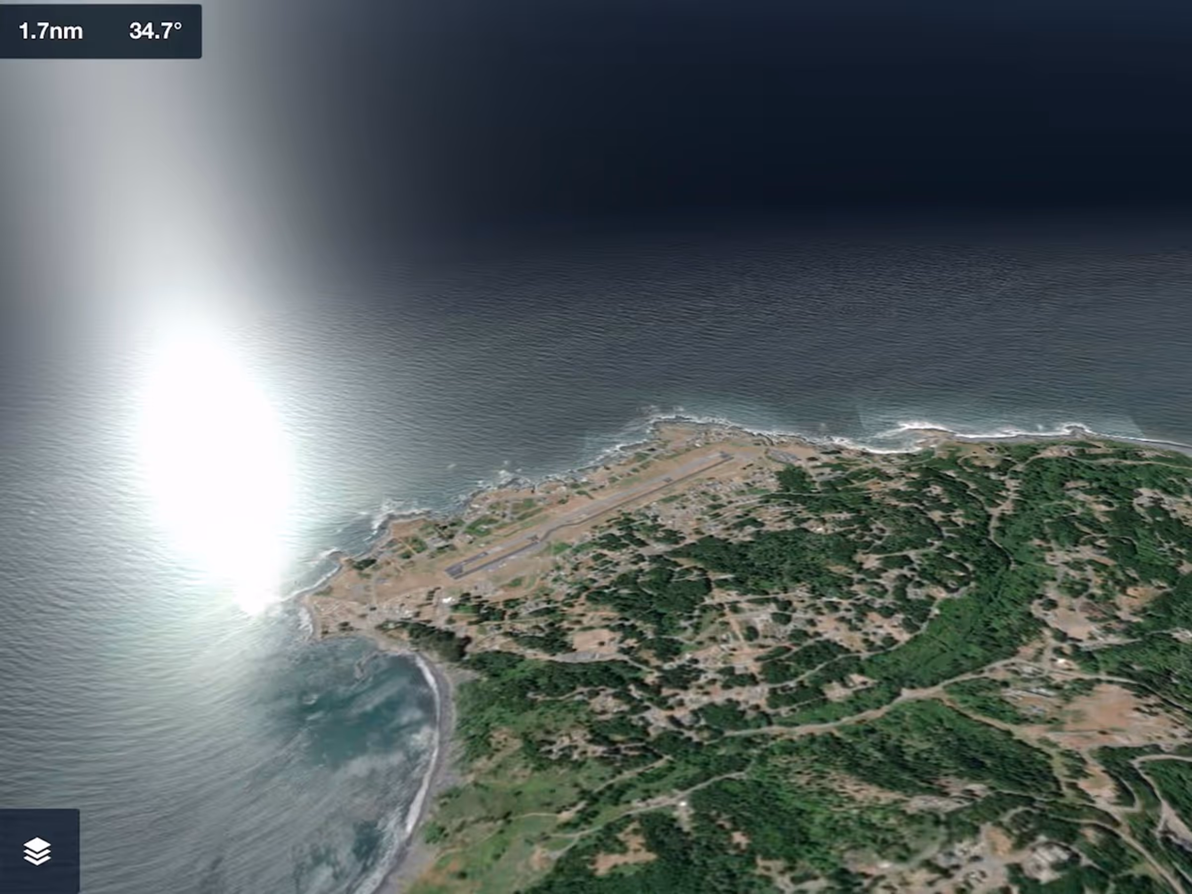
3D View Visual Enhancements
- 3D View looks better than ever with sunlight reflections on ocean water, subtle improvements to the sky’s coloring, and more.
- The improvements appear in all 3D View modes: 3D Airports, 3D Preview, and 3D Review, all of which are included with ForeFlight Premium subscription plans.
Expanded Runway Analysis Support
- ForeFlight’s advanced Runway and Obstacle Analysis capability for jets now supports Textron's Citation CJ2 and 680A Latitude, Gulfstream’s G550, G650, and G650ER, and two variants of Bombardier’s Global 6000.
- Runway Analysis is available for a growing list of aircraft types as an add-on to ForeFlight Premium subscription plans.
New Synthetic Vision Button
- The Synthetic Vision button in the Maps toolbar has a new look to better distinguish it from the adjacent Instrument Panel button.
- The button now appears as a banking attitude indicator with vertical bars on either side representing the speed and altitude tapes.
- Synthetic Vision is available with ForeFlight’s Essential subscription plan and above.
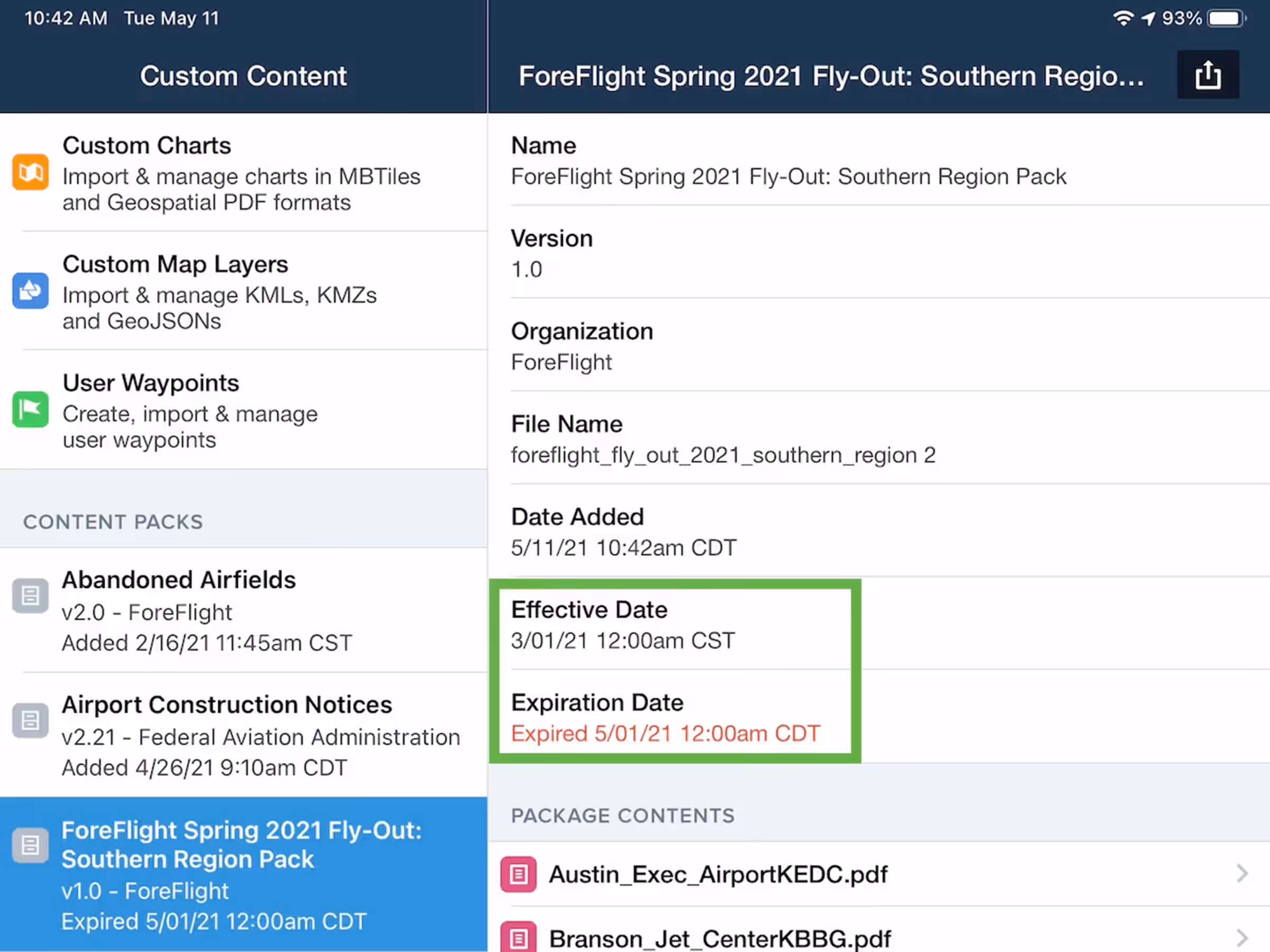
Content Pack Effective Dates
- Define Effective and Expiration dates for Content Packs in the manifest.json file and ForeFlight will display a warning in Plates and Custom Content when you view expired content.
- Both fields accept date and time information in the same format as the following example encoding midnight local time (based on the device’s time setting) on June 1st, 2021: “20210601T00:00:00”.
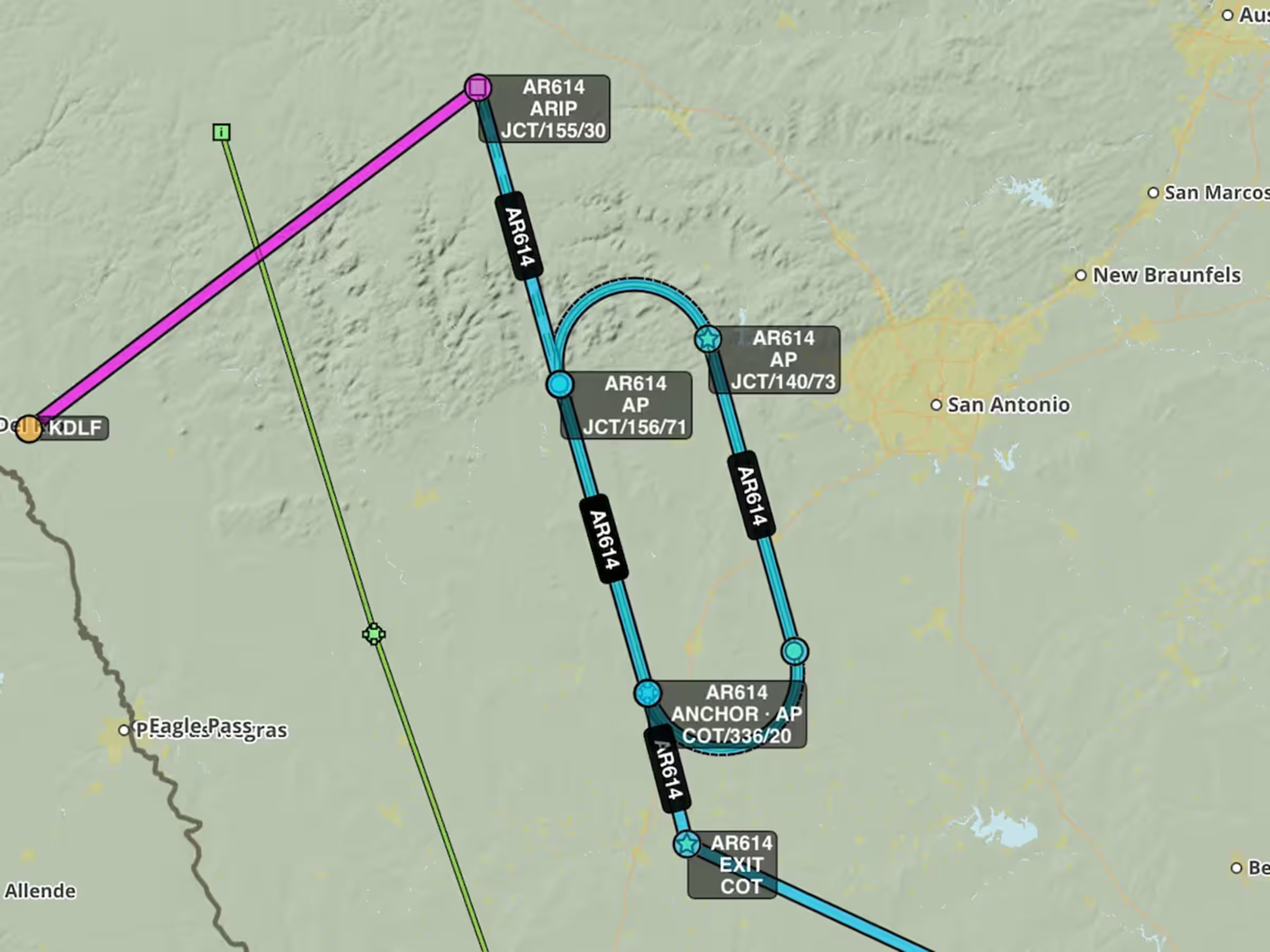
Military Flight Bag: Improved Filing of AR Tracks
- ForeFlight MFB now formats U.S. aerial refueling tracks in your route more neatly and simplifies how you file them with ATC.
- ForeFlight no longer uses a series of “virtual” waypoints to construct large turns in AR tracks, allowing you to send routes that include these turns to the Flights view and file them without needing to remove such waypoints.
- ForeFlight also automatically adds information to the Remarks field of the flight plan in accordance with the official guidance on filing AR tracks outlined in the DoD’s General Planning Flight Information Publication.