
All Plans
Aeronautical Map Drawer
A consolidated settings container for aeronautical map toggles and settings, optimizing space.
ForeFlight 16.3 includes an Aeronautical Map Drawer, Basic Navlog Template, Power Lines on the Basemap, and more.
A consolidated settings container for aeronautical map toggles and settings, optimizing space.
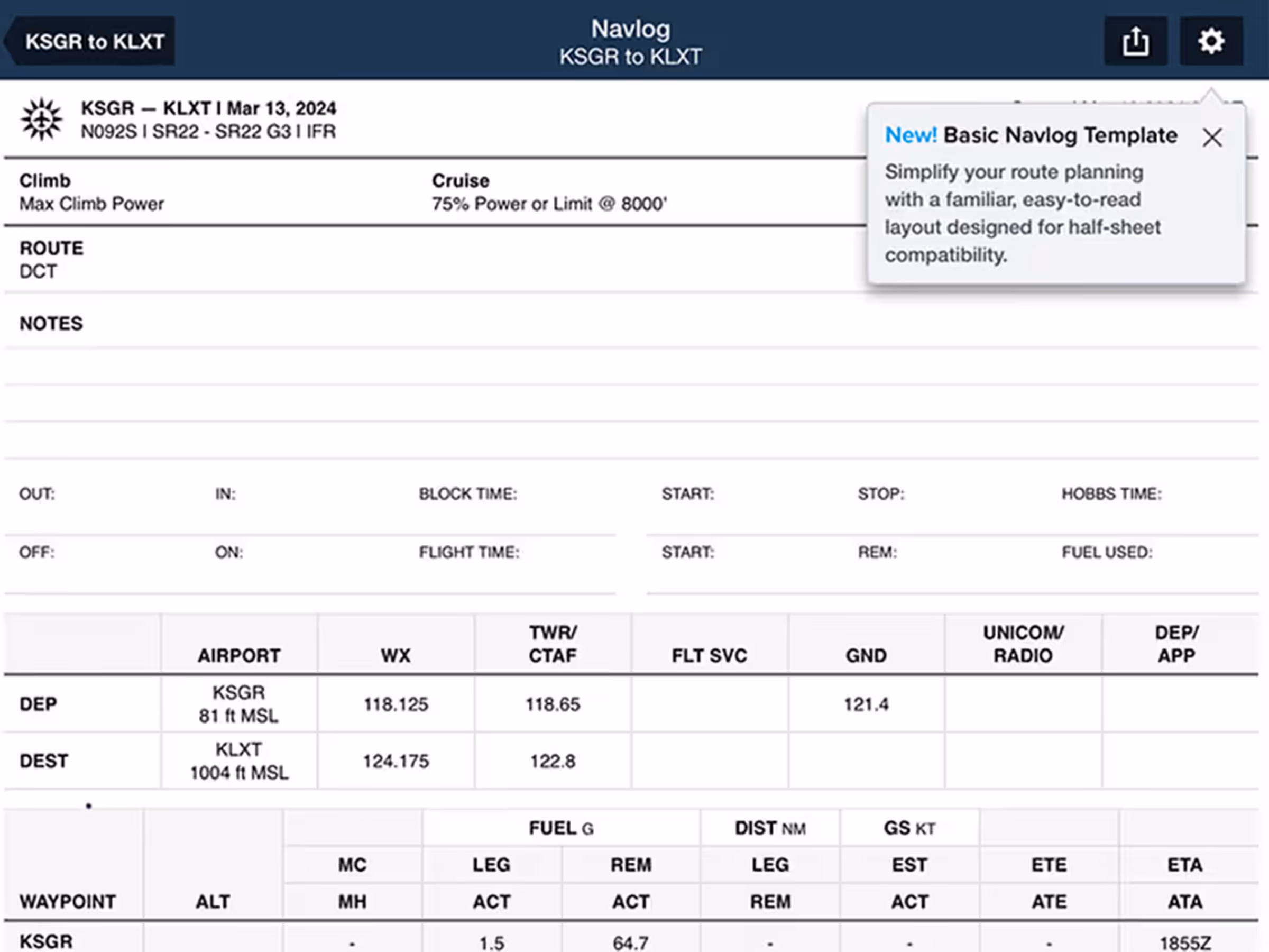
New Basic Navlog template gives VFR pilots a cleaner, traditional format.
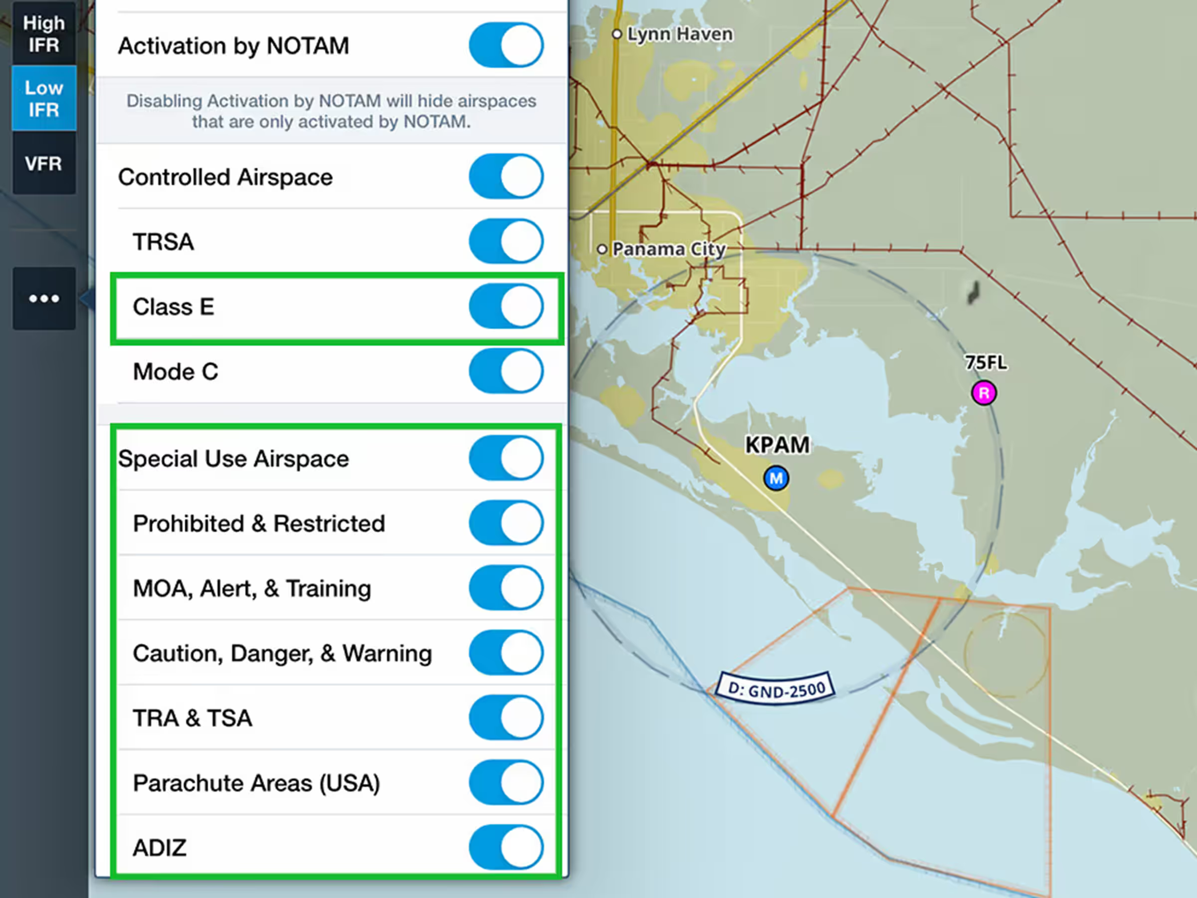
Control airspace display with global Class E filtering and detailed Special Use Airspace options.

View global power lines on the Basemap shown as maroon lines with hash marks.

Use cellular data while connected to Sentry receivers for internet weather layers and flight plan updates.
Aeronautical Map Drawer
Basic Navlog Template
Power Lines on Basemap
Sentry Allows Cellular Data
New Airspace Settings
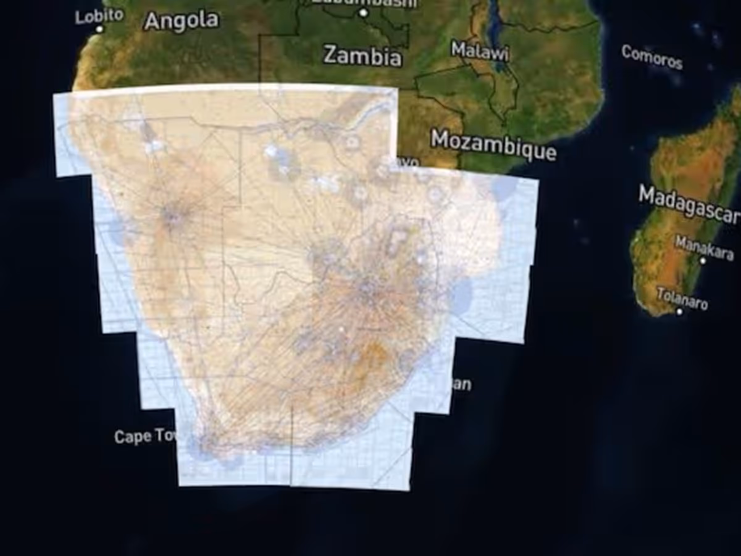
Southern Africa VFR Charts