New 100’ and 500’ Hazard Altitude options are now available for low-altitude flying. Access these options by navigating to Map Settings > Hazards > Hazard Altitudes > Low: 100’ / 500’.

Plan with precision at lower altitudes using new 100' and 500' Hazard Altitude options.

New 100’ and 500’ Hazard Altitude options are now available for low-altitude flying. Access these options by navigating to Map Settings > Hazards > Hazard Altitudes > Low: 100’ / 500’.
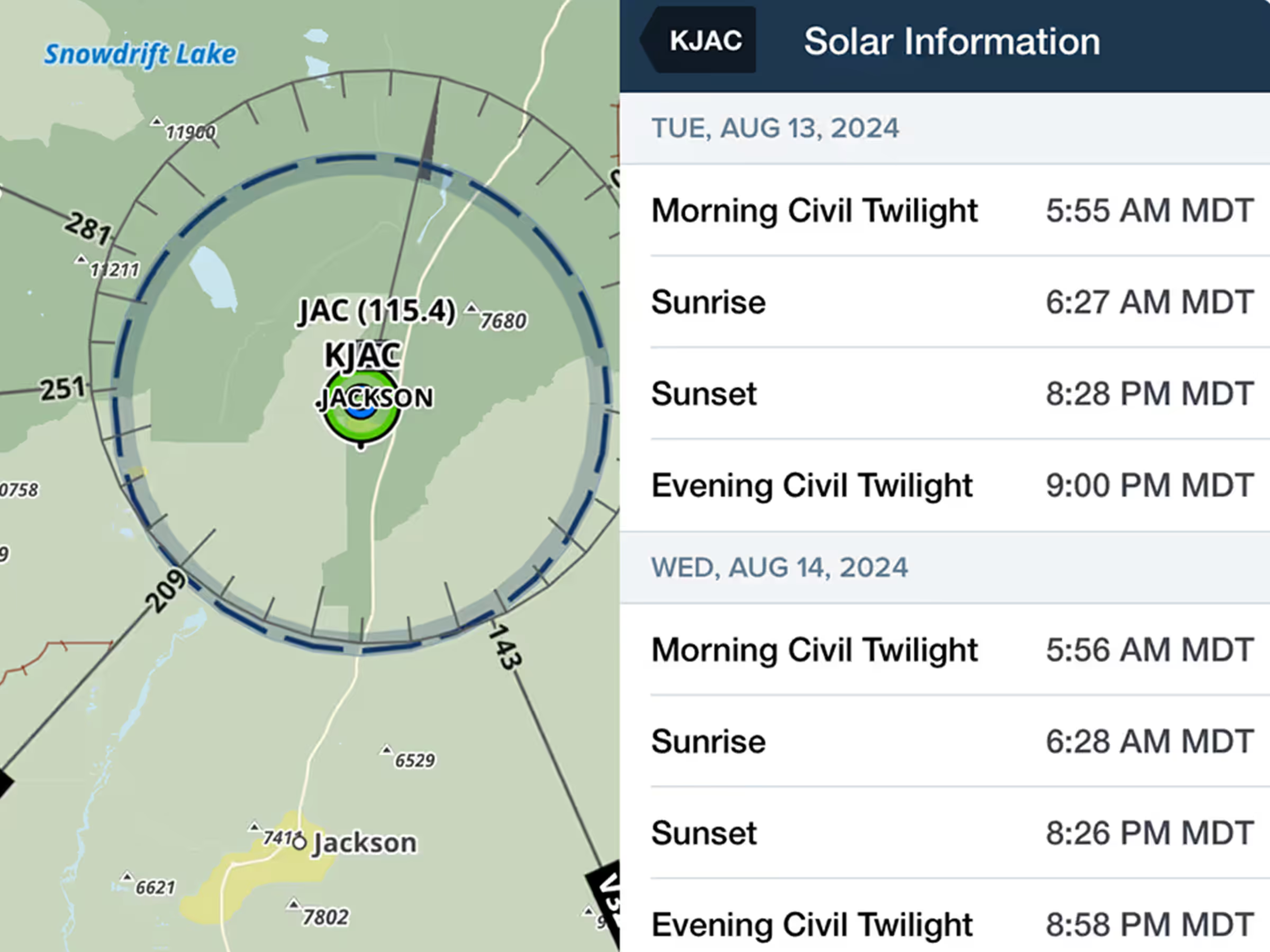
Log day and night hours accurately with sunrise, sunset, and civil twilight data at any airport.
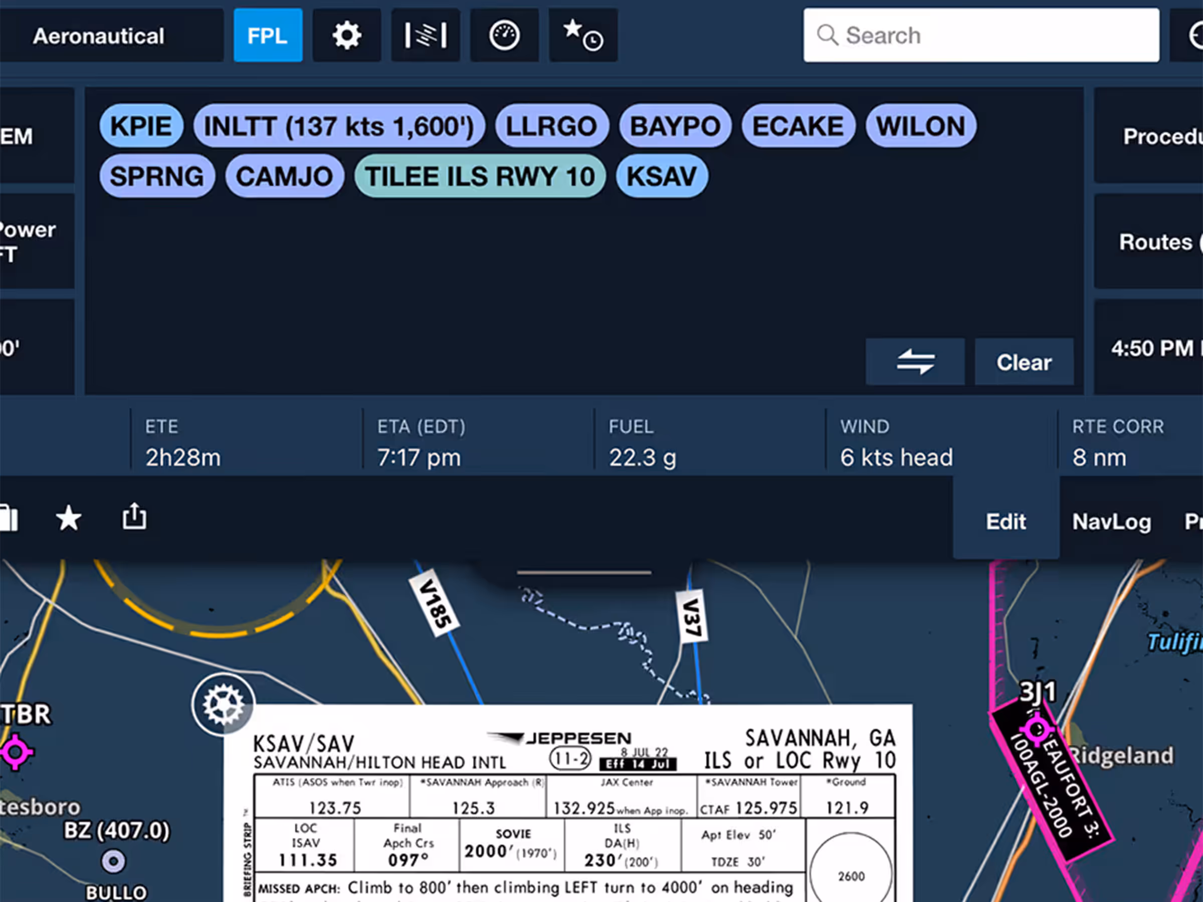
New FPL drawer strip shows key flight info with resizable view for better information display.
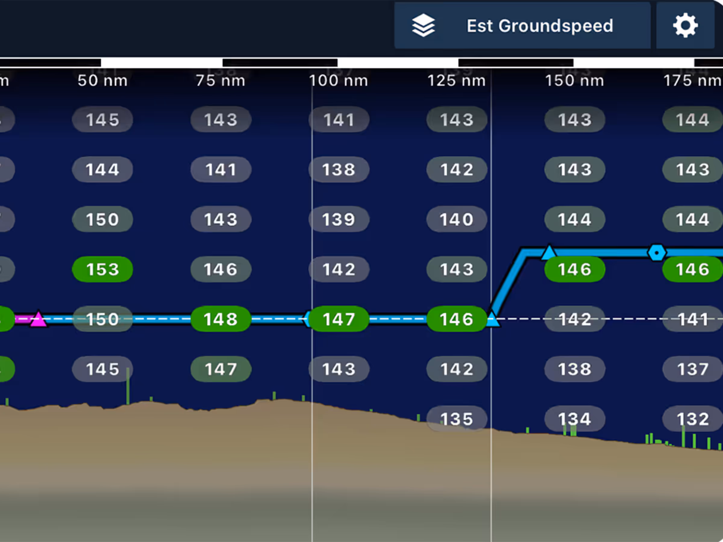
Enhance planning with head/tailwind and ground speed layers in Profile View.

New VFR chart add-ons for Northern Africa, Northern Middle East, and Japan.


