No items found.
Skip to main content
May 2022

Global Graphical NOTAMs

View color-coded global Graphical NOTAMs with filters for Exercises, Controlled Airspaces, and Obstacles.

No images available to display.
back
next

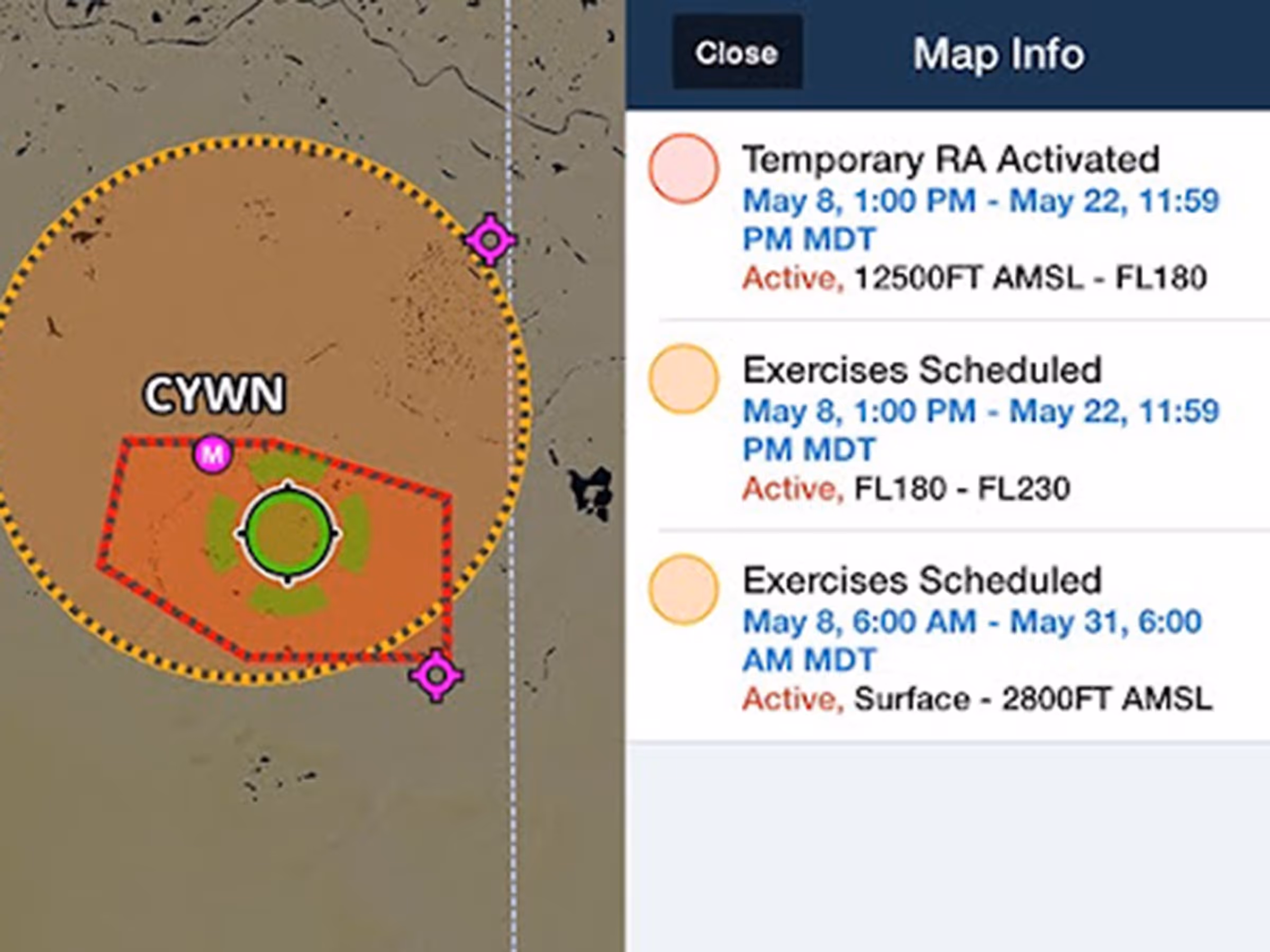
Previously limited to Europe, Graphical enroute NOTAMs are now supported globally with the new NOTAMs map layer. NOTAMs are color-coded red, yellow, or gray based on type, severity, and active times. Additionally, with the NOTAMs layer enabled, you can selectively filter which types are shown using the new menu in Map Settings > NOTAMs Settings, with toggles for Exercises, Controlled Airspaces, Obstacles, and Other.

Release notes

Release notes

  • Previously limited to Europe, Graphical enroute NOTAMs are now supported around the world with the new NOTAMs map layer.
  • To enable Graphical NOTAMs, tap the Layer Selector and then tap NOTAMs on the right.
  • Tap a NOTAM on the map to view its details or tap on multiple overlapping NOTAMs to select one from a summary list.
  • NOTAMs are color-coded red, yellow, or gray based on type, severity, and active times. Airspace restriction NOTAMs first appear in yellow 120 minutes prior to activating and turning red.
  • With the NOTAMs layer enabled, selectively filter which types are shown using the new menu in Map Settings > NOTAMs settings, with toggles for Exercises, Controlled Airspaces, Obstacles, and Other.
  • The Graphical NOTAMs layer does not display 5G or GPS NOTAMs in the US, and does not currently support any NOTAMS in Australia.

Support

Support

FAQs
Find answers to your questions
Pilot's Guide
The complete ForeFlight handbook
Video Library
ForeFlight videos all in one place
Buying Guide
Choose the right iPad and plan