Essential & Above
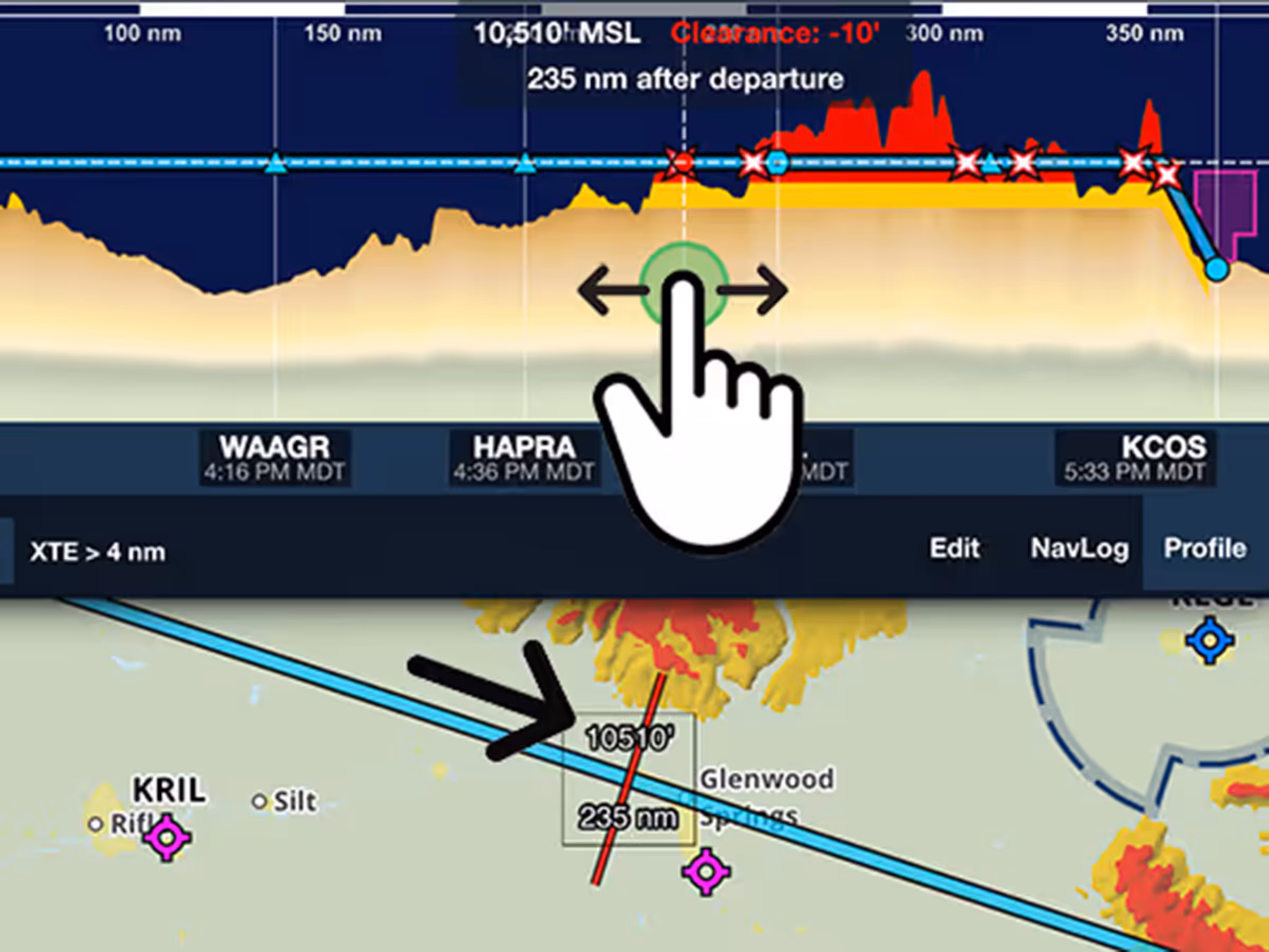
Profile Line Pointer
See Profile View hazards on the map and visualize your route corridor.

See Profile View hazards on the map and visualize your route corridor.

See Profile View hazards on the map and visualize your route corridor.

Try the new vector Radar layer with reduced pixelation and faster updates.
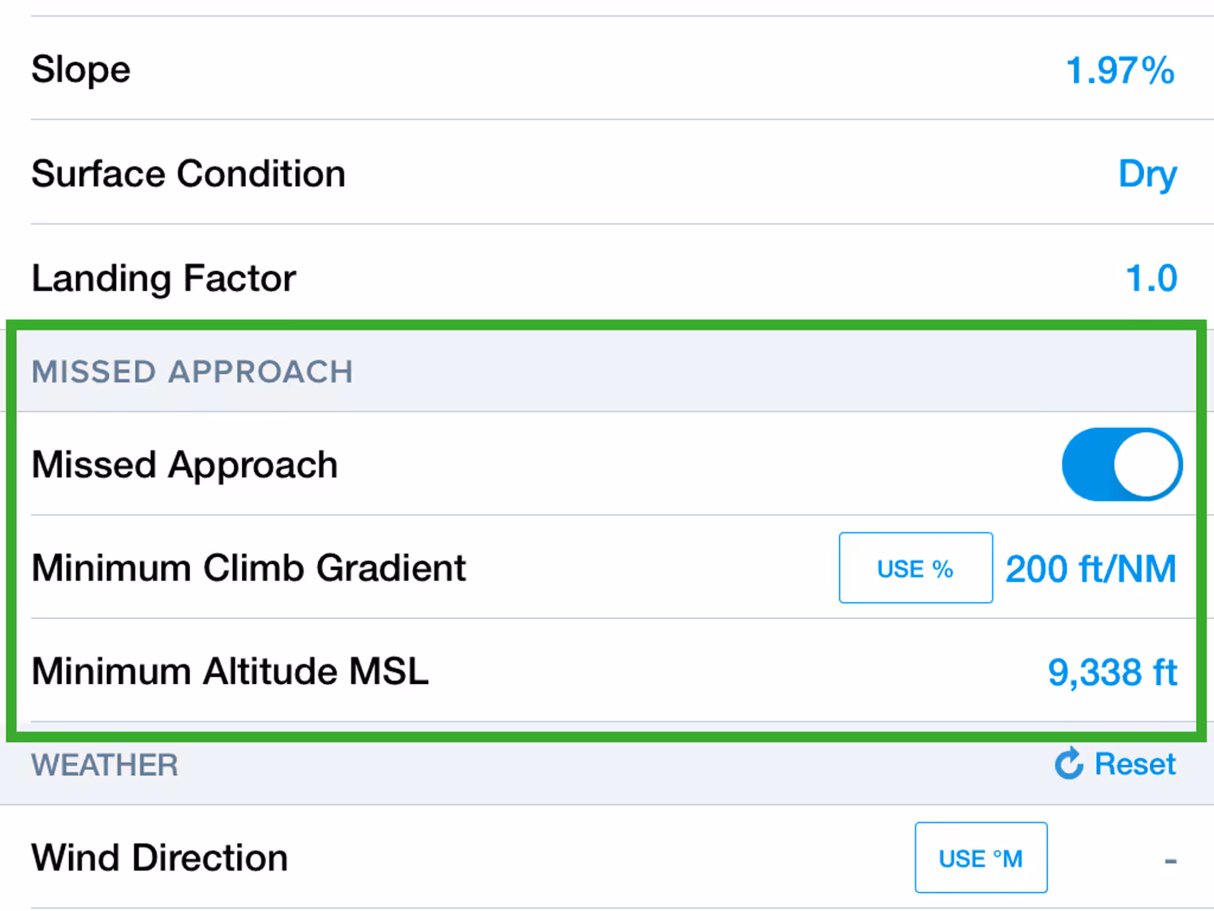
Include missed approach climb requirements in Landing Analysis calculations.

Hide airspace activated by NOTAM to declutter the Aeronautical Map.


