3D REVIEW
Preview each leg of your planned flights and review past flights and maneuvers, with pitch and bank from recorded AHRS data.
3D Review is included with ForeFlight's Premium plans.

AIRPORT 3D VIEW
High-resolution terrain and aerial imagery are combined to create this immersive, interactive preview to help you get familiar with new airports.
Airport 3D is included with ForeFlight's Premium plans.

3D APPROACH PREVIEW
3D Preview displays markers for each waypoint in your route, including labeled approach fixes, allowing you to better visualize every step of your approach down to the runway.
3D Review is included with ForeFlight's Premium plans.

Get the View at Altitude with 3D Review
The newest addition to ForeFlight’s suite of 3D capabilities lets you follow the path of a planned or recorded flight with high-resolution terrain and aerial imagery. Preview planned flights from the Maps or Flights views, and replay past flights from Track Logs or Logbook entries with realistic pitch and bank if recorded with an AHRS-capable device. Pan and zoom within the interactive 3D View to get a full 360° perspective of the route environment. 3D Review is included in ForeFlight Premium plans.
Watch the video
Weather in 3D Preview
Enable U.S. or Global Icing and Turbulence layers using the new layer selector in 3D Preview to display forecast weather along your route. 3D View depicts forecast weather as floating colored blocks that use the same color scale to represent forecast severity as the overhead map and Profile View. Use the altitude slider on the right to view weather at different altitudes, and tap the RTE button at the top of the altitude slider to only show weather at the same altitude as your route.
Weather in 3D Preview is included in ForeFlight’s Premium plans.
Watch the video
Obstacles in 3D View
Identify potential hazards along your route or near an airport with Obstacles in all 3D views. ForeFlight displays obstacles using three shape styles: buildings, towers, and windmills. Enabling Night Mode in 3D Airports will also show obstacle lighting. In 3D Preview, ForeFlight helps you identify potentially hazardous obstacles near your route by highlighting them with yellow or red stripes based on your current Hazard Altitude settings.
Airport 3D Runway Lighting
Prepare for a night approach or establish a mental picture with toggleable Day/Night modes and realistic Runway Lights in Airport 3D. Use the Day/Night toggle in the bottom-right corner of Airport 3D to dim the surrounding terrain and expose the airport’s runway lights. Runway edge lighting is supported for most paved airports around the world, while larger airports may also display touchdown zone lights, PAPI lights, displaced threshold lights with approach light system if available, centerline lights, end light flashers, and more.
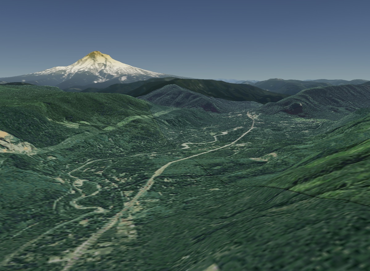
View the World in 3D
3D View and 3D Review are supported for any flight or airport in ForeFlight, anywhere in the world. By combining aerial imagery with Jeppesen-sourced high-resolution terrain for every continent, these features let you explore airports and plan or relive flights near and far with ease.

Third-Person View
Switch between first- and third-person modes to view your flight from any angle. In third-person mode the camera stays centered on your aircraft, allowing you to pan, tilt, and zoom the view. Track Logs recorded with an AHRS-capable device like Sentry will incorporate pitch and bank data into the blue aircraft’s movements.
Route Line
In both first- and third-person modes, your route line appears as a blue curtain that the aircraft travels along, making it easy to see your route’s path before and after your current position.

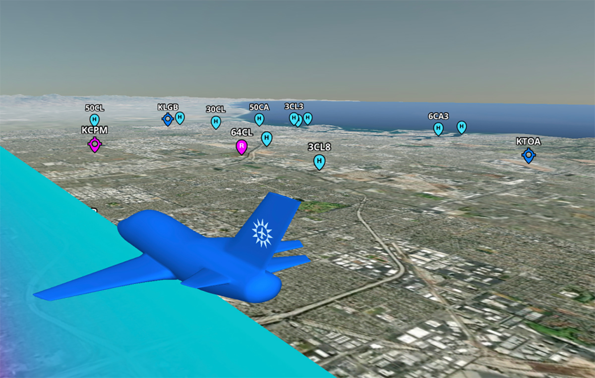
Airport Markers
Easily find and learn about airports along your route in 3D Preview and Review with tappable markers to help you plan for fuel stops, emergency landings, and more. Show or hide markers for different types of airports using the Aeronautical Map settings in Map Settings > Airports.
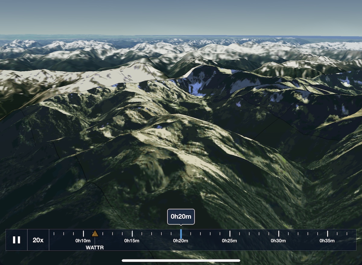
Review at your own Pace
No matter how long the flight, 3D Review lets you get through it as quickly or slowly as you like. Play the flight on autopilot at 1x, 3x, 5x, 10x, or 20x normal speed, or swipe through the timeline to get to the best parts right away. You can also zoom within the timeline itself to see more granular time markers.
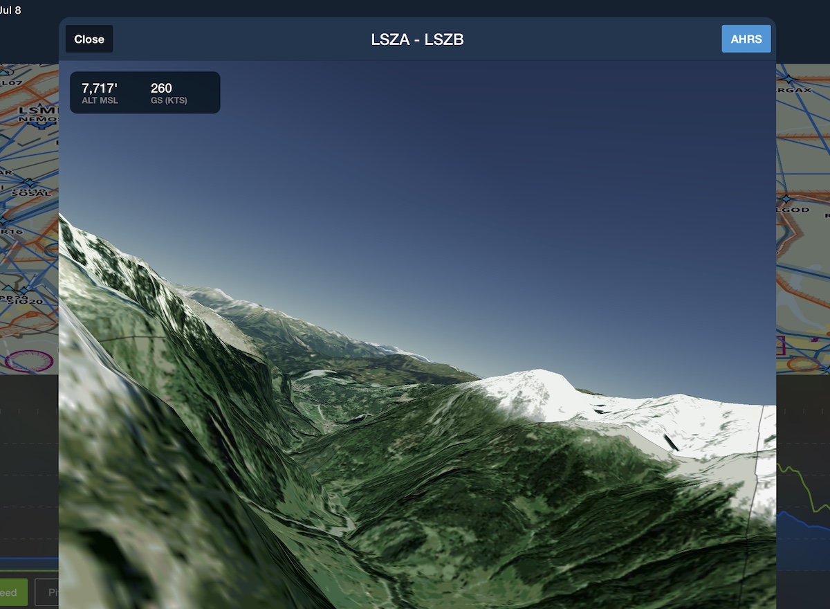
Debrief with Attitude
Review flights recorded with an AHRS-capable device to see your actual pitch and bank displayed in 3D Review. Easily evaluate your turns and other maneuvers with real-time replay, or tap the AHRS button in the top-right to disable attitude display and focus on your flight path.
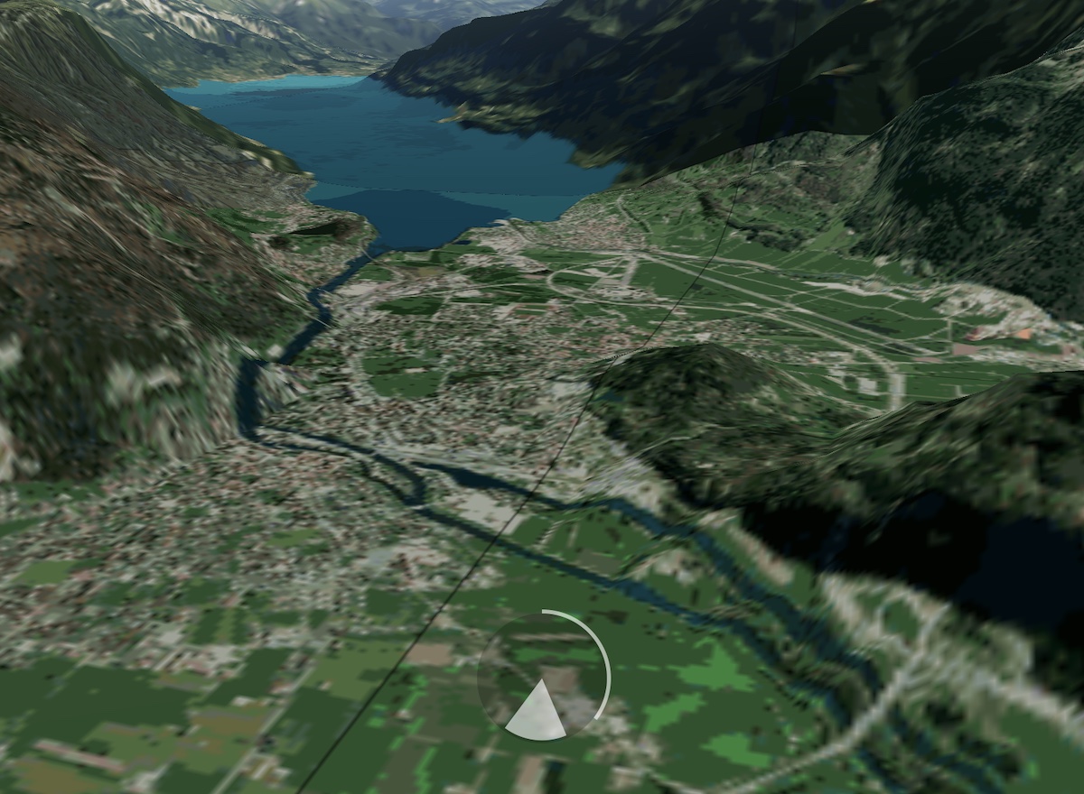
Take in the View
Keep your head on a swivel with full 360° Glance Mode support. Swipe with one finger to enter Glance Mode and pan or zoom to investigate your surroundings in any direction. Tap the circular indicator to return to a forward-facing view or wait for Glance Mode to exit automatically after 5 seconds.
Watch the Video
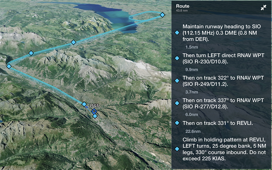
3D Approach Preview
3D Preview displays markers for each waypoint in your route, including labeled approach fixes, allowing you to better visualize every step of your approach down to the runway. 3D Preview also features an interactive navlog, allowing you to view each waypoint and the distances between them and quickly jump to any leg in the flight.
3D Engine Out Procedures
Familiarize yourself with an airport’s EOPs before takeoff using interactive 3D terrain and aerial imagery. While viewing the Runway Analysis Takeoff page or the list of Engine Out Procedures, tap the 3D View button next to any EOP to open it in 3D.
Available as part of ForeFlight’s Runway Analysis add-on product for turbine aircraft.
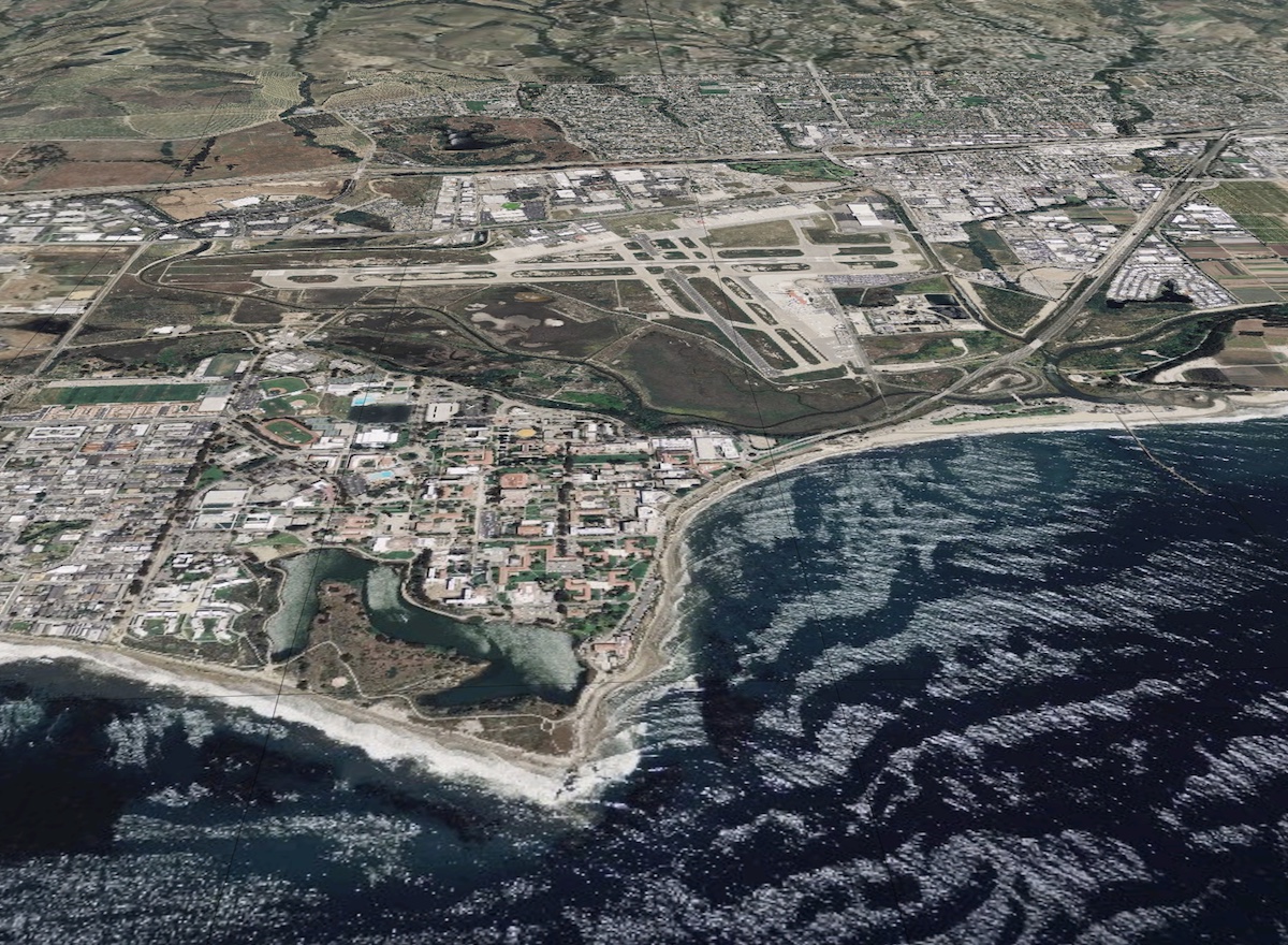
Explore Airports From a New Perspective
Airport 3D View is an interactive preview that combines terrain and aerial imagery to help you get familiar with new airports anywhere in the world. Whether you're preparing for a challenging approach or daydreaming about new places to fly, 3D View provides new and unique vantage points that prepare you for the real thing. Airport 3D in included in ForeFlight Premium plans.
Watch the video
Next-Generation Airport Familiarization
Airport 3D View goes beyond the static airport familiarization chart, delivering a unique and interactive tool to explore a photorealistic 3D representation of the airport layout and the surrounding terrain. Visualize your takeoff or landing on any runway to more effectively and efficiently prepare for flights and approaches into any airport worldwide.
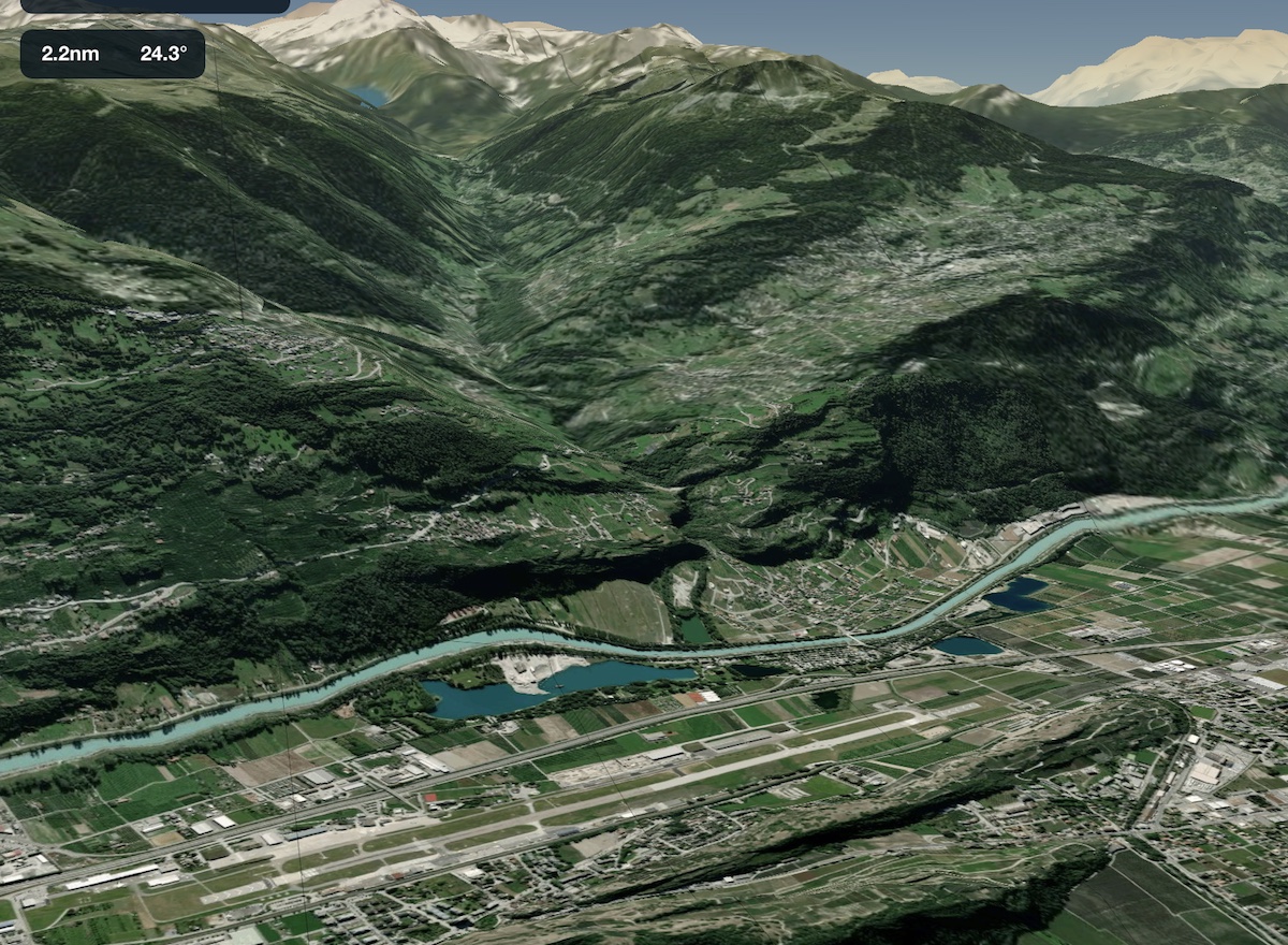
Discover New and Unique Vantage Points
Airport 3D View puts you behind the camera lens, with full motion control so you can preview every perspective. Pan and zoom 360° around any airport and up to 15 nautical miles away, and tilt the camera from 3° to 89° to preview any viewing angle.
Internet Traffic in 3D Airports
View live Internet Traffic via FlightAware in 3D Airports to analyze airport activity, follow takeoffs and landings, and more. When viewing an airport in 3D, tap the layer selector in the bottom left and select Traffic to display any airborne traffic near the airport as blue diamonds with their tail number and current altititude. Tap on any traffic target to display its vertical and horizontal track as a blue curtain like in 3D Review.
Watch the video
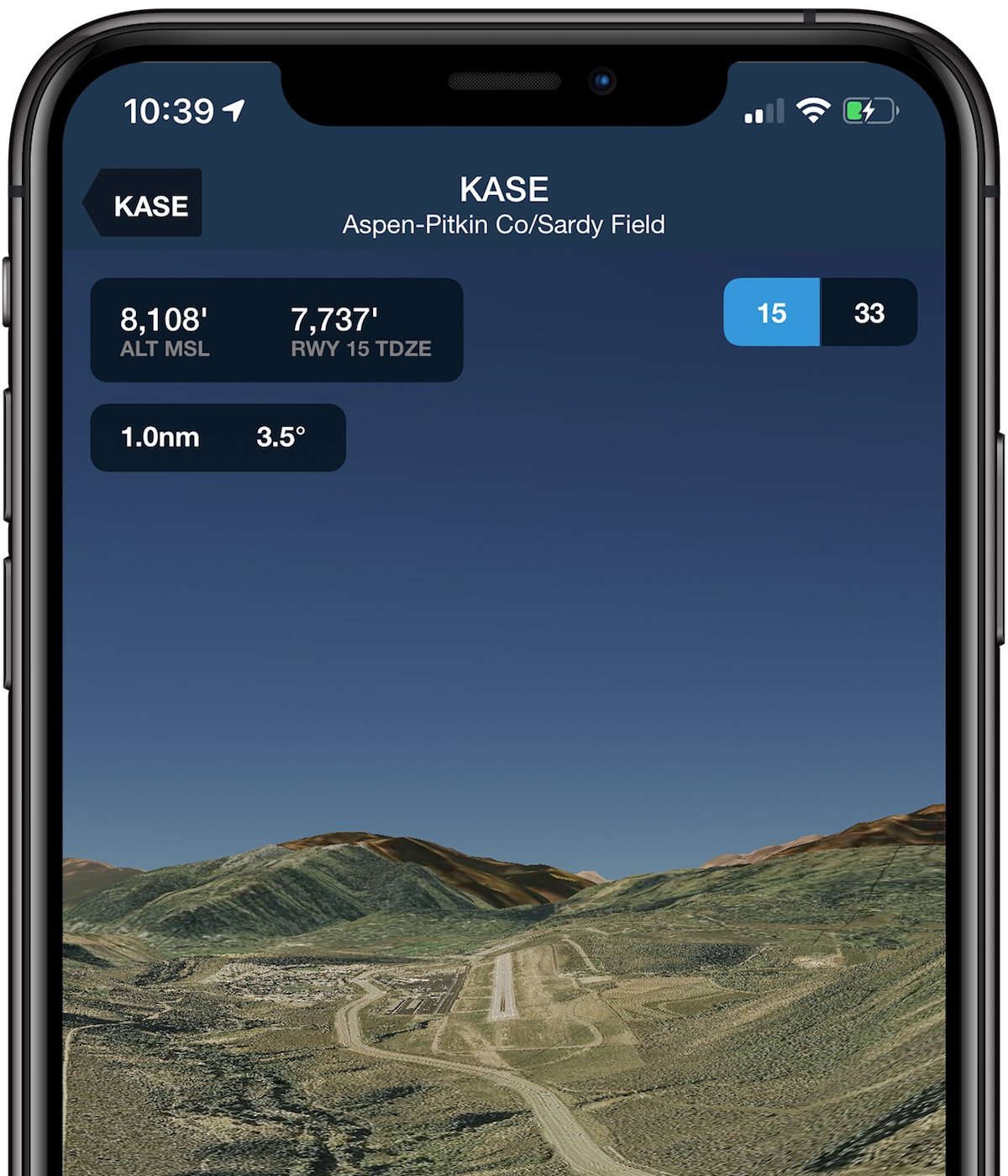
Brief Your Approach with Glideslope Preview
Select a runway to get the view from short final. 3D View automatically places the camera along the published glideslope of airports with known approaches, providing a snapshot of terrain and ground features to help you prepare for the real thing.
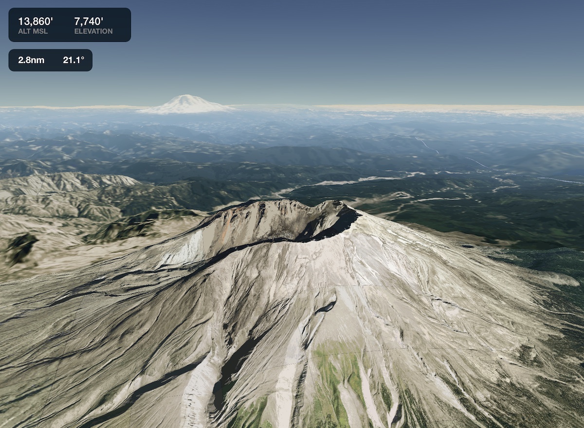
3D View, Anywhere
Access 3D View for any location on Earth, not just airports. The combination of high-resolution terrain and aerial imagery allows you to see a realistic representation of anywhere on the map. Tap-hold on the map and tap the 3D button in the upper-right corner to begin exploring.
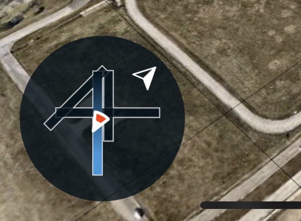
Integrated Crosswind
The small compass and airport diagram doesn’t just help you find your bearings - it also displays a windsock icon on the selected runway so you can plan for a crosswind correction.
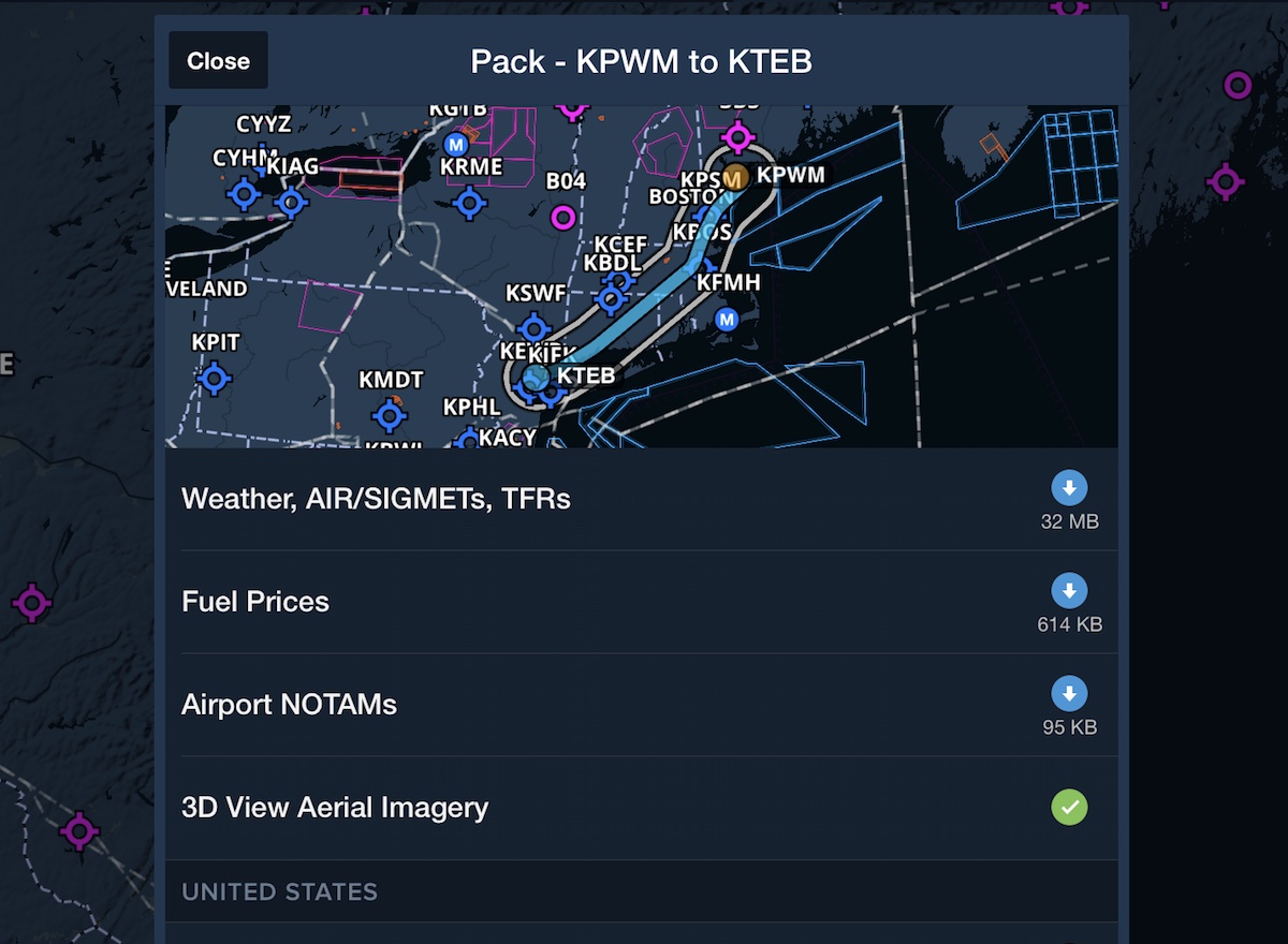
Packed & Ready
ForeFlight automatically downloads terrain and aerial data for any airport in your route when you Pack for the flight, ensuring you have access in the air as you prepare for arrival.