All Plans
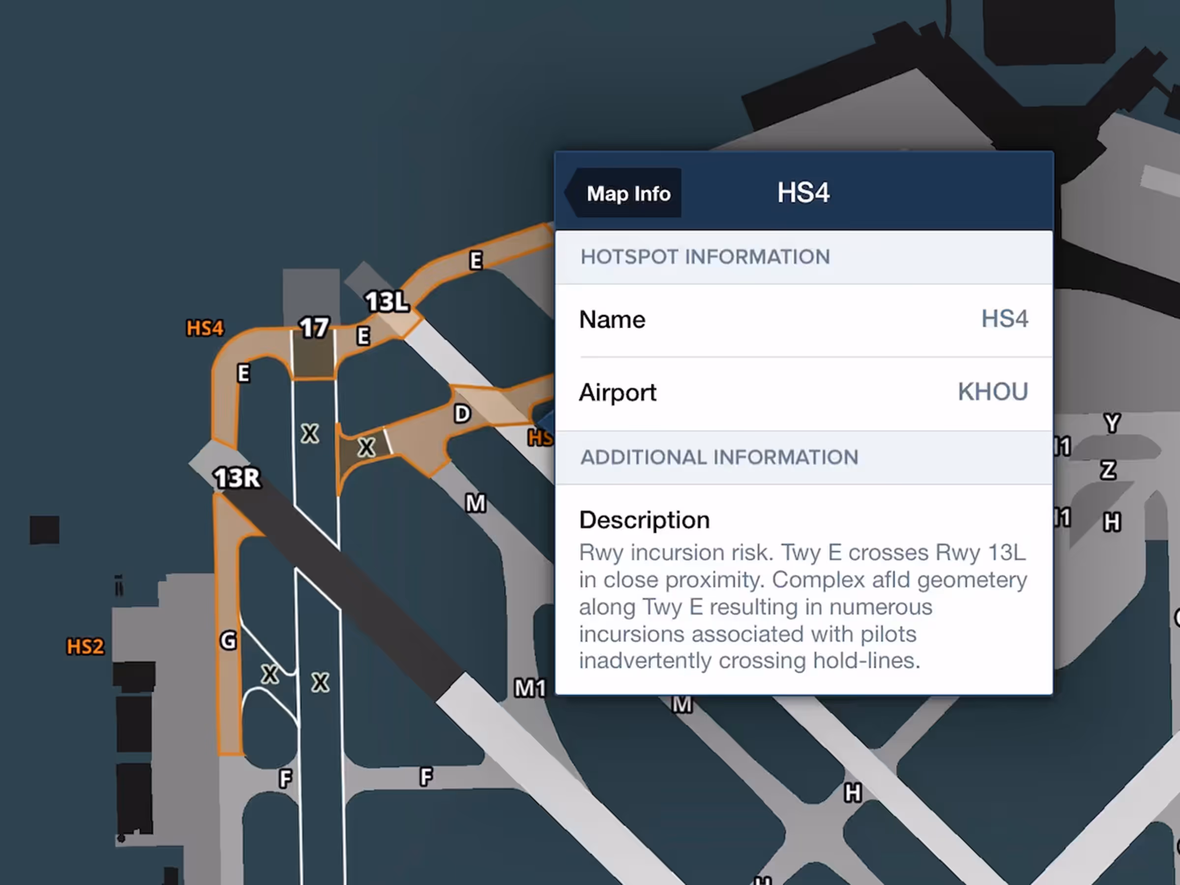
Airport Hotspot Details
Tap on airport hotspots on the Aeronautical Map to view each one’s description.
This release includes Daily/Hourly Forecasts, Parachute Jump Areas on the Aeronautical Map, tappable Airport Hotspot details, and more.
Tap on airport hotspots on the Aeronautical Map to view each one’s description.
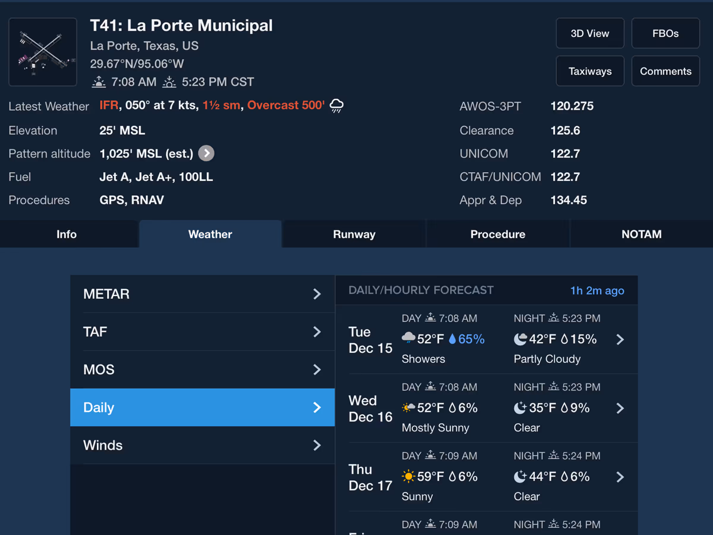
Get a detailed 10 day, hour-by-hour forecast for anywhere in the world.
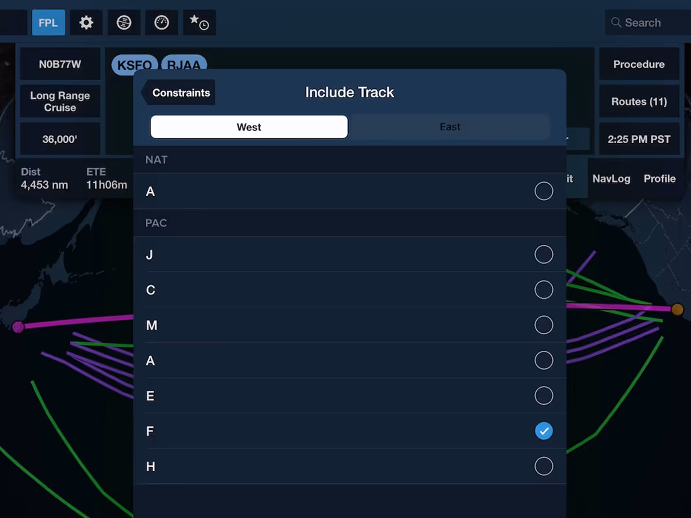
Guide ForeFlight’s Recommended Route while planning oceanic flights.
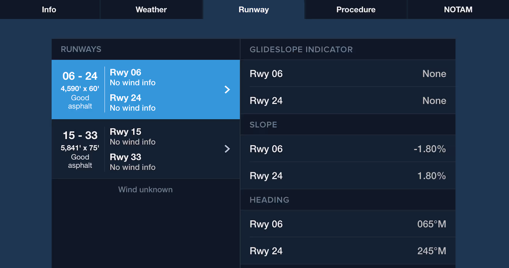
ForeFlight now displays a runway’s slope alongside other details in the Airport view’s Runway tab.
Daily/Hourly Weather
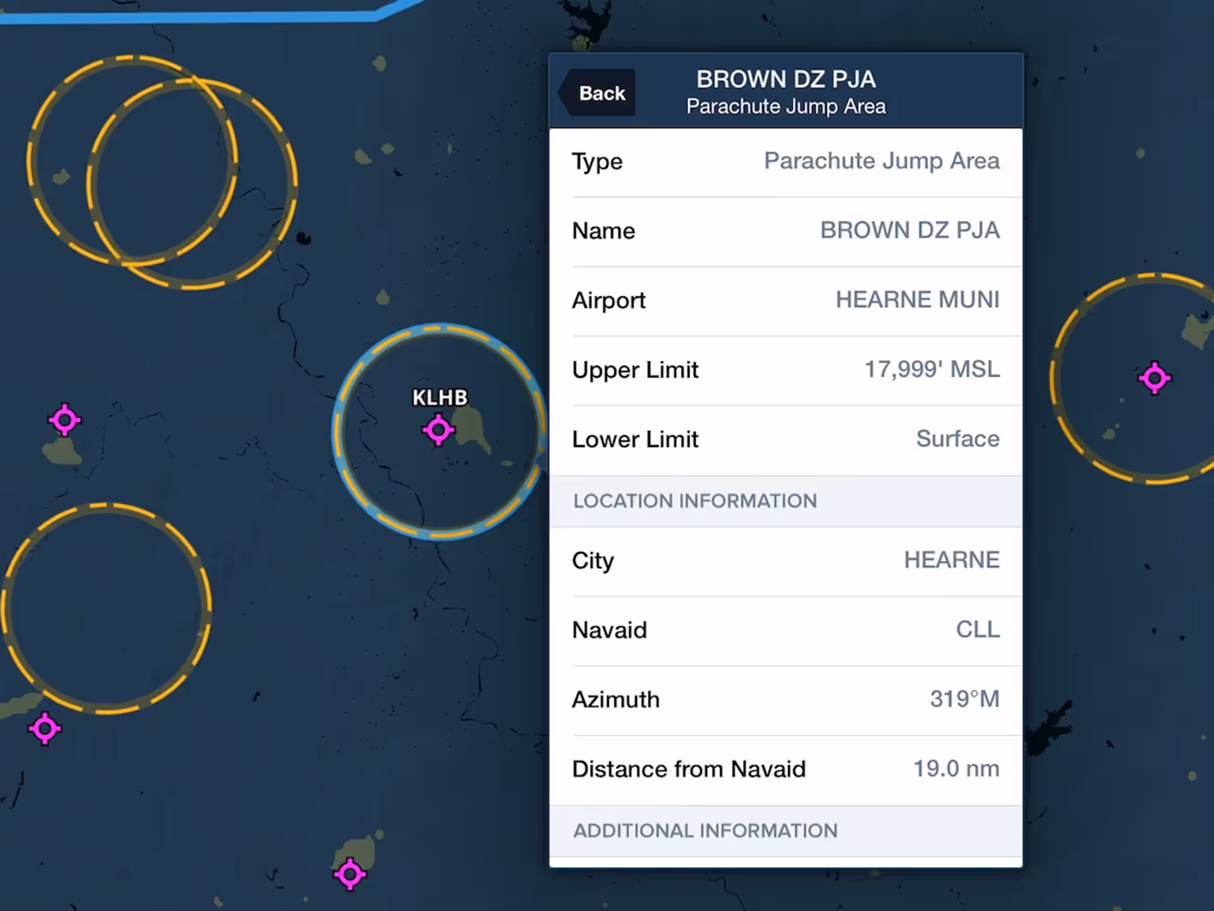
Parachute Jump Areas
Airport Hotspot Details
Recommended Route Constraint: Include Track
Slope in Runway Details
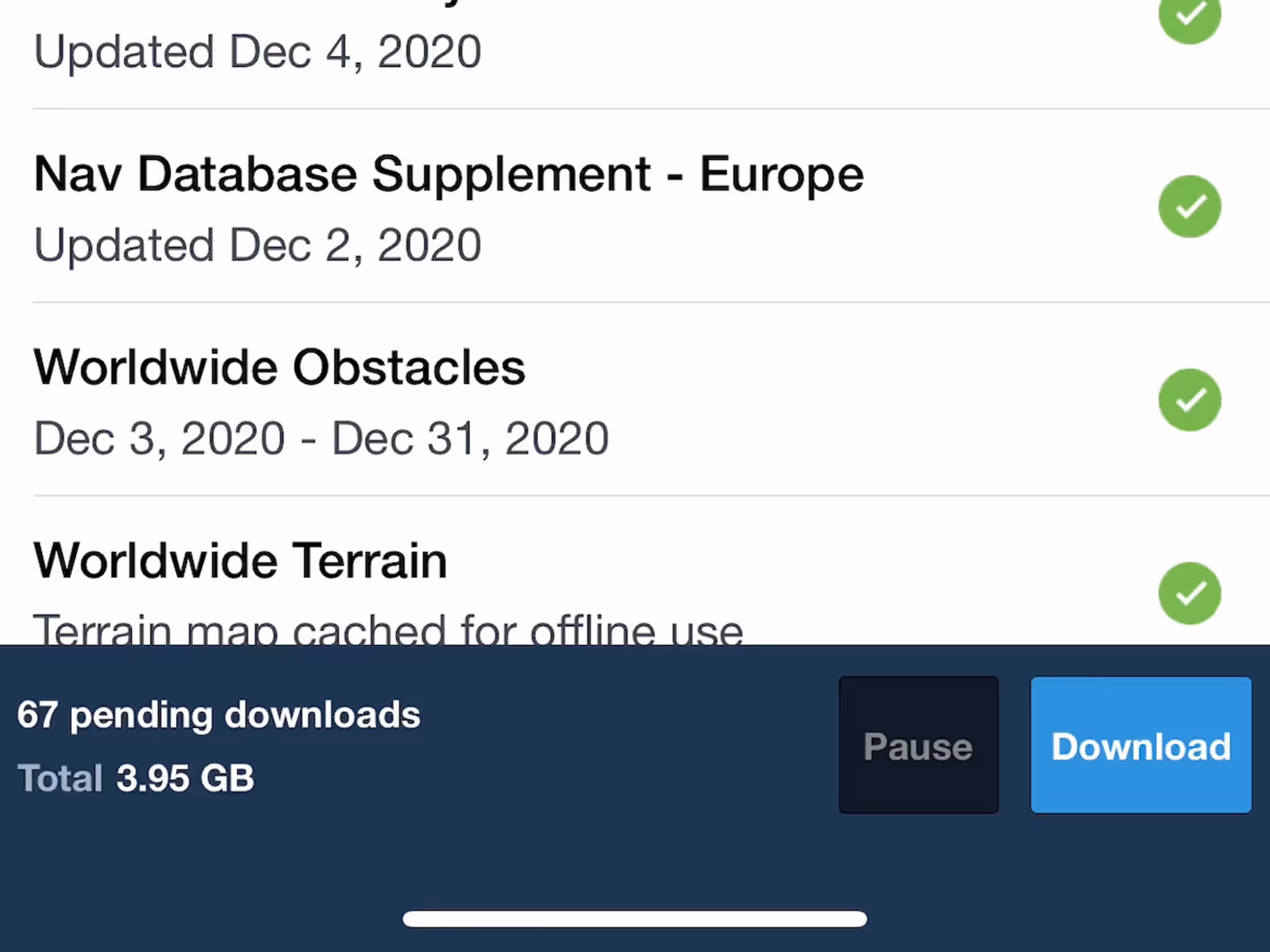
Download & Pack Improvements