
Skip to main content
- Products
- solutions
- resources
- company
12.2
March 2020
This release includes 3D Approach Preview, Mountain Passes and other Basemap elements, Quick-Access Airspace Frequencies, and more.
All Plans
Expanded Jeppesen VFR Data Coverage
Access broader VFR data coverage in the Nav Database Supplement – Europe download.

Mountain Passes & Other Basemap Elements
Reference mountain passes, highway labels, and more on ForeFlight's High Resolution Basemap.

Quick-Access Airspace Frequencies
Easily access communication frequencies for many kinds of controlled airspace on the Maps view.
Release Notes
Release Notes
3D Approach Preview
- 3D Preview now displays markers for each waypoint in your route, including labeled approach fixes, allowing you to better visualize every step of your approach down to the runway.
- Preview any planned route in 3D from either the Maps or Flights views by tapping the 3D button on each page, and preview only an approach procedure by tapping the procedure’s name in the Maps view Bubble Editor and tapping “3D Procedure Preview” at the bottom of the popup menu.
- 3D Preview displays each waypoint along your route using the same labeled markers as shown on the map, including speed and altitude restrictions for approach fixes that have them. The translucent “curtain” representing your route is also colored orange, magenta, or blue to indicate past, current, and future legs as you play through the route.
- 3D Preview also features an interactive navlog in the top-right (or at the bottom of the screen on iPhone), allowing you to view each waypoint and the distances between them. Tap on any waypoint in the navlog to jump to that leg of the flight.
- If you manually change the flight’s altitude at specific waypoints using the Set Altitude/Speed option, 3D Preview will incorporate these changes and display them in 3D.
- 3D Preview is available with ForeFlight Premium plans.
Quick-Access Airspace Frequencies
- Easily locate frequencies for many kinds of controlled airspace by tap-holding on the map to see them listed in the Add to Route popup.
- The Airspace section of the popup shows a summary of airspace frequencies for each terminal control zone at the place where you tapped, and you can tap into the details of an airspace to reveal all of its associated frequencies.
New Basemap Elements
- ForeFlight’s High Resolution Basemap includes new terrain and cultural elements such as mountain passes for the U.S. and Europe, highway labels, and additional bodies of water for improved inflight reference.
- Enable and download the High Resolution Basemap for any region in More > Downloads.
- Mountain pass icons are oriented to indicate their direction, and also include the pass name and elevation in feet. Like mountain peak markers, you can enable or disable mountain passes using the switch in Map Settings > Terrain.
- The new highway labels apply to US interstates, federal and state highways, and international motorways, and use icons that will be familiar to U.S. drivers.
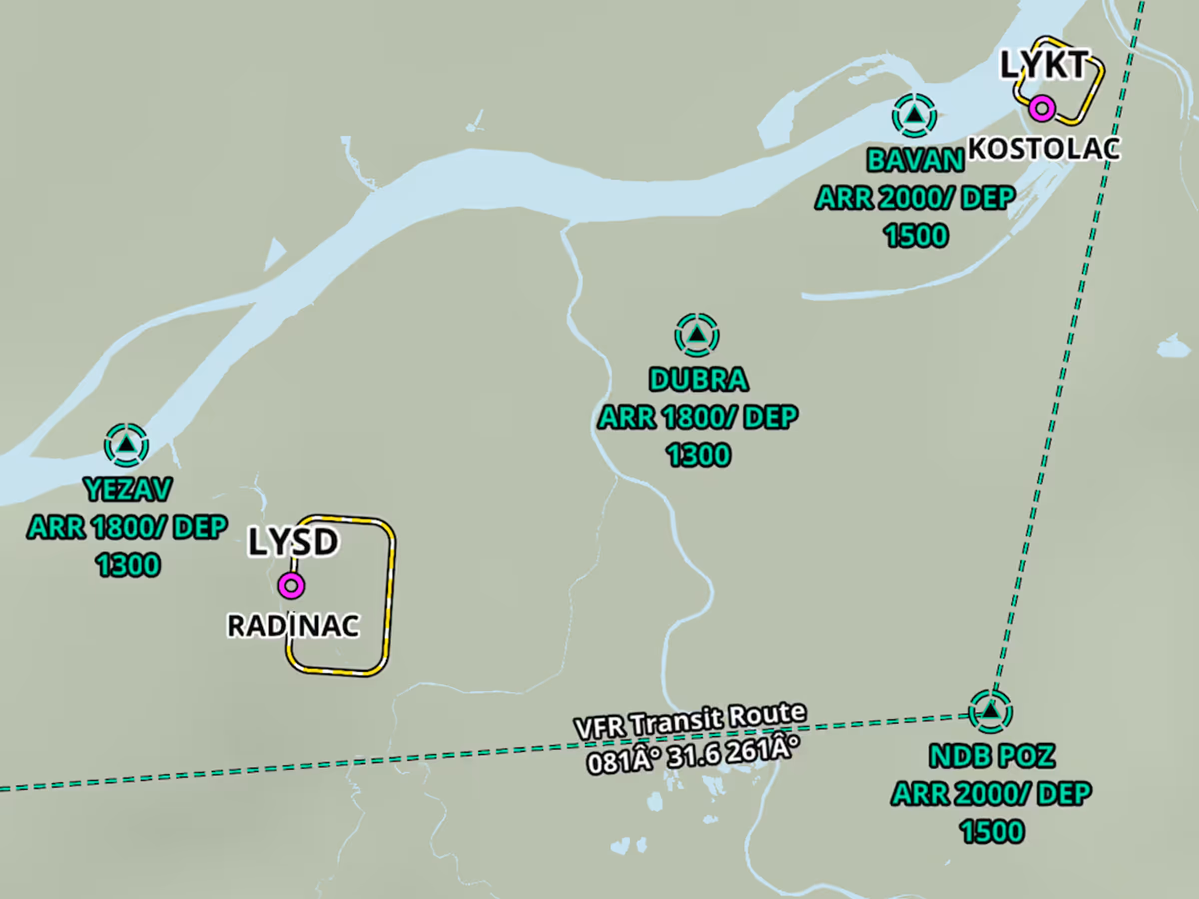
Expanded Jeppesen VFR Data Coverage
- ForeFlight’s Aeronautical Map includes new Jeppesen VFR data covering Bosnia and Herzegovina, Serbia and Montenegro, Albania, Kosovo, and North Macedonia.
- Jeppesen’s digital VFR data includes VFR waypoints, entries and exits, traffic circuits, VFR routes, and more, and is included in the “Nav Database Supplement - Europe” download.