ForeFlight 13.1 
Now Available!

This release includes a new Maps view Sidebar, renaming Imported Documents, and more.

DOWNLOAD FOREFLIGHT 13.1
ON THE APP STORE TODAY

Visit our video library for additional support and information.

Maps Sidebar

The Maps view now displays information for most tappable elements and layers in a new semi-permanent sidebar that stays open while you interact with the map. The Sidebar appears any time you tap-hold on the map to open the Add to Route window or tap on most Map elements, including Aeronautical Map elements like airports and weather or informational layers like AIR/SIGMETs, TFRs, Fuel Prices, and more. The sidebar remains open until you tap the Close button or tap on a blank area on the map, allowing you to pan and zoom the map with the sidebar open, tap other map elements to update the sidebar with their information, change map layers or settings, use Map Annotation or the Ruler, and more.

Watch the video

Selection Marker

ForeFlight displays a flashing green marker on the selected map element or location where you tapped so you don’t lose track of it, and highlights any airspace at that location in green. Tapping on an airway or route leg will outline such segments in green rather than displaying the point marker.

Rename Imported Documents

Rename imported documents directly in ForeFlight for enhanced flexibility and organization. Renaming a document in your Imported Drive will also change the name of that document in any Binder you’ve added it to, and vice versa. Rename documents by tapping Edit in the Documents view toolbar while viewing the Imported drive or a binder containing imported documents, then tap Rename next to any document to edit and save its name.


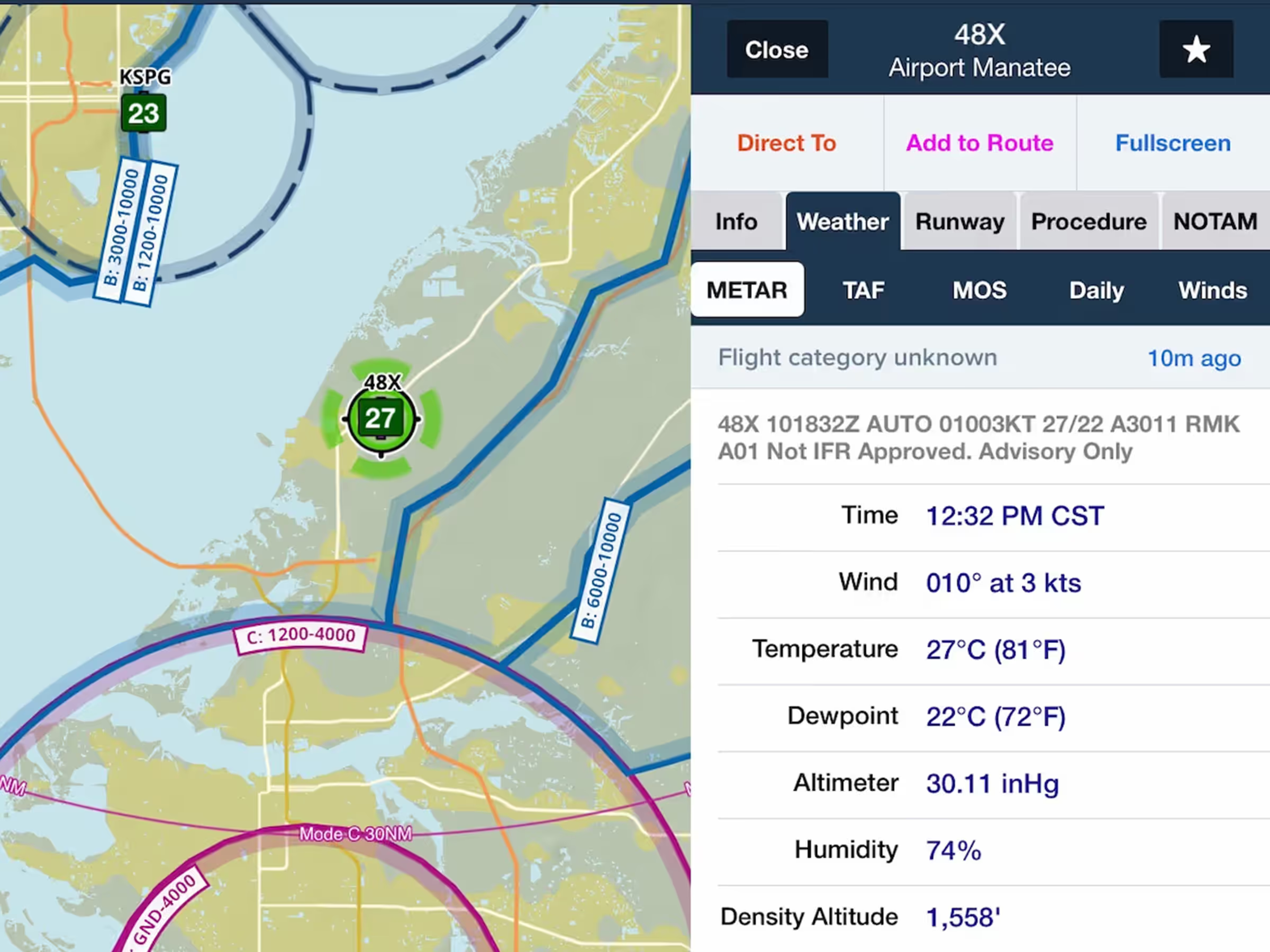
SayWeather METARs

View METARs from SayWeather advisory weather stations at small airports and heliports that lack certified AWOS. A “Not IFR Approved. Advisory Only” remark in the METAR text flags these as unofficial sources. Some stations are not equipped with ceiling or visibility sensors and will thus not report any flight category, but will report wind, temperature, dewpoint, altimeter, humidity, and some standard remarks.

Consolidated International Imagery

The Imagery view offers improved organization for static weather products outside of the U.S. and Canada by better consolidating major regions. All European imagery is contained in the Europe region, all South American imagery in the South American region, and Mexican, Carribean, and Central American imagery is also combined into a single region.