Dynamic Procedures
- Go beyond charts with a new procedures sidebar, MSA displayed on map, vertical descent in Profile View, and more.
- Building on existing capabilities such as Procedure Advisor, enhanced fix markers, and auto-filtered approach minimums, Dynamic Procedures enables an immersive data-driven experience that’s integrated with the moving map.
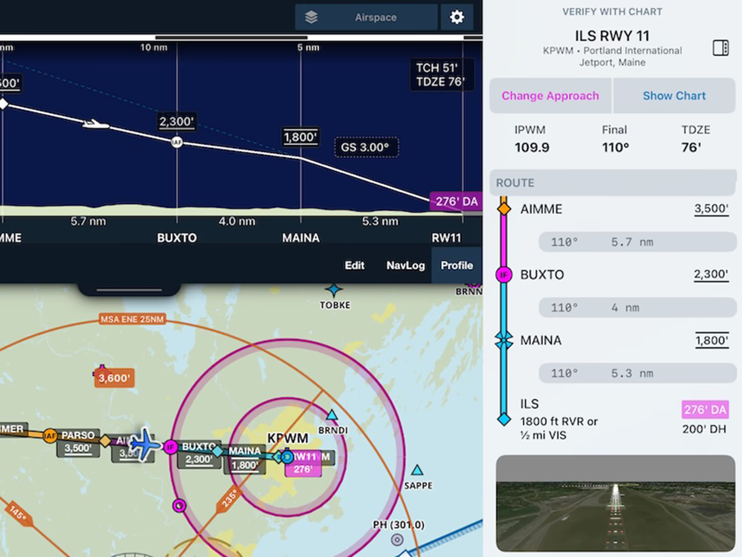
- After selecting an approach, transition, and minimums from Procedure Advisor, tap the square button in the top-right corner of the map to open the procedure sidebar containing key procedure details, frequencies, notes, and per-leg speed and altitude limits for your selected approach.
- Multiple 3D views of the runway integrated into the sidebar provide realistic views of the approach lighting system and short final.
- ForeFlight displays the approach’s MSA directly on the map as an orange circle, with support for multi-altitude MSAs segmented by radial.
- The approach descent profile and glideslope are also viewable in Profile View via the new APCH mode.
- Dynamic Procedures is initially available for the U.S. and Canada only, with additional regions coming soon. All customers in supported regions may access the feature as part of a limited 3-month preview, after which it will require ForeFlight’s Essential subscription plan or above.
Alternates in Flight Binders
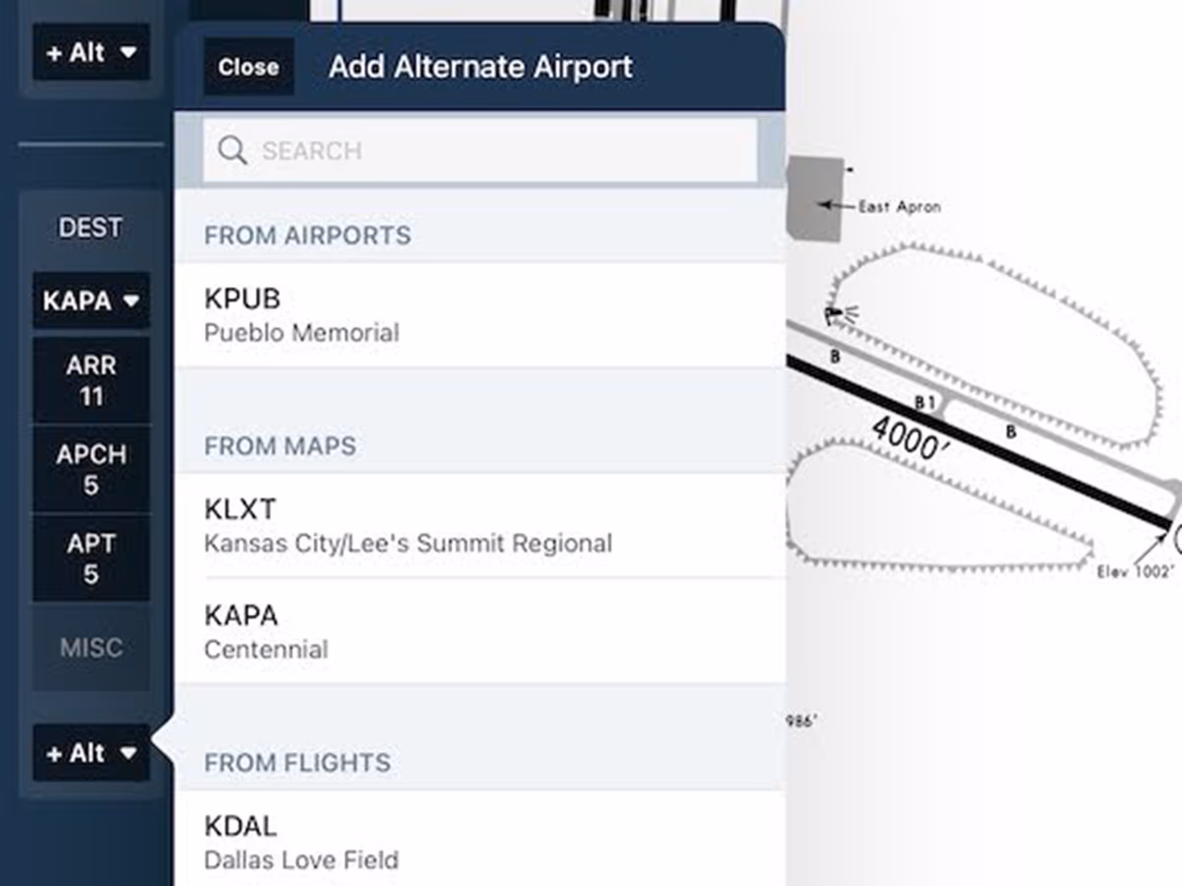
- Easily organize and access all the plates you need for a flight with support for alternate airports in Flight Binders.
- The improved Flight Binder sidebar allows you to add one or more alternate airports for both your departure and destination and select the full range of procedure plates, airport diagrams, and other charts for each one.
Logbook: Custom Currencies
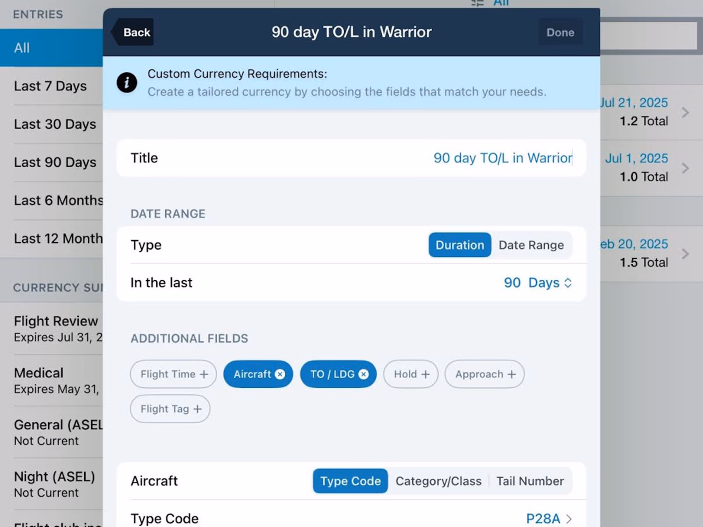
- Set up custom currencies in Logbook using a range of field types to track everything from personal flight minimums to insurance requirements.
- Create a new custom currency using the option at the bottom of the Add Currency menu, and edit your custom currencies from the currency detail view.
- Each custom currency can measure time with either a moving duration or fixed date range, and supports up to six field types, enabling the construction of highly-flexible currency rules.
- Custom Currencies are available with ForeFlight Essential subscriptions and above.
Logbook: Currency Widget
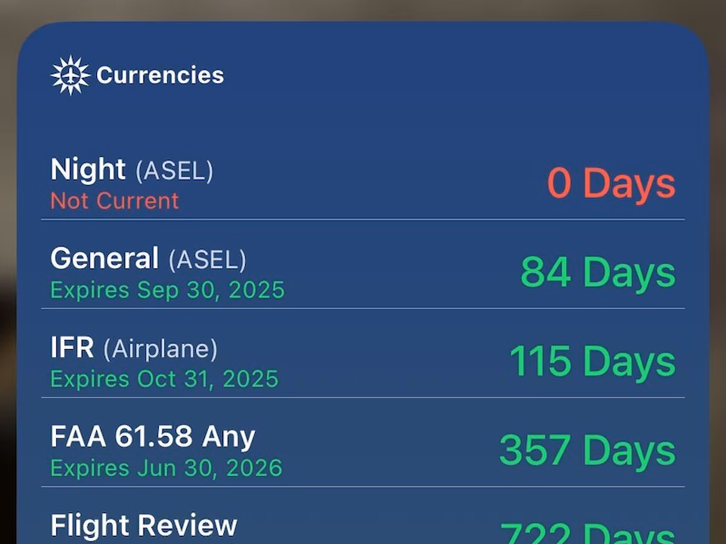
- Keep an eye on your nearest-expiring Logbook currencies, including custom currencies, right from your home screen with ForeFlight’s first ever widget!
- Long-press your home screen and tap Edit > Add Widgets > ForeFlight to select from five available widget sizes.
Improved Multi-Element Single Tap
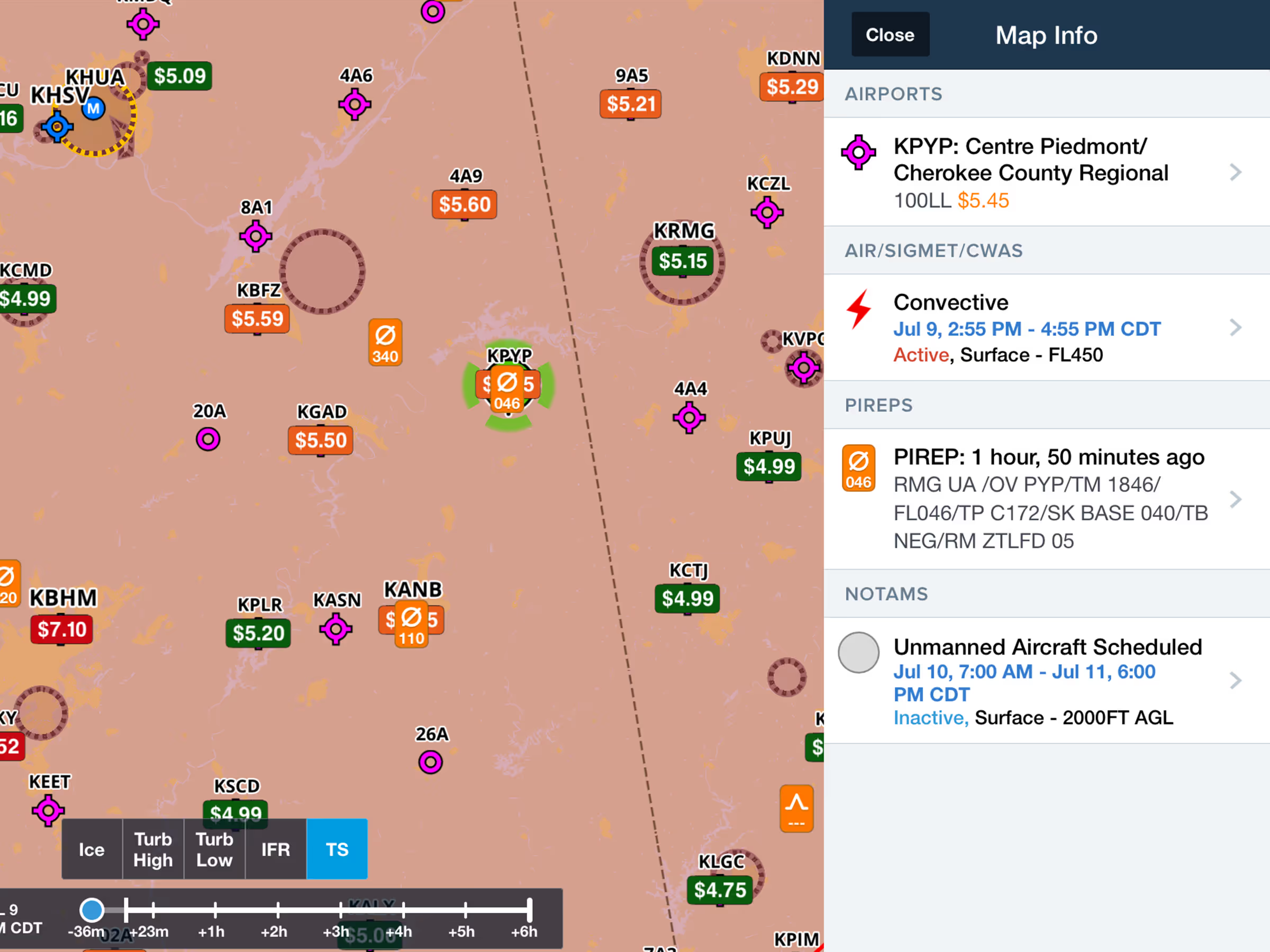
- Avoid frustrating mis-taps on overlapping Map elements with an improved Map Info menu that lists all available elements at the location you tapped, providing at-a-glance information and easy access to each element’s detail view.
Improved NavLog Layout
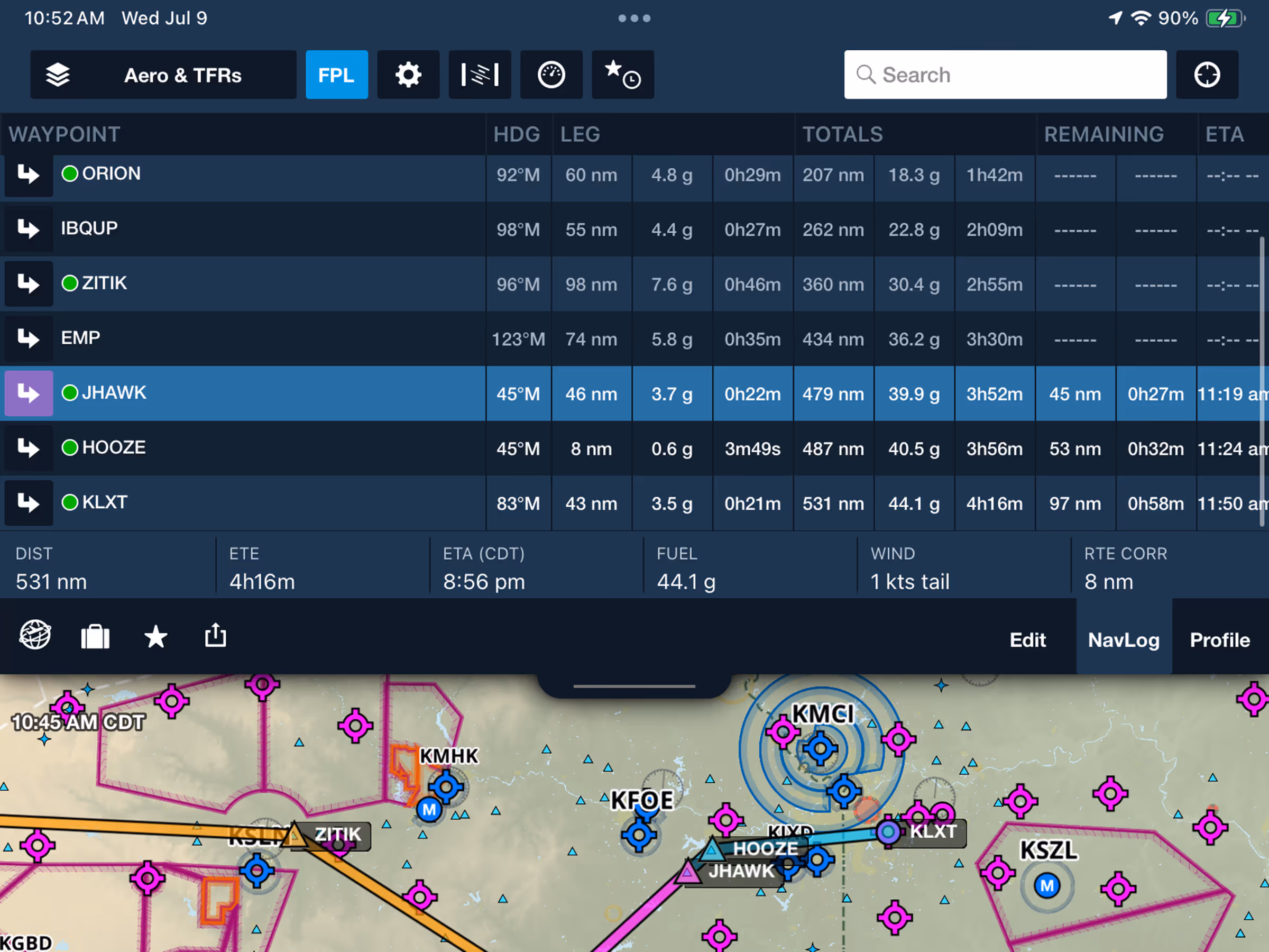
- View and interpret the FPL NavLog on Maps more easily with a simplified single-column waypoint list and swapped positions for Leg and Total details for more intuitive scanning.
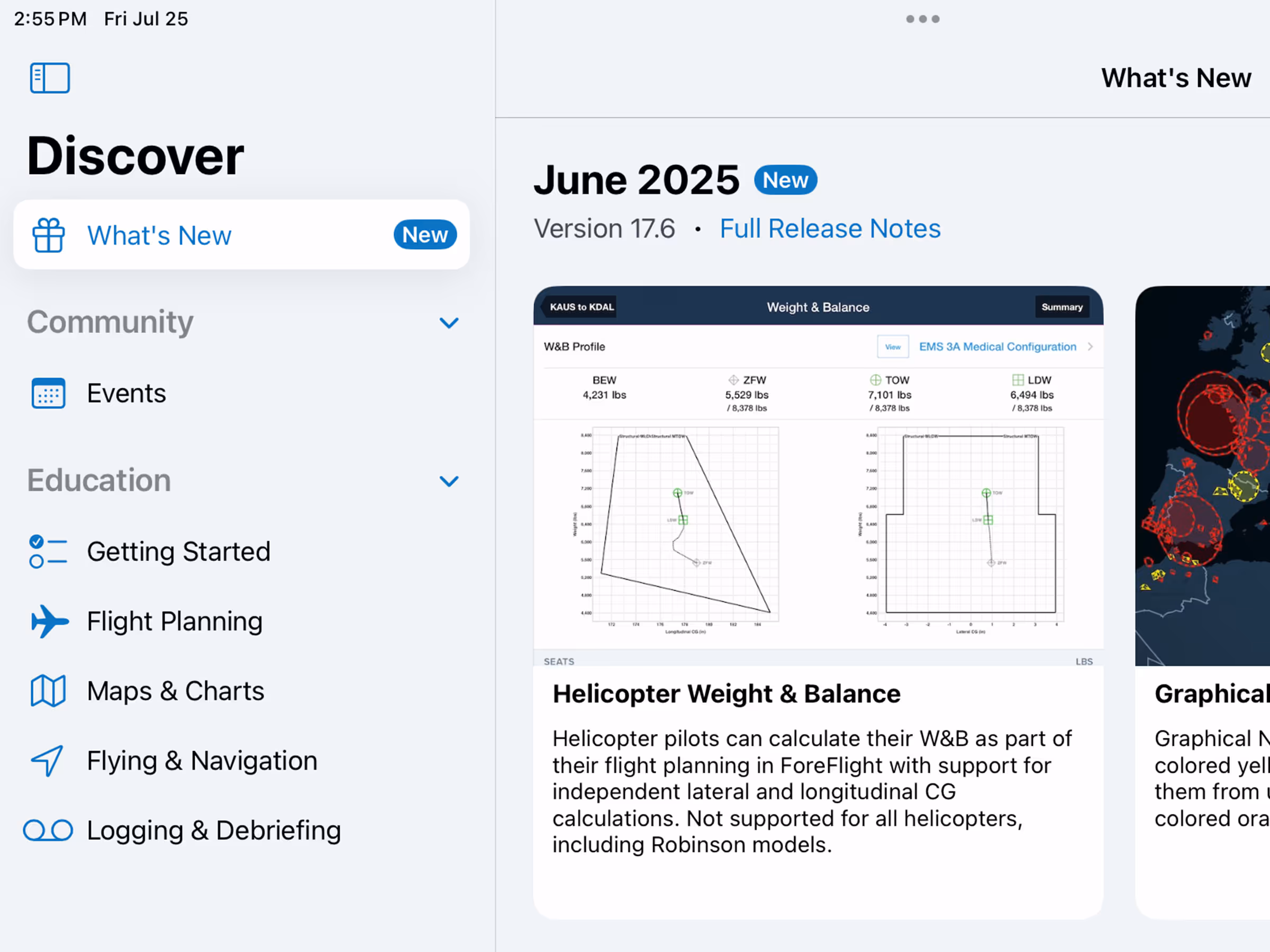
Discover: What’s New
- Catch up on ForeFlight’s latest features at any time right inside the app with the What’s New tab in More > Discover. A blue notification dot lets you know when there’s new features to discover.
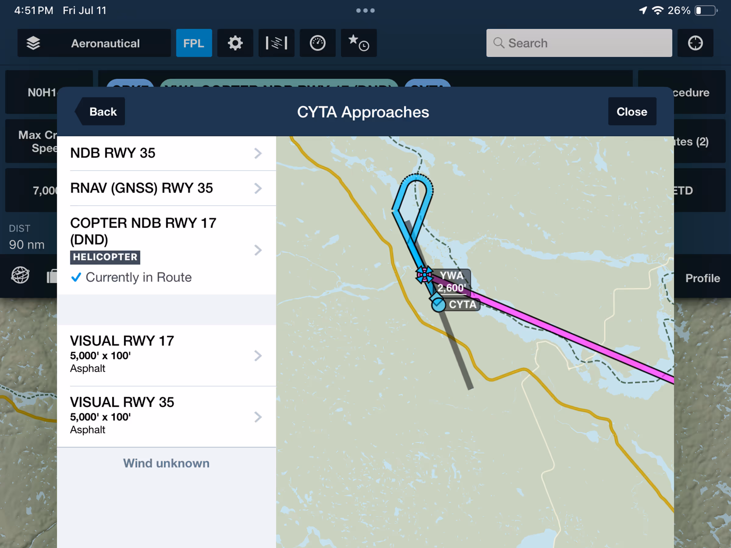
Helicopter Procedures
- Simplify rotorcraft flight planning and inflight navigation with support for helicopter-specific procedures at supported airports.
- With a rotorcraft profile selected in the FPL Edit view, available procedures appear in Procedure Advisor with a prominent HELICOPTER label.
Military Fight Bag: Camo App Icon
- ForeFlight MFB offers a new camo-styled app icon as an alternative to the blue civilian version, available via the new toggle in More > Settings > App Icon. Available with all ForeFlight MFB subscriptions.
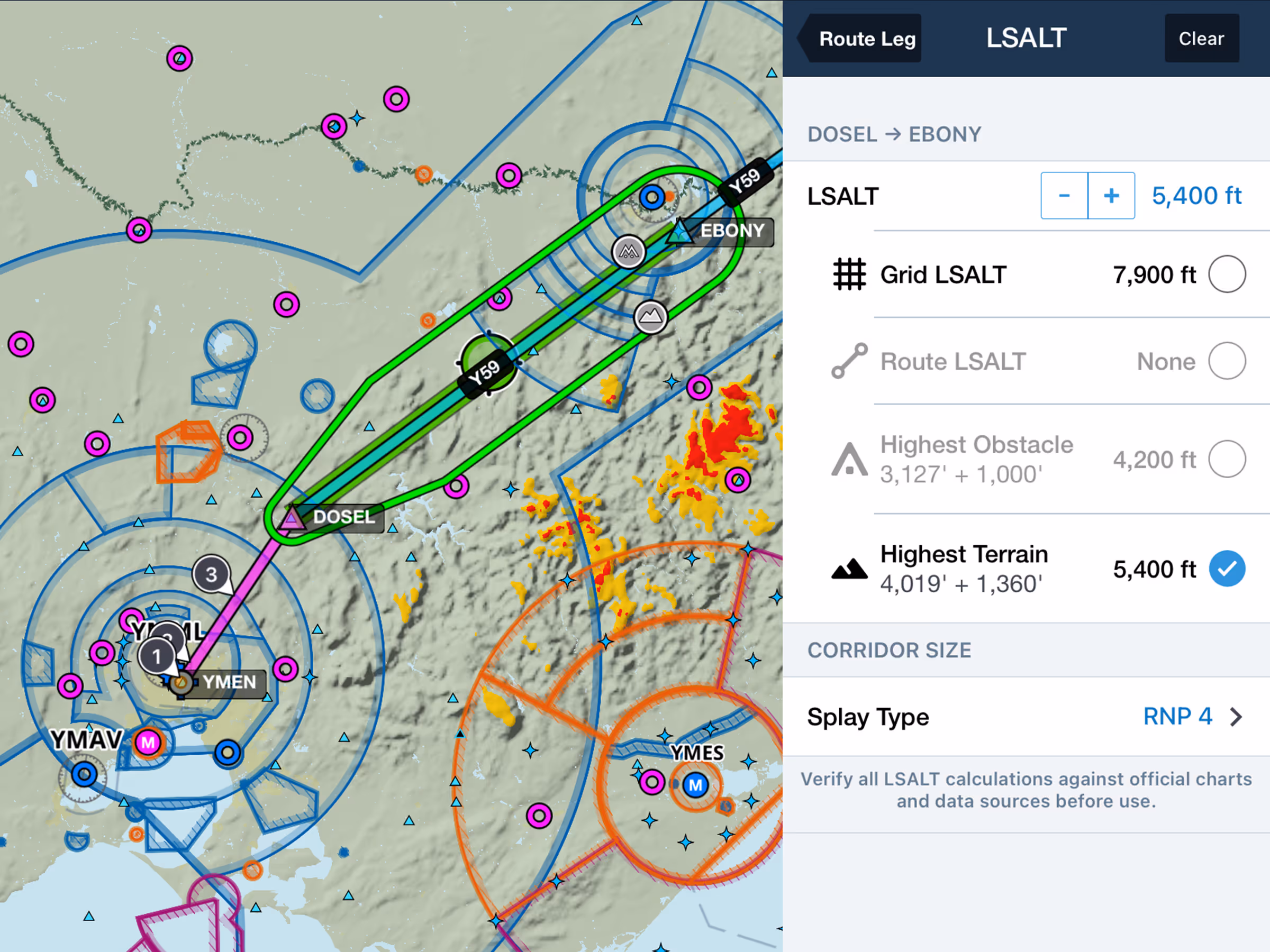
LSALT Calculator
- Streamline your IFR planning and comply with CASA requirements with auto-calculated lowest safe altitudes (LSALT) based on per-leg terrain and obstacle data.
- The LSALT Calculator setting is available in the Map Settings menu and is enabled by default for all non-military accounts with the Australia subscription region.
- Access the calculator from either the FPL NavLog under the LSALT column or by tapping any route leg on the map and tapping LSALT.
- ForeFlight will automatically calculate each leg’s LSALT based on one of four available values - Grid or Route LSALT, or the highest terrain or obstacle along each leg. You can also manually set the LSALT in 100’ increments.
- Multiple Splay Type settings are available to calculate the size of the terrain and obstacle corridor around each leg, such as RNP 2 or 4, GNSS and non-GNSS RNAV, night VFR, and radio navaid.
- While the LSALT Calculator is open for a given leg, the corridor for that leg is depicted in green on the map based on the splay type, and the Hazard Advisor map layer is automatically enabled and set to the current LSALT altitude to highlight the location of hazards at that altitude.
- LSALT Calculator is available with any ForeFlight subscription that includes Australia.