No items found.
Skip to main content
April 2023

Avian Hazards Forecast

View consolidated military bird forecasts (NEXRAD, BAM, SOAR) for supported airports.

No images available to display.
back
next

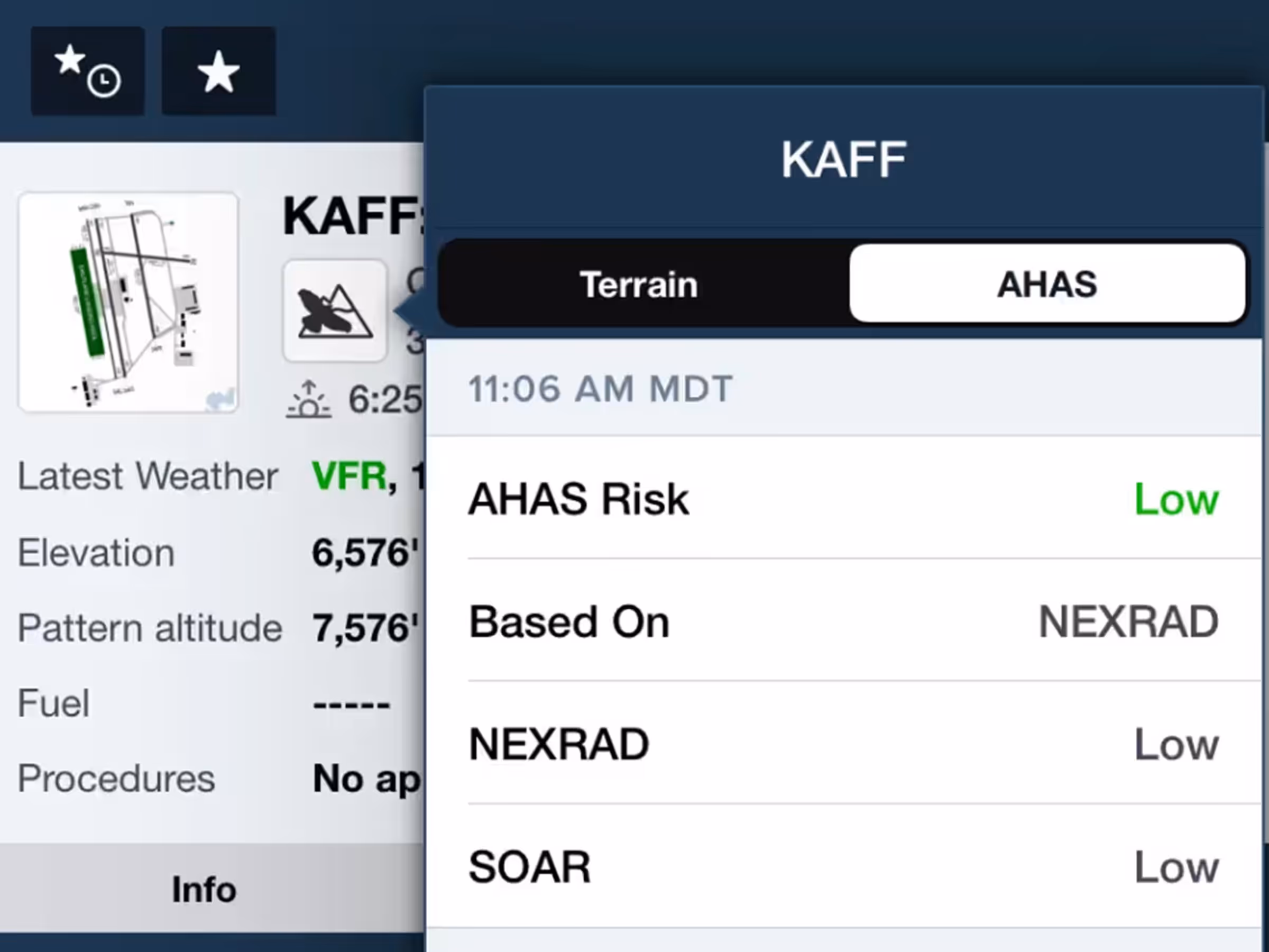
Get a consolidated view of all available USAF AHAS forecasts for supported airports. You can search for an airport in the Airports tab or tap it directly on the map. A bird or bird and mountain icon indicates that an airport supports AHAS forecasts. Tap the icon to see the military bird forecasts for the next 10 hours, which combine forecasts from NEXRAD, BAM, and SOAR.

Available with ForeFlight’s Military Flight Bag One subscription plan.


Release notes

Release notes

  • Get a consolidated view of all available military bird forecasts (NEXRAD, BAM, and SOAR) for supported airports.
  • Supported airports are indicated by a bird or bird + mountain icon just below the airport’s name in the Airports view or in any airport popup.
  • Tap the icon to view all available USAF AHAS forecast data for the next 10 hours.
  • Available with ForeFlight’s Military Flight Bag One subscription plan.

Support

Support

FAQs
Find answers to your questions
Pilot's Guide
The complete ForeFlight handbook
Video Library
ForeFlight videos all in one place
Buying Guide
Choose the right iPad and plan