

ForeFlight’s High Resolution Basemap depicts ground features and cultural elements in much greater detail for improved inflight reference.
ForeFlight’s basemap is what you see with no other charts or maps other than the Aeronautical Map enabled, and includes terrain, roads, and other cultural elements.
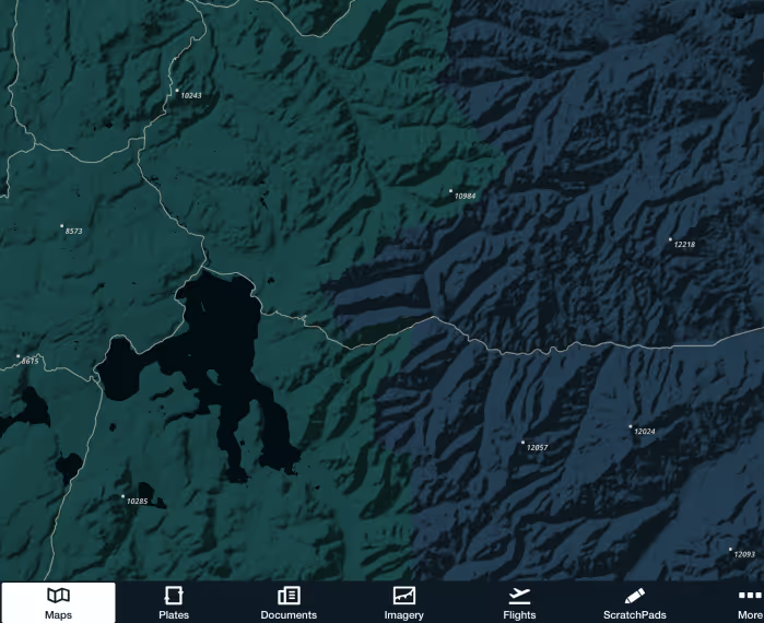
The default basemap provides a basic depiction of major roads and urban areas, while the High Resolution Basemap dramatically increases the level of detail, exposing minor roads and individual railway lines, increasing the resolution of coastlines and urban areas, and highlighting national parks and forests in green. The High Resolution Basemap also adds terrain peak markers with altitudes so you can easily identify the highest points in an area. You can enable/disable these by tapping Map Settings (cog button in the Maps View) > Terrain and toggling the Peaks switch on/off.
The Cultural Elements menu in Map Settings also allows you to toggle different features of the basemap on or off. The last element, Points of Interest, includes landmarks or notable buildings that are visible from the air, such as castles and palaces in Europe, and will include additional elements in the future.
Like with High Resolution Terrain, ForeFlight will automatically select and download the High Resolution Basemap for your region, but you can also download the basemap for other regions by enabling it in Download Settings. Toggle the High Resolution Basemap switch on for a region and select each desired country/state for download.