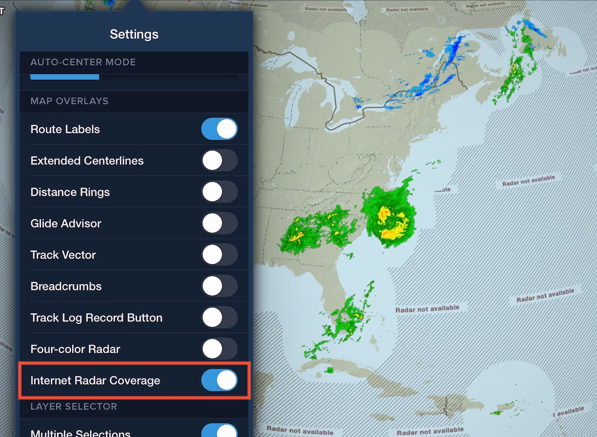

ForeFlight’s internet radar map layers (Composite and Lowest Tilt) now visually indicate on the map where coverage is not available to help you differentiate between areas without coverage and areas with clear skies.
Non-covered areas display gray cross-hatching with a “Radar not available” message, allowing you to easily see the coverage boundaries.
You can disable the coverage display and remove the cross-hatching by turning off the “Internet Radar Coverage” setting at the bottom of the Map Settings menu (the cog button on the Maps view).