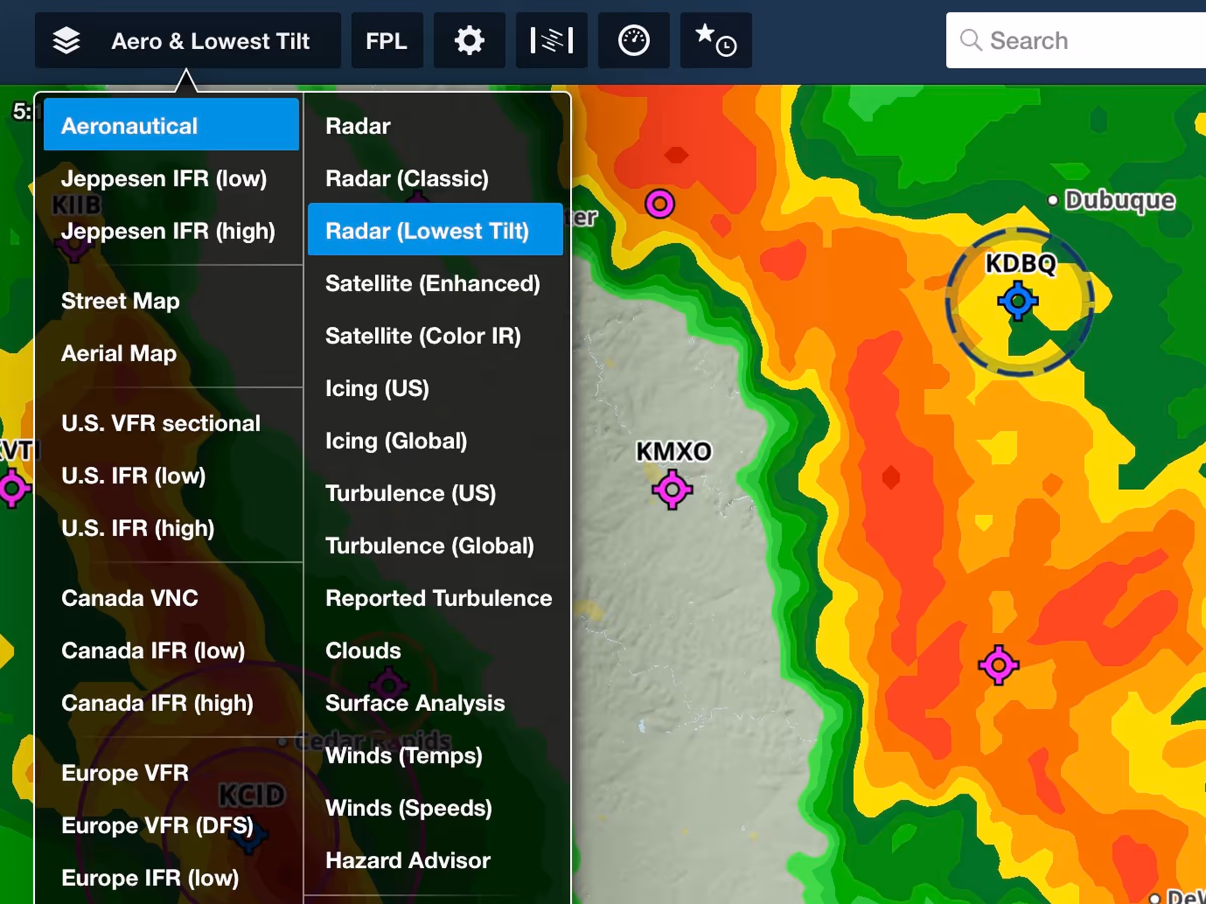
See where precipitation is likely reaching the ground with the return of this popular map layer sporting lower latency and improved spatial resolution.
The Radar (Lowest-Tilt) layer only depicts radar returns obtained at the lowest angle of the radar’s sweep, which better correspond to where precipitation is reaching the ground in the form of rain or snow.
The new layer benefits from significantly reduced latency of 6 minutes or less and also provides enhanced spatial resolution, although the layer doesn’t yet support storm track markers.
Enable this new layer just below the existing one in Layer Selector > Radar (LowestTilt). Coverage for the Radar (Lowest-Tilt) layer is currently limited to the U.S. and South Korea.