.avif)
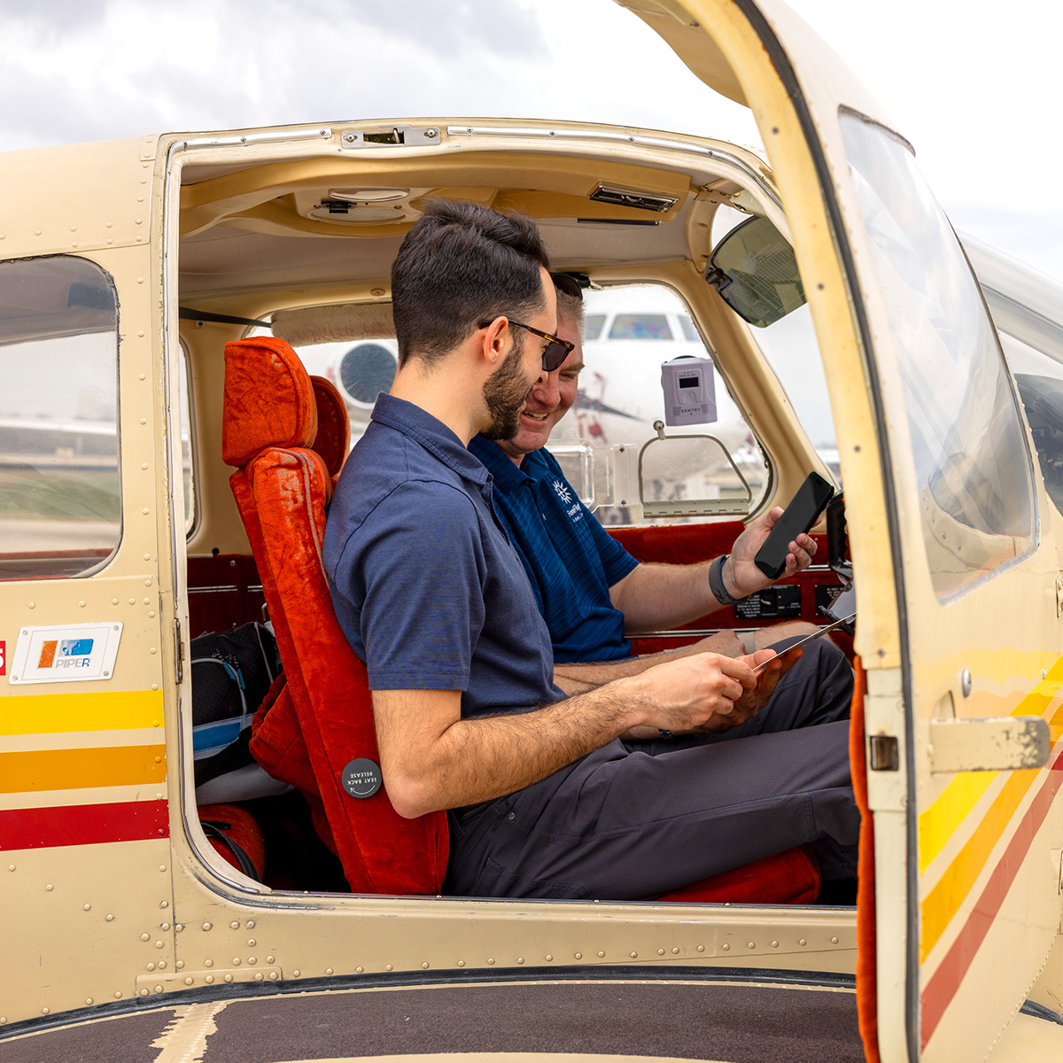
The town of Pagosa Springs is a hidden gem in the southern Colorado Rockies, known for its hot springs, hiking, and small town charm, with even more to explore in nearby Durango. My wife and I make it a yearly tradition to visit, first with our dogs, and now with our two young sons.
We used to make the 12-hour drive, but with two boys under three, that’s no longer appealing. This year, my wife drove ahead with the dogs while I followed the next day with the kids for a relatively quick five-and-a-half-hour nonstop flight in my Lancair Columbia 300.
When flight planning matters most
Flying single-pilot IFR into an unfamiliar mountain airport with two kids onboard? Not exactly a walk in the park. Spring weather in the Rockies meant icing was my top concern, so I started planning days in advance. Forecasts suggested a system clearing the region, but terrain requirements near Santa Fe would push me close to the freezing level, so I built flexibility into my plan.
The value of a clearance
The route looked like smooth VFR all the way, but I filed IFR anyway. It turned out to be the right call; wildfire smoke and turbulence made for a rough ride across Texas. The boys slept through it, but for me, it was a reminder of how quickly conditions can turn complex.
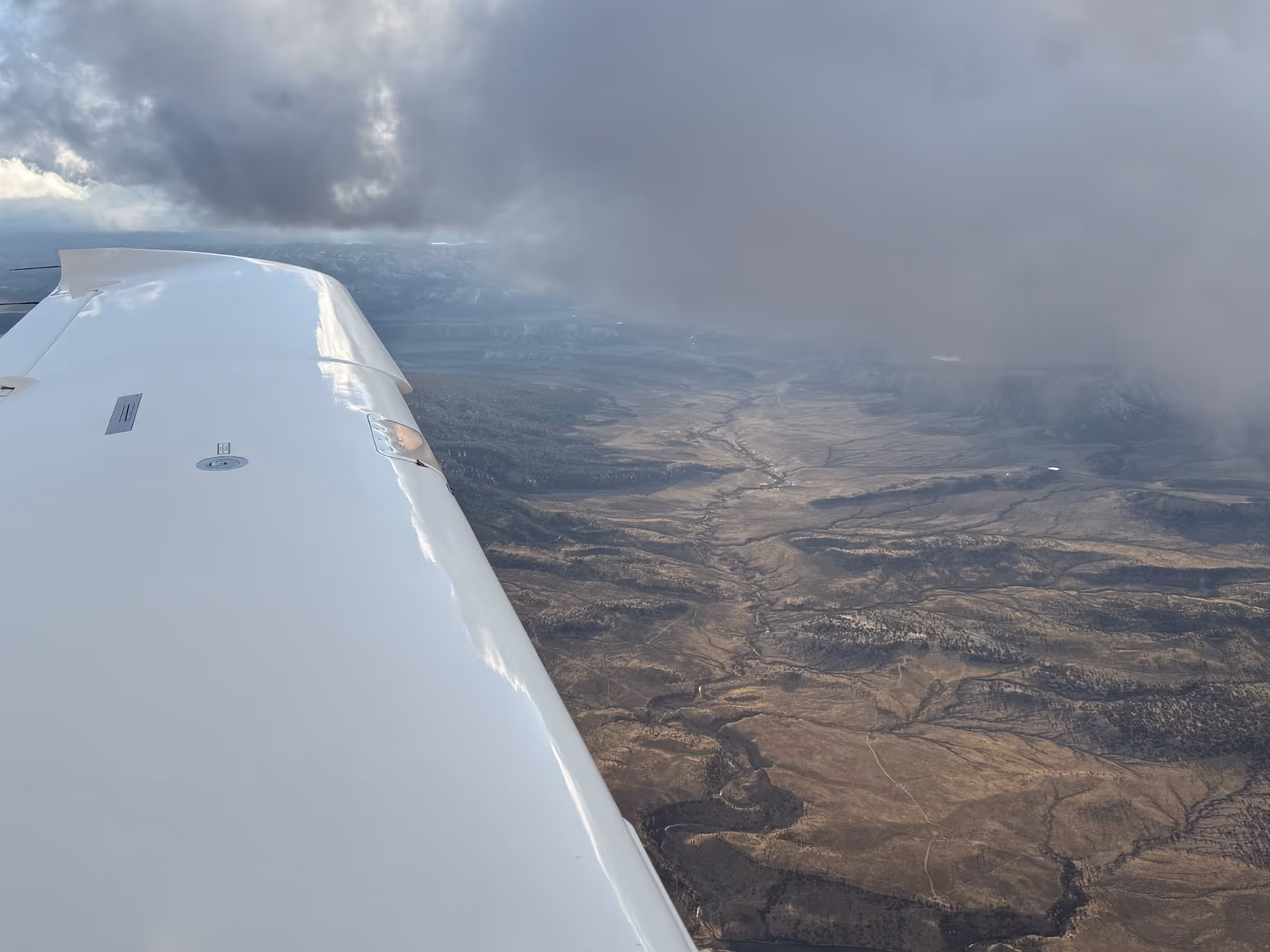
As we neared Santa Fe, Albuquerque Center was busy with all kinds of traffic. Virga trailed from the clouds above while terrain rose from below. Staying ahead of the airplane and keeping up with radio calls became critical.
.avif)
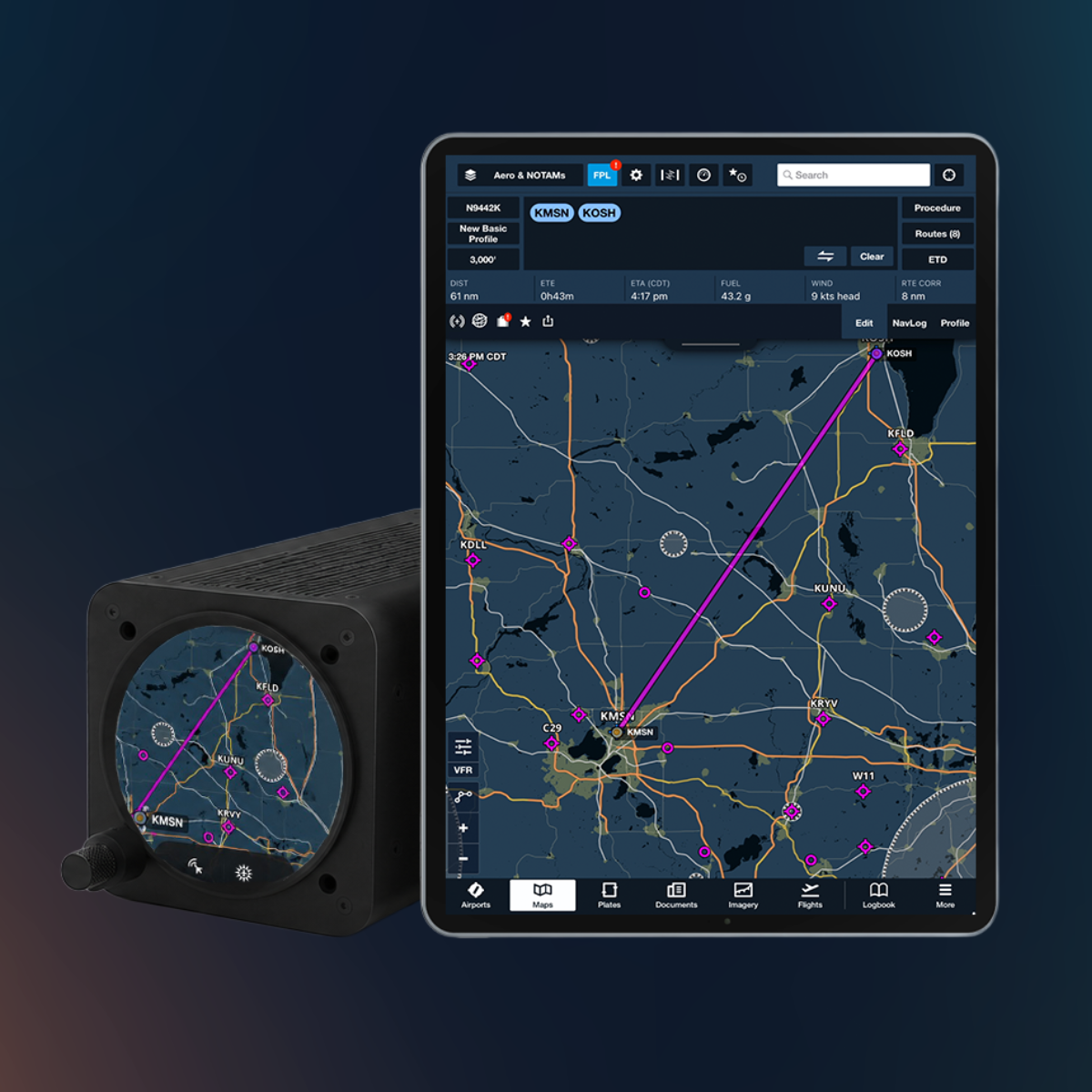
Tracking north over the Rio Grande Corridor, I requested the RNAV 01 into Pagosa Springs. The high terrain, heavy frequency load, and a pilot with a similar callsign made it a bit of a challenge, but after a few tries, I was cleared for the initial at FEMAD. With both kids awake and hungry, snacks and toys kept them occupied while I focused on flying safely.
To circle or not to circle?
Pagosa Springs has just one instrument approach: the RNAV 01, with LP, LNAV, and circling minimums. The final approach is offset by 20º, and the day I flew in, the AWOS reported winds favoring the opposite runway.
Circling in the mountains carries real risk, but so does landing downwind in a Columbia. I decided that if we were clear of clouds at 500’ above minimums, I’d circle. Otherwise, I’d accept a straight-in landing downwind.
Keeping the brief simple
I was helped immensely in the moment by our new Dynamic Procedures sidebar. Filing single-pilot IFR with both kids aboard, I loved having a fast brief of the approach. Before, I’d have relied on the plate on the map, which still serves well, but requires more heads-down time.
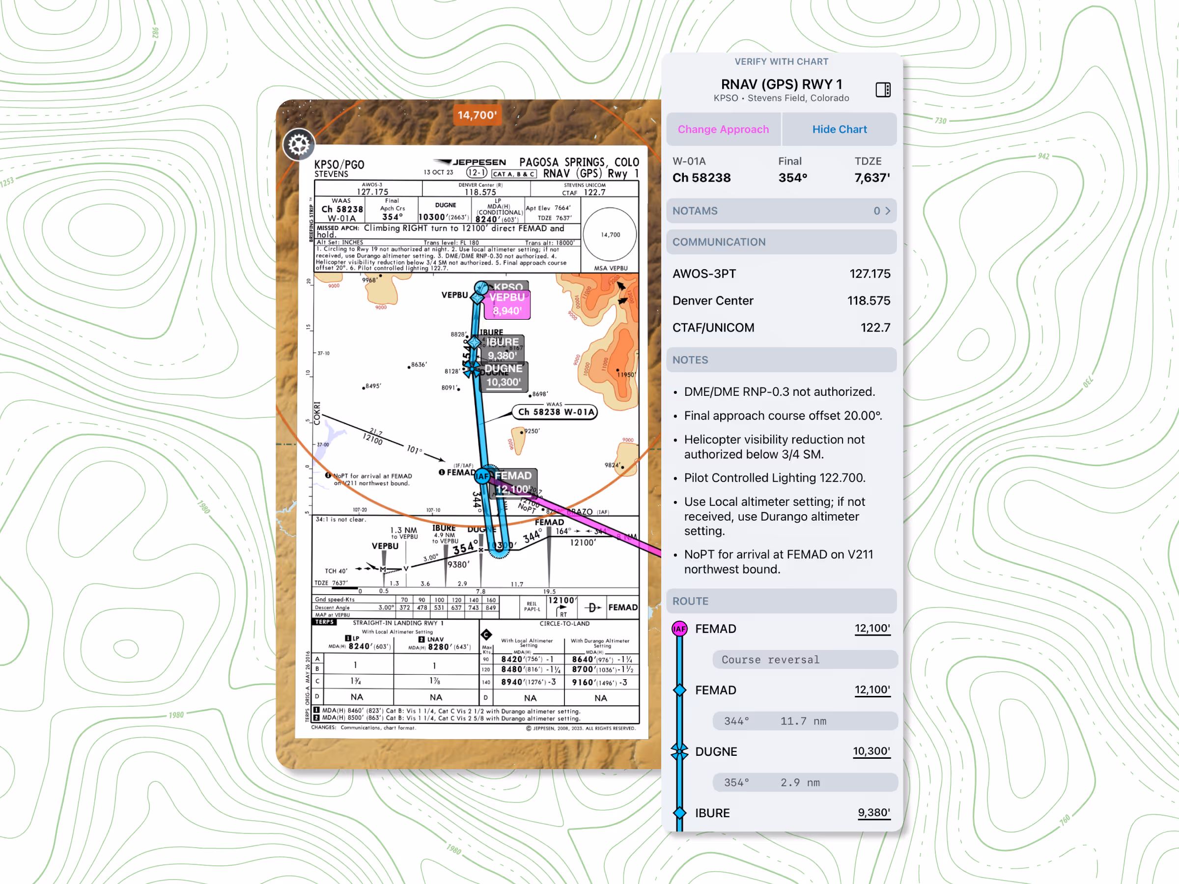
With the sidebar, I could quickly check touchdown zone elevation, step-down altitudes, and comm frequencies in a single, linear workflow. The 3D depiction of the offset final made it easier to visualize the approach than simply reading about it.
As we descended through the mountains, the ability to scan and verify each element kept me ahead of the airplane, even with snowy ridges passing uncomfortably close and my headset trying to enforce a sterile cockpit against a wailing infant. By the time we established left downwind for Runway 19, I could focus fully on flying, and my wife captured what ended up being one of my better landings.
A data-first approach to IFR
That day made me a believer in data-driven approaches. Having all the procedure information organized and easy to reference kept me ahead of the airplane, especially with terrain close and two kids alongside me.
The Dynamic Procedures sidebar helped me verify step-down altitudes, frequencies, and the offset final quickly, while the 3D View gave a clear picture of the valley and runway alignment. Together with hazard awareness and traffic layers, I could concentrate on flying rather than flipping pages or searching for details.
It’s not a replacement for careful preflight planning or a traditional plate, but in a high-workload environment like circling an approach in the mountains, having the data clearly laid out made a real difference in staying safe and in control.