Have you ever been on short final with everything feeling locked in, airspeed is great, descent is stable, when suddenly you're either sinking too fast or ballooning unexpectedly? One second you’re feeling like a textbook pilot, and the next you’re yanking in power and wondering what went wrong.
Chances are, you just met one of aviation’s trickiest threats: wind shear.
Wind shear doesn’t care if you’re a student pilot in the pattern, a weekend warrior headed to a pancake fly-in, or an airline crew on final to JFK. It can hit anyone, anywhere. The good news is that with ForeFlight, you’ve got the tools to spot it, plan for it, and stay ahead of the surprises.
Let’s break it down.
What is wind shear, really?
Wind shear is a rapid change in wind speed or direction over a short distance, either horizontally or vertically. While it’s not always dangerous, it can be incredibly disruptive, especially during takeoff or landing.
Picture this: you're flying through a strong headwind, and suddenly it switches to a tailwind. Your airspeed drops rapidly, even though your instruments may lag behind. That sudden loss of lift can lead to altitude loss, stalls, go-arounds, or worse.
Why it matters to every pilot
Many people assume wind shear is only a problem for jets, but lighter aircraft can actually be more vulnerable. We don’t have the extra thrust or momentum to power through it as easily. That means whether you’re flying a Cessna or a Cirrus, wind shear deserves your attention.
Even if you’re just making a short hop for lunch, a microburst in the area can quickly turn a calm approach into a go-around. Add terrain, obstacles, or gusty crosswinds, and you’ve got a serious challenge on your hands.
Where wind shear shows up
It can happen almost anywhere, but it’s most common in a few specific situations:
- Near thunderstorms, especially during downdraft or outflow stages
- Along frontal boundaries, especially cold fronts
- In low-level jet streams or temperature inversions at dawn and dusk
- Around mountainous areas, where terrain disturbs airflow
- Close to the ground during changing weather at busy airports
How ForeFlight helps you outsmart it
Here’s where technology gives us a real advantage. ForeFlight includes several features that make spotting and avoiding wind shear easier than ever.
TAFs and METARs with wind shear callouts
When you check Terminal Aerodrome Forecasts (TAFs) in ForeFlight, look for entries like WS020/22035KT. That tells you wind shear is expected at 2,000 feet AGL from 220 degrees at 35 knots. METARs may also report sudden shifts or loss/gain in wind, especially after thunderstorms.
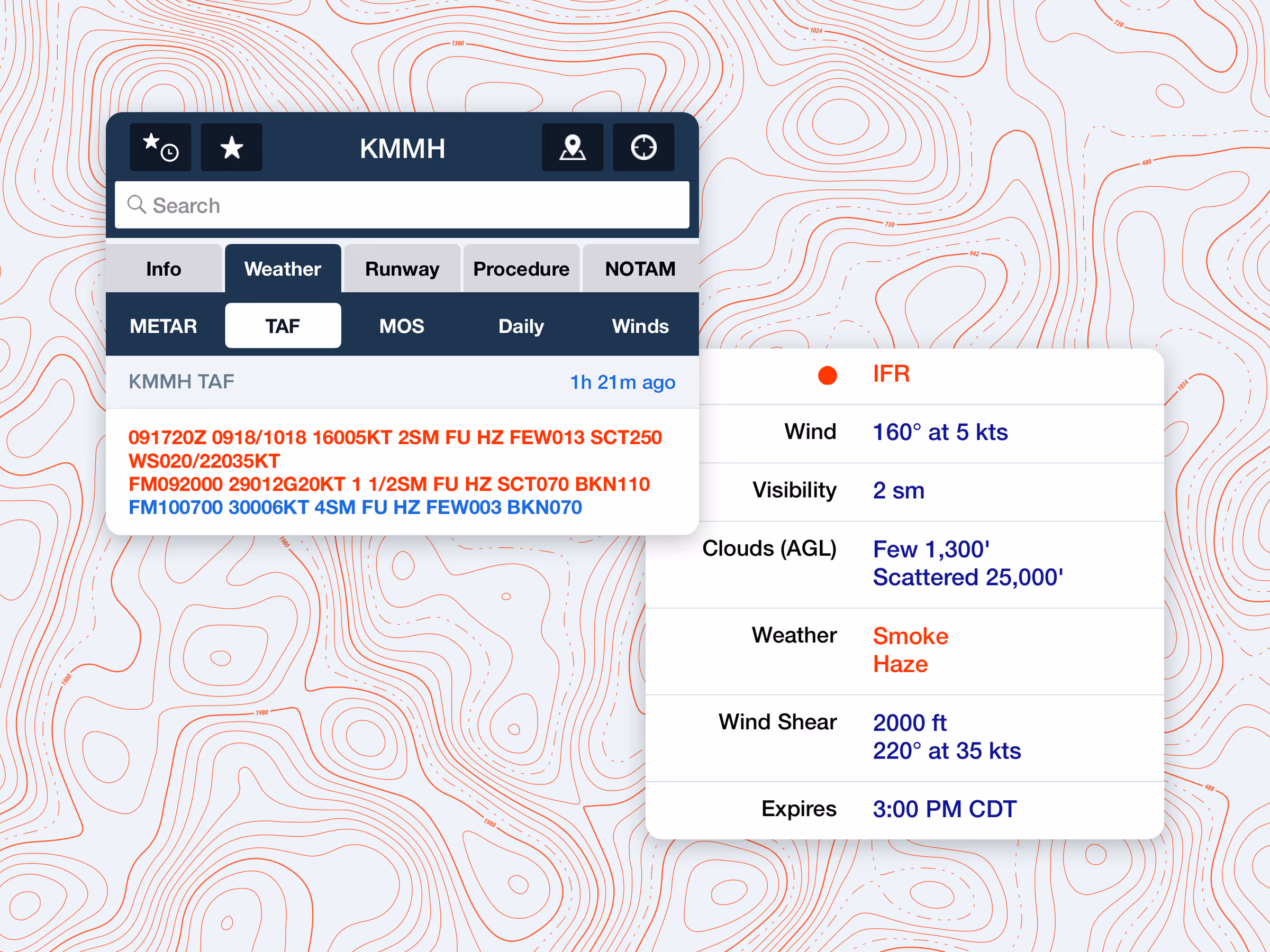
ForeFlight clearly highlights these notations and provides a simple translation with just a tap. It also summarizes the hourly TAF and displays wind shear in its own category in the hourly summary below the TAF. This takes the guesswork out of interpreting those coded messages we’ve discussed in the previous blog when you’re preflighting or reviewing conditions in flight.
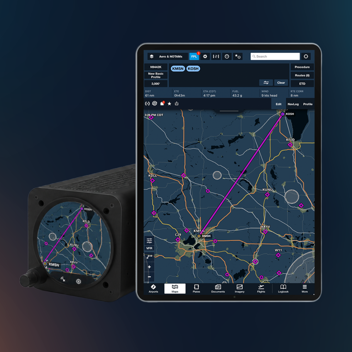
Profile View and Winds Aloft
Planning your route using Profile View? You can do more than just check for terrain. You can also add the Headwind/Tailwind layer to see potential changes in speed or direction along your climb or descent.

If the wind direction or speed shifts significantly with altitude, you may be flying through a shear layer. Seeing this ahead of time gives you the opportunity to adjust your climb profile or be extra vigilant.
Weather imagery tools: Radar, satellite, and wind shear charts
Within the Imagery tab, ForeFlight offers radar, satellite overlays, and prog charts, including low-level wind shear charts and convective SIGMETs.
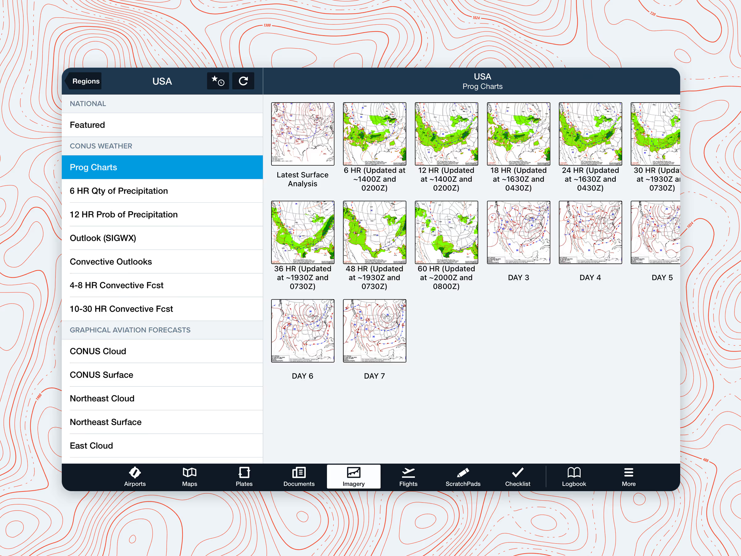
If you’re flying near thunderstorms or frontal systems, these tools help you understand the environment before you enter it. Combine this with the Flight Category layer to gauge instability along your route.
What you can do about it
Being aware is the first step, but knowing how to respond is just as important. Here are a few tips:
- Plan for it: If wind shear is in the forecast, brief it. Know where it’s expected and when.
- Stabilize early: Getting stabilized on approach gives you more room to notice and react to sudden changes.
- Use a buffer: A few extra knots on final (within limits) can help maintain energy through unexpected losses.
- Be ready to go around: Trust your instincts. If it feels off, go around and reset.
- Stay up-to-date: Conditions can evolve quickly. Continue checking METARs and radar while en route and even during taxi.
Final thoughts: Respect the shear
Wind shear may be invisible, but it doesn’t have to be unpredictable. With a good understanding of where it tends to form and the ability to identify it with tools like ForeFlight, pilots can make better, safer decisions.
So next time you’re reviewing the weather and something seems just a little... off, don’t ignore it. Trust the tools you used during training, trust your instincts, and fly prepared.
Fly smart. Stay sharp. And may your next landing be perfectly uneventful in the best way!