No items found.
Skip to main content
April 2026

Enhanced US Icing & Turbulence Map Layers

Plan more accurately with improved US Icing and Turbulence layers.

No images available to display.
back
next

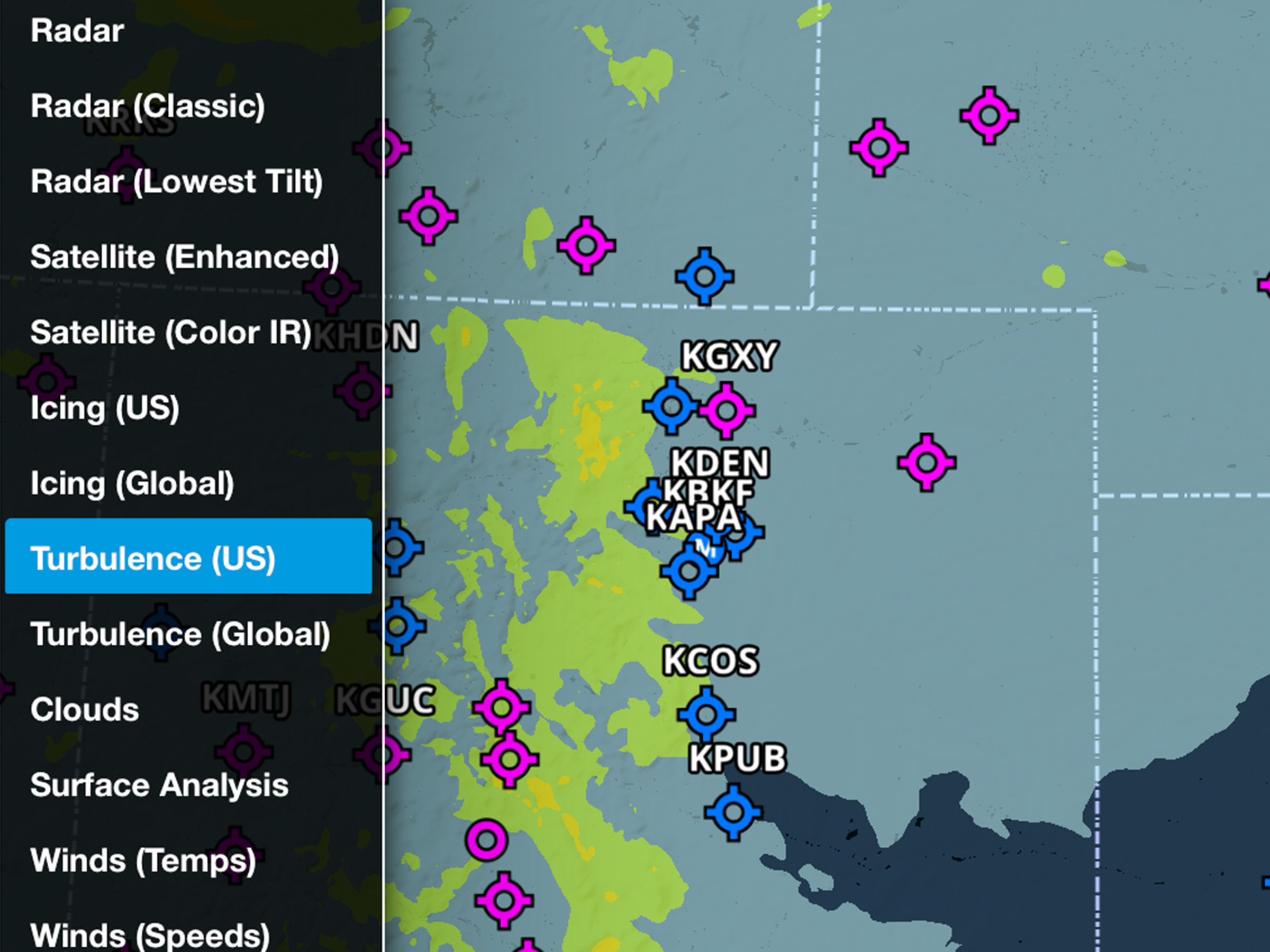
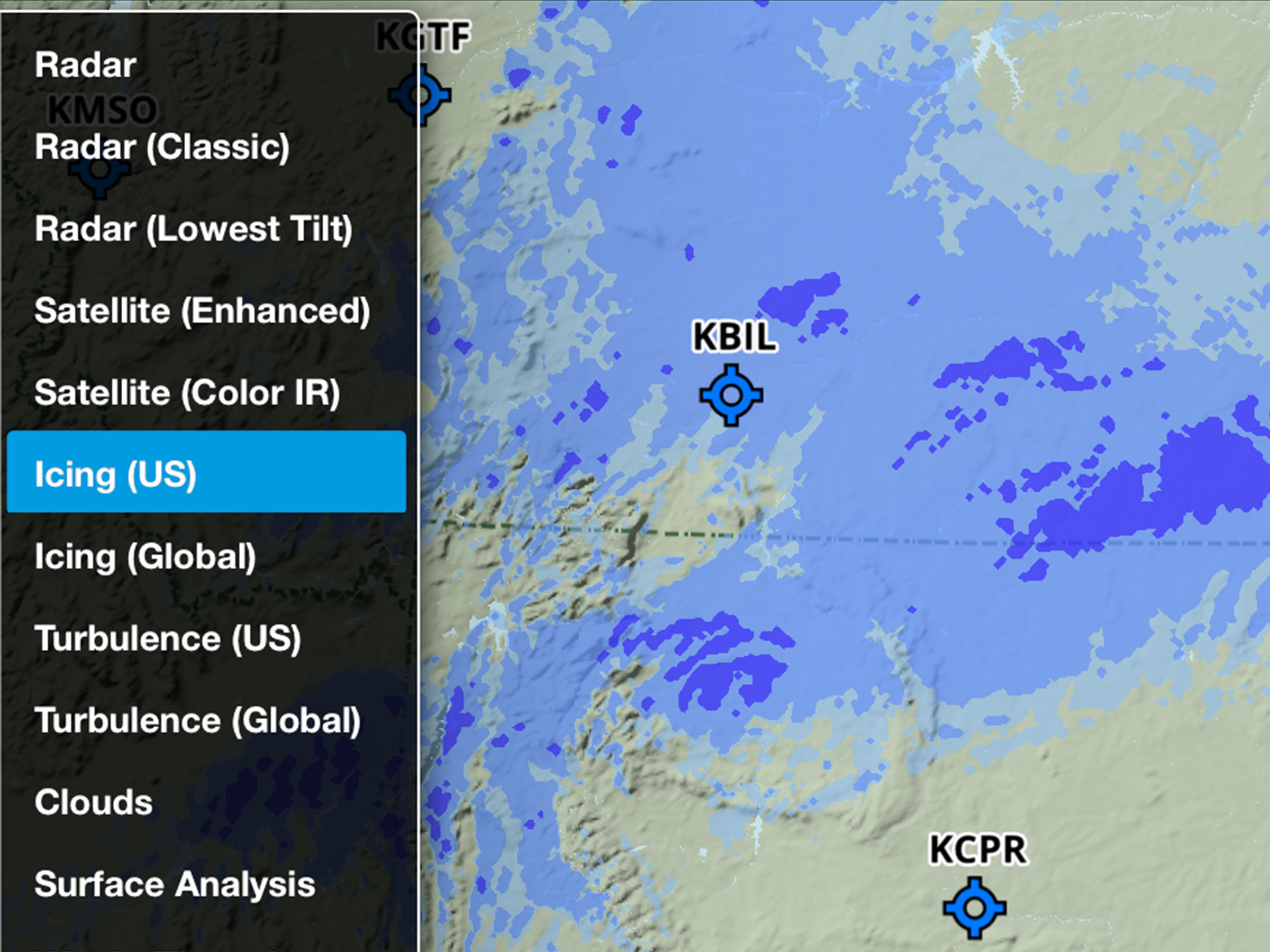
Identify inflight icing and turbulence conditions using enhanced Icing (US) and Turbulence (US) map layers, powered by NOAA’s Domestic Aviation Forecast System (DAFS). Both layers now use higher-resolution (3km) model data, down from 13km, providing more detailed, localized forecasts.

Tap the Icing (US) layer to view improved modeling of liquid water content and large droplet icing environments, or tap the Turbulence (US) layer to better detect clear-air, mountain wave, low-level, and storm and cloud-driven turbulence. 

Icing and Turbulence forecast map layers are available on Essential plans and above.

Release notes

Release notes

  • Plan with higher-resolution graphical icing and turbulence forecasts for the US with improved data from NOAA’s Domestic Aviation Forecast System (DAFS). 
  • Both the “Icing (US)” and “Turbulence (US)” map layers are now derived from higher resolution (3 km) model data, down from 13km, providing significantly more detail and precision.
  • Icing severity forecasts now incorporate improved modeling of liquid water content and large droplet icing environments.
  • Turbulence forecasts include improved detection of clear-air and mountain wave turbulence, enhanced low-level turbulence guidance, and the addition of convectively induced turbulence (CIT).
  • The extent of both layers’ coverage outside U.S. borders has been slightly reduced due to the improvements in forecast precision. The global icing and turbulence forecast layers remain unchanged.
  • Icing and Turbulence forecast map layers are available with Essential plans and above.

Support

Support

FAQs
Find answers to your questions
Pilot's Guide
The complete ForeFlight handbook
Video Library
ForeFlight videos all in one place
Buying Guide
Choose the right iPad and plan