
Release Spotlight
Release Spotlight

17.11
CFI Referral Program
Active CFIs can earn discounts on their subscription by introducing students to ForeFlight.
2021
13.4
May 2021
May 2021
Premium
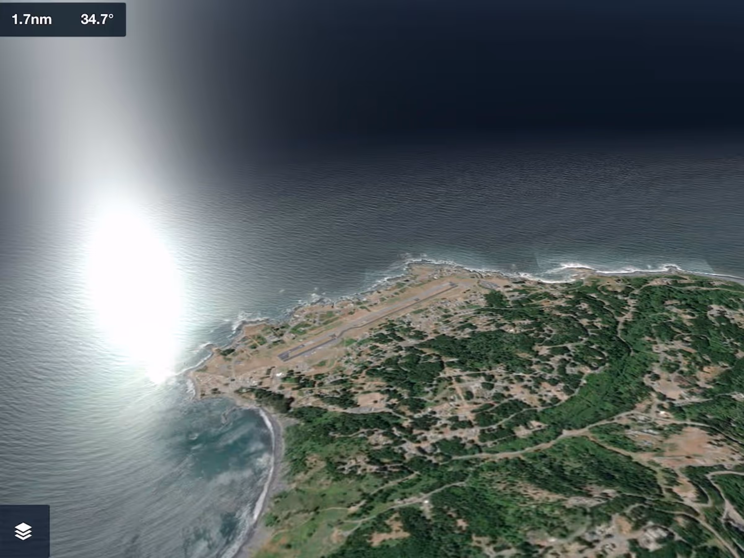
3D View Visual Upgrades
3D View adds sunlight reflections on ocean water, improved sky coloring, and more across all 3D View modes.
Essential & Above
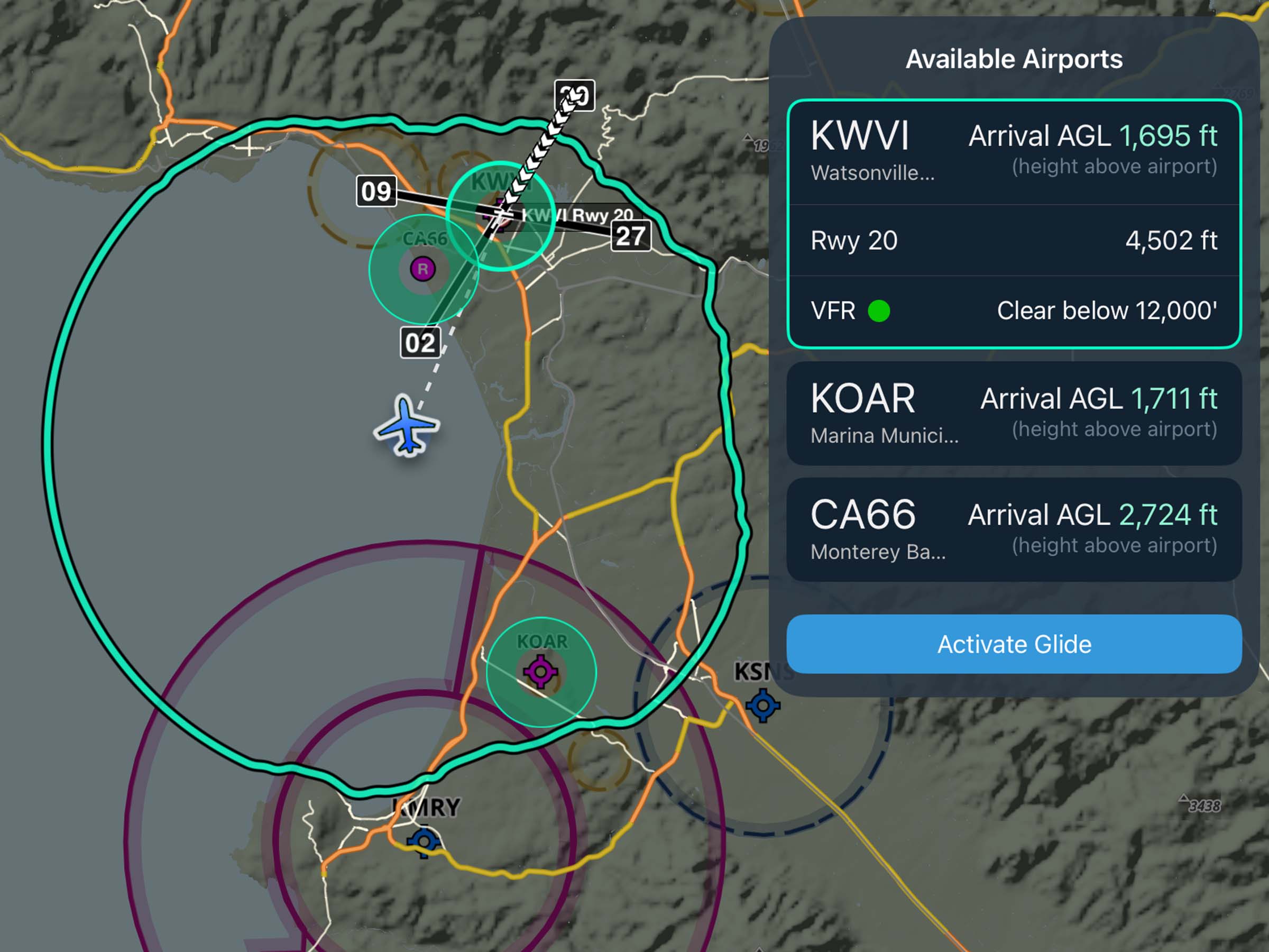
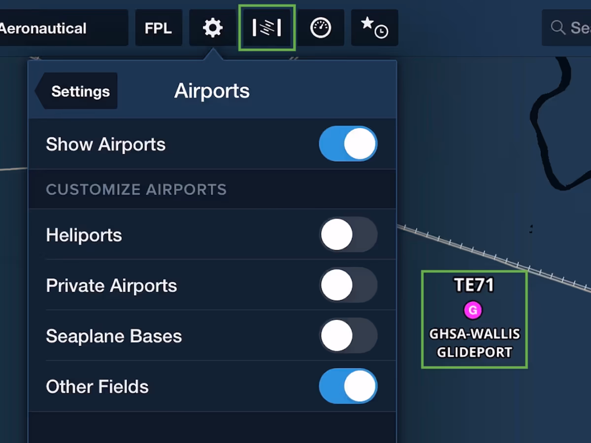
Aeronautical Map Enhancements & New Synthetic Vision Button
Aeronautical Map layer adds glider and balloon fields, TACAN navaids, plus a new Synthetic Vision button.
All Plans
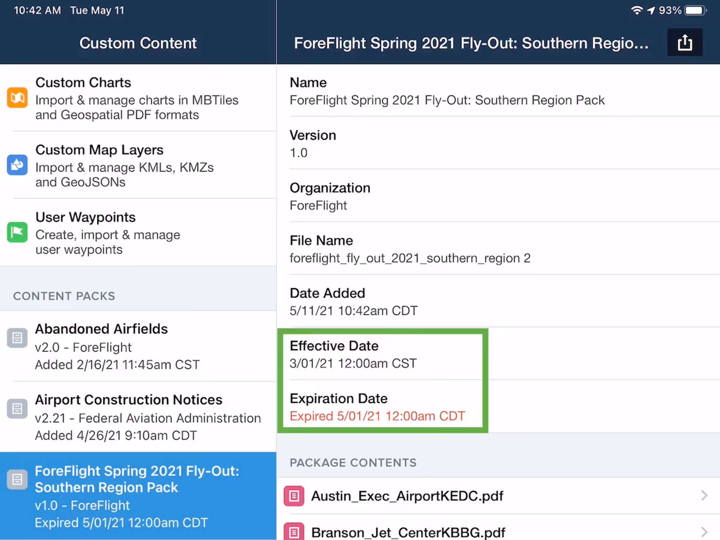
Content Pack Effective Dates
Add effective and expiration dates to Content Packs to display warnings for expired content.
All Plans
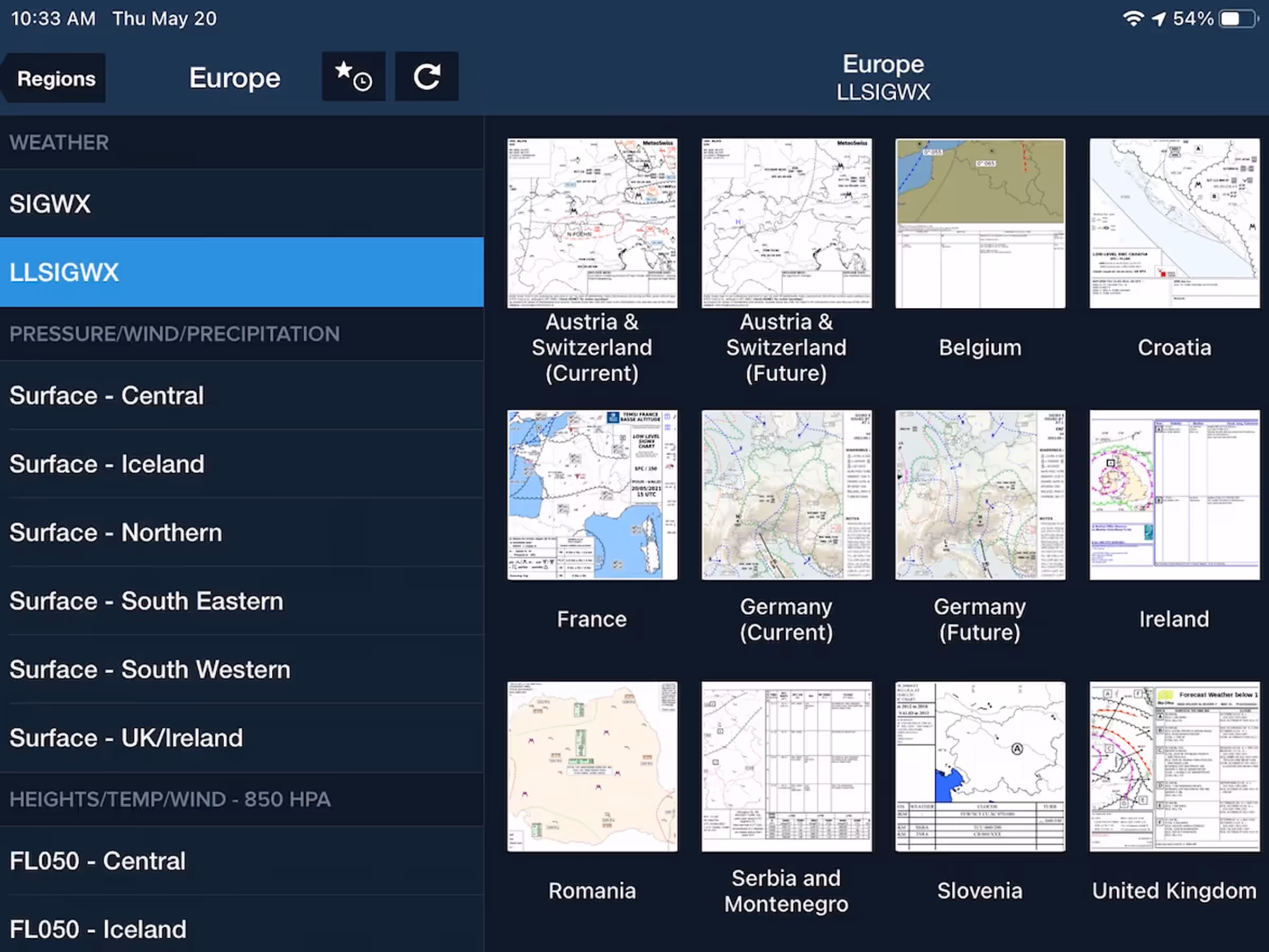
European SIGWX Forecast Graphics
Access extended European coverage with standard and low-level SIGWX charts in Imagery view.
2021
13.3
April 2021
April 2021
Premium
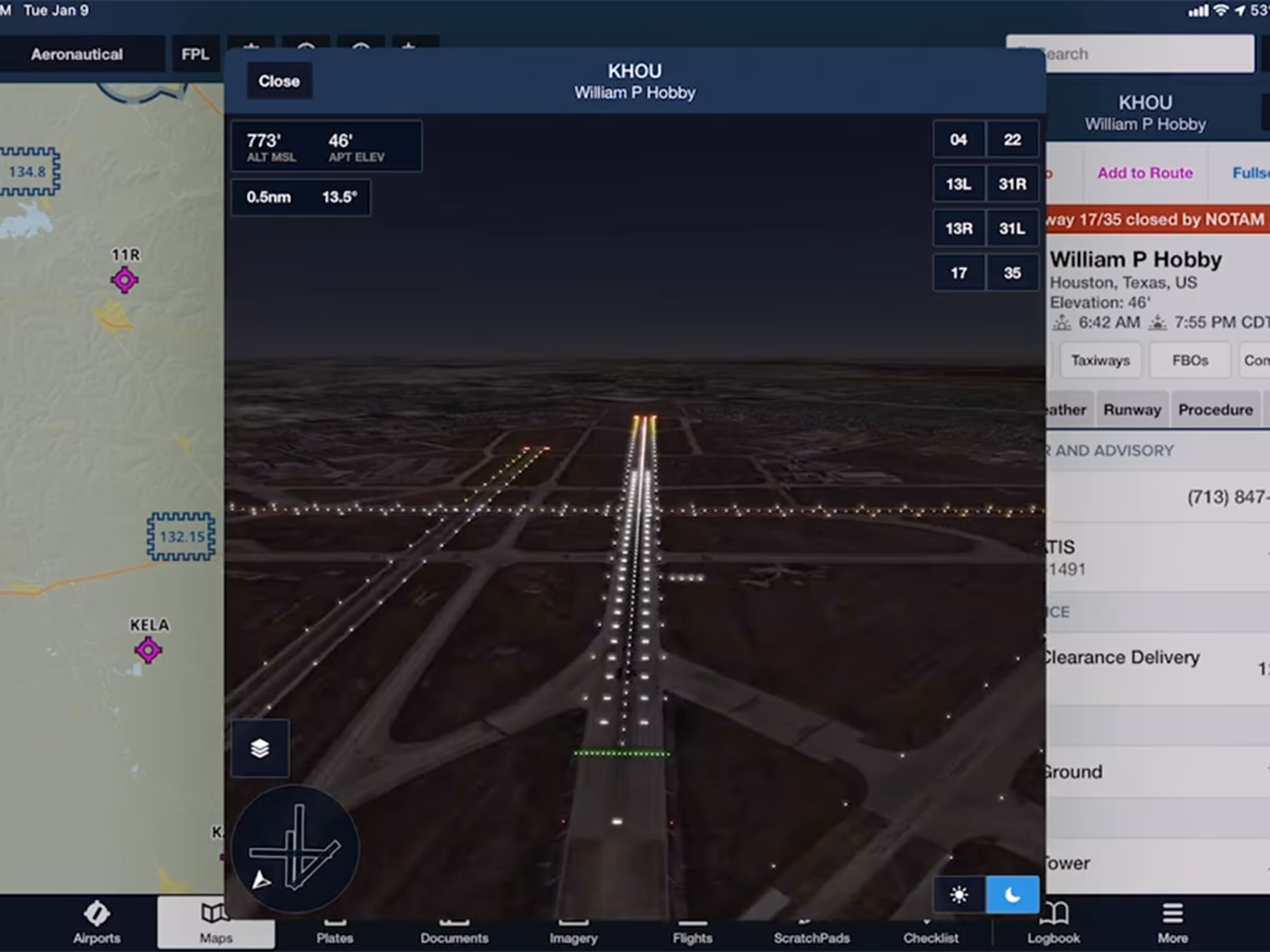
Airport 3D Runway Lighting
Use Day/Night modes and realistic Runway Lights in Airport 3D to prep for night approaches.
All Plans
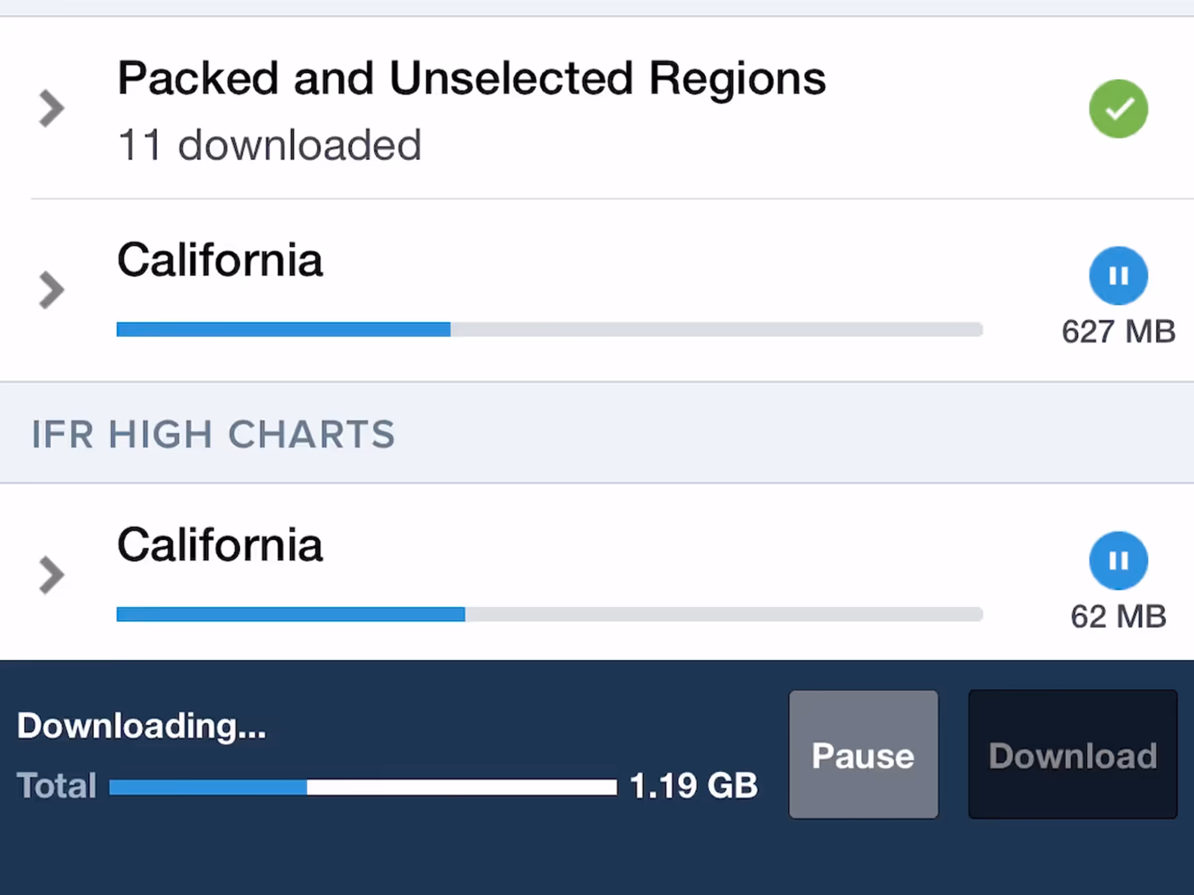
Download in Background
Download charts and data without needing to keep the ForeFlight app open.
Premium
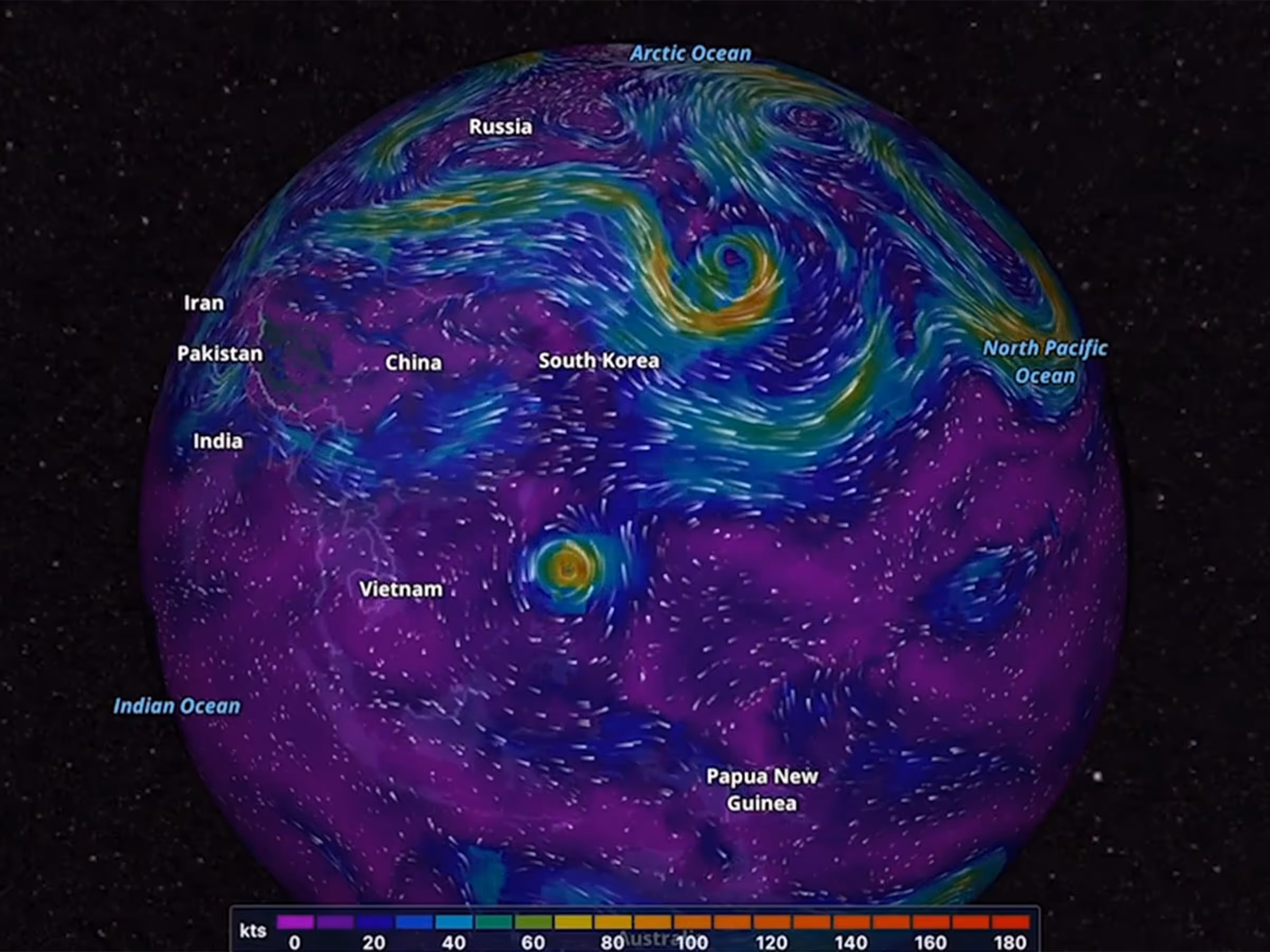
Dynamic Winds and Temperatures
View forecast wind speed, direction, and temperature worldwide with animated layers at high altitudes.

2021
13.2
March 2021
March 2021

All Plans
Expanded Place Labels
Place Labels have expanded to include over 1.4 million labels for cities, parks, bodies of water, and more.
Premium
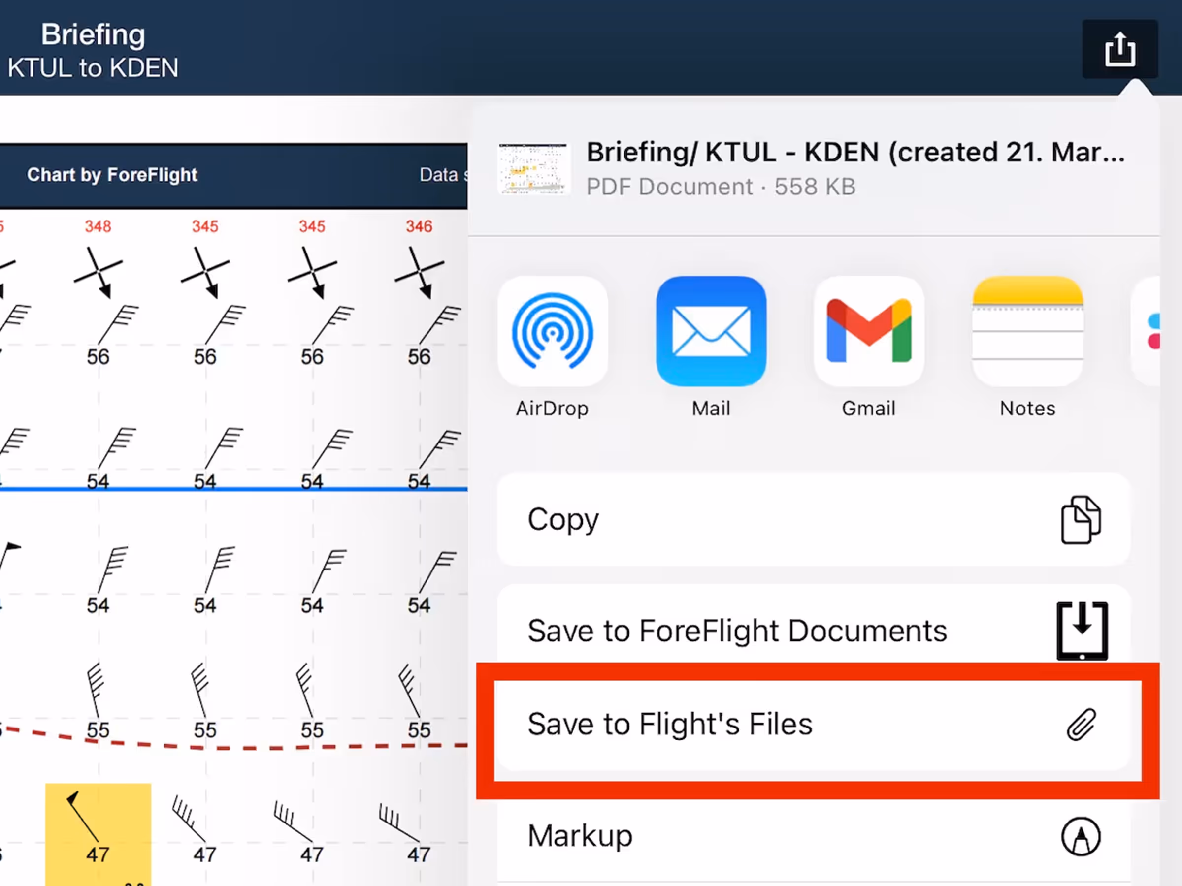
Files in Flights Navlog & Briefing
Save a flight’s Navlog, Briefing, or filing form to its Files menu for inflight access and record keeping.
All Plans
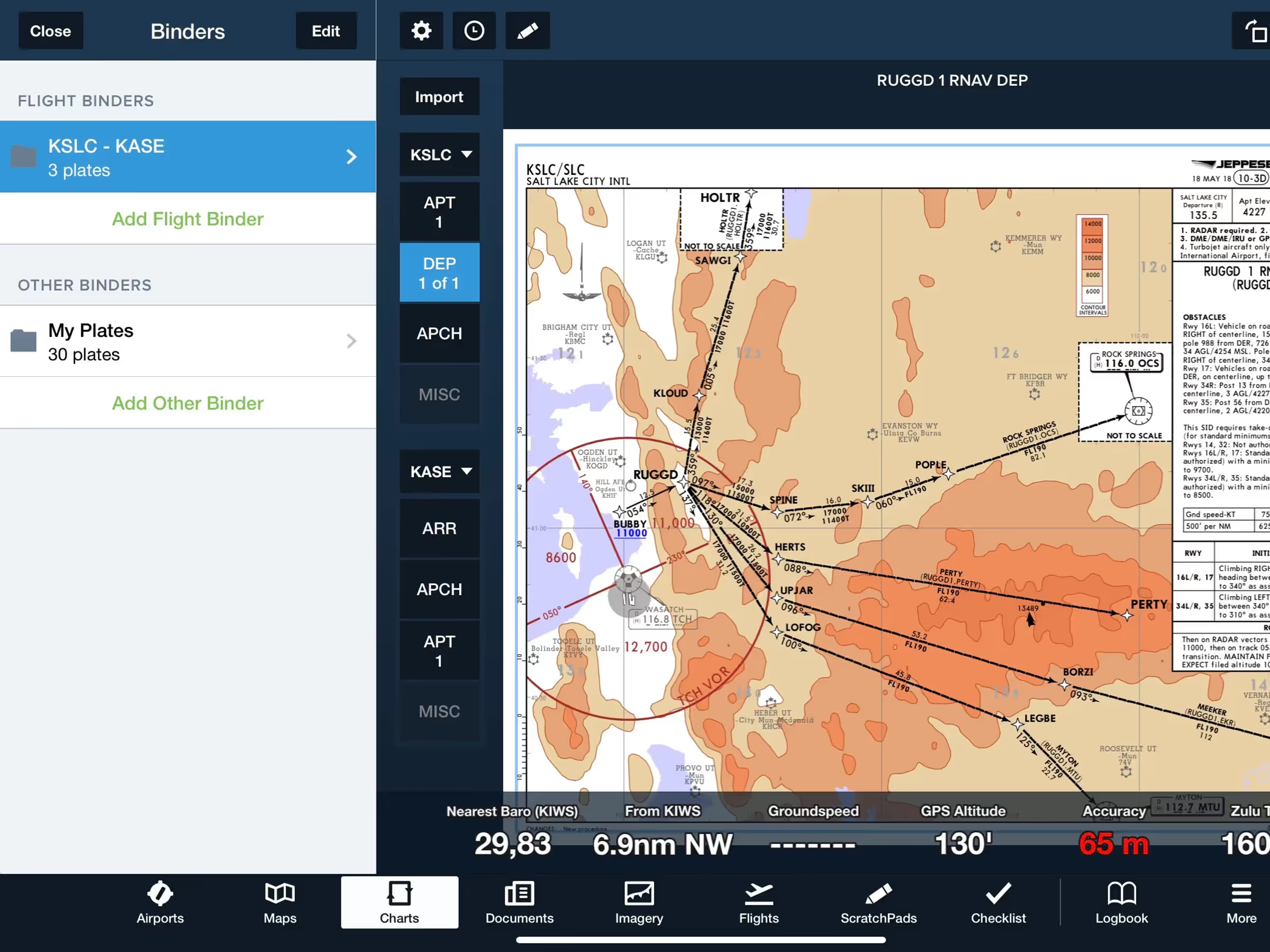
Flight Binders in Plates
Flight Binders organize plates by category for seamless planning and inflight experience.
2021
13.1
February 2021
February 2021

All Plans
Consolidated International Imagery
The Imagery view better organizes non-US/Canada weather products by combining Europe, S. America, and Mexico

All Plans
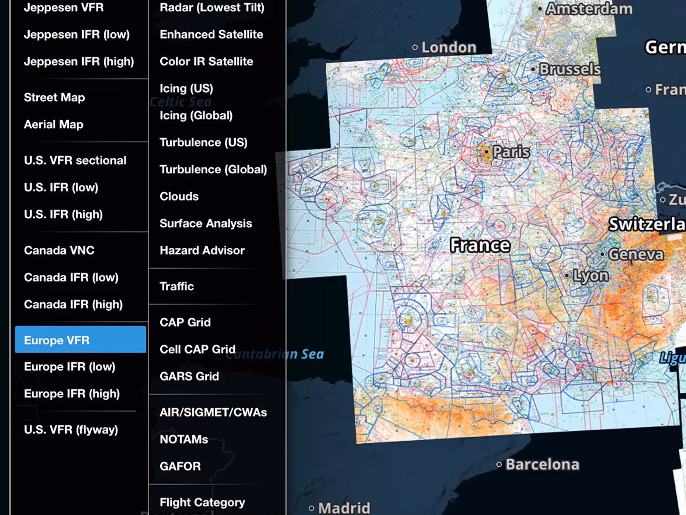
Maps Sidebar
Access information for various elements and layers in a new semi-permanent sidebar within the Maps view.

All Plans
Rename Imported Documents
Rename imported documents directly in ForeFlight to keep your files organized across Drives and Binders.
All Plans
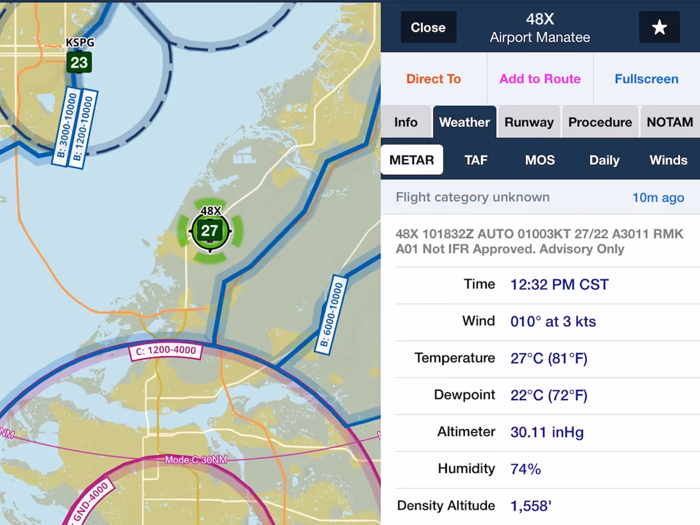
SayWeather METARs
Access METARs from SayWeather advisory stations at small airports and heliports without certified AWOS.
2021
13.0
January 2021
January 2021
All Plans
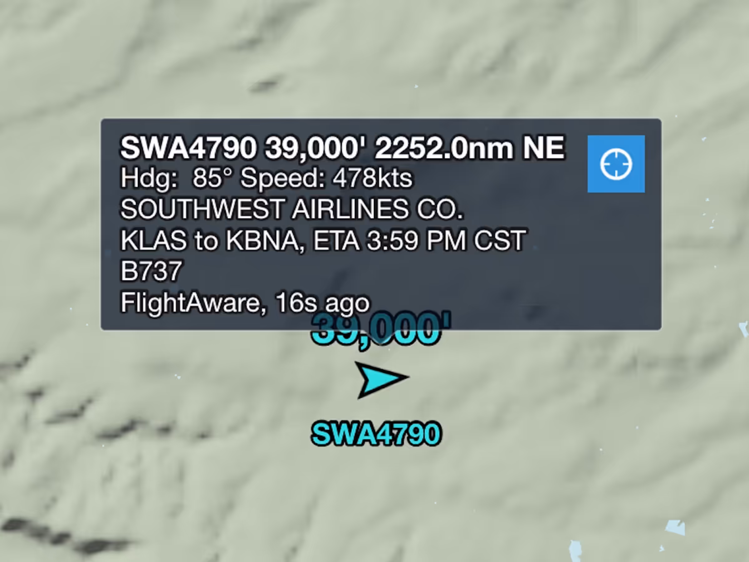
Auto-Center Internet Traffic
Easily keep track of any Internet Traffic target with the new Auto-Center button.
All Plans
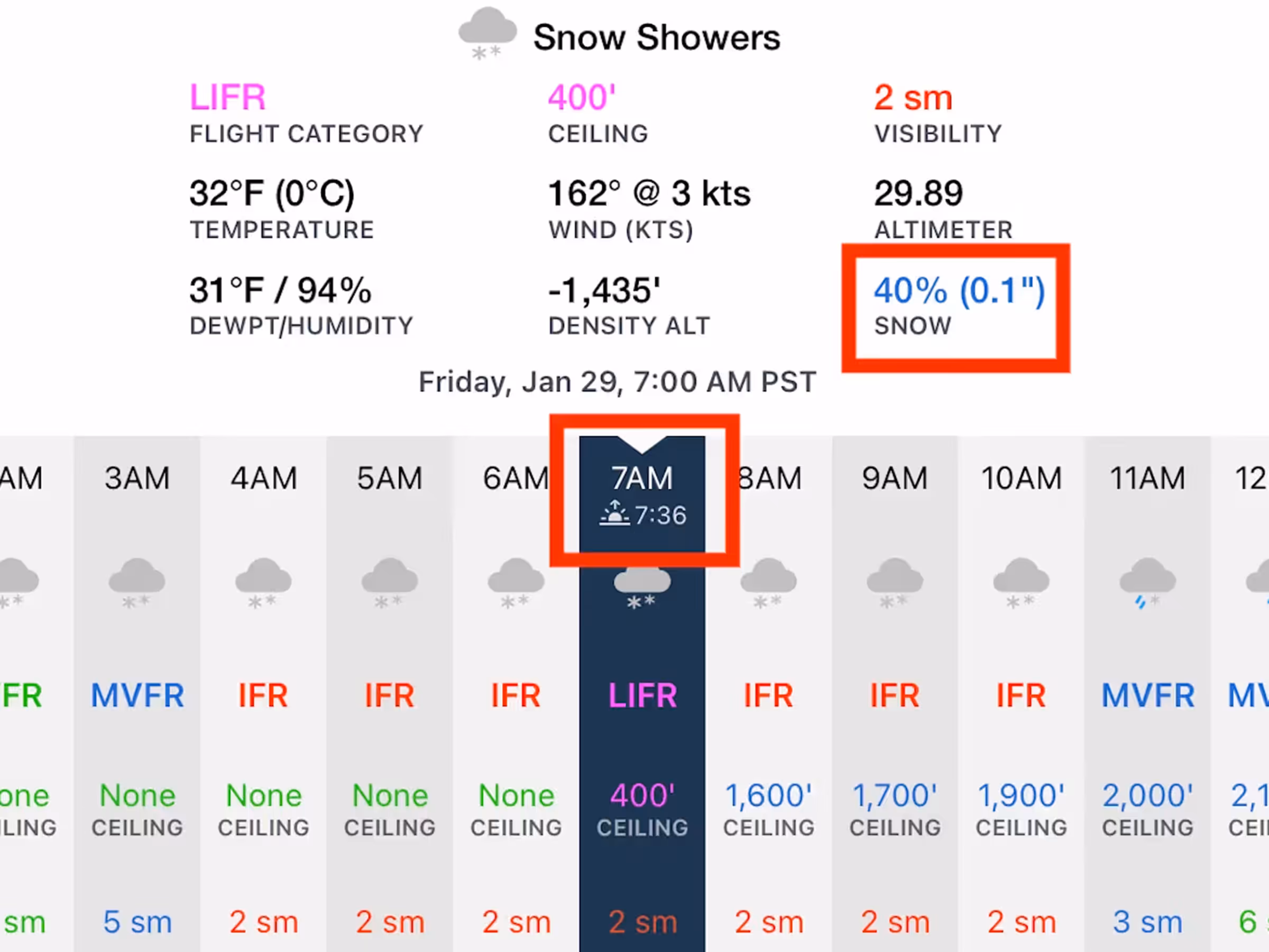
Daily/Hourly Weather Improvements
See the forecast quantity of precipitation per hour in Daily/Hourly Weather.
All Plans
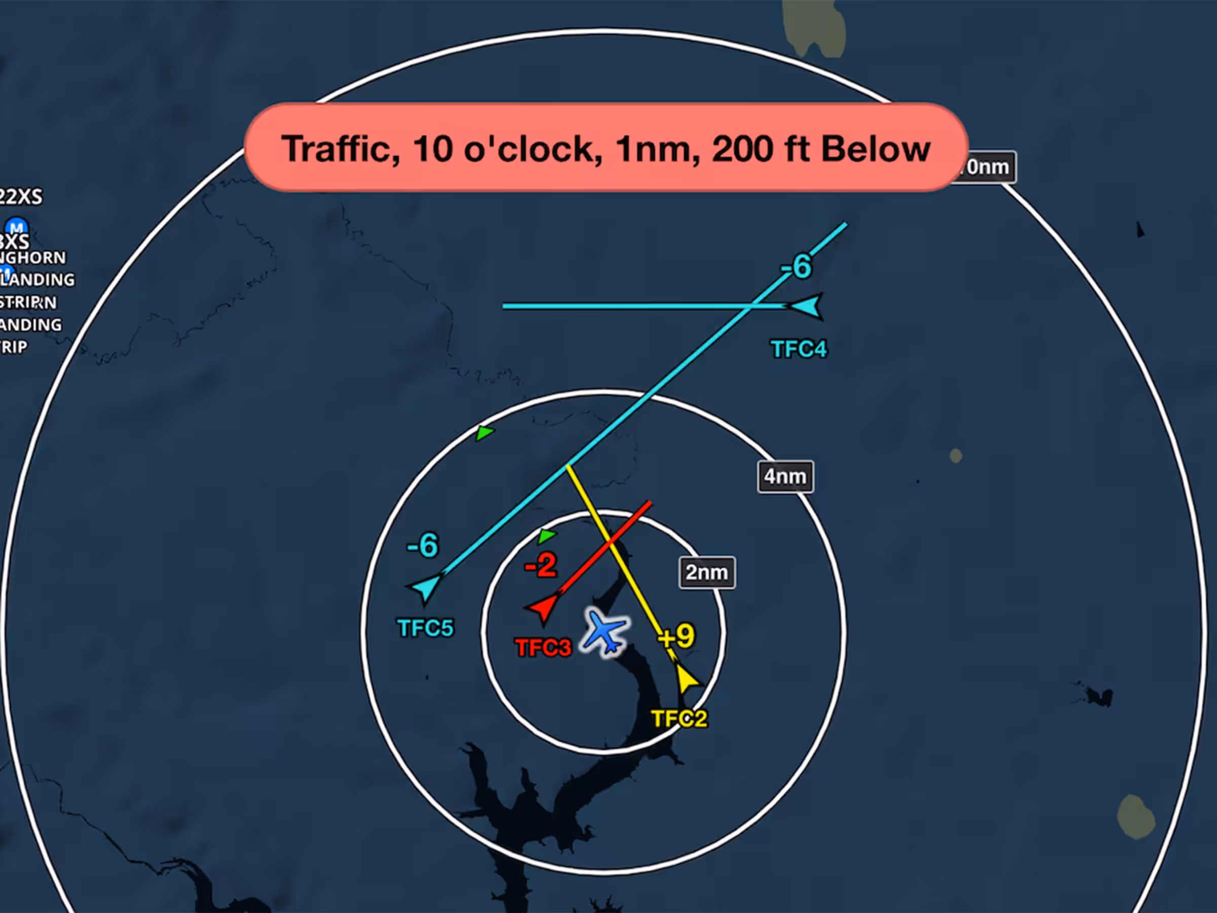
Improved Traffic Alerting
Inflight Traffic Alerts now appear earlier with two alert levels for better awareness and avoidance.
All Plans
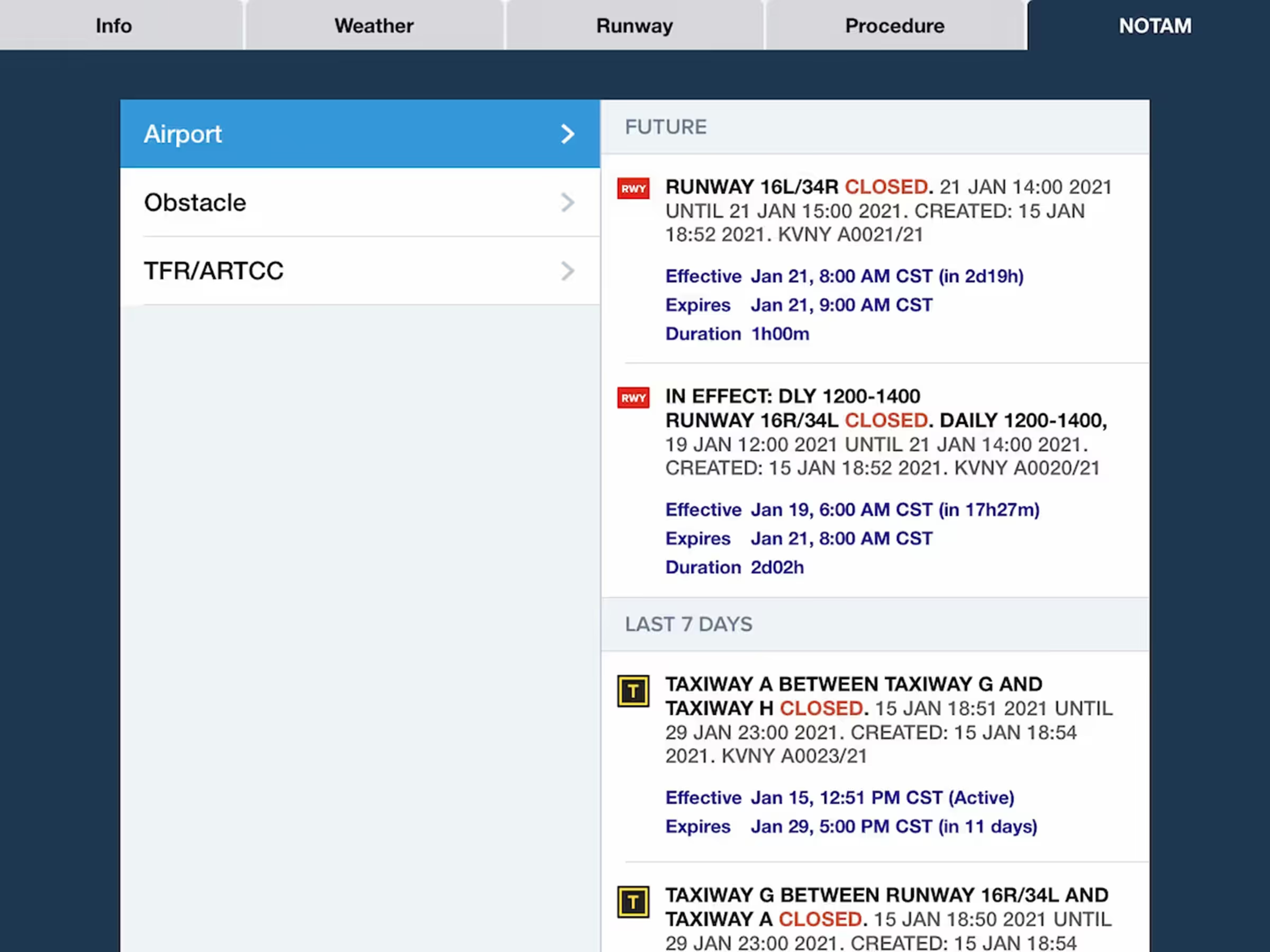
NOTAMs Via Jeppesen
ForeFlight now uses Jeppesen-sourced NOTAMs for greater accuracy and global coverage.