Essential & Above
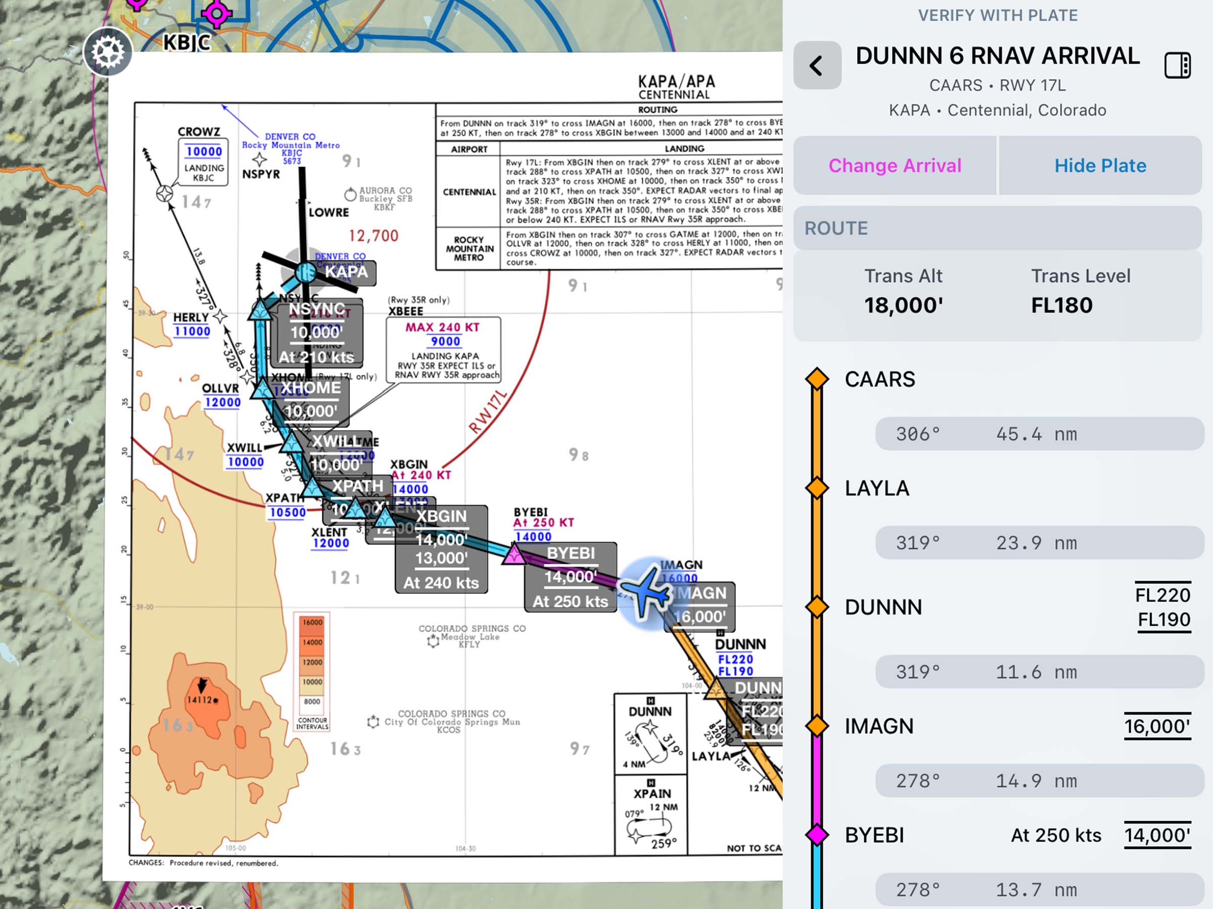
Dynamic Procedures: SID/STAR Support
Access SIDs and STARs in the Dynamic Procedures sidebar.


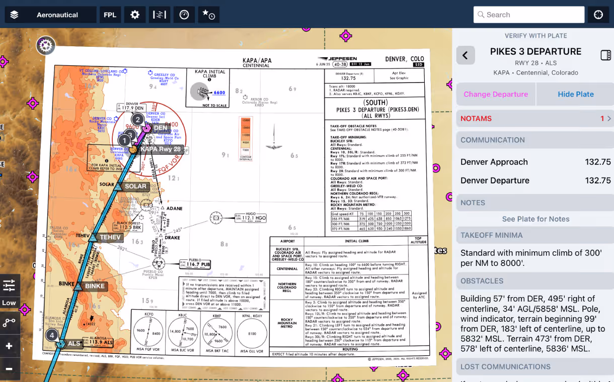

Access SIDs and STARs in the Dynamic Procedures sidebar.
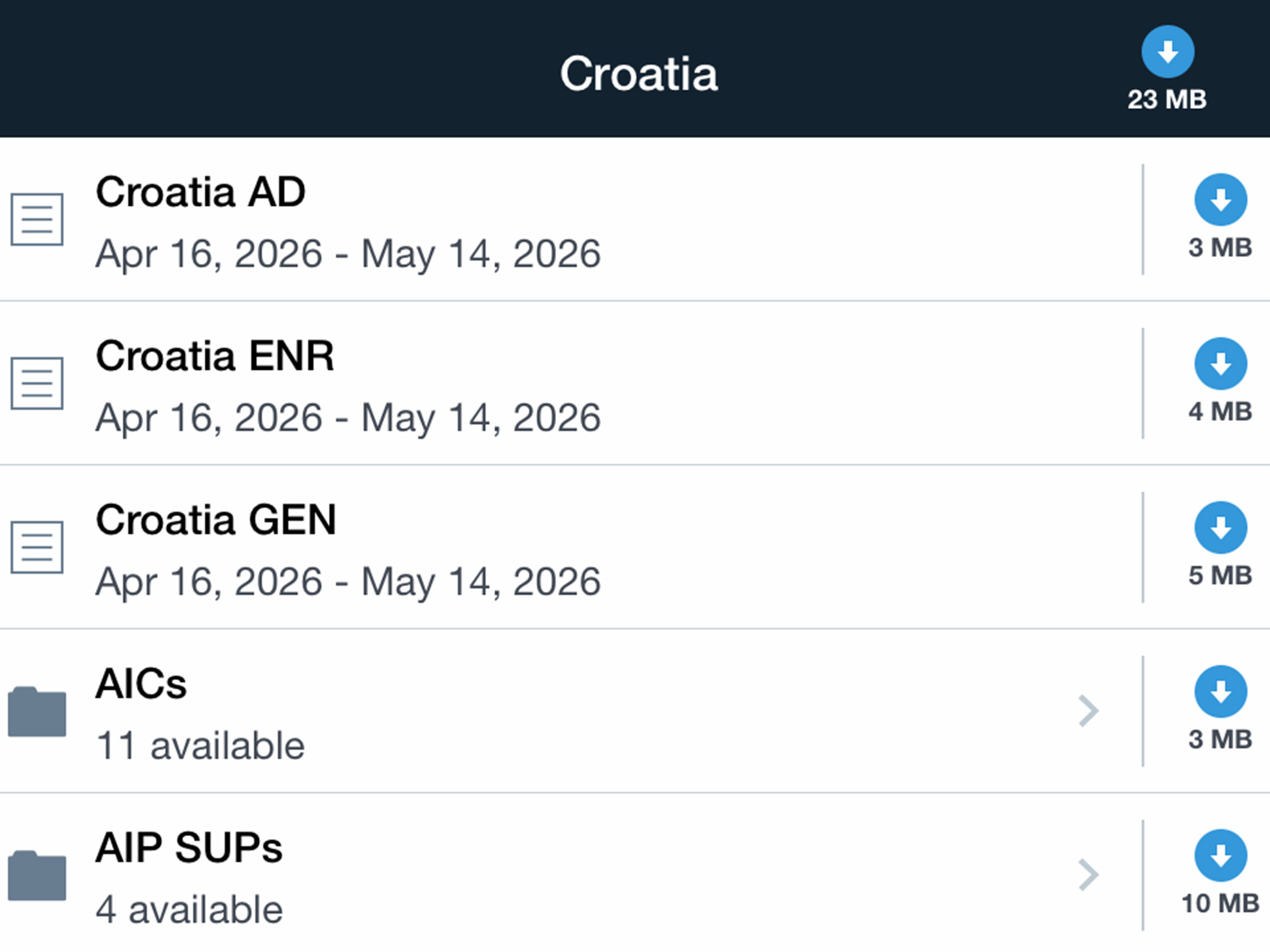
Stay up to date with European AICs and AIP supplements.
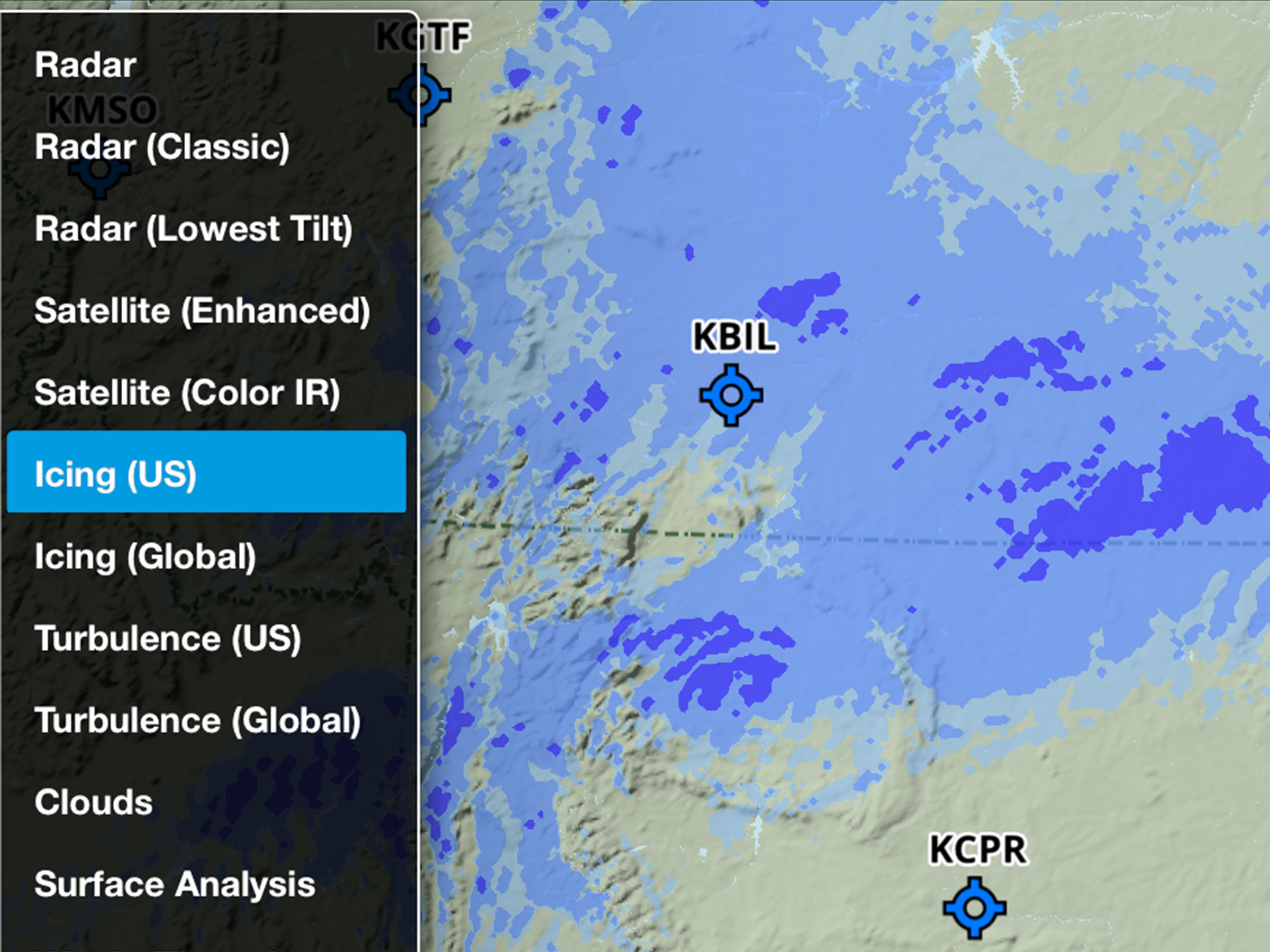
Plan more accurately with improved US Icing and Turbulence layers.
.jpg)
Sign and lock a Weight & Balance load summary with a secure PIN code.
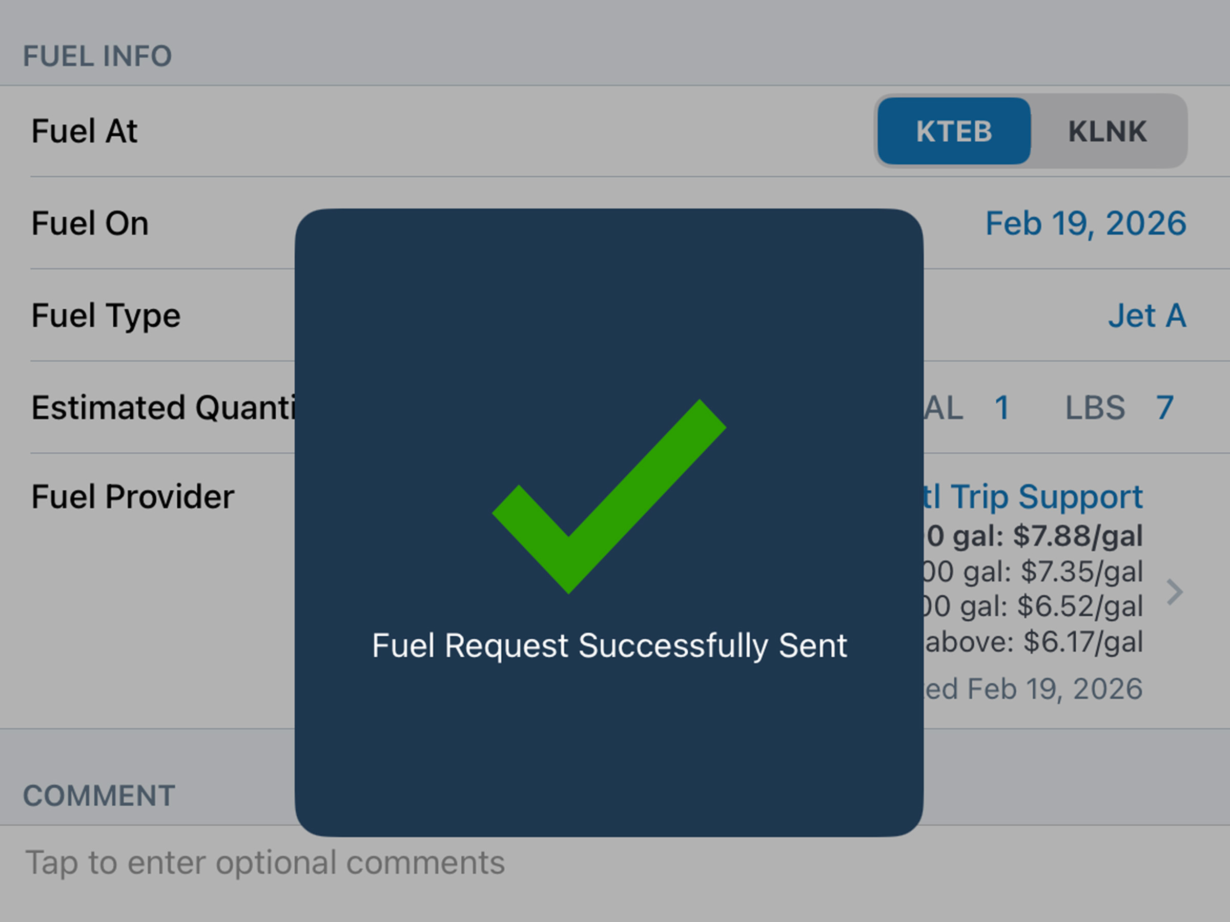
Compare JetFuelX contract prices and request fuel releases directly in the Flights view.
Compare JetFuelX contract prices and request fuel releases directly in the Flights view.
Sign and lock a Weight & Balance load summary with a secure PIN code.
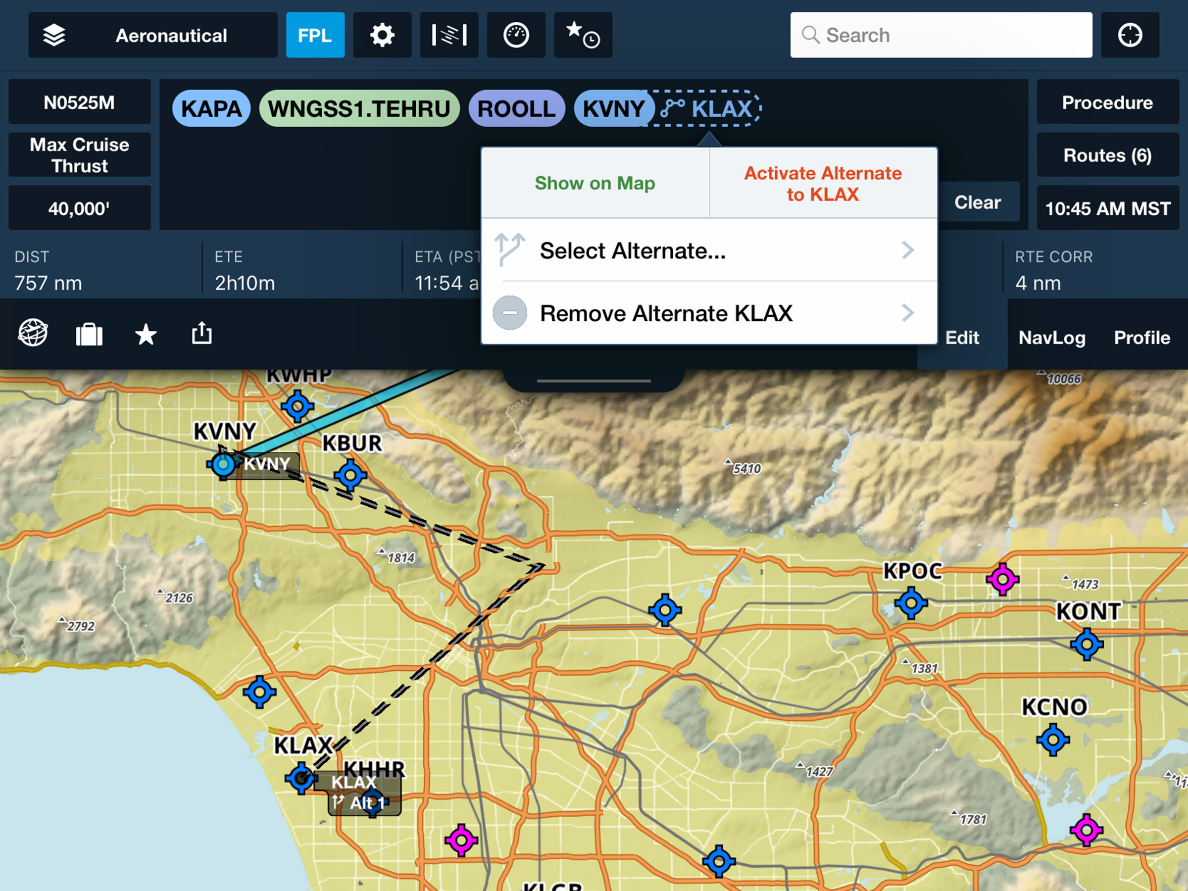
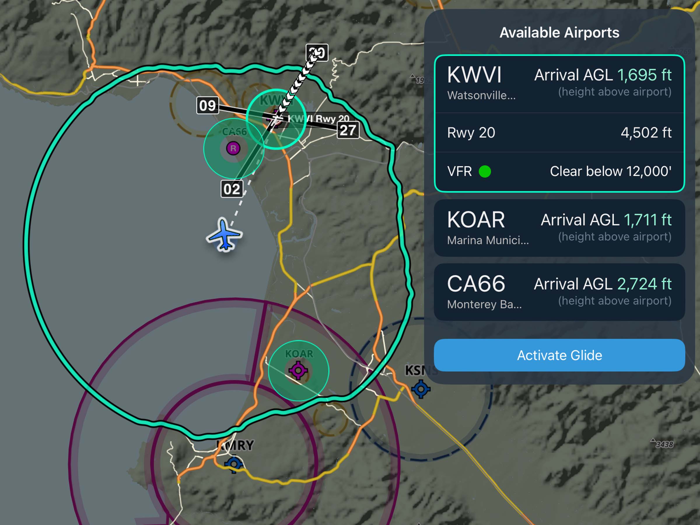
Select and route to alternate airports in-flight from the Maps view.
.avif)