
Release Spotlight
Release Spotlight

17.11
CFI Referral Program
Active CFIs can earn discounts on their subscription by introducing students to ForeFlight.
2021
13.9
October 2021
October 2021
All Plans
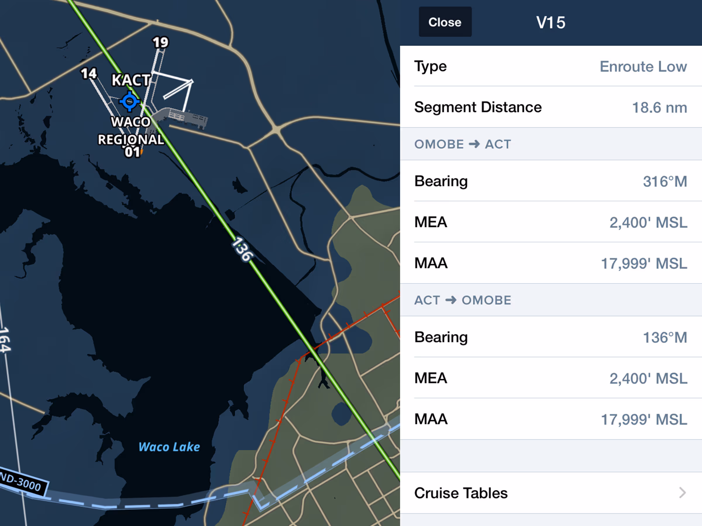
Enhanced Airway Details
View airway details including MEA, MOCA, MAA altitudes, and bearing.
2021
13.8
September 2021
September 2021

Premium
GPS Data with Honeywell Apex & Aspen Connected Gateway
Receive GPS position from Honeywell Apex FMS via Aspen Connected Gateway.
Essential & Above
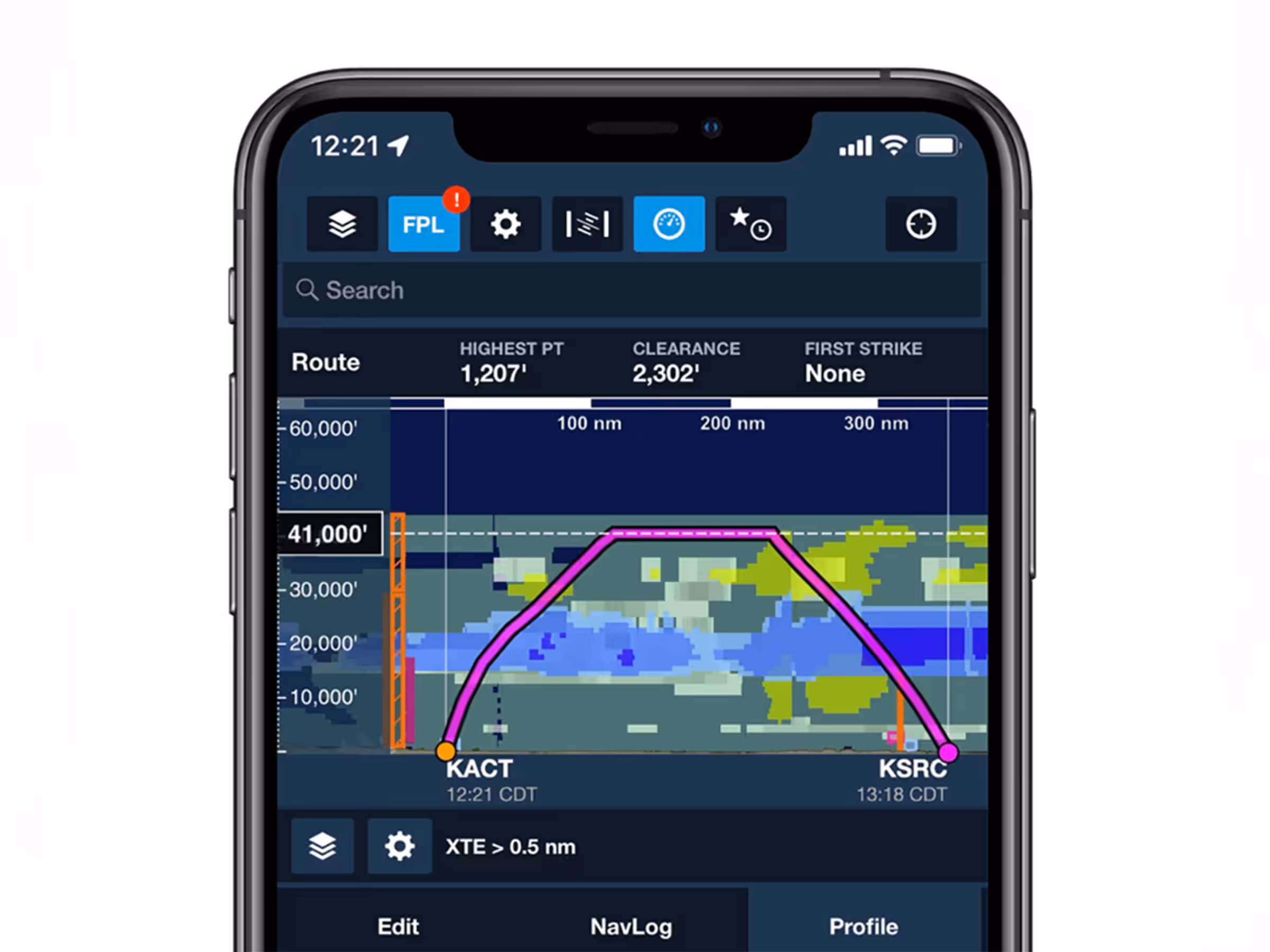
Profile View on iPhone
Use Profile View on iPhone to see terrain, obstacles, and weather forecasts along your route.

All Plans
Track Log Review Layer Selector
Access combined flight data buttons for Speed, Altitude, Pitch, and Bank in the Track Log Graph.
2021
13.7
August 2021
August 2021

Premium
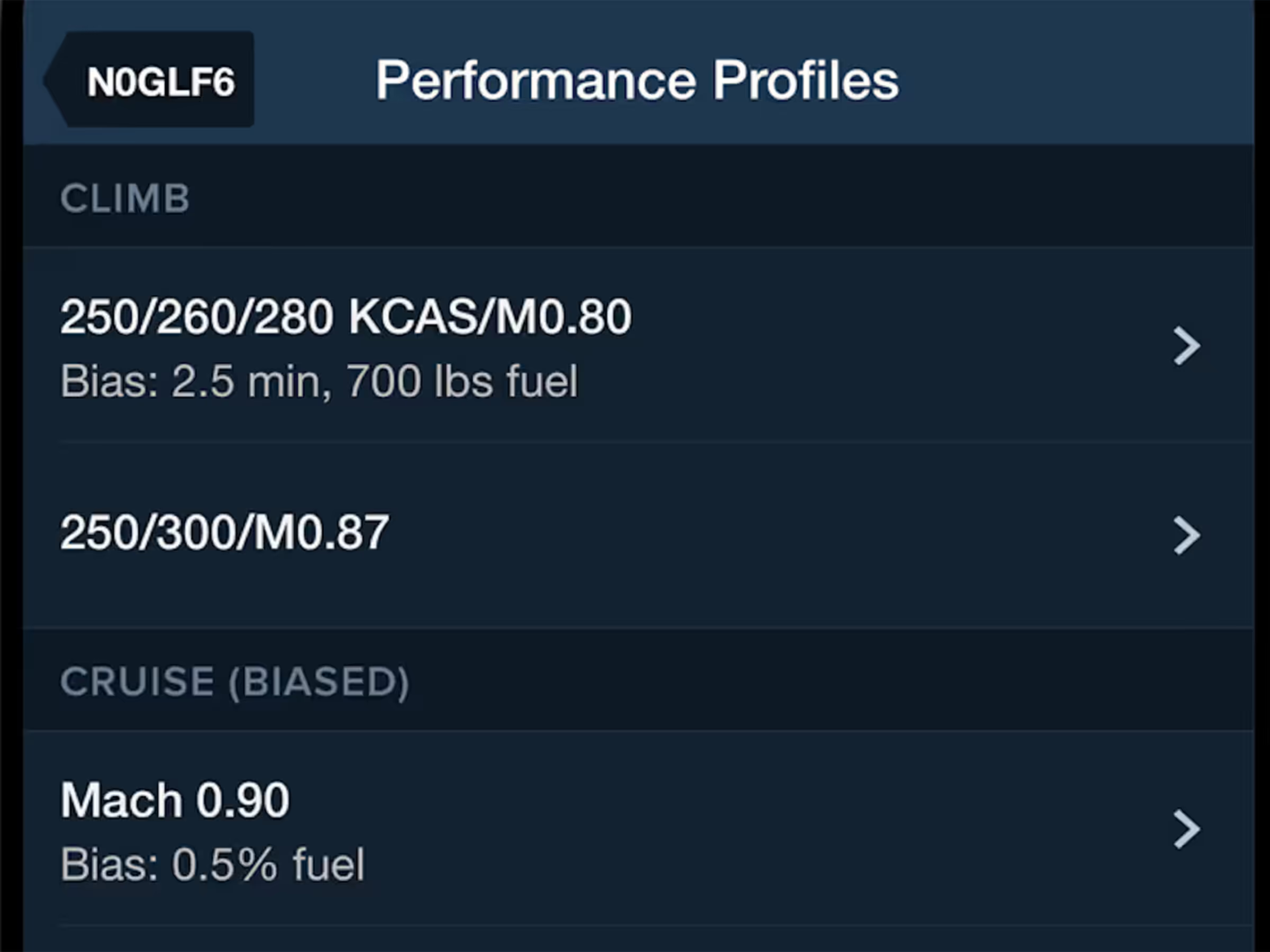
Bias Climb & Descent Performance Profiles
Adjust aircraft climb and descent profiles with bias settings to match real-world performance.
Premium
Multiple Climb/Descent Profiles
Access multiple climb and descent profiles for select Bombardier, Dassault, Embraer, and Gulfstream aircraft.
2021
13.6
July 2021
July 2021
All Plans
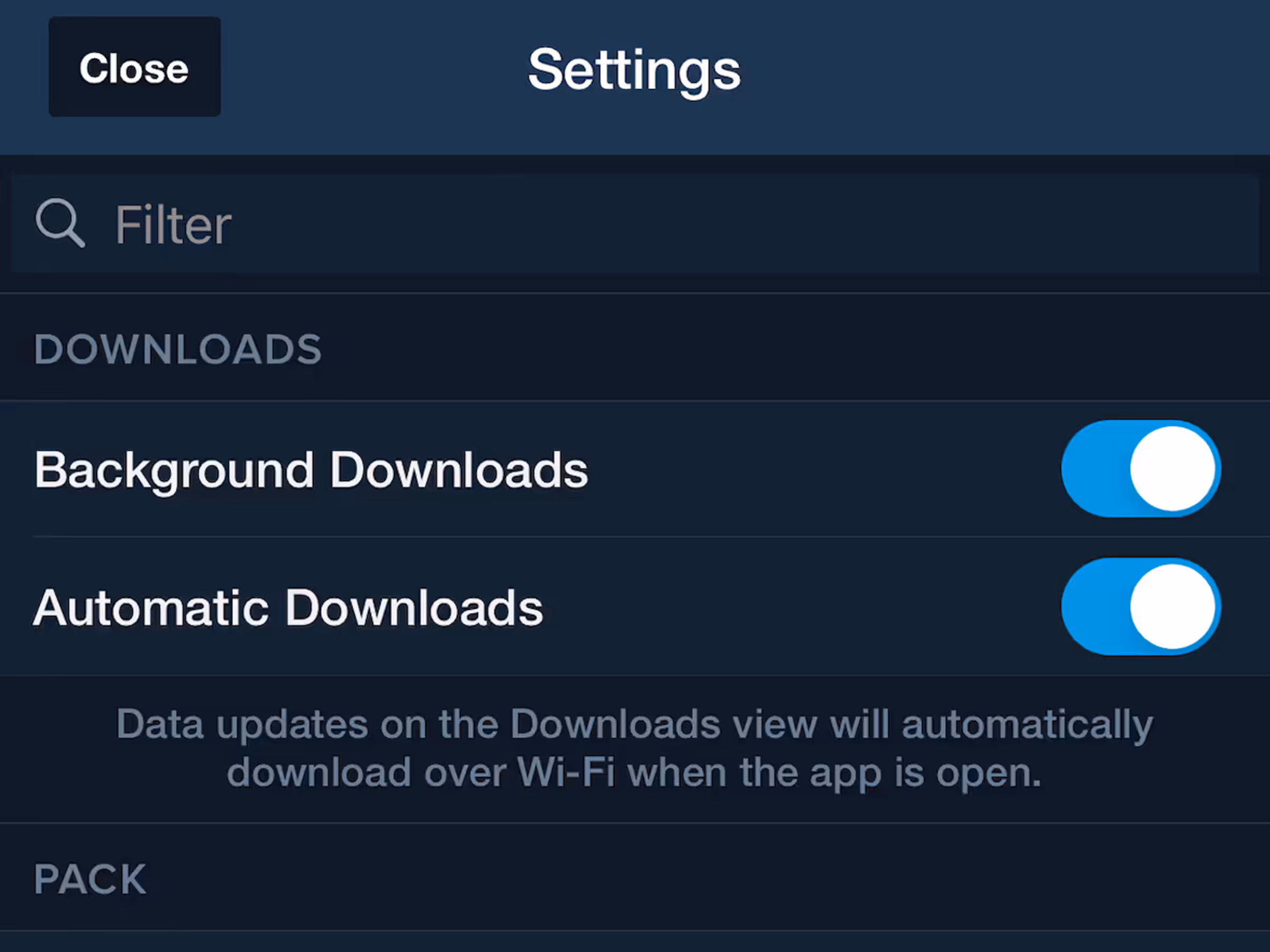
Background Downloads Setting
Disable background downloads to prevent interruptions from slow internet connections.
All Plans
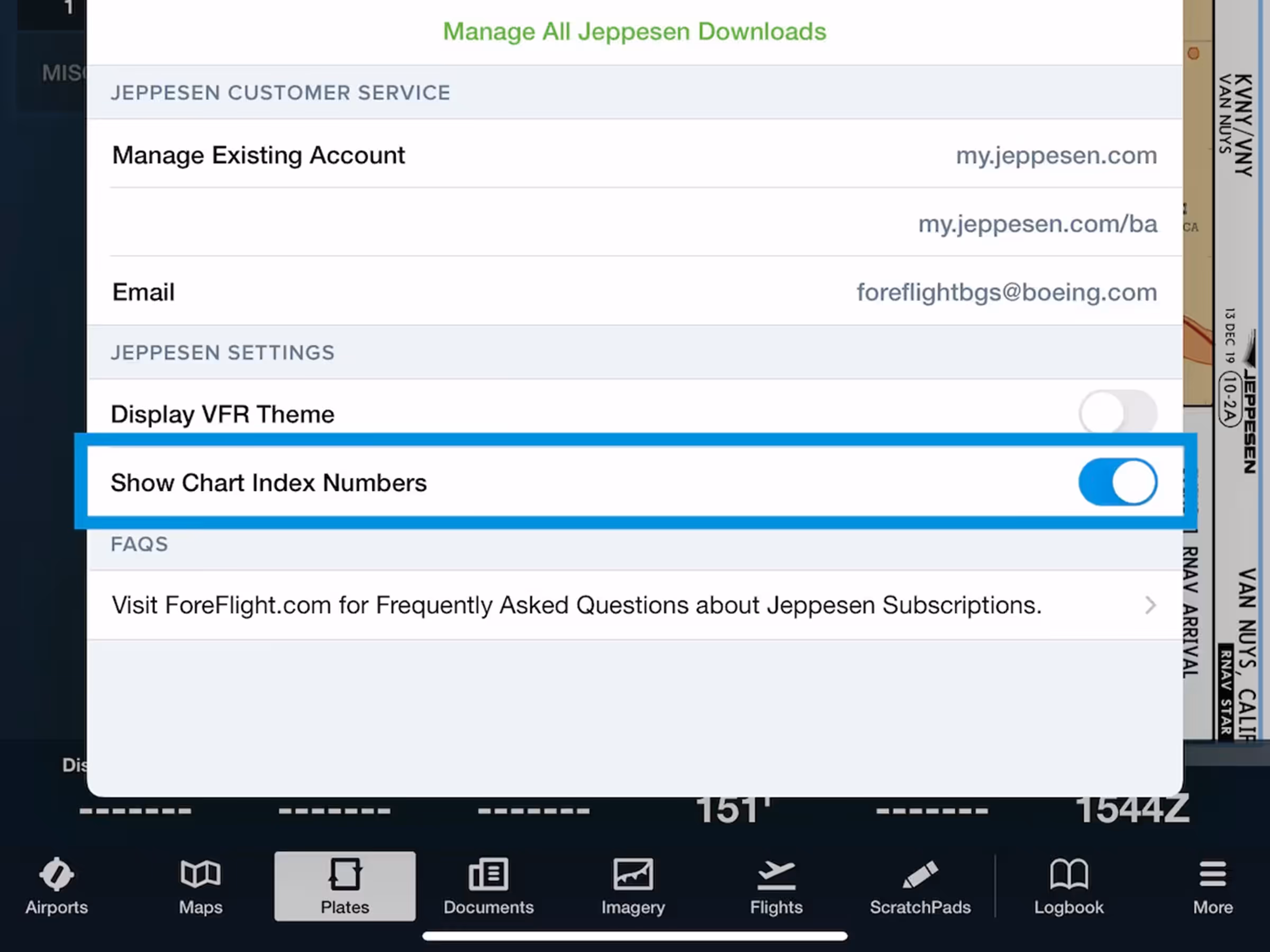
Jeppesen Chart Index Numbers
View chart index numbers alongside names for faster identification of Jeppesen procedures.
All Plans
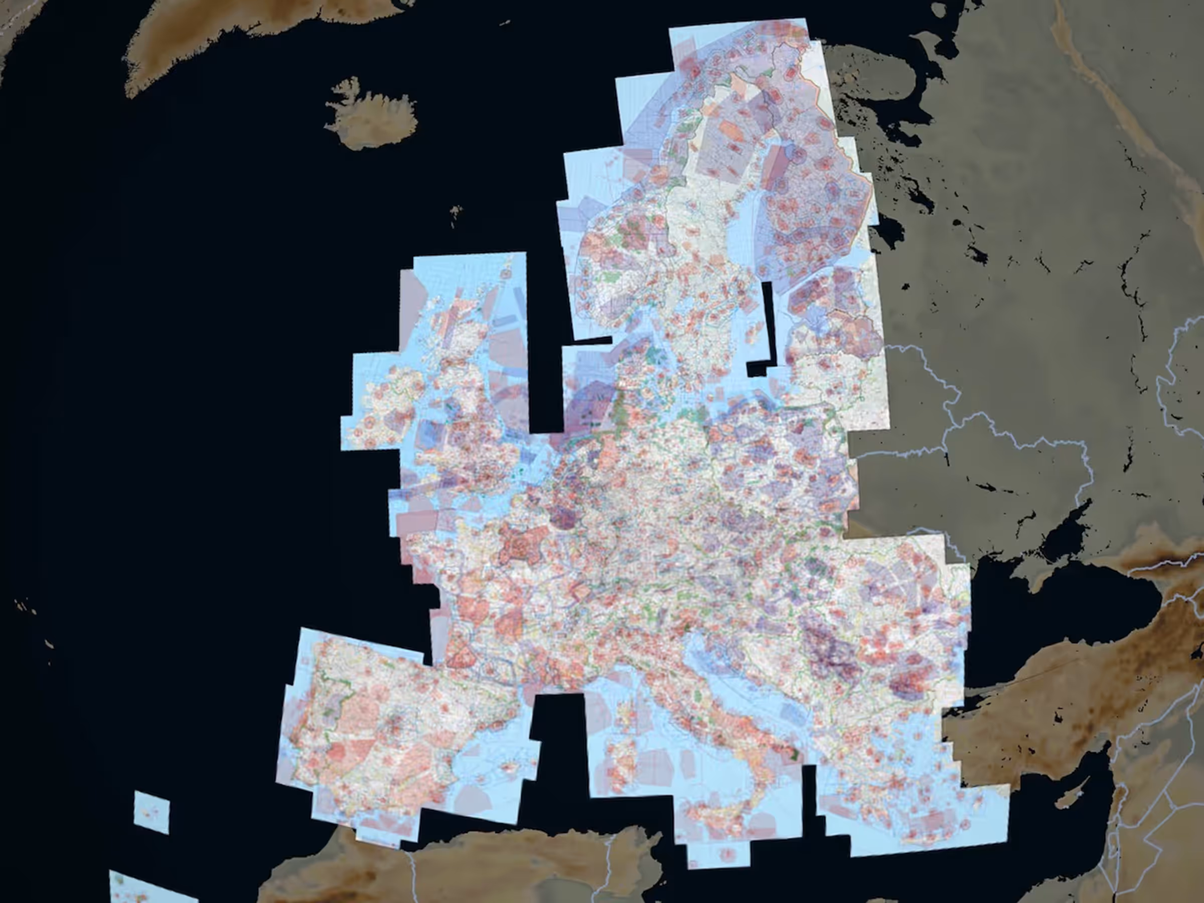
New Rogers VFR Chart Coverages
Access new Rogers Data VFR 500k charts for Serbia and the Baltics as European subscription add-ons.
All Plans
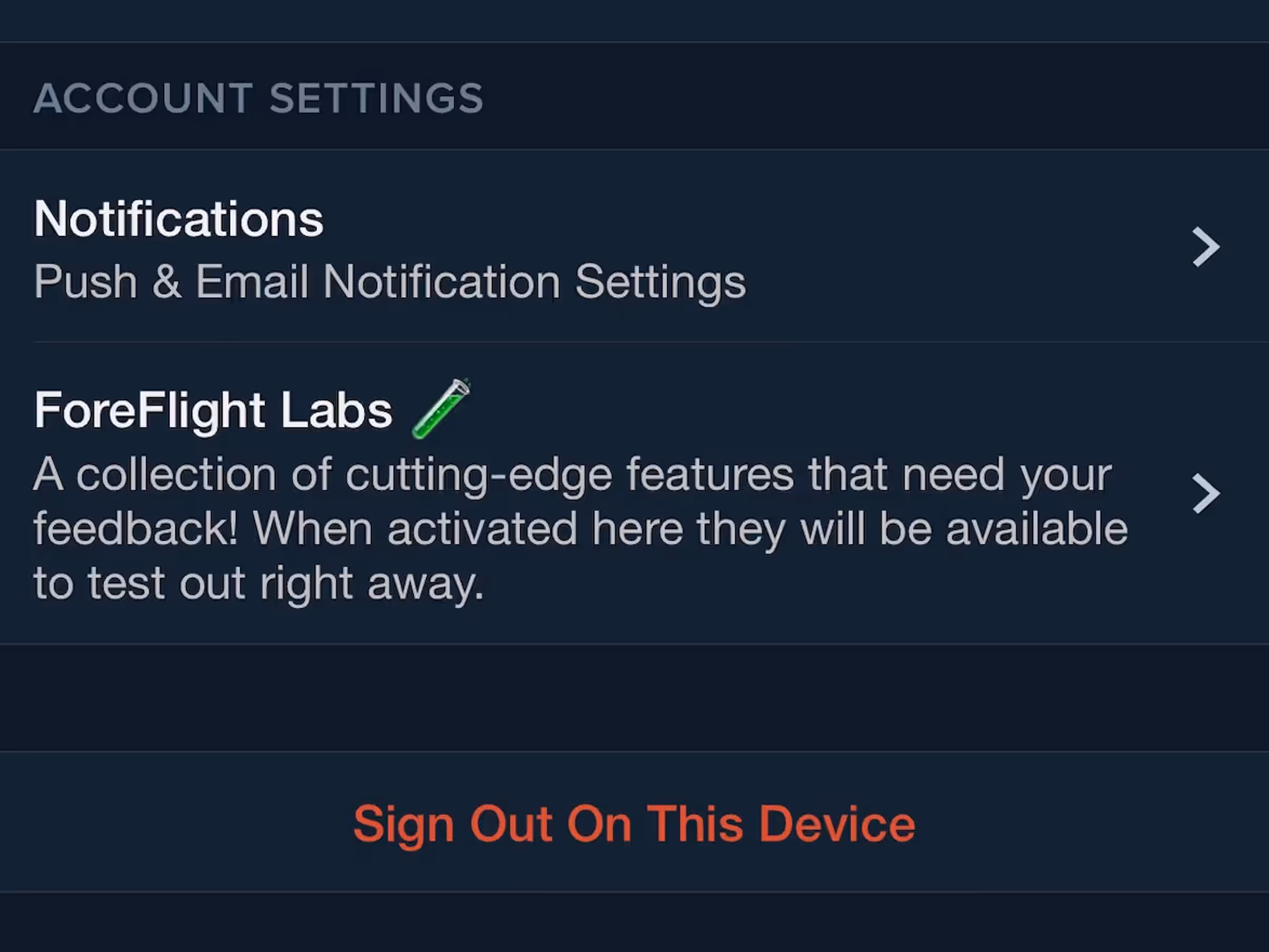
Notification Preferences
Opt-in to marketing notifications about feature releases, subscription offers, events, and training.
2021
13.5
June 2021
June 2021
Premium
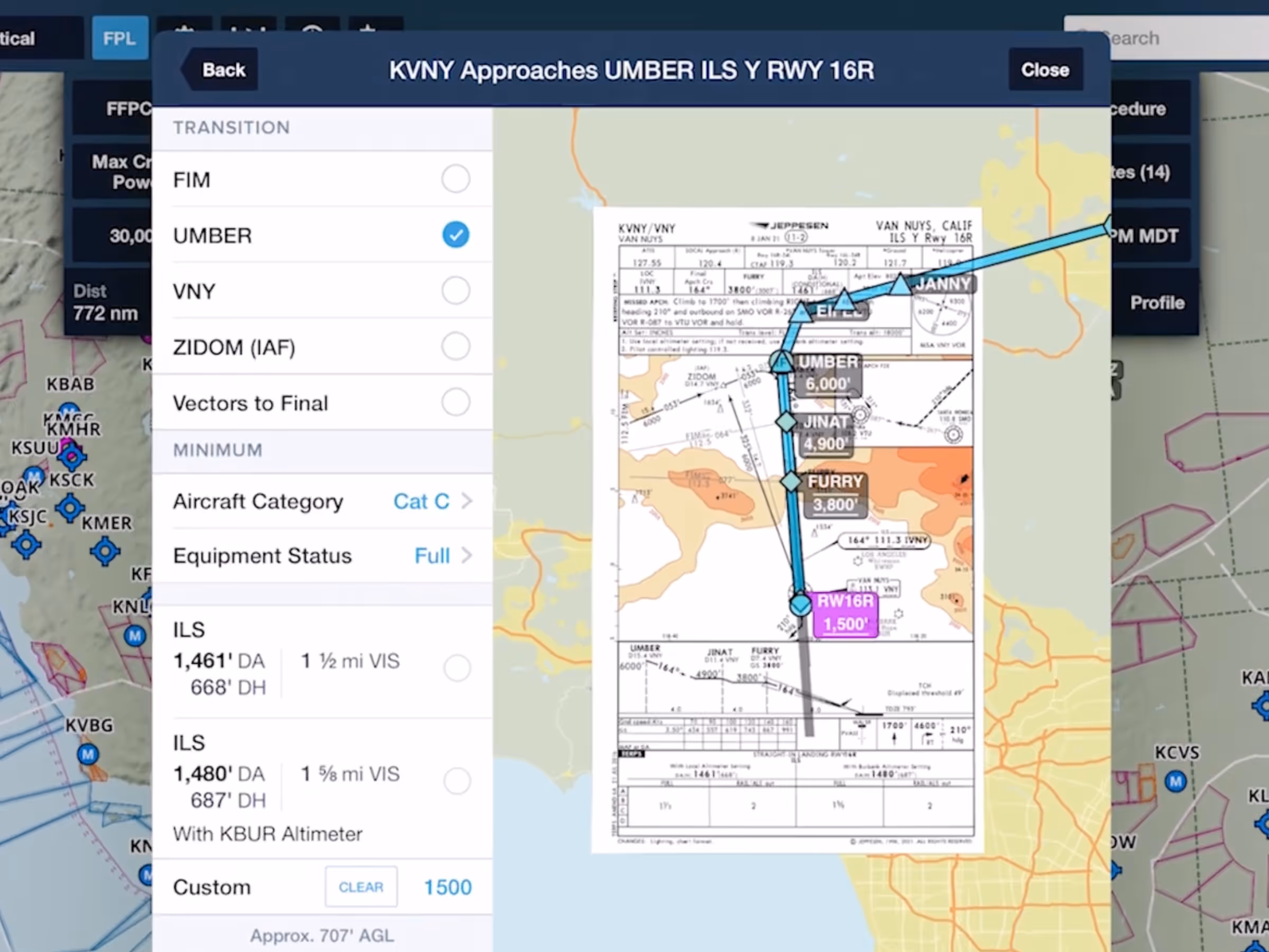
Augmented Procedures™
Find and display approach minimums on your route to reduce risk with Augmented Procedures.

MFB Plans
ForeFlight MFB: Select Multiple MTR Types
Military Flight Bag formats U.S. aerial refueling tracks more neatly and simplifies ATC filing.
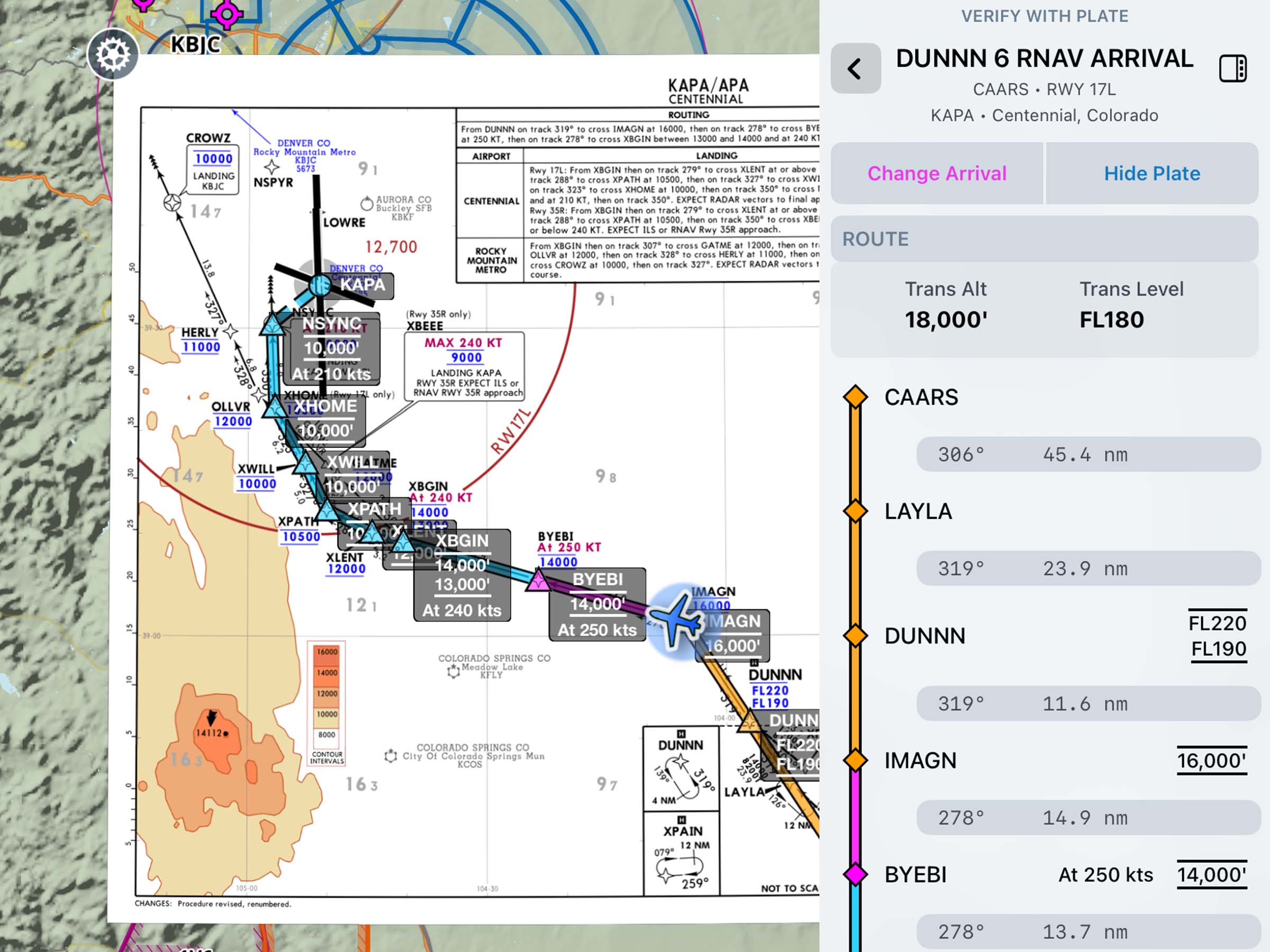
Essential & Above
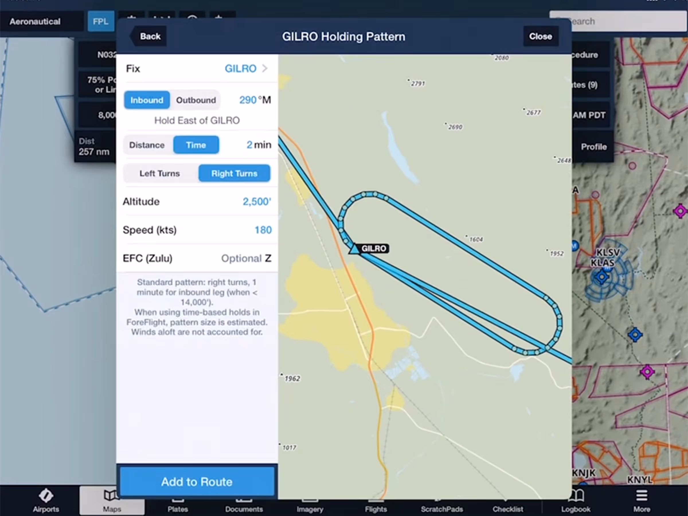
Hold Advisor
Quickly add a holding pattern anywhere in your route with flexible parameters and automatic entry selection.

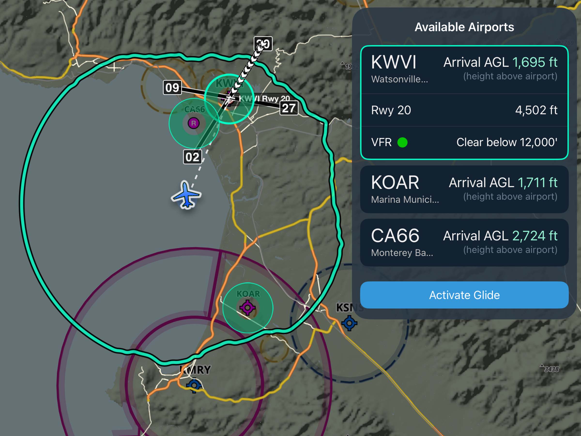
Runway Analysis
Runway Analysis: EOP Visualization
View EOP ground tracks and instructions in Runway Analysis for better flight planning visualization.