
Release Spotlight
Release Spotlight

17.11
CFI Referral Program
Active CFIs can earn discounts on their subscription by introducing students to ForeFlight.
2022
14.9
October 2022
October 2022

All Plans
Multi-Source Radar Layer Support
Select from multiple Radar sources while connected to external devices providing datalink weather.
Premium
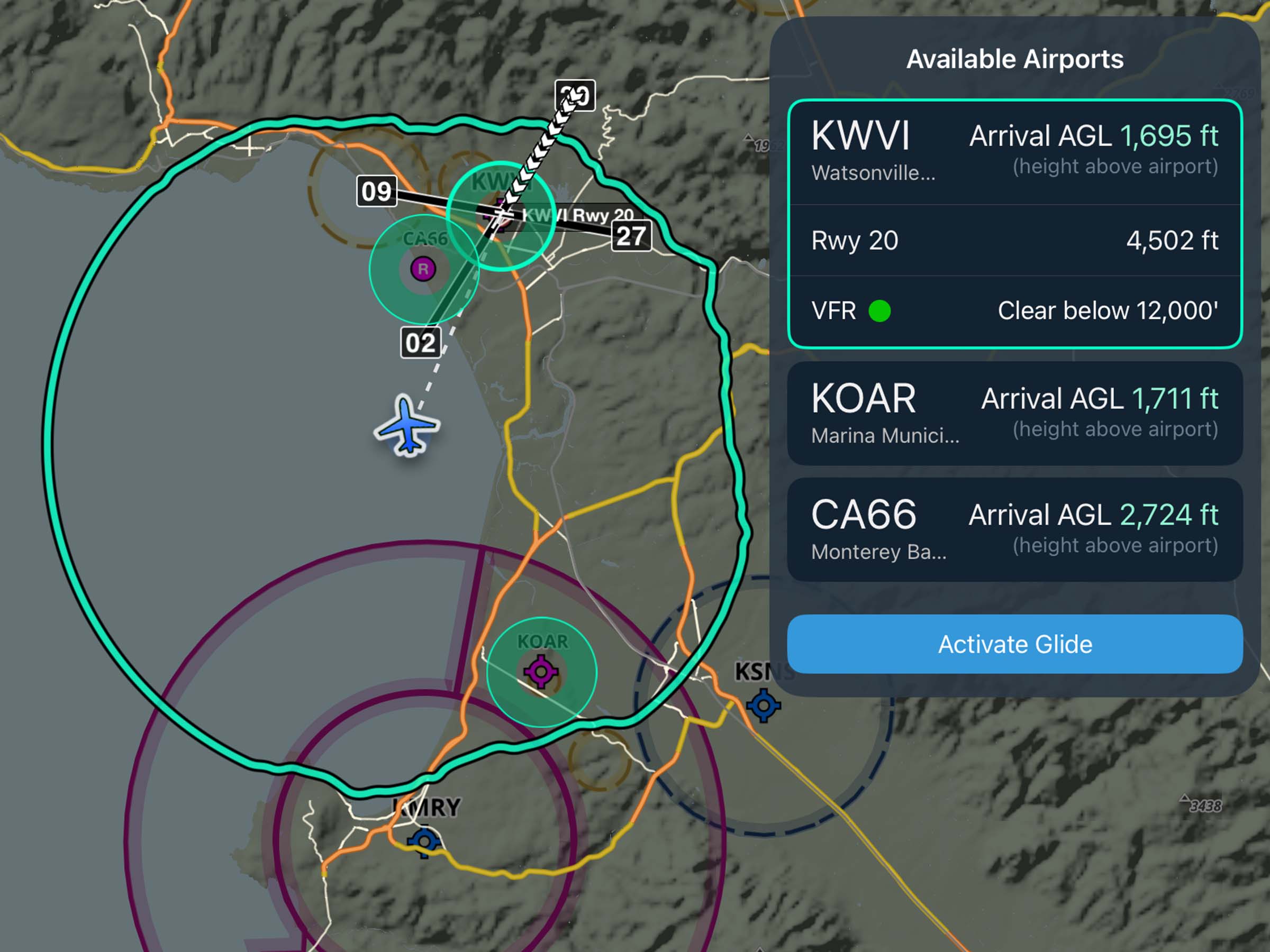
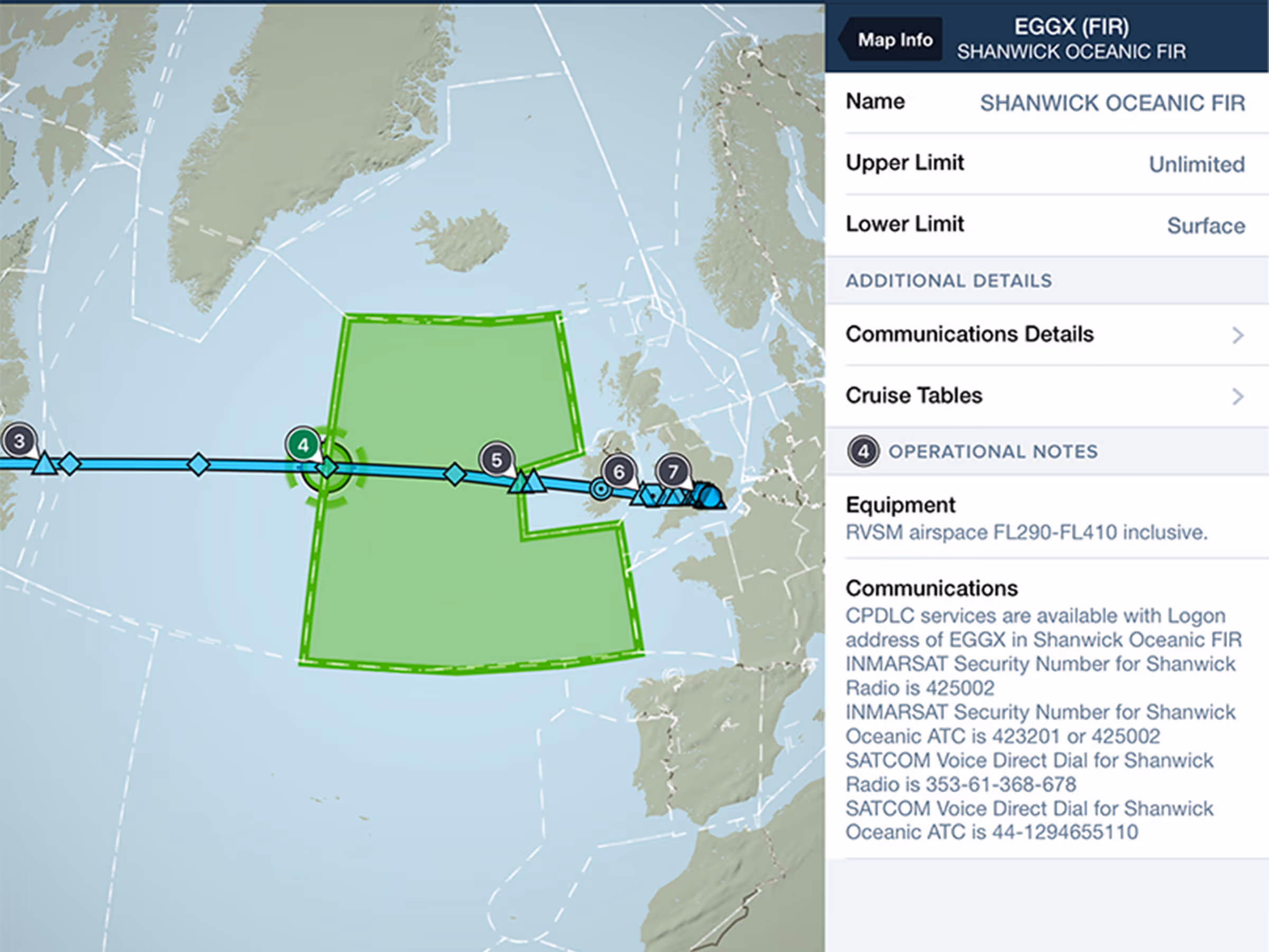
Operational Note Flags
Find Operational Notes with tappable numbered flags placed along your route. Available with Premium plans.
All Plans
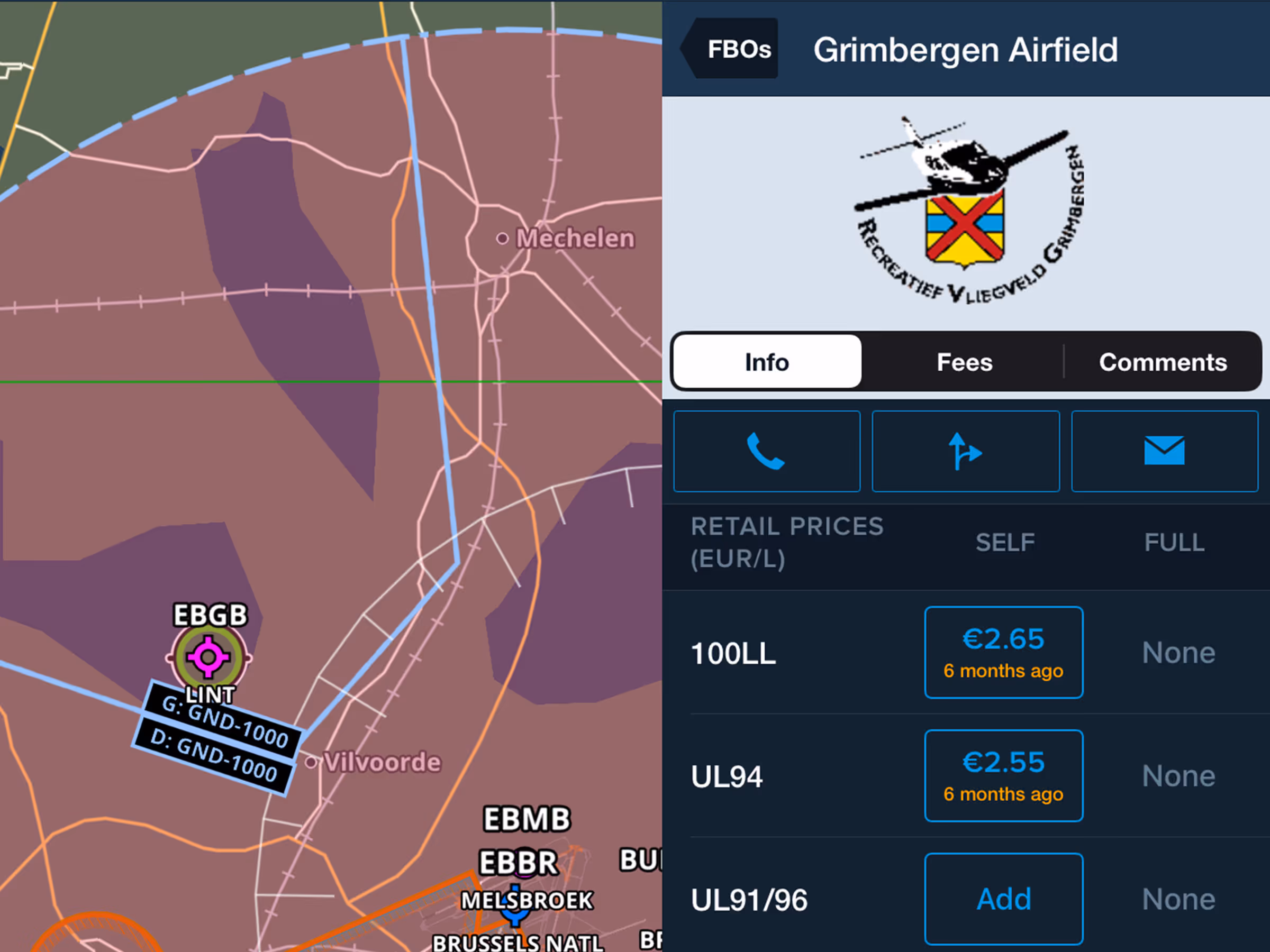
UL 91/96 Fuel Prices
Find UL 91/96 fuel pricing and availability with self/full service options and price update timing.
2022
14.8
September 2022
September 2022
All Plans
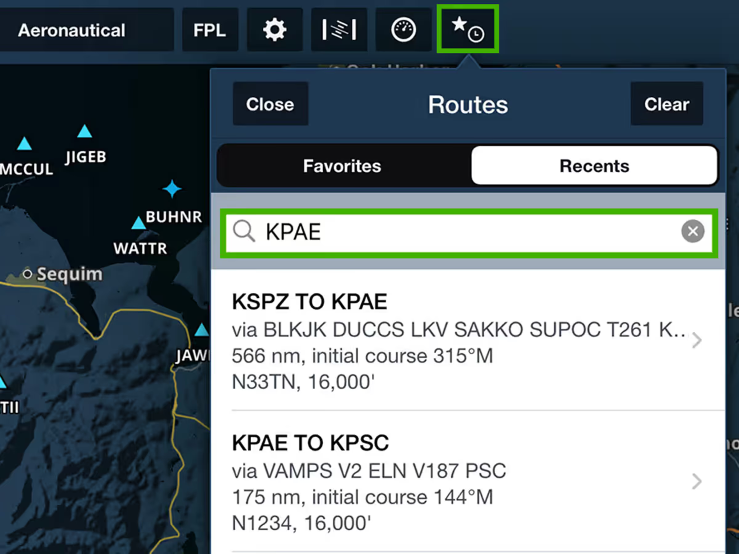
Favorite/Recent Routes Filter
Search for Favorite and Recent Routes using different identifiers to find routes faster.
All Plans
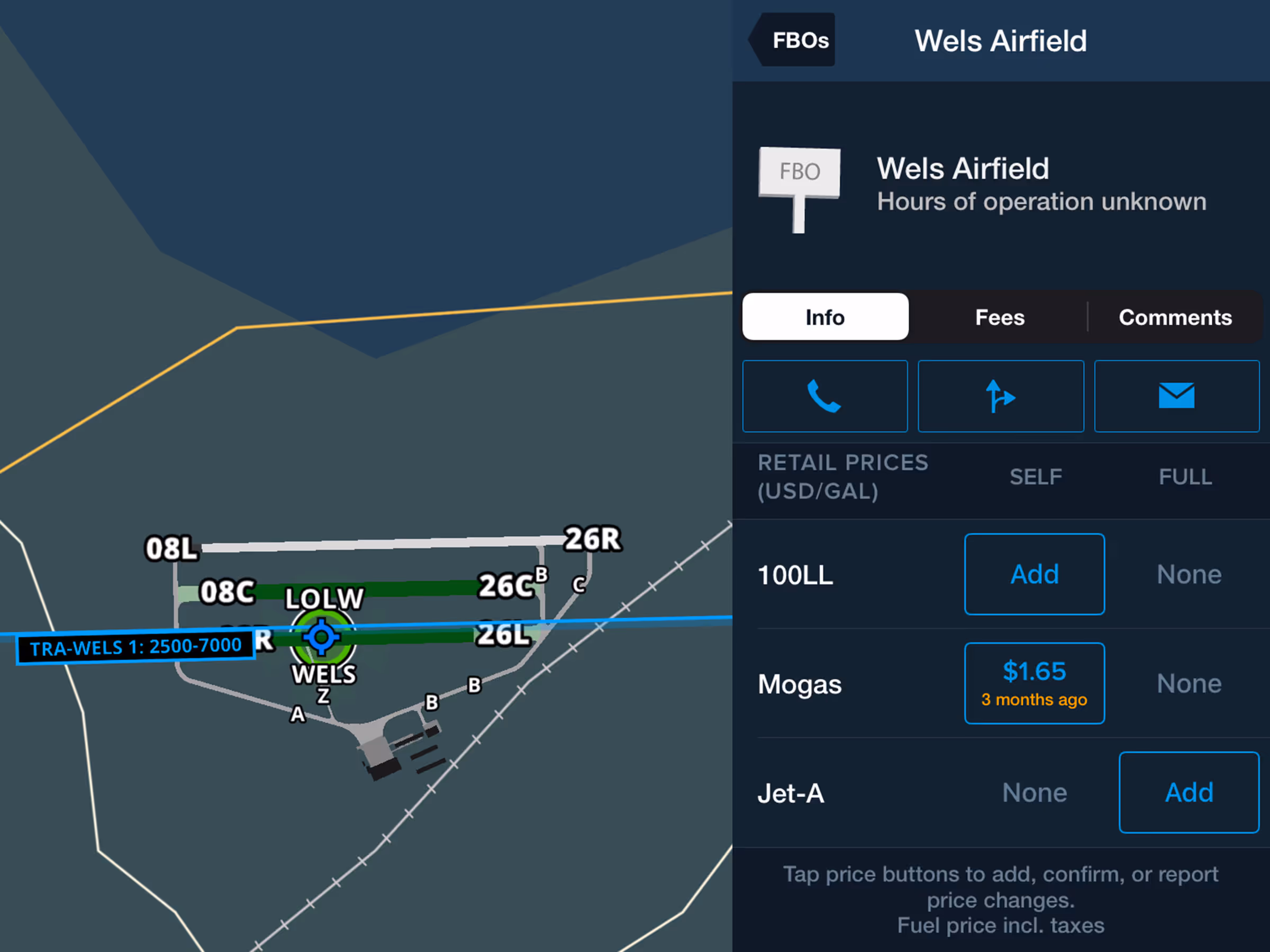
Mogas Fuel Prices
Find Mogas fuel pricing and availability with self/full service options and price update timing.
Premium
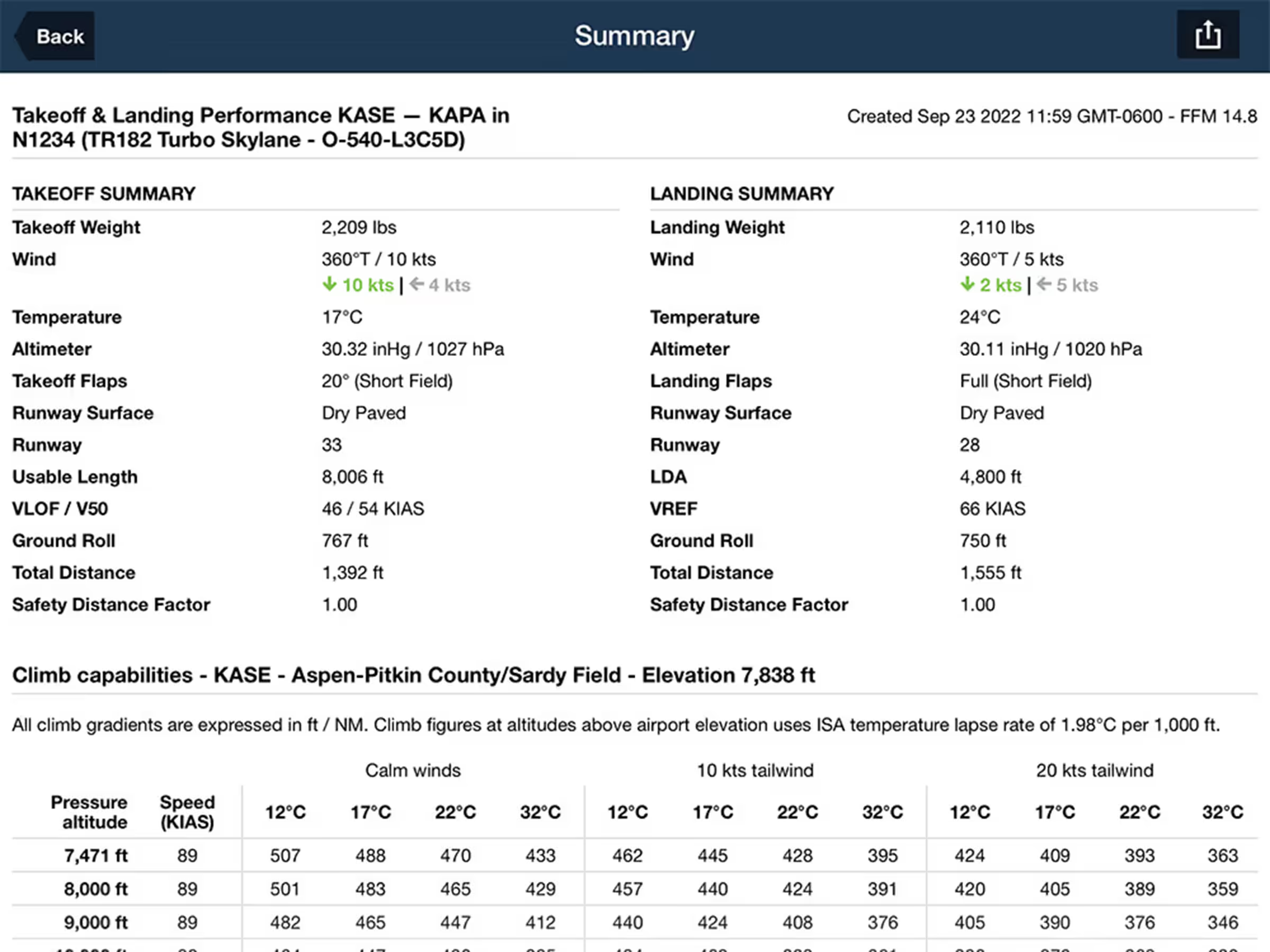
Takeoff & Landing Summary
Generate detailed takeoff and landing performance summaries for supported aircrafts.
2022
14.5
June 2022
June 2022

Bearing and Track Orientation Setting
Display bearing and track using Magnetic or True North for Ruler, Synthetic Vision, and Cockpit Instruments.
All Plans
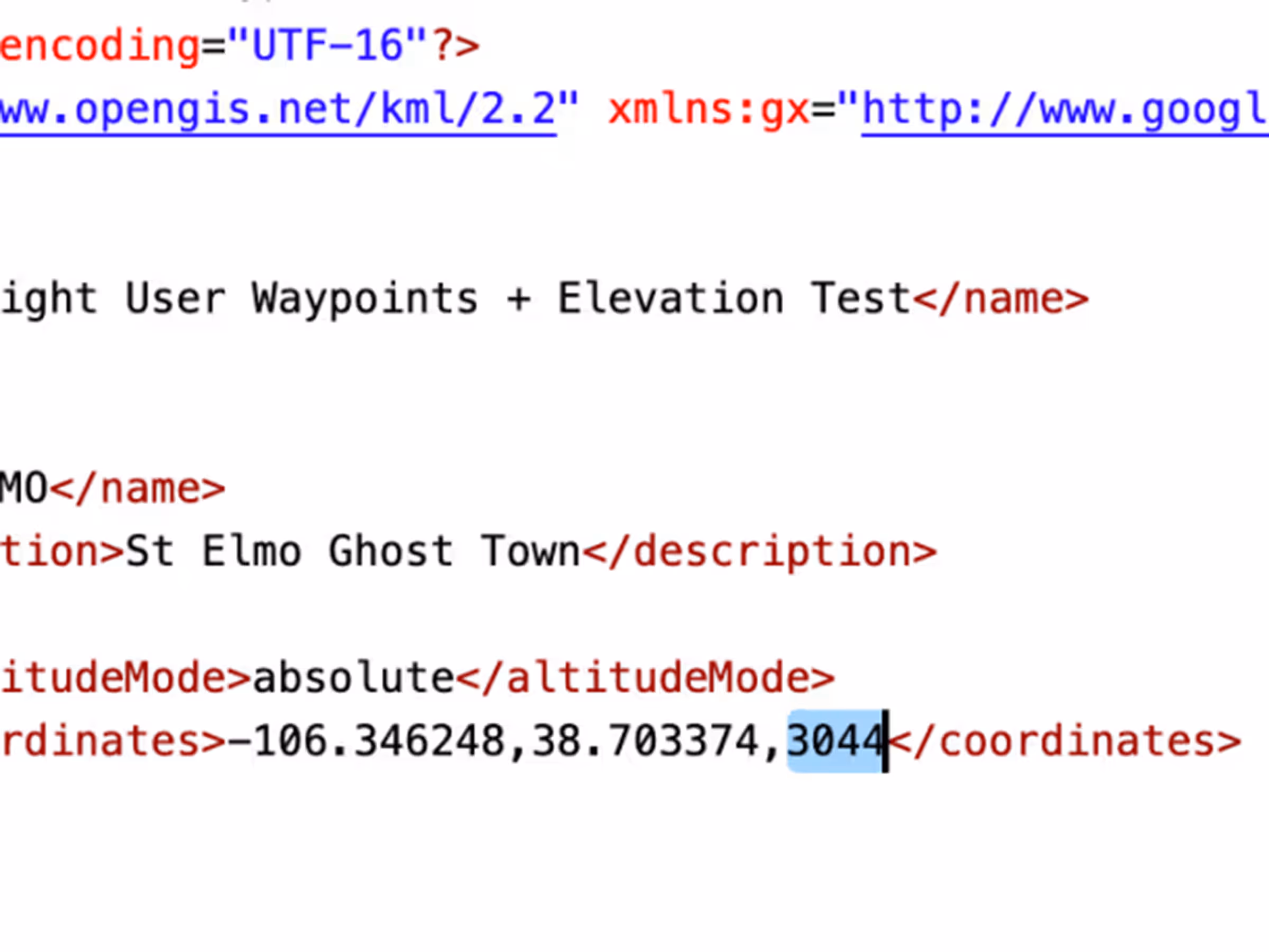
Custom Waypoint Elevation
Add elevations to User Waypoints for accurate climb/descent metrics and Profile View depictions like airports.
All Plans
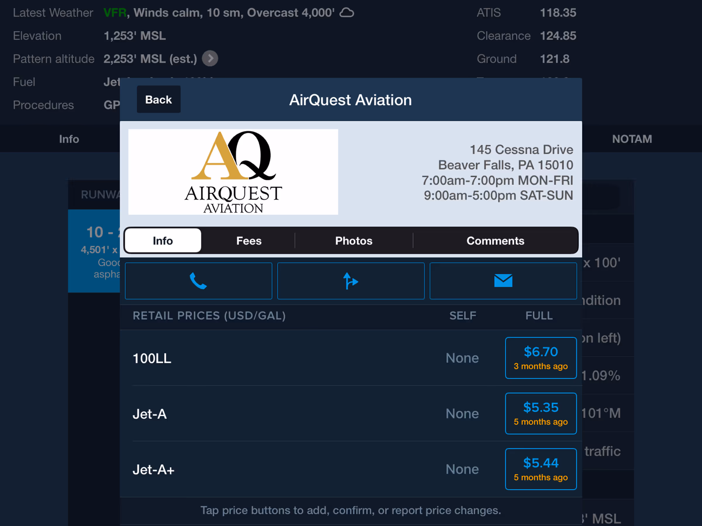
Fuel Price Table Updates for FBOs
The fuel price table in an FBO’s detail view now only displays fuel types that are actually offered.

All Plans
Simplified Download Settings
Configure downloads faster with separated Data/Chart and Region selection menus.
2022
14.4
May 2022
May 2022
All Plans
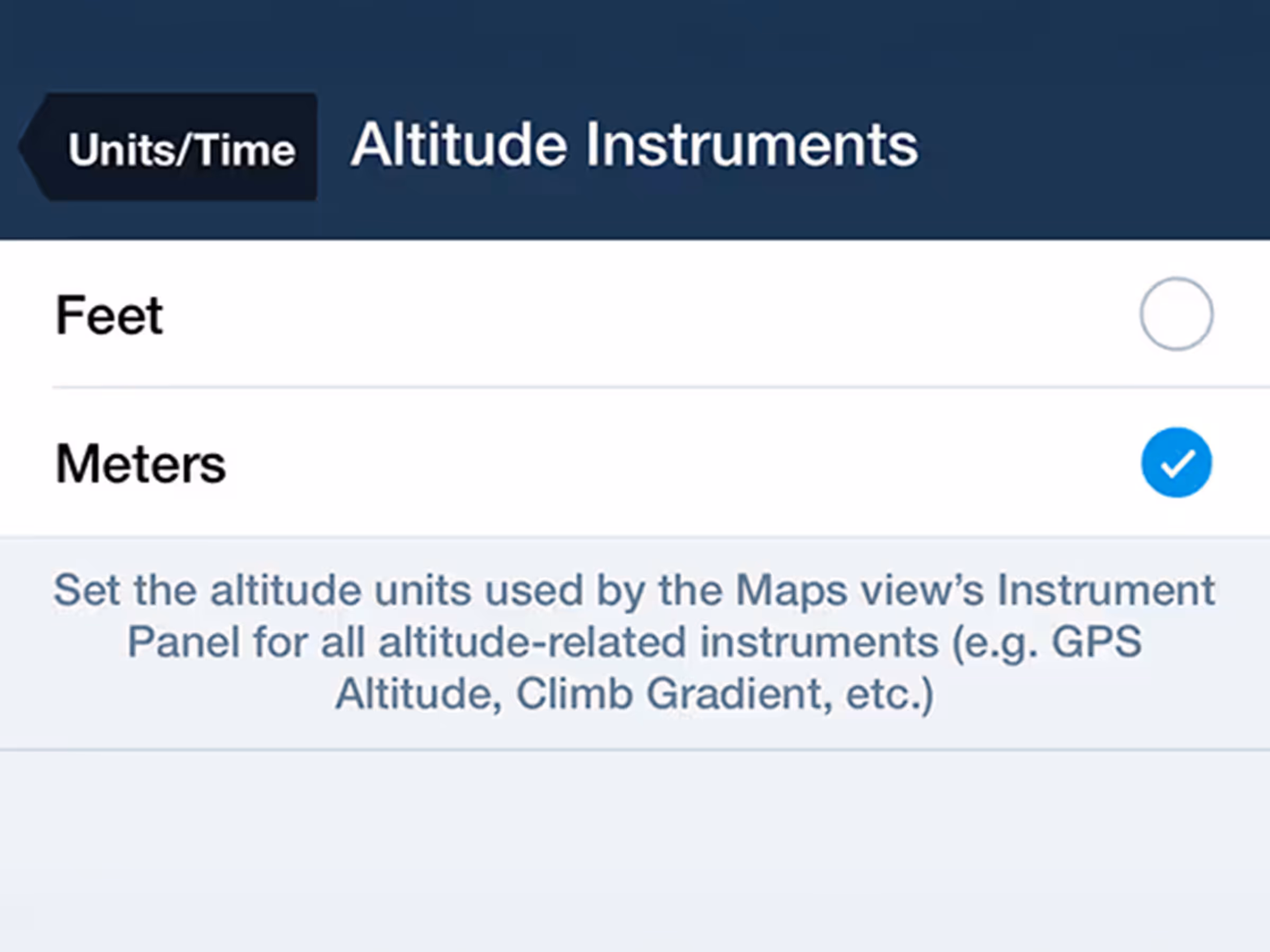
Altitude Instruments in Meters
Customize altitude display units in the Map's Instrument Panel.
All Plans
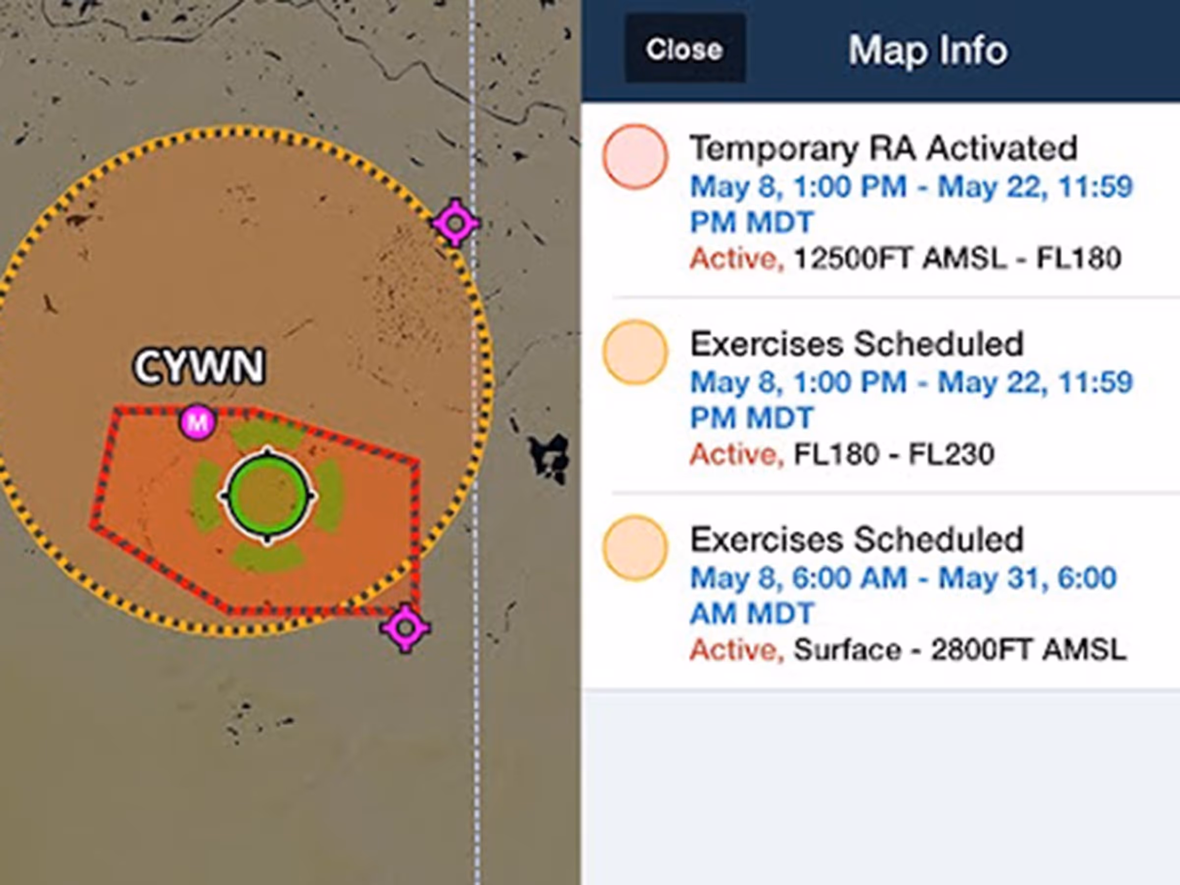
Global Graphical NOTAMs
View color-coded global Graphical NOTAMs with filters for Exercises, Controlled Airspaces, and Obstacles.

Per-Leg Altitude in Profile
Visualize and plan enroute altitude changes at key waypoints to avoid terrain, weather, and airspace.