
Release Spotlight
Release Spotlight

17.11
CFI Referral Program
Active CFIs can earn discounts on their subscription by introducing students to ForeFlight.
2025
17.11
December 2025
December 2025
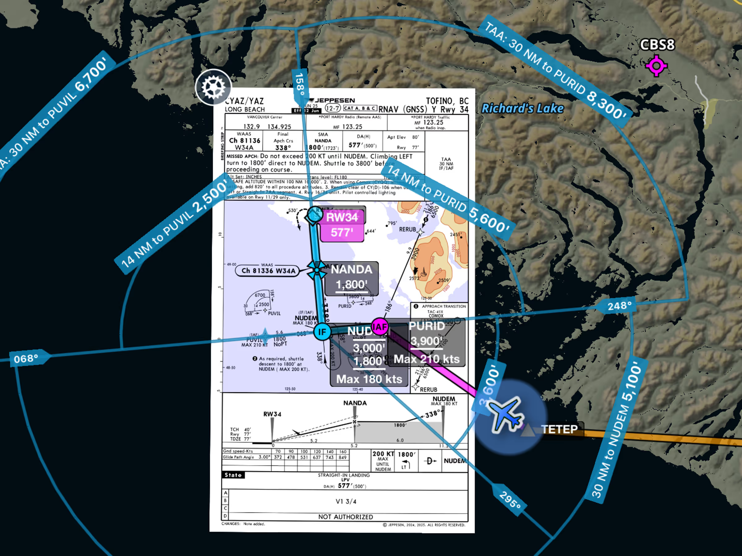
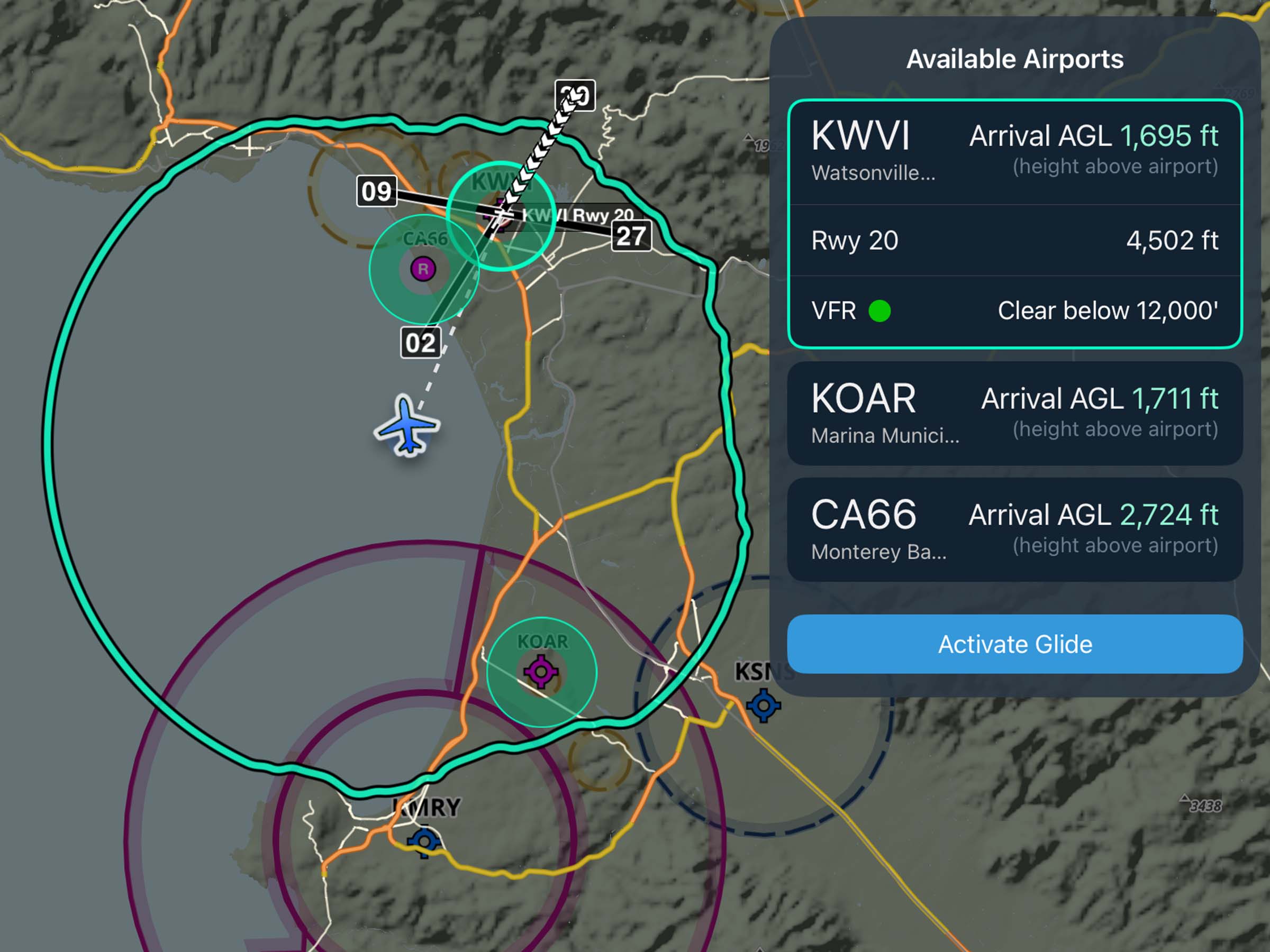
Essential & Above
Dynamic Procedures: Terminal Arrival Altitudes
View approved descent altitudes on the map.
All Plans
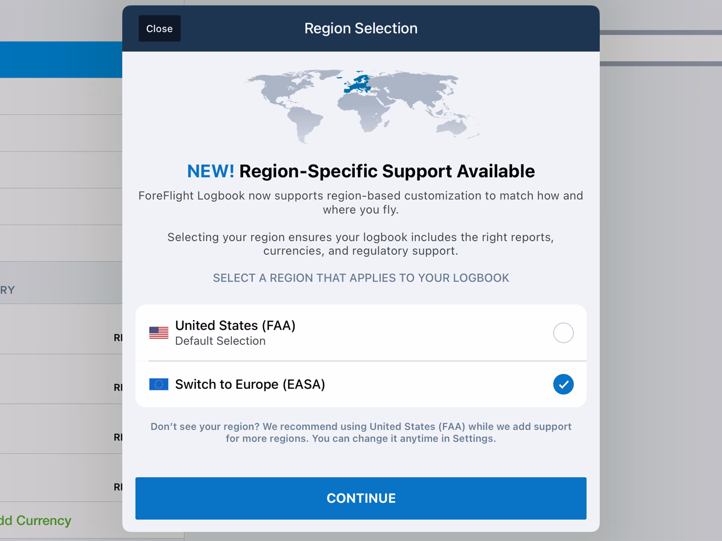
European Logbook Support
Log flights, track recency, and generate detailed reports in accordance with European standards.
All Plans
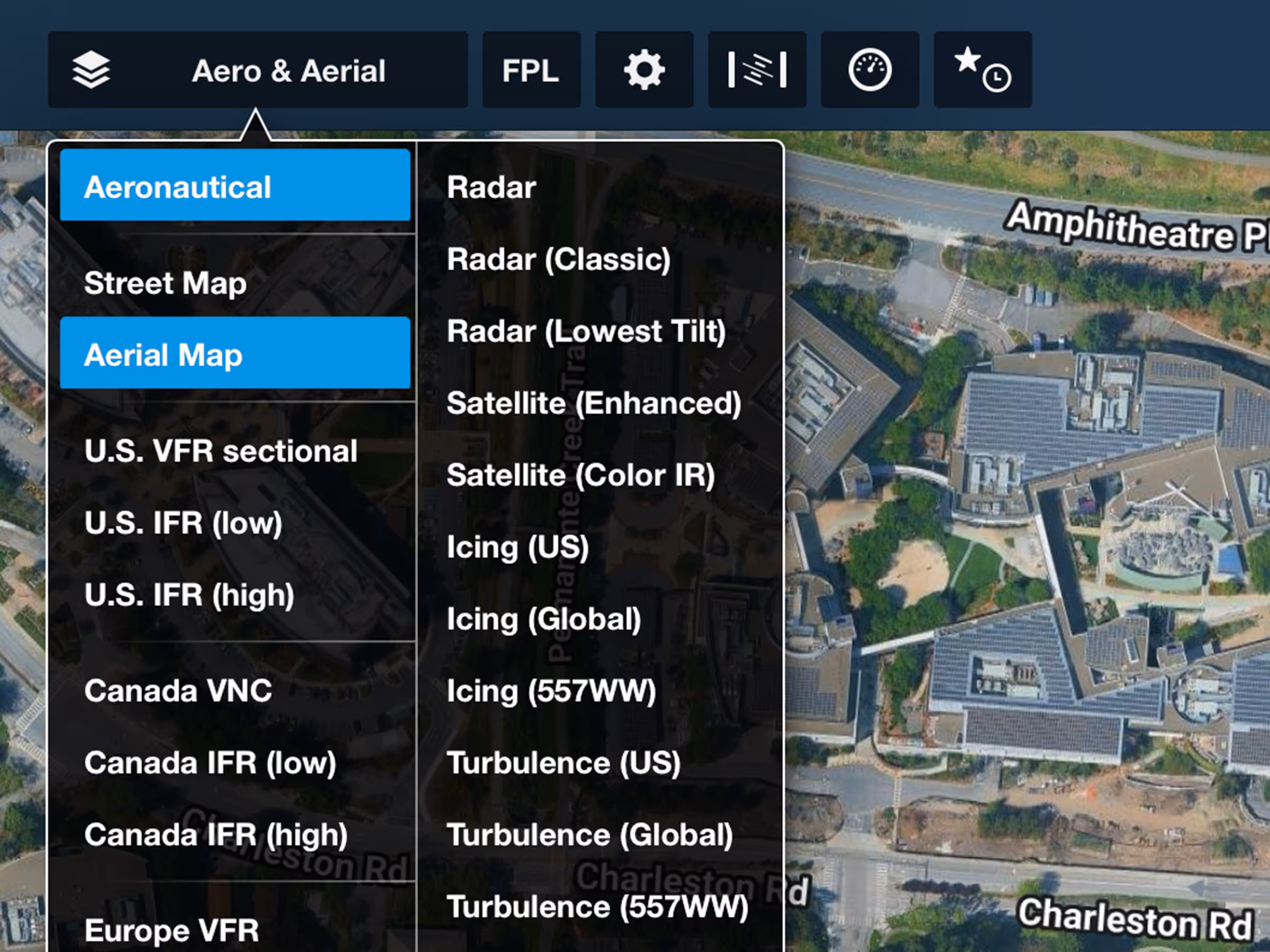
Google Aerial Map Imagery
Plan with higher-quality views of Earth powered by Google’s satellite imagery.
.avif)
Premium
GPS Cross Check
Compare GPS and VOR/DME-derived positions to verify accuracy when GPS reliability is uncertain.
2025
17.9
September 2025
September 2025
All Plans
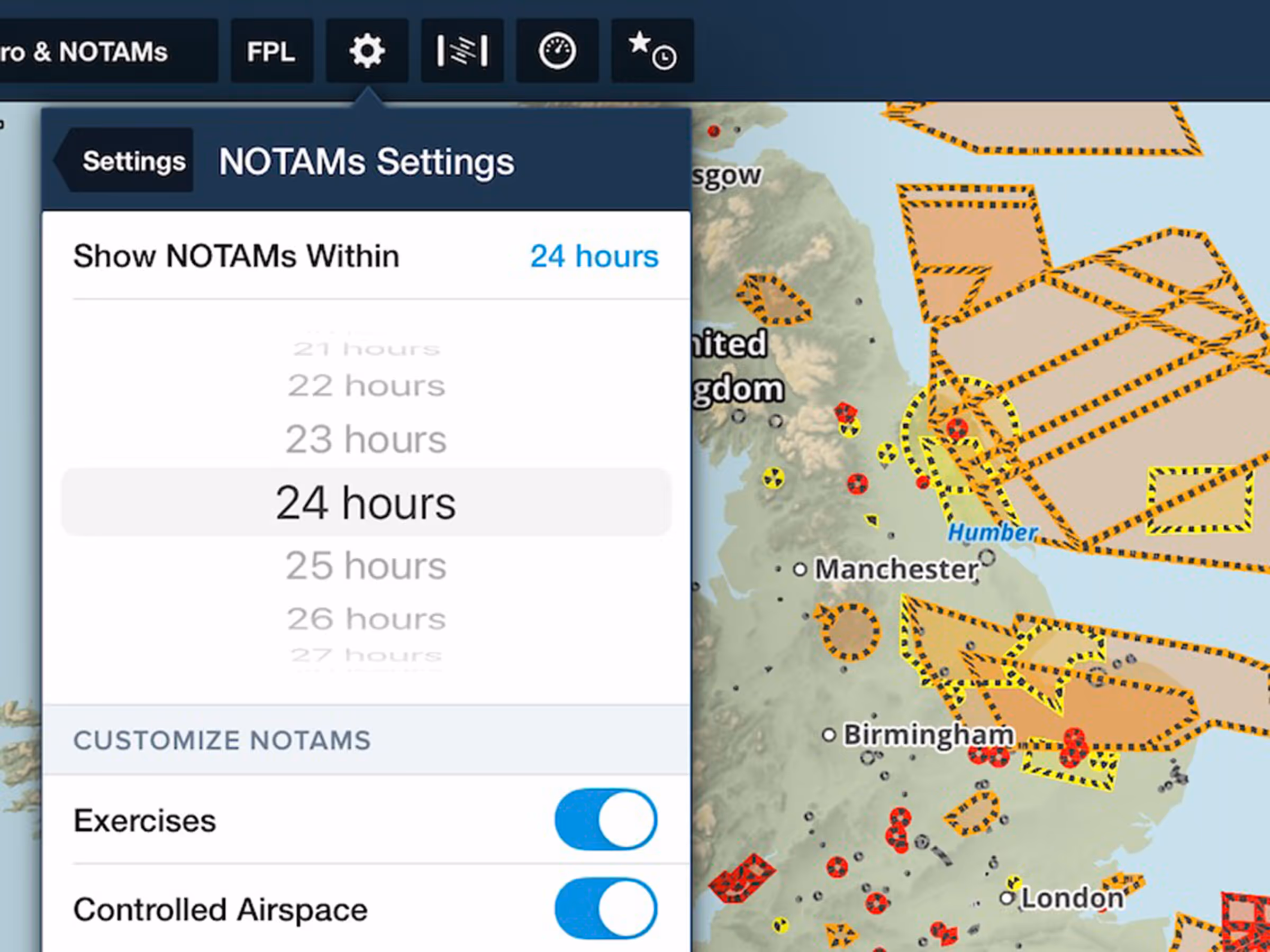
Future Graphical NOTAMs Setting
Display Graphical NOTAMS on the Map up to 48 hours before they take effect.
All Plans
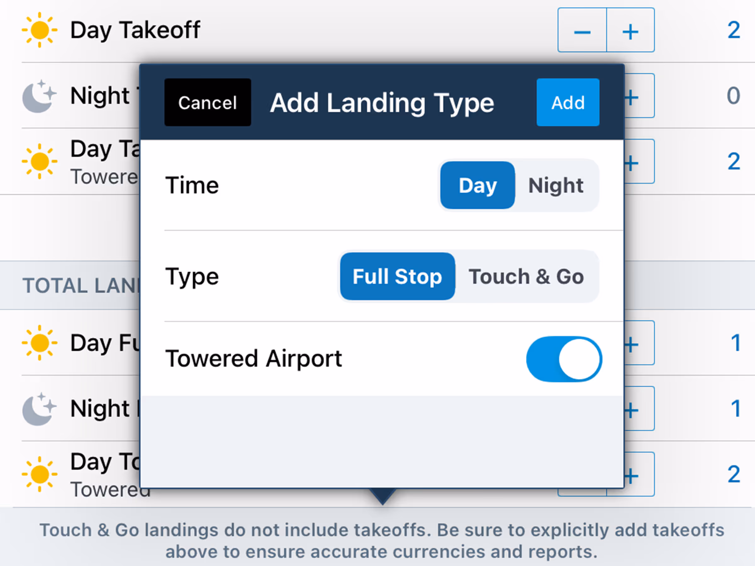
Logbook Expanded Takeoff & Landing Types
Log expanded takeoff and landing types such as Towered, Touch & Go, and more.
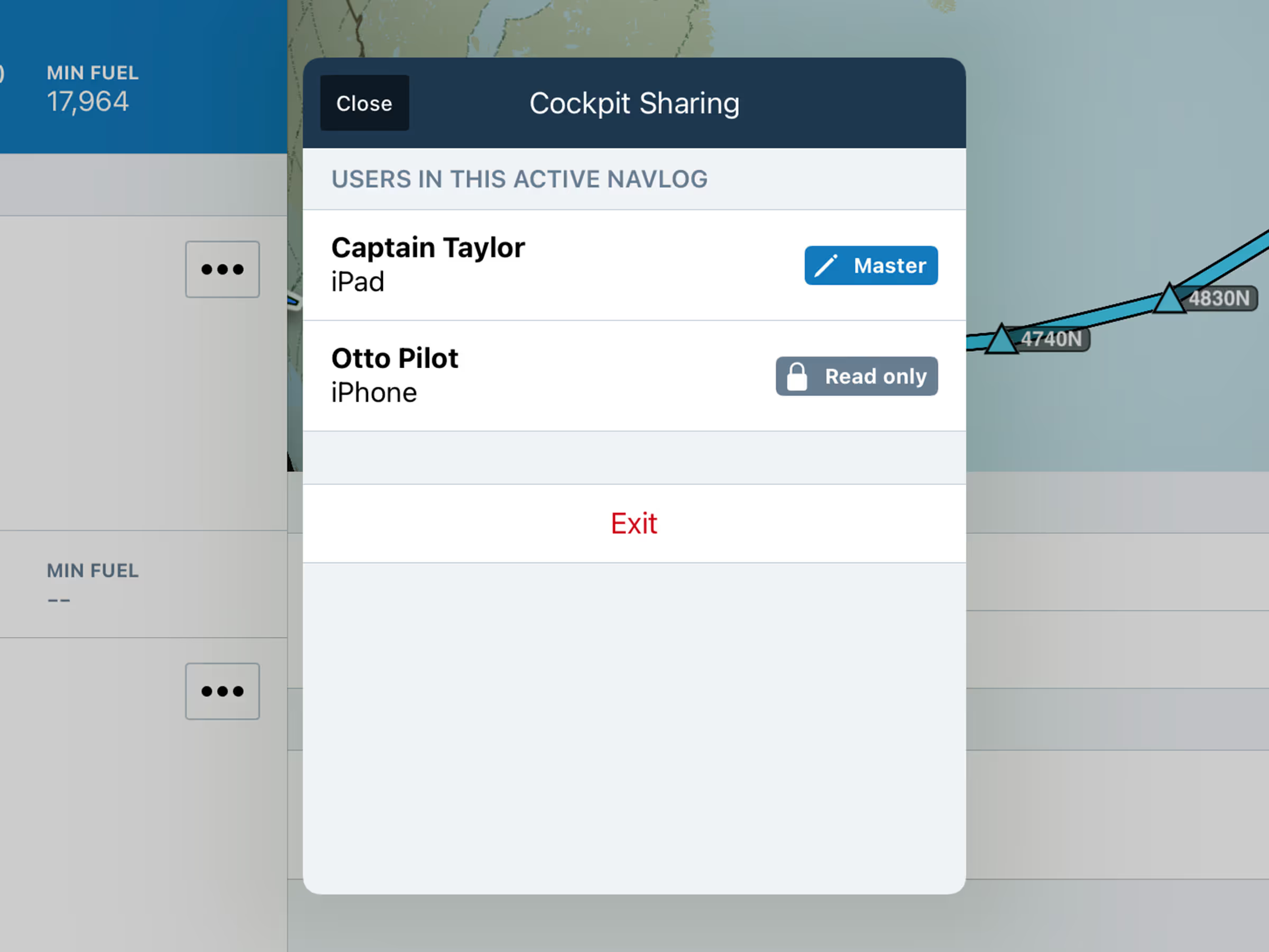
Active Navlog
Active Navlog: Cockpit Sharing
Access and reference a centralized, real-time master Navlog throughout flight.
2025
17.8
August 2025
August 2025
.avif)
All Plans
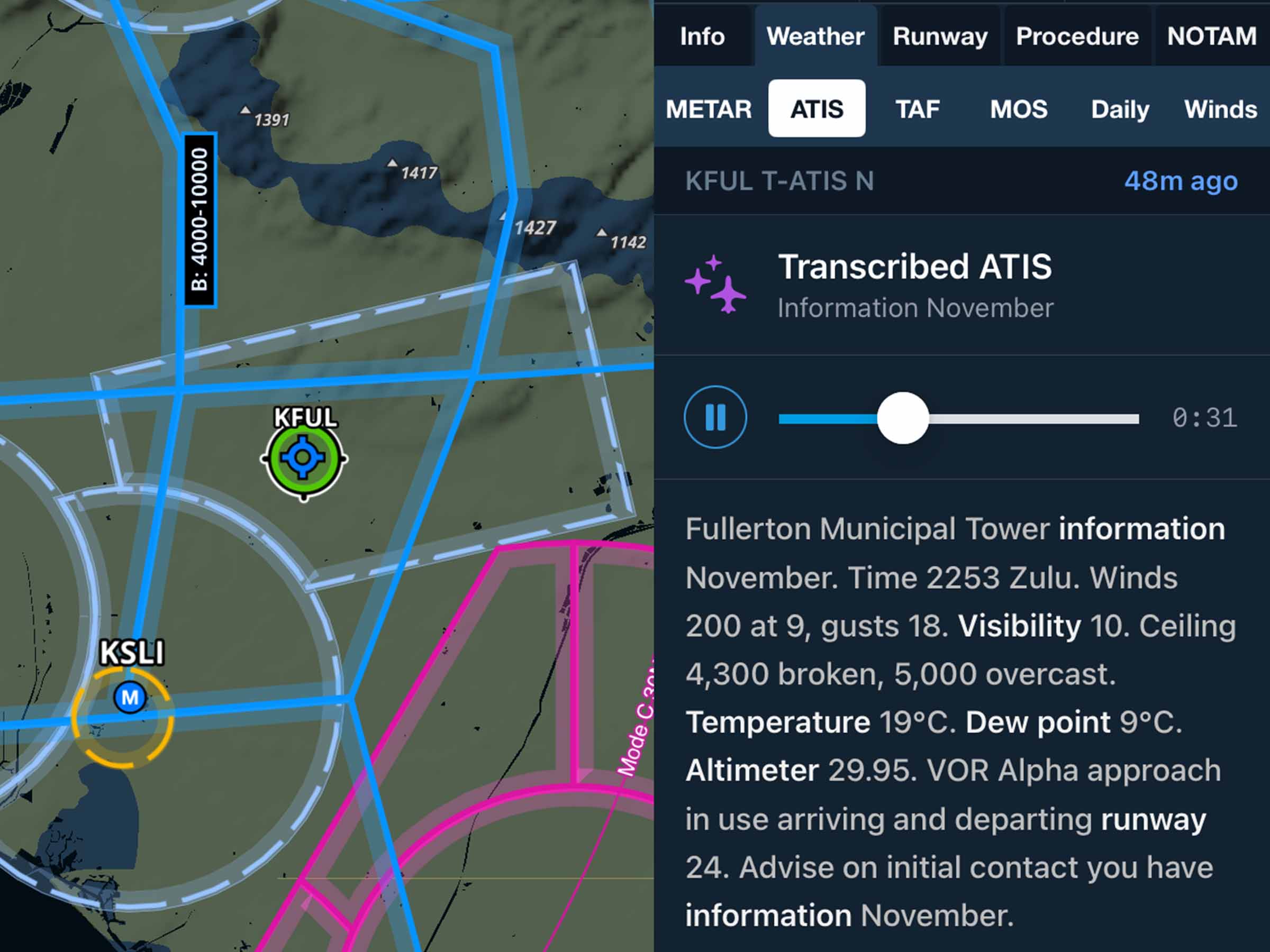
Dynamic Procedures: NOTAMs in Sidebar
View active NOTAMs for your selected approach or airport directly in the Dynamic Procedures sidebar.
.avif)
All Plans
Breadcrumb Speed/Altitude Settings
Set the minimum speed and altitude required for Breadcrumbs to show on the map.
.avif)
.avif)
All Plans
Sync Status View
Verify connection status to Sync servers and view troubleshooting tips to resolve data issues.
2025
17.7
July 2025
July 2025
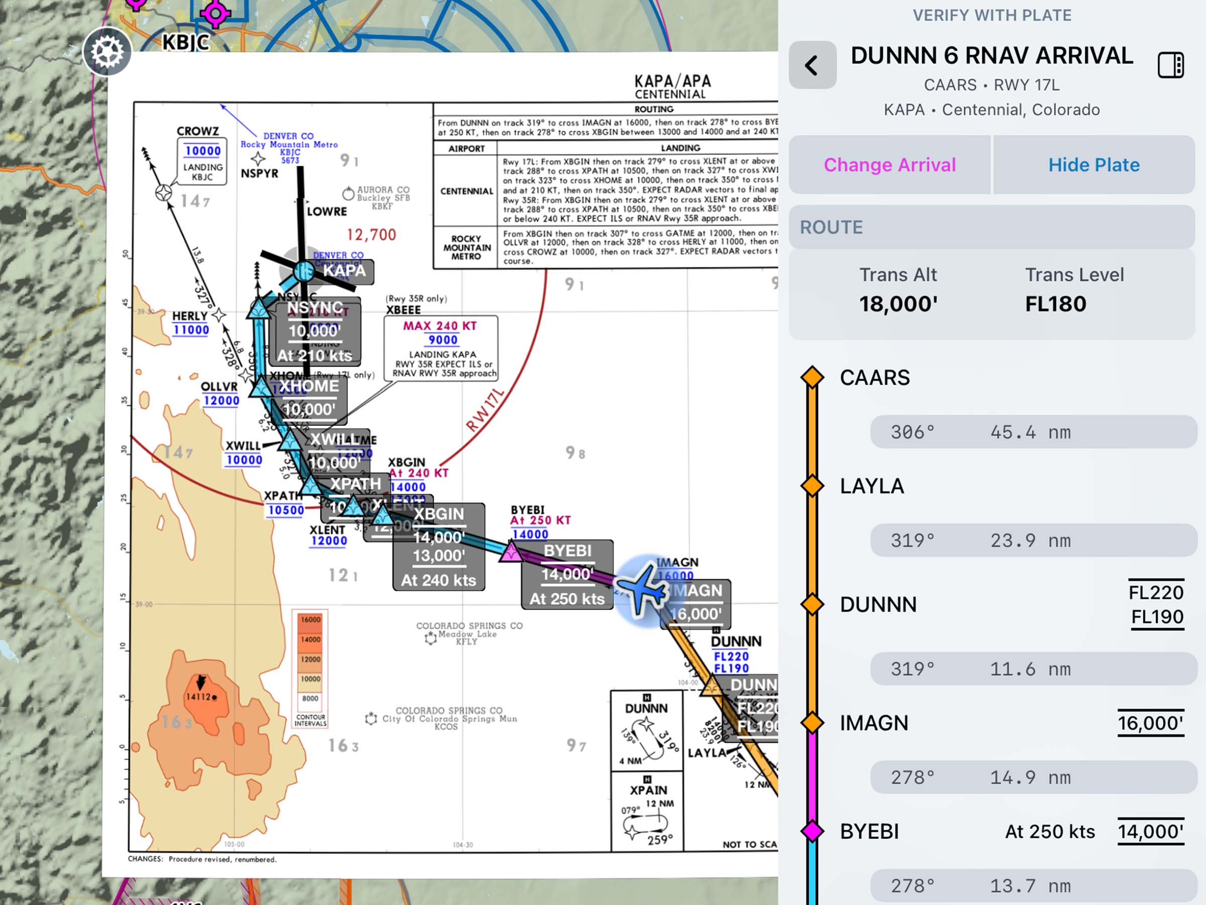
Essential & Above
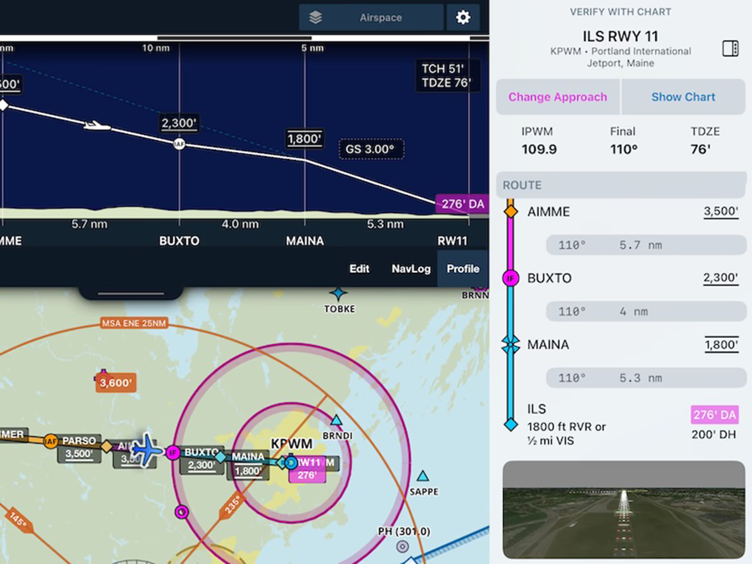
Dynamic Procedures
Go beyond charts with a procedures sidebar, MSA displayed on map, vertical descent in Profile View, and more.
All Plans
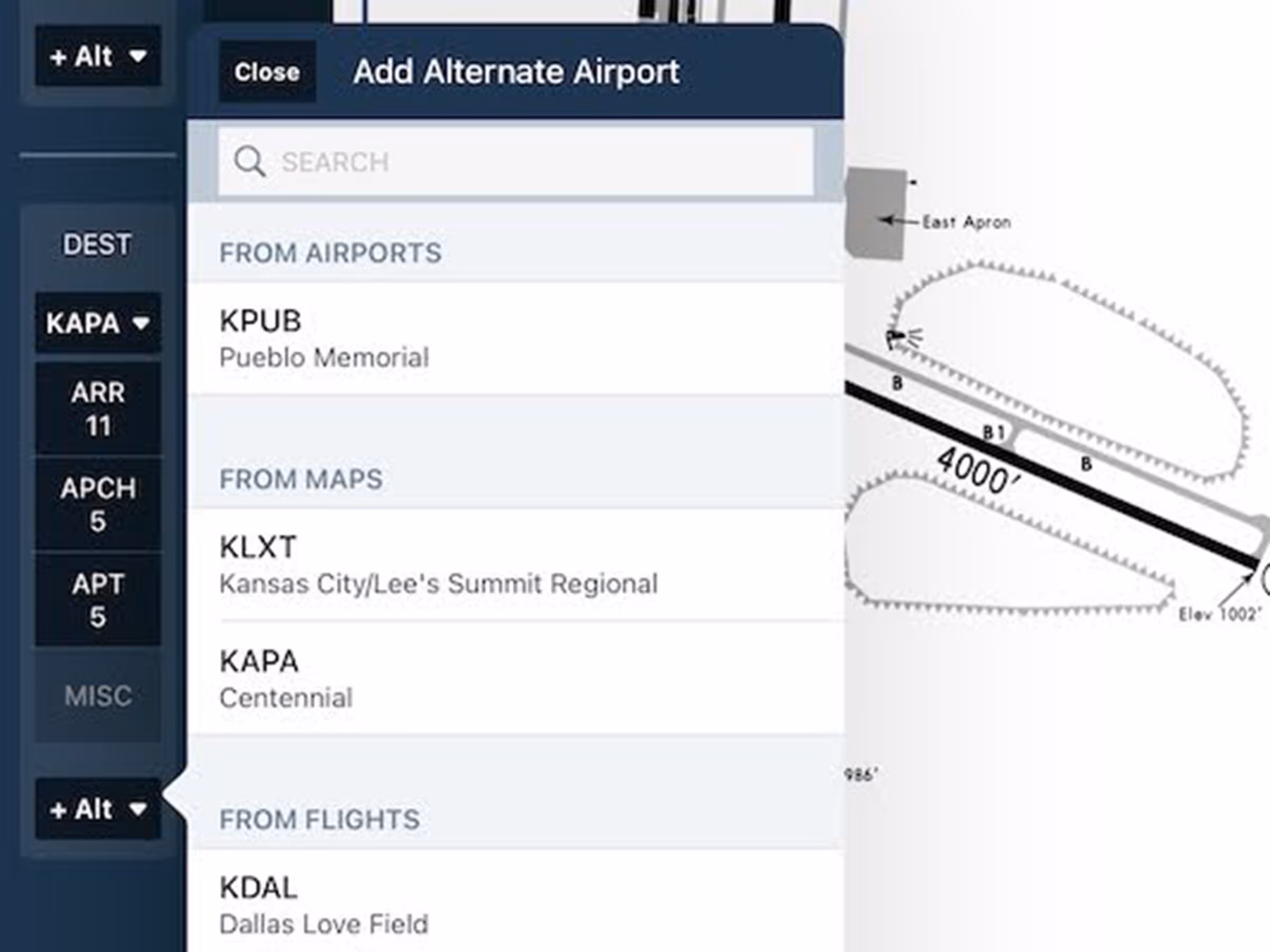
Alternates in Flight Binders
Add alternate charts with just a few taps so you're ready when workload is high and time is short.
Essential & Above
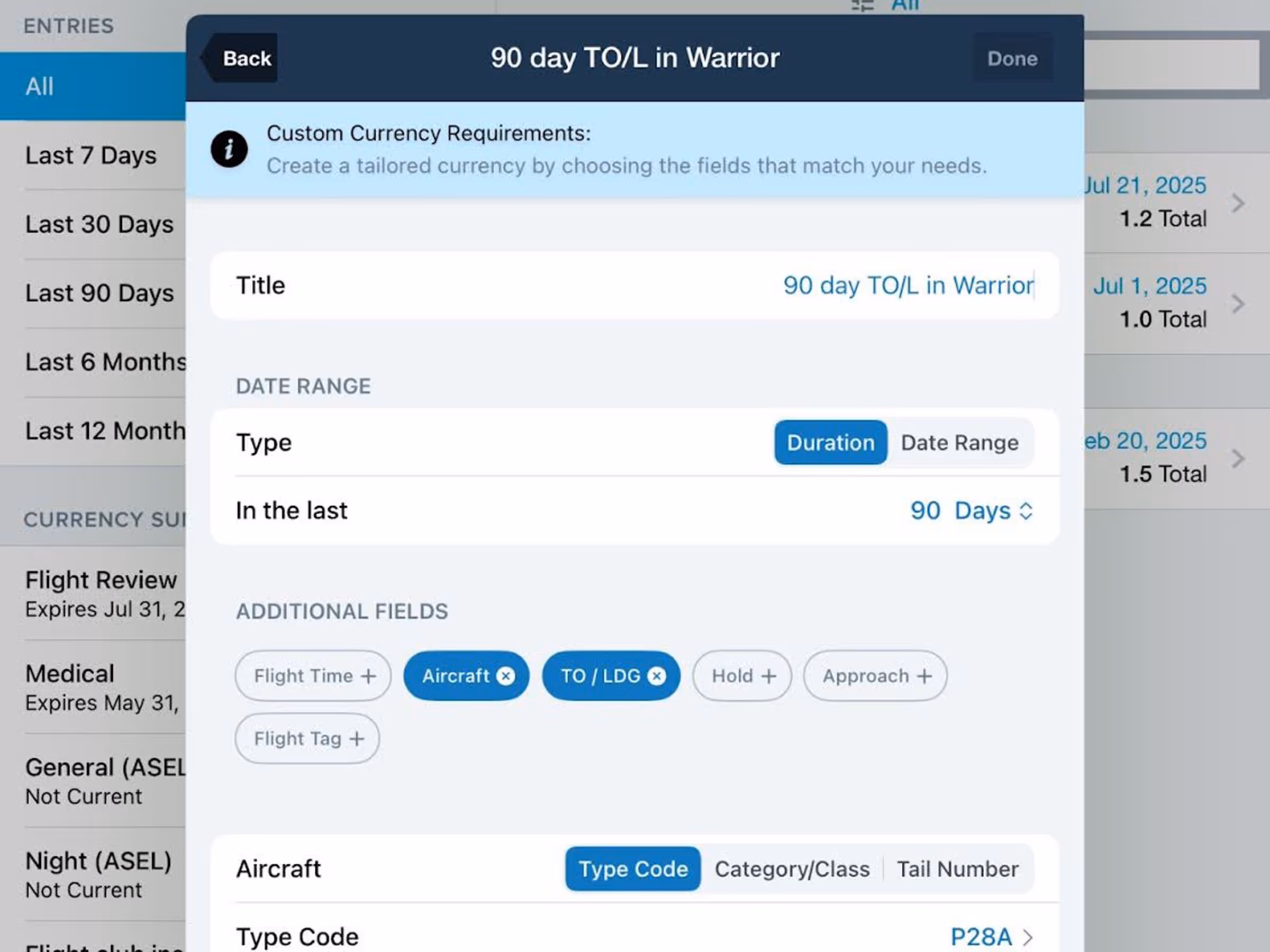
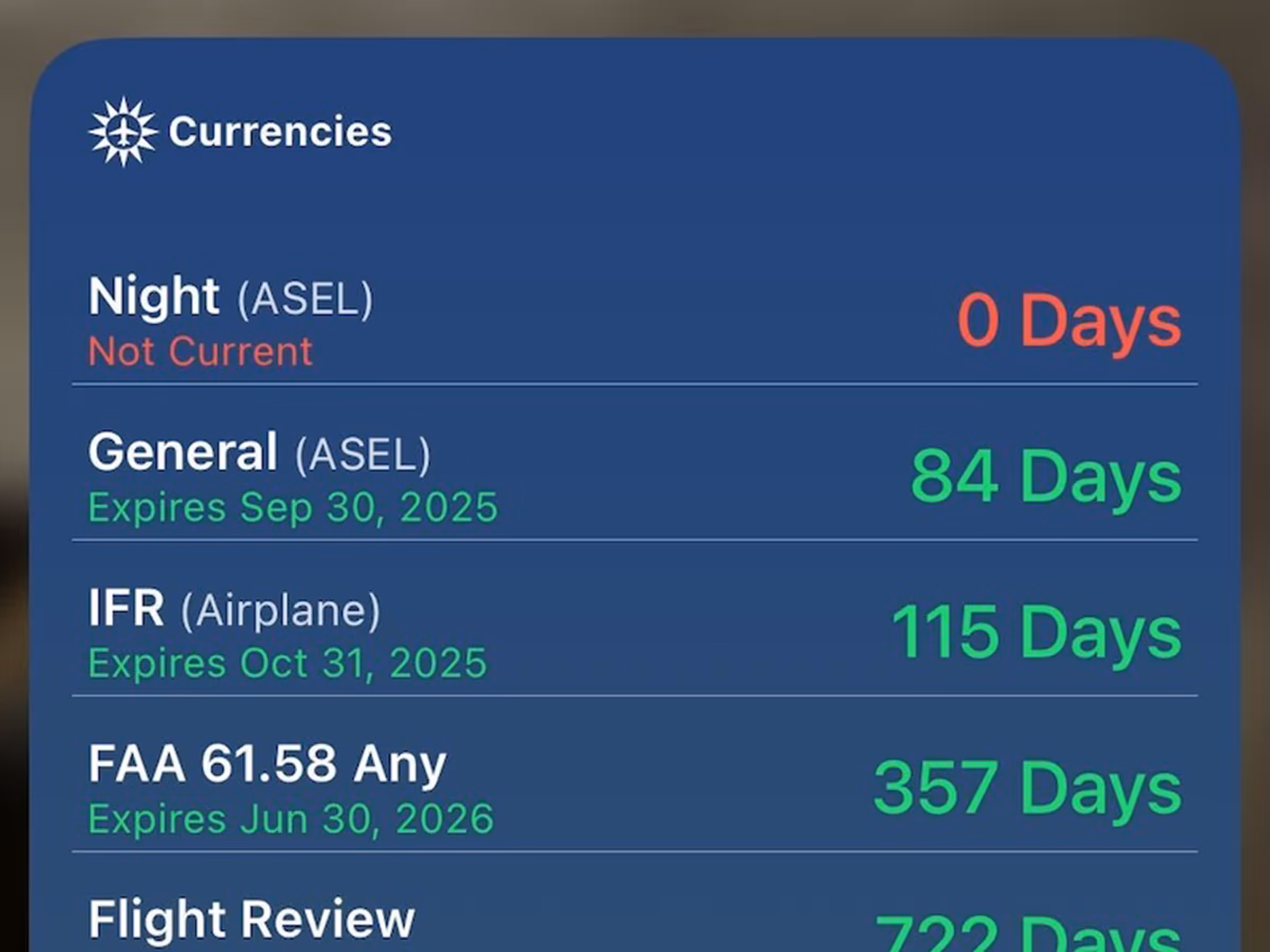
Logbook Custom Currencies
Track personal minimums, insurance requirements, and more with Custom Currencies in Logbook.
2025
17.6
June 2025
June 2025
.avif)
All Plans
Graphical NOTAMs Color Change
Active Graphical NOTAMs with moderate severity are colored yellow to help visually distinguish them.
All Plans
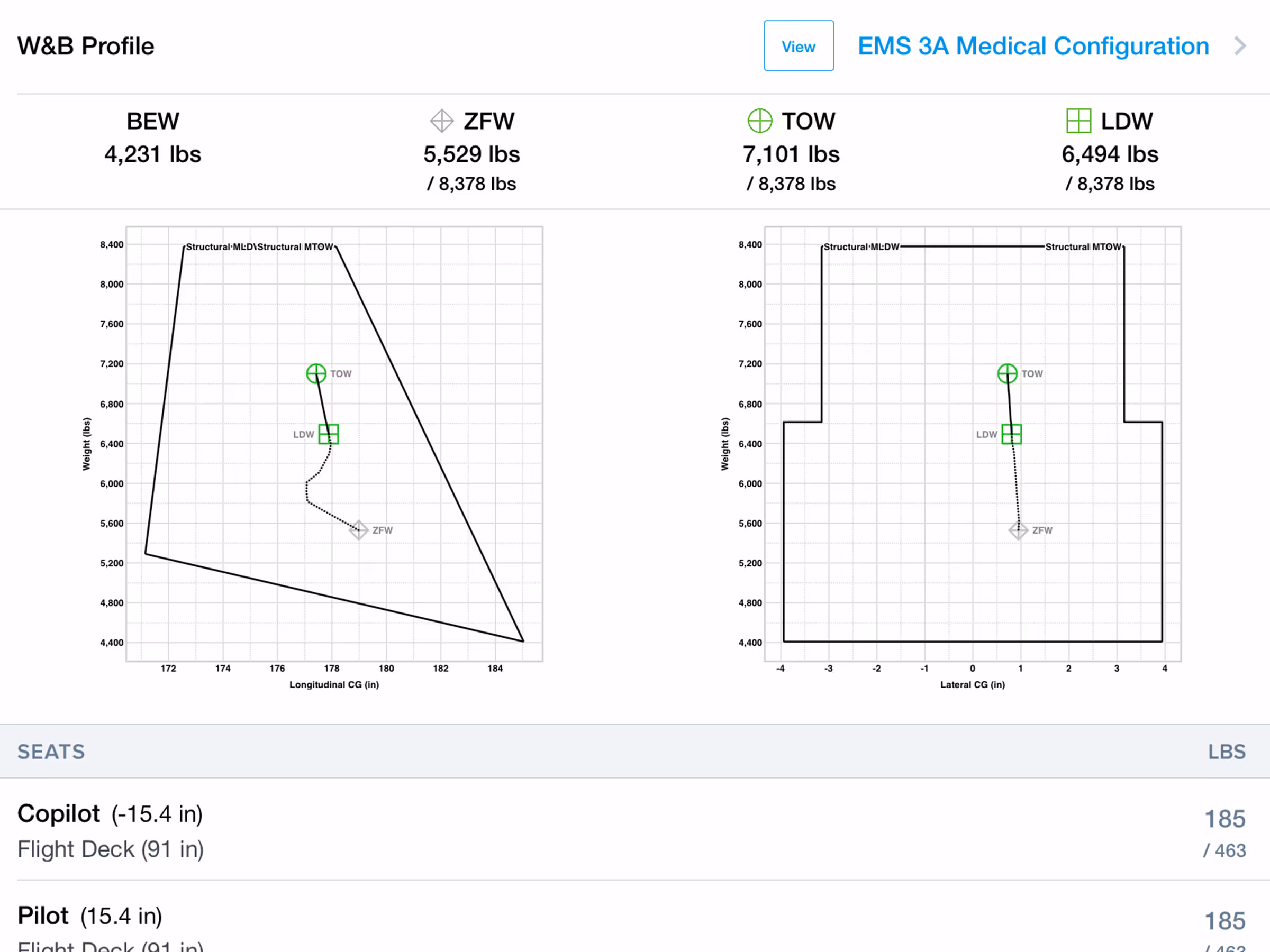
Helicopter Weight & Balance Support
Access expanded helicopter-specific weight and balance support.
All Plans
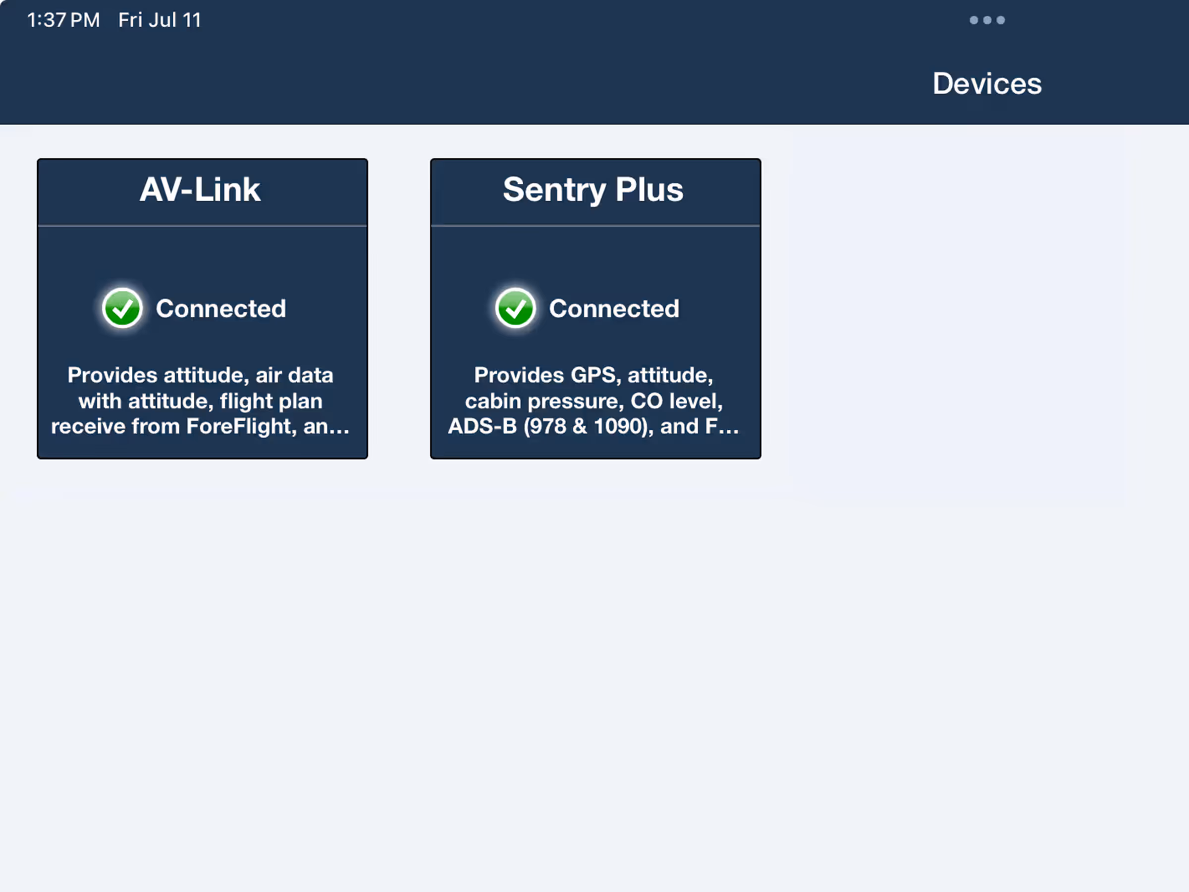
AV-30 Support
Wirelessly connect to uAvionix AV-30 to send route updates and receive live flight data,