
Release Spotlight
Release Spotlight

17.11
CFI Referral Program
Active CFIs can earn discounts on their subscription by introducing students to ForeFlight.
2025
17.5
May 2025
May 2025
All Plans
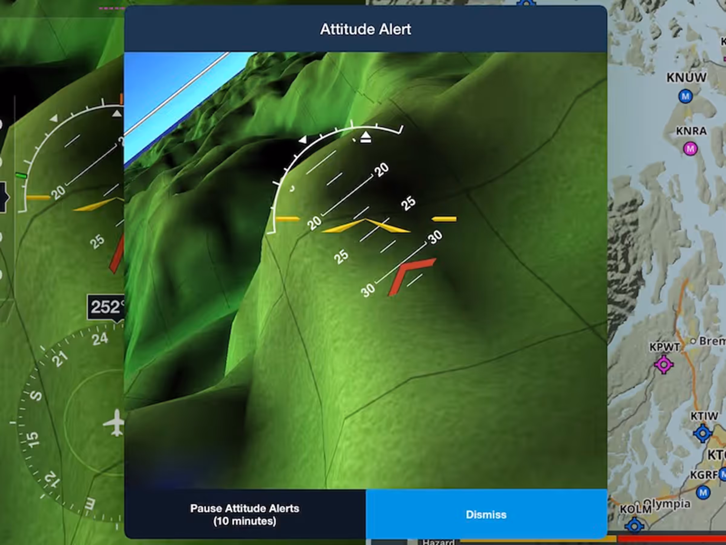
Unusual Attitude Alerts
Get alerted to recover from dangerous attitudes when connected to a certified attitude source in flight.
All Plans
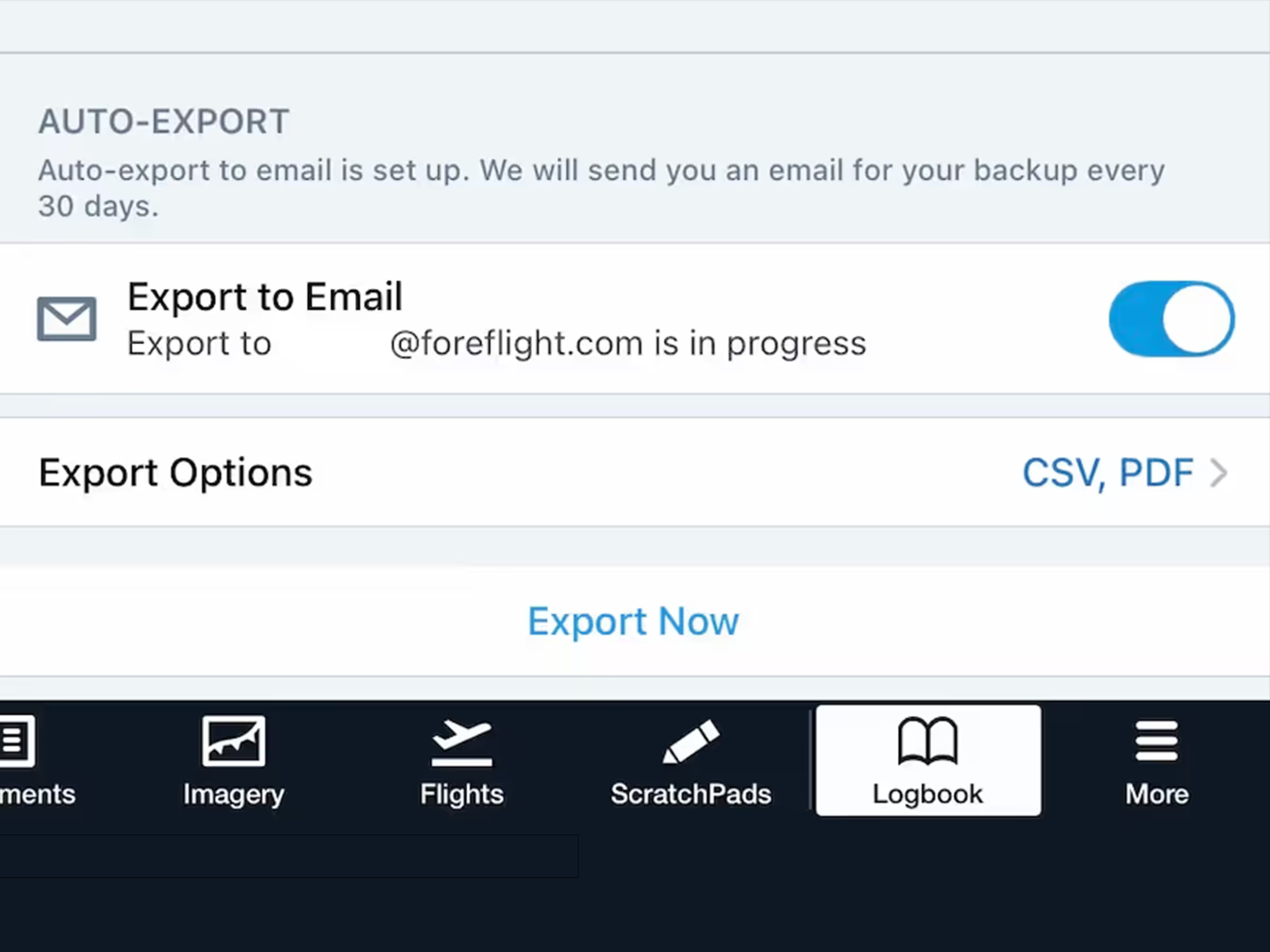
Automatic Logbook Exports
Protect your Logbook with automatic monthly exports sent to your email.
All Plans
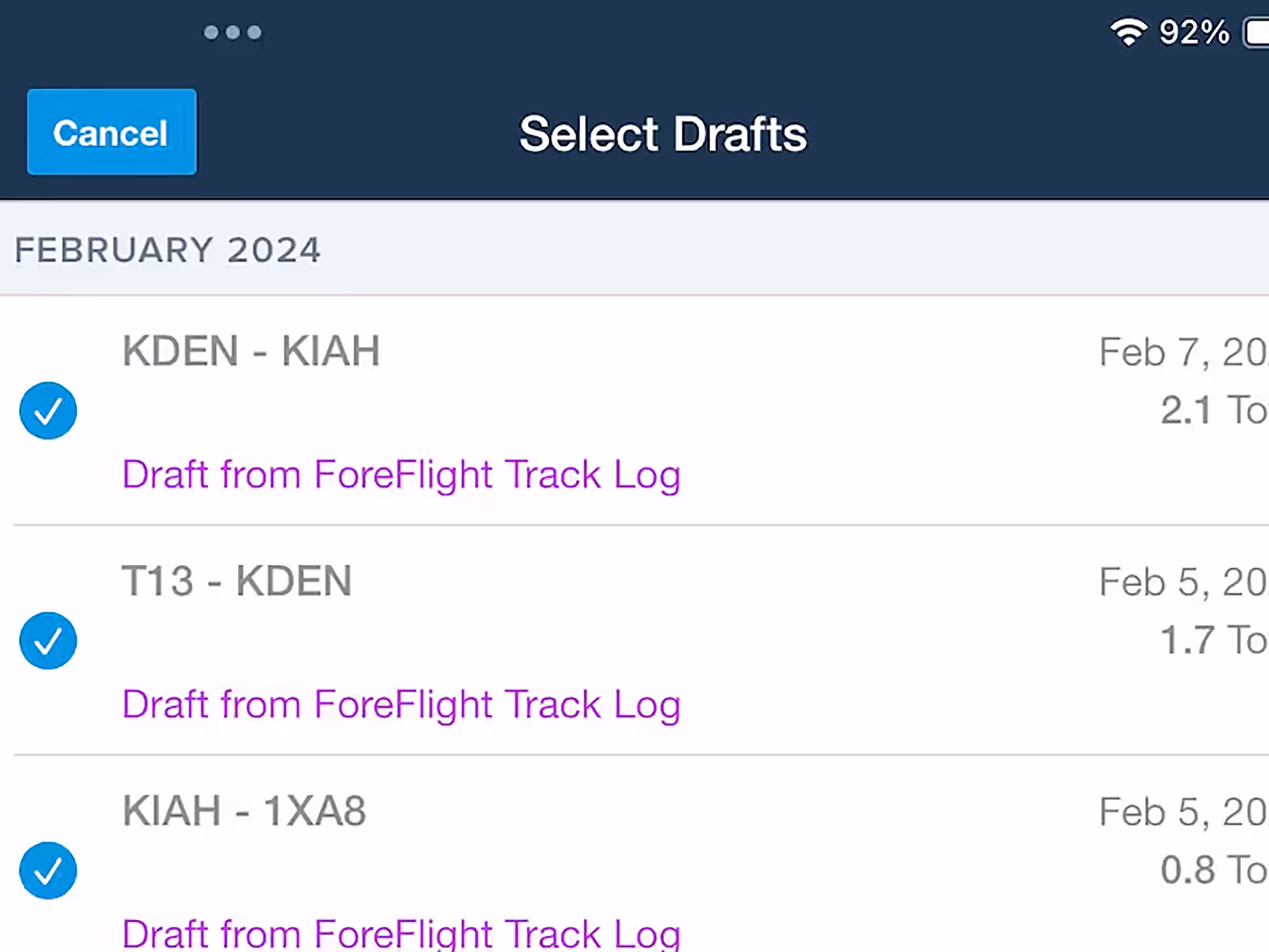
Logbook Draft Entry Multi-Select
Bulk select draft entries in Logbook with options to approve or delete all.
All Plans
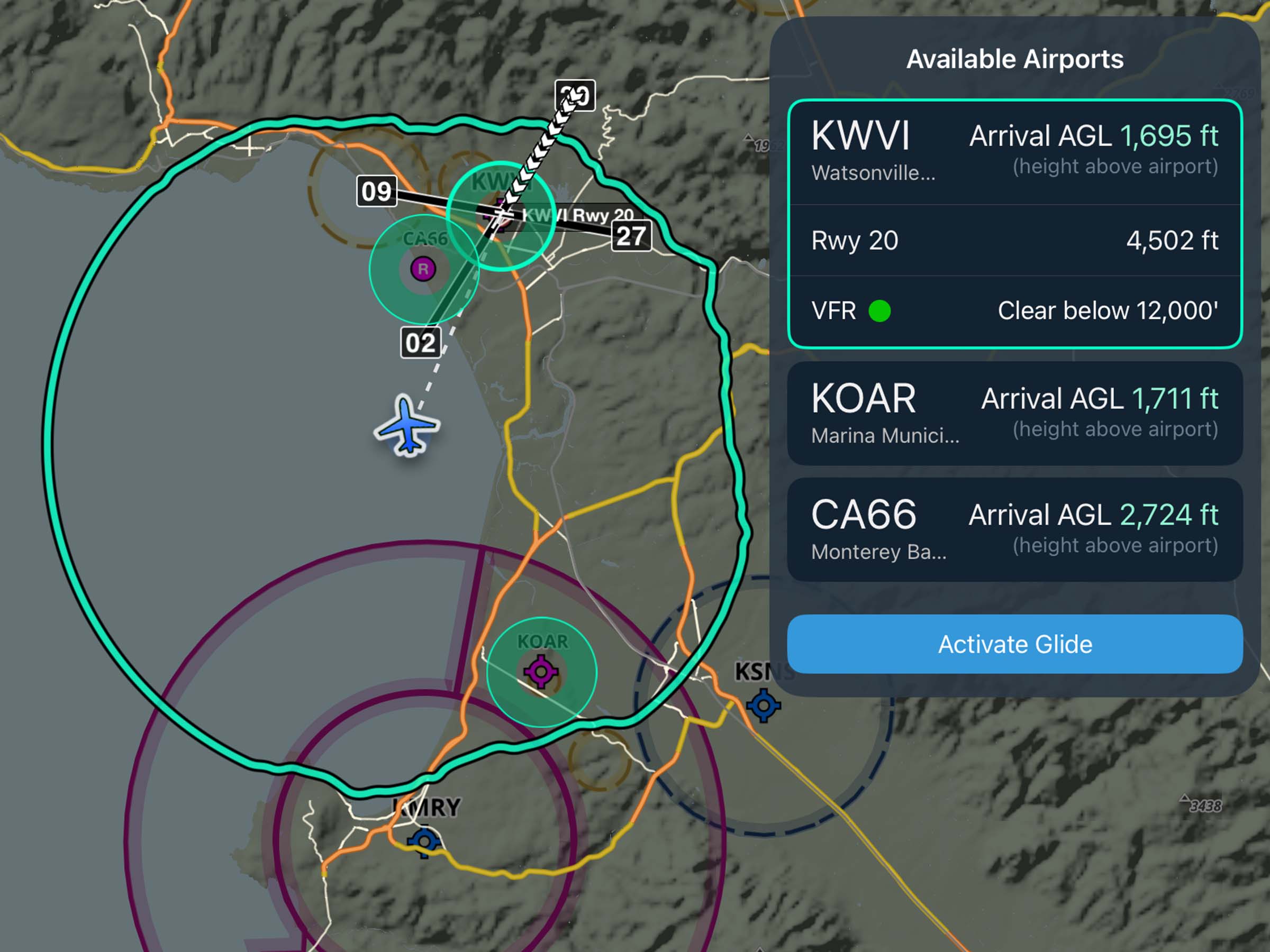
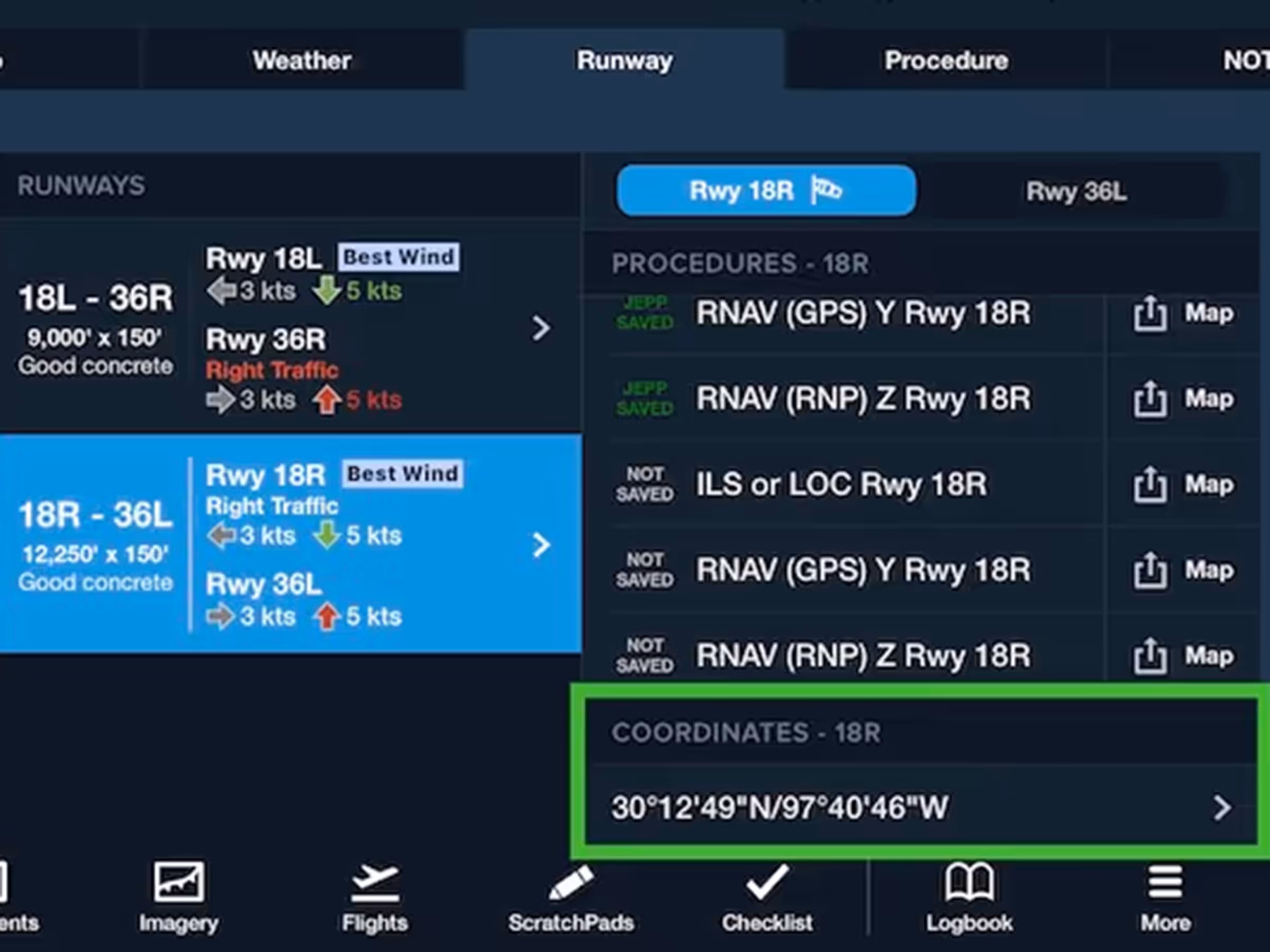
Runway End Coordinates
View and copy runway threshold coordinates from the Runway Details view or any airport popup on the Map.
2025
17.3
April 2025
April 2025

Essential & Above
Cameras Map Layer
Get real-time visibility and runway insights from weather cameras across the U.S. and Canada.
Essential & Above
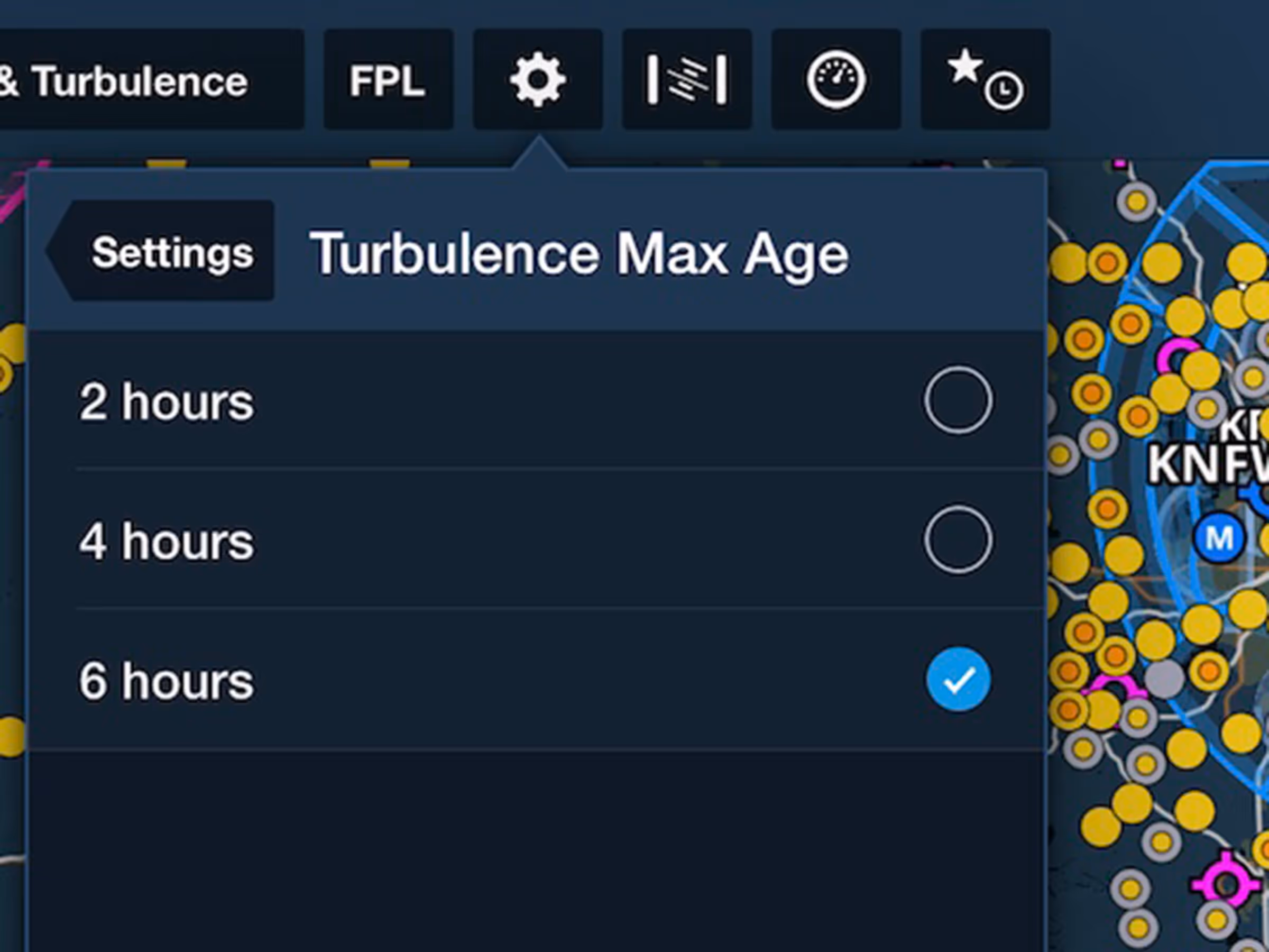
Reported Turbulence: Maximum Age Setting
Declutter your map by limiting turbulence reports to 2, 4, or 6 hours old.

All Plans
Airport Tab in ForeFlight Web
Easily access airport information in ForeFlight Web with the new Airport Tab.
All Plans
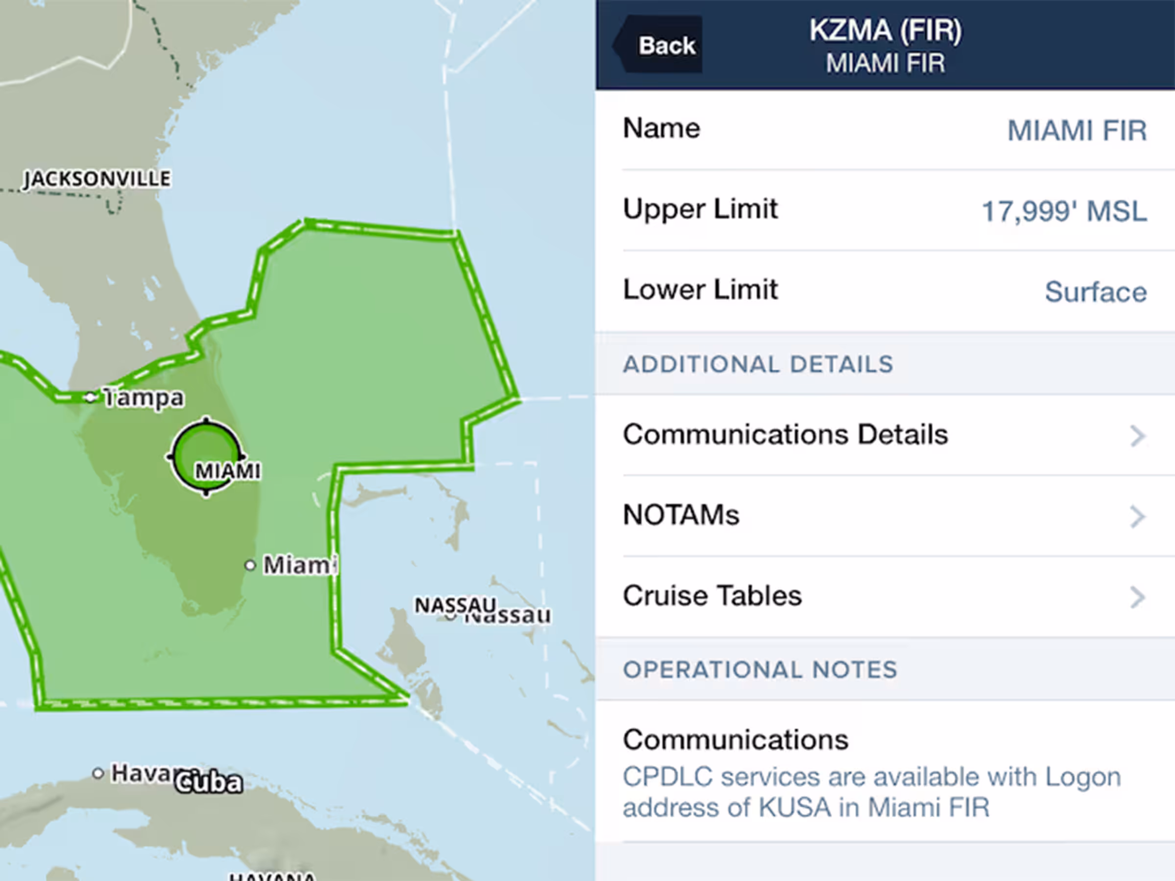
NOTAMs in ARTCC/FIR Details
Quickly view FIR and UIR NOTAMs within each region’s Airspace Detail view.
2024
16.11
November 2024
November 2024

All Plans
Imagery: High Ice Water Content (HIWC)
New charts to identify areas with potentially dangerous levels of ice water at high altitude.
2024
16.10
October 2024
October 2024
All Plans
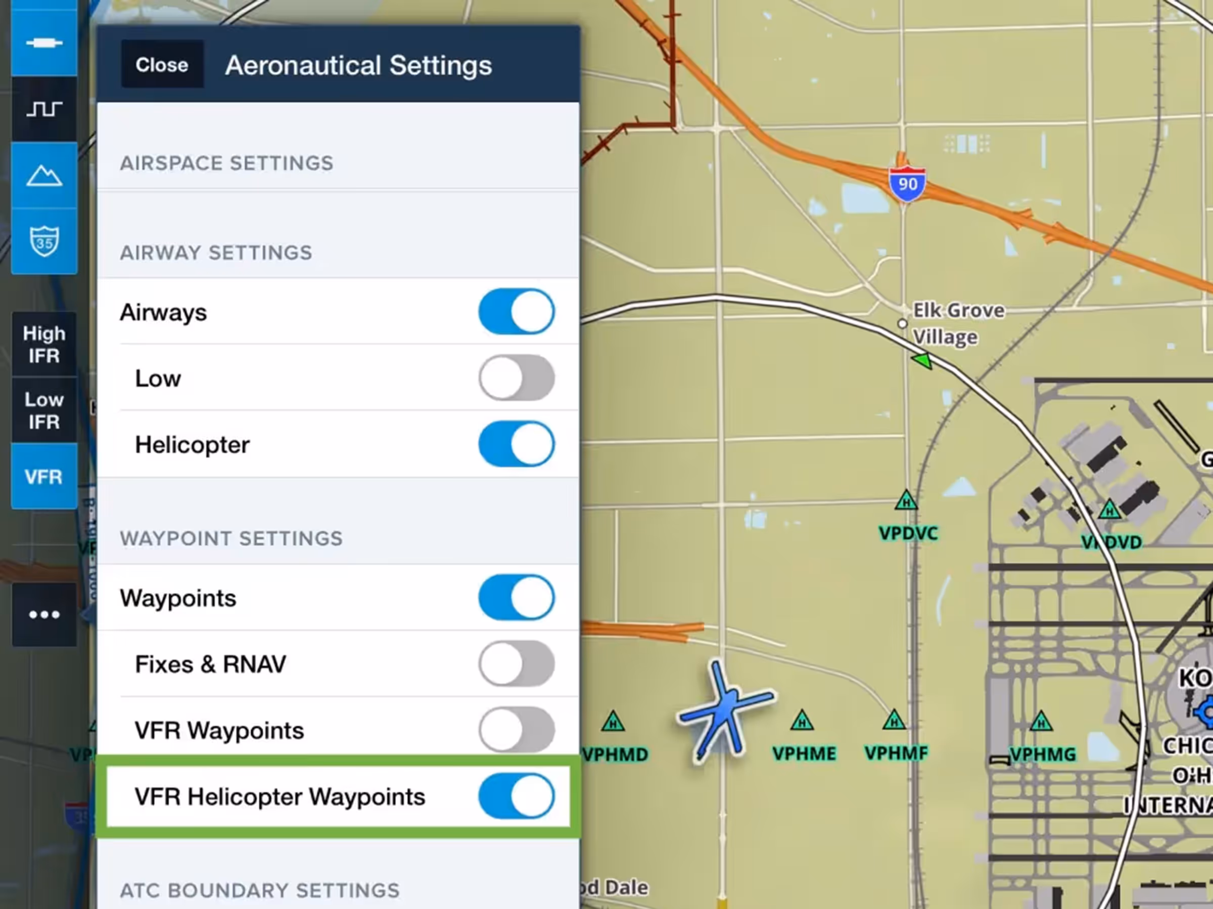
Helicopter VFR Waypoints
Control helicopter-only VFR waypoint visibility in VFR Aeronautical Mode.
All Plans
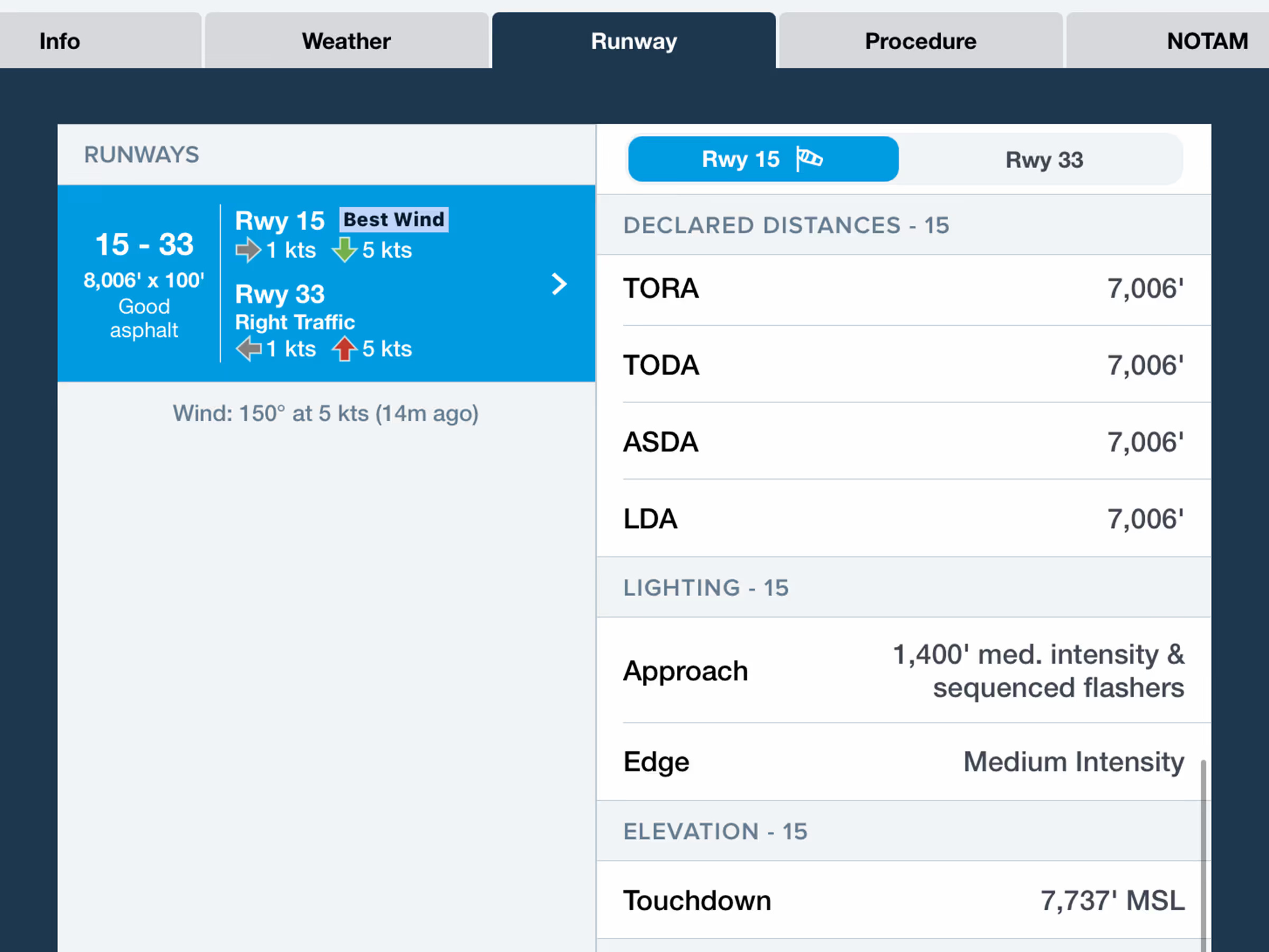
Runway Details
Find runway declared distances (TORA/TODA/ASDA/LDA) with new toggle in runway details.
2024
16.9
September 2024
September 2024
Premium
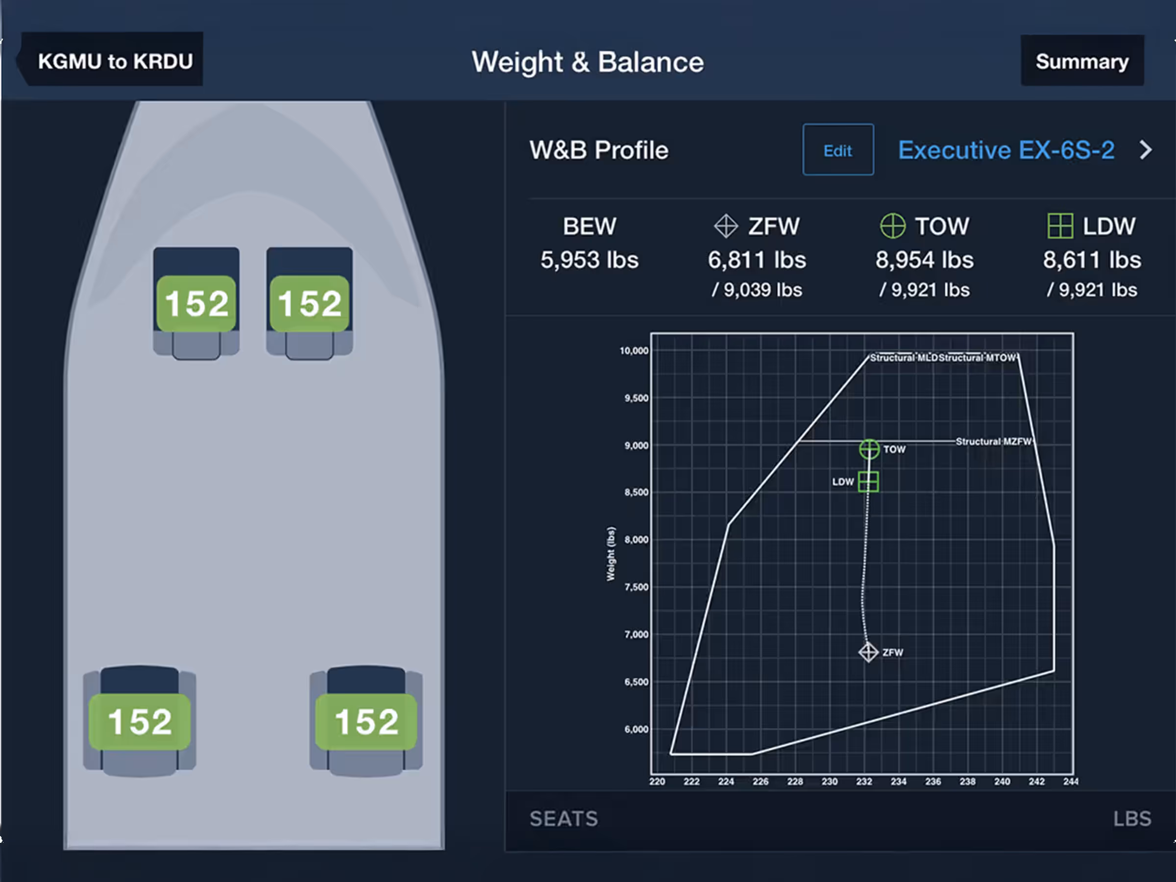
Graphical Weight & Balance
Plan W&B with an interactive cabin layout to easily enter passenger and payload details.
All Plans
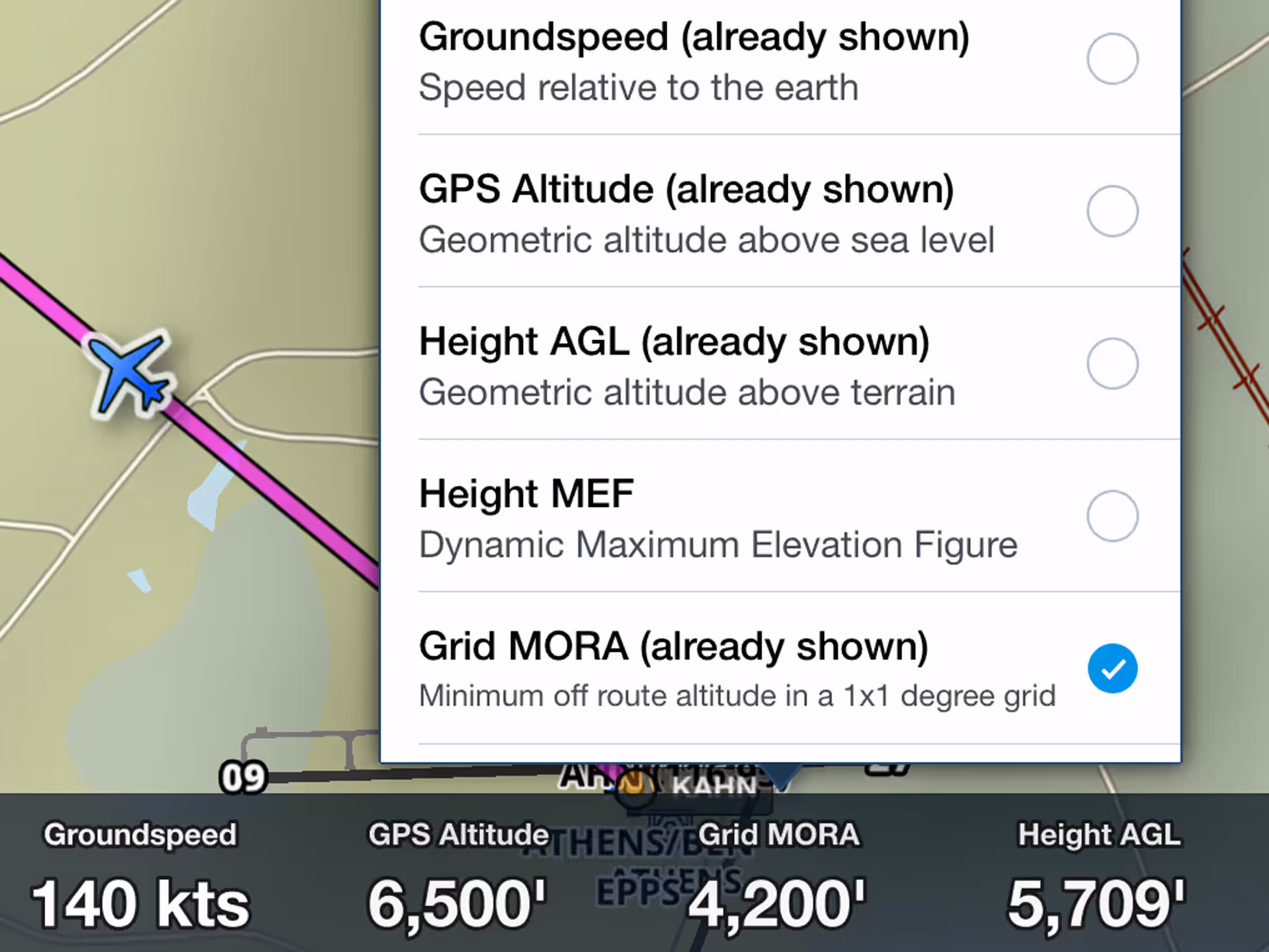
Grid MORA/LSALT Instrument
View minimum off-route altitude at your location in the Instrument Panel.

All Plans
Helicopter Airways
Create and file flight plans with helicopter-only airways alongside IFR Low airways.

All Plans
VFR Charts: Mexico
Fly Mexico with official VFR charts showing local geographical and aeronautical details.