Feature Focus
Forecast Weather in Profile View
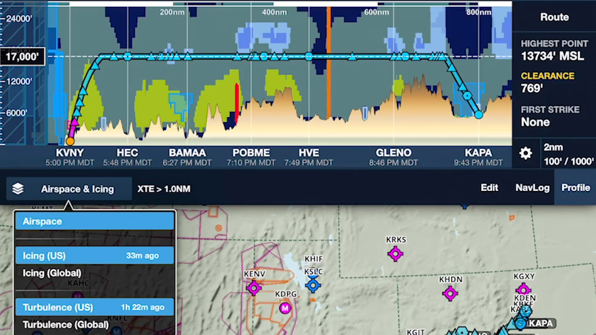
ForeFlight's Profile View includes selectable Icing and Turbulence forecast layers, providing a cross-section of weather in addition to terrain, obstacles, and airspace along your route.
Find the best altitude to avoid terrain, obstacles, and weather with Profile view and other tools.
ForeFlight's Profile View includes selectable Icing and Turbulence forecast layers, providing a cross-section of weather in addition to terrain, obstacles, and airspace along your route.
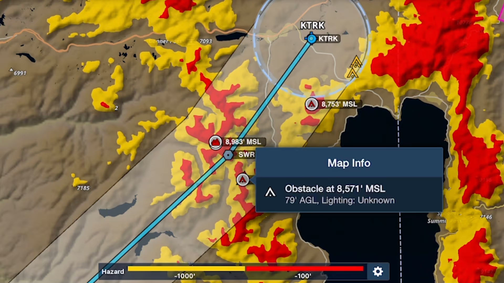
Bolster your preflight and inflight hazard awareness and get a fresh perspective on Profile View with Profile Corridor, available with ForeFlight’s Pro Plus subscription plan and above.

Manually control Hazard Advisor’s altitude before a flight to find a minimum altitude route around terrain, then revert to Auto mode during a flight to lock Hazard Advisor to your actual altitude.

Plan enroute altitude changes around terrain, weather, or airspace and visualize them in Profile View, with the option to start or end a climb or descent at a specified waypoint.

Quickly find the appropriate minimum for an approach procedure and display it as part of your route to supplement the plate and reduce the risk of errors with Augmented Procedures.

Easily add a visual approach or traffic pattern entry to your route with a customizable pattern altitude.

Join Robert MacLeod and Tim Stahl, both members of ForeFlight’s specialized Flight Operations team, as they walk through the simple steps to set up and file US IFR flight plans in ForeFlight.

ForeFlight’s High Resolution Basemap includes Jeppesen-sourced terrain and cultural elements such as mountain passes, highway labels, and more for improved inflight reference.
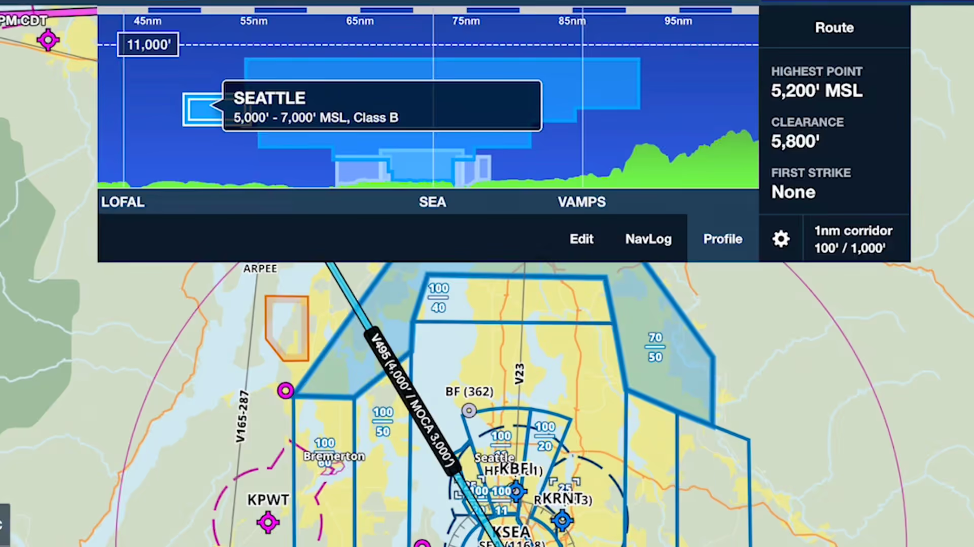
Profile view in ForeFlight now depicts airspace along your route, providing you with valuable information for flight planning and inflight use beyond terrain and obstacle avoidance.