Quick Tips
Hide Airspace by Altitude
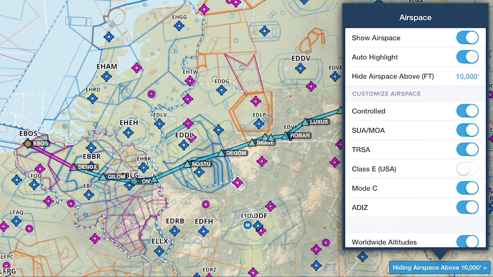
You can declutter ForeFlight's Aeronautical Map by hiding any airspace above a selected altitude, making it easier to focus on airspace closer to you.
Make the map your own with extensive customization options for a decluttered and focused view.
You can declutter ForeFlight's Aeronautical Map by hiding any airspace above a selected altitude, making it easier to focus on airspace closer to you.
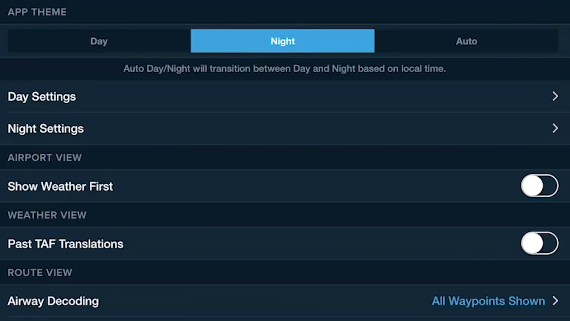
Customizing ForeFlight's look and feel is easier with the App Theme selector, and the Auto Day/Night setting helps your eyes adjust to changing light levels.
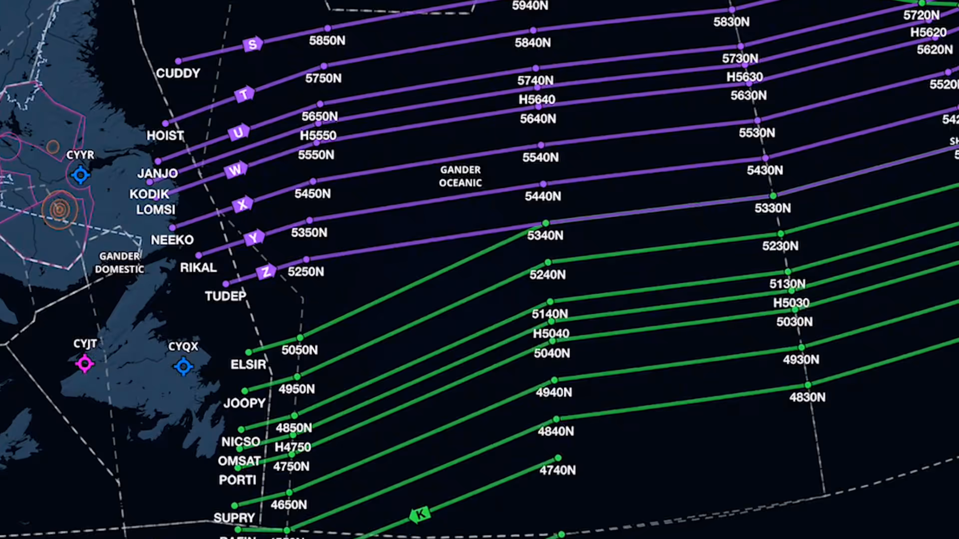
Organized Track depictions in ForeFlight provide a valuable reference for pilots who utilize these track systems.
Color Inversion is an innovative setting for reducing glare from bright charts at night.
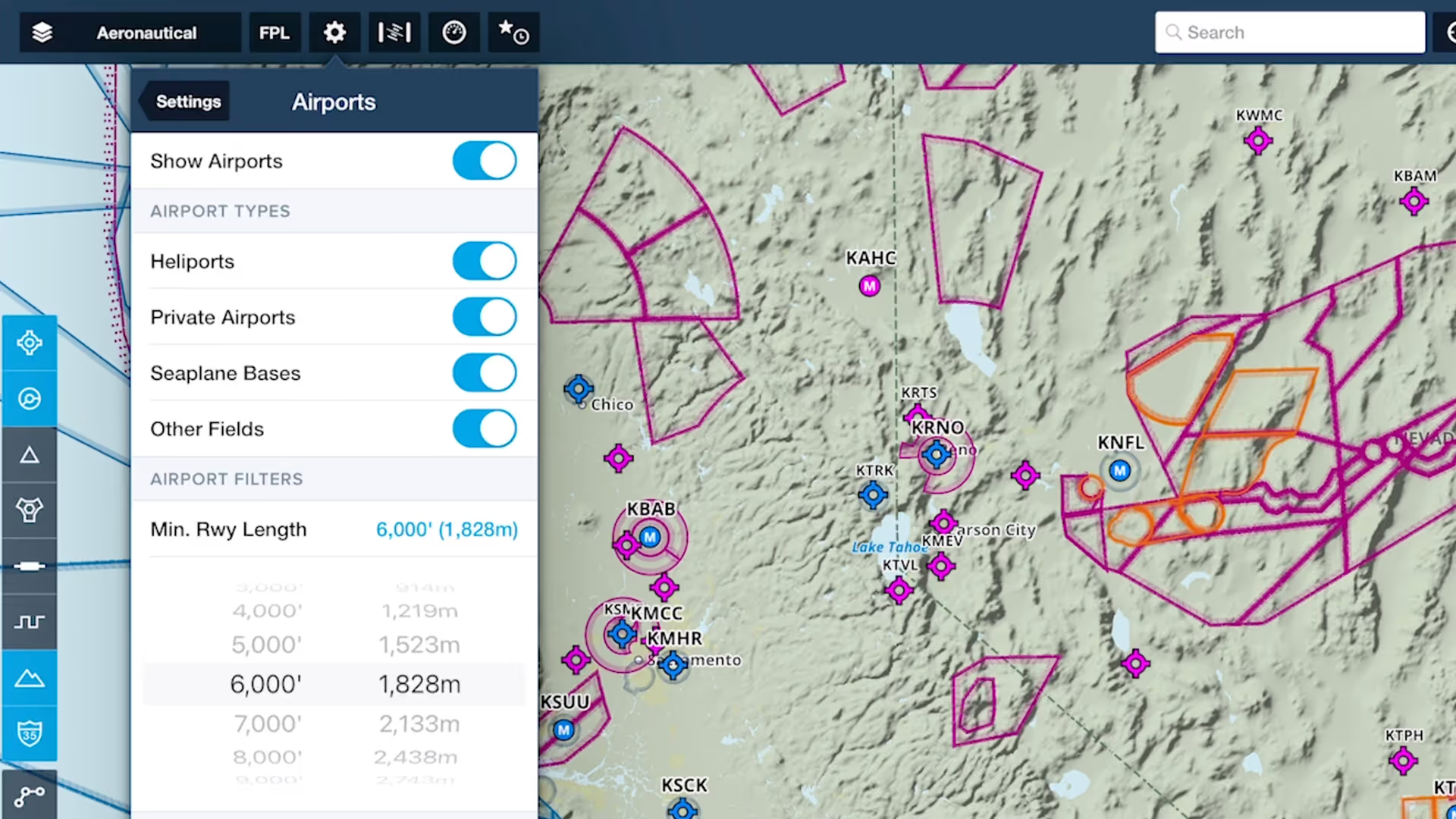
Customize ForeFlight’s Aeronautical Map by hiding airports with runways shorter than a set length with the Minimum Runway Length filter.
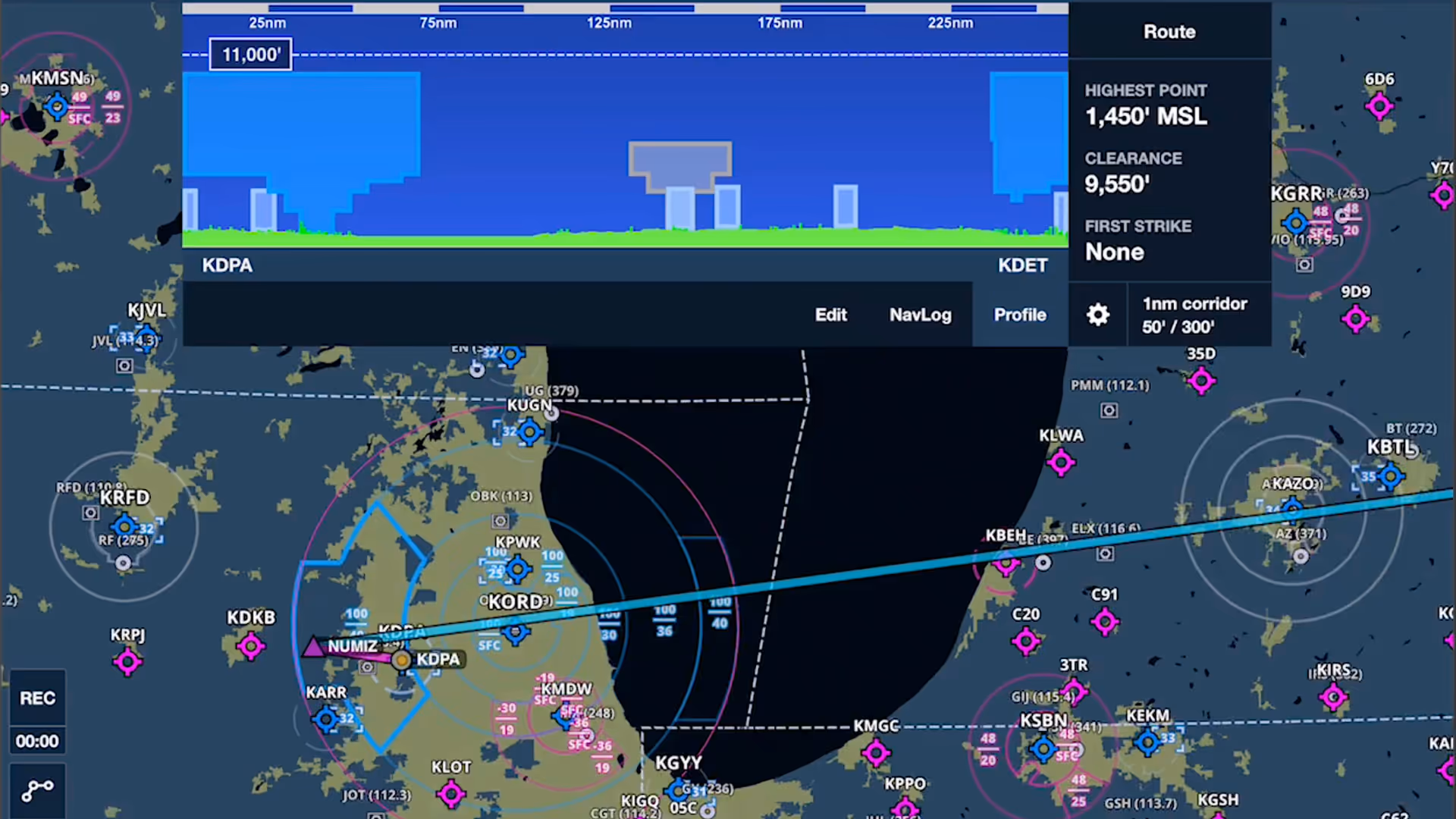
Airspace Highlighting in ForeFlight helps declutter the map and keeps you aware of the airspace affecting your route.