Feature Focus
Controlled Airspace Alerts
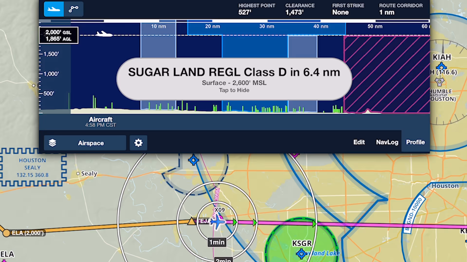
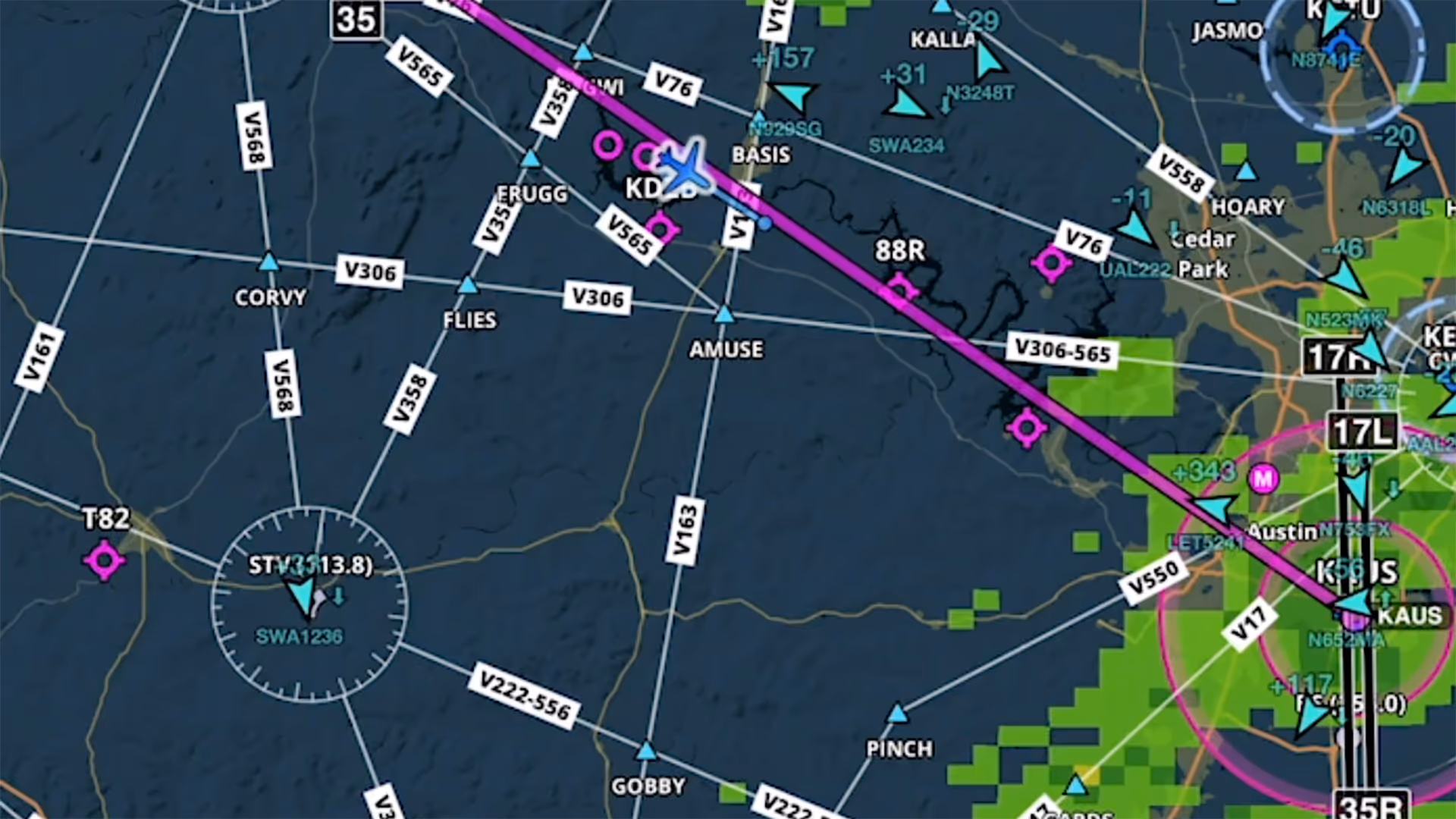
Fly more confidently around controlled airspace with multi-stage visual and audio alerts that proactively warn you of approaching airspace with Controlled Airspace Alerts.
Enhance your situational awareness with ForeFlight’s comprehensive inflight feature set
Fly more confidently around controlled airspace with multi-stage visual and audio alerts that proactively warn you of approaching airspace with Controlled Airspace Alerts.
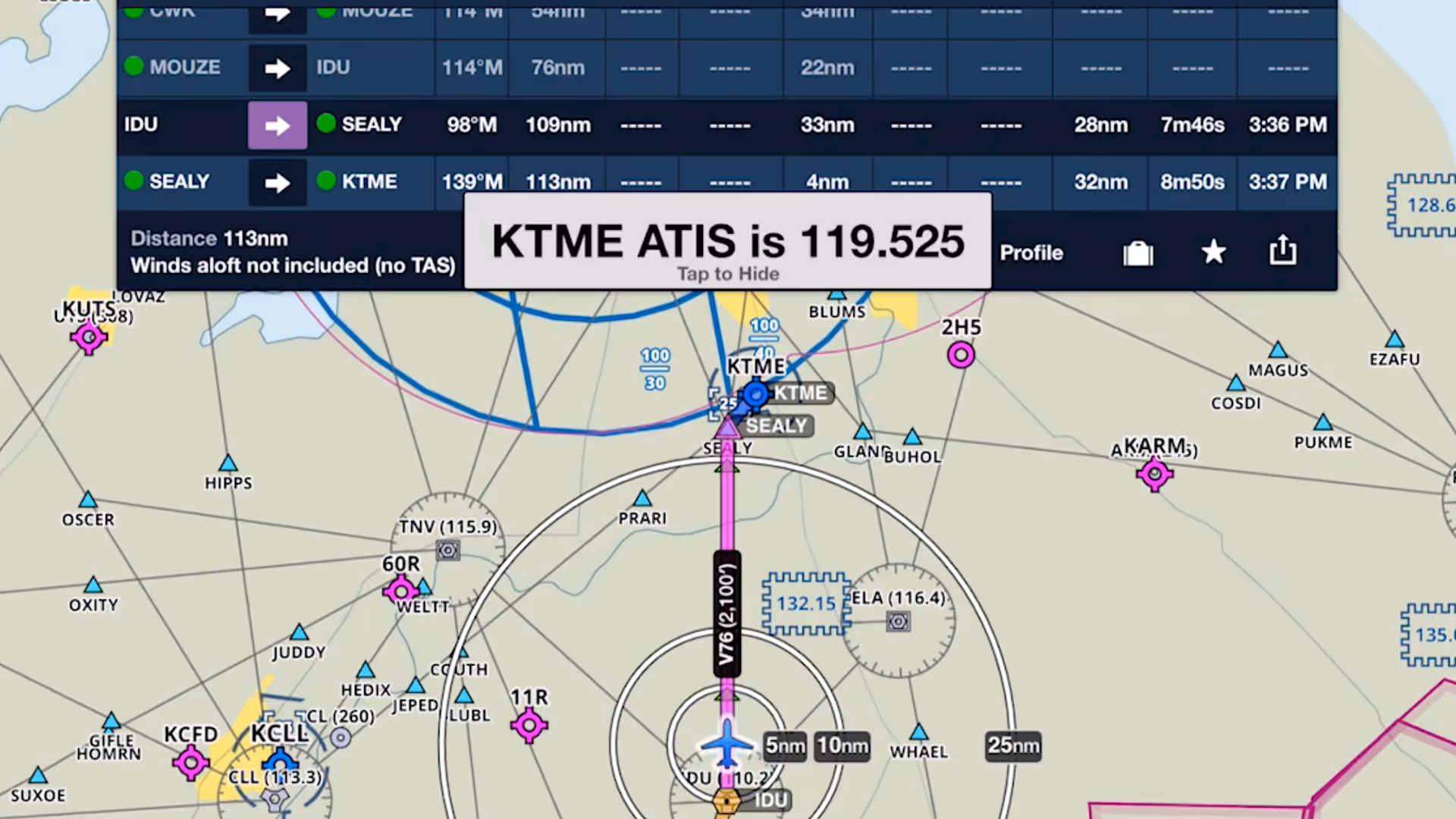
Checking your destination airport's weather is an important step in any pre-landing checklist. Like a helpful co-pilot, ForeFlight automatically displays the weather frequency as you near the airport.
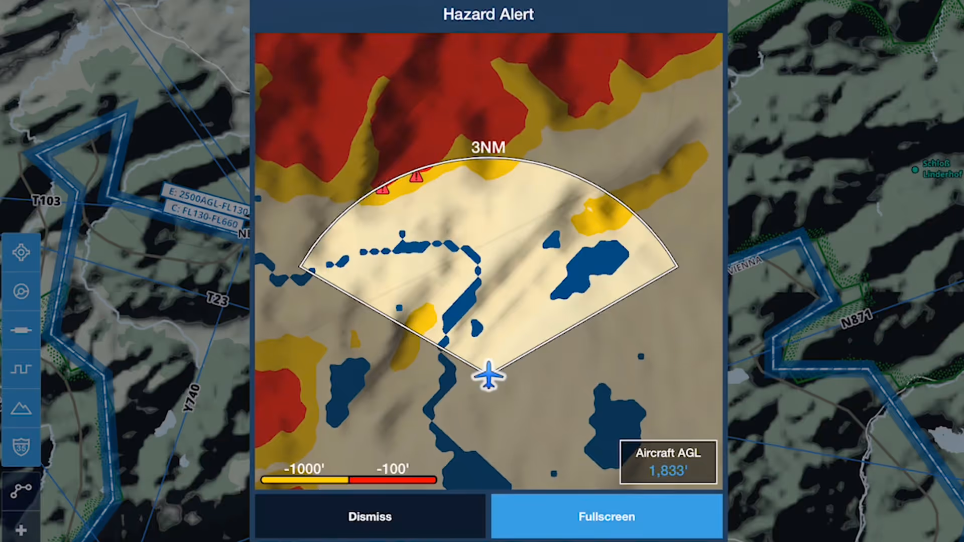
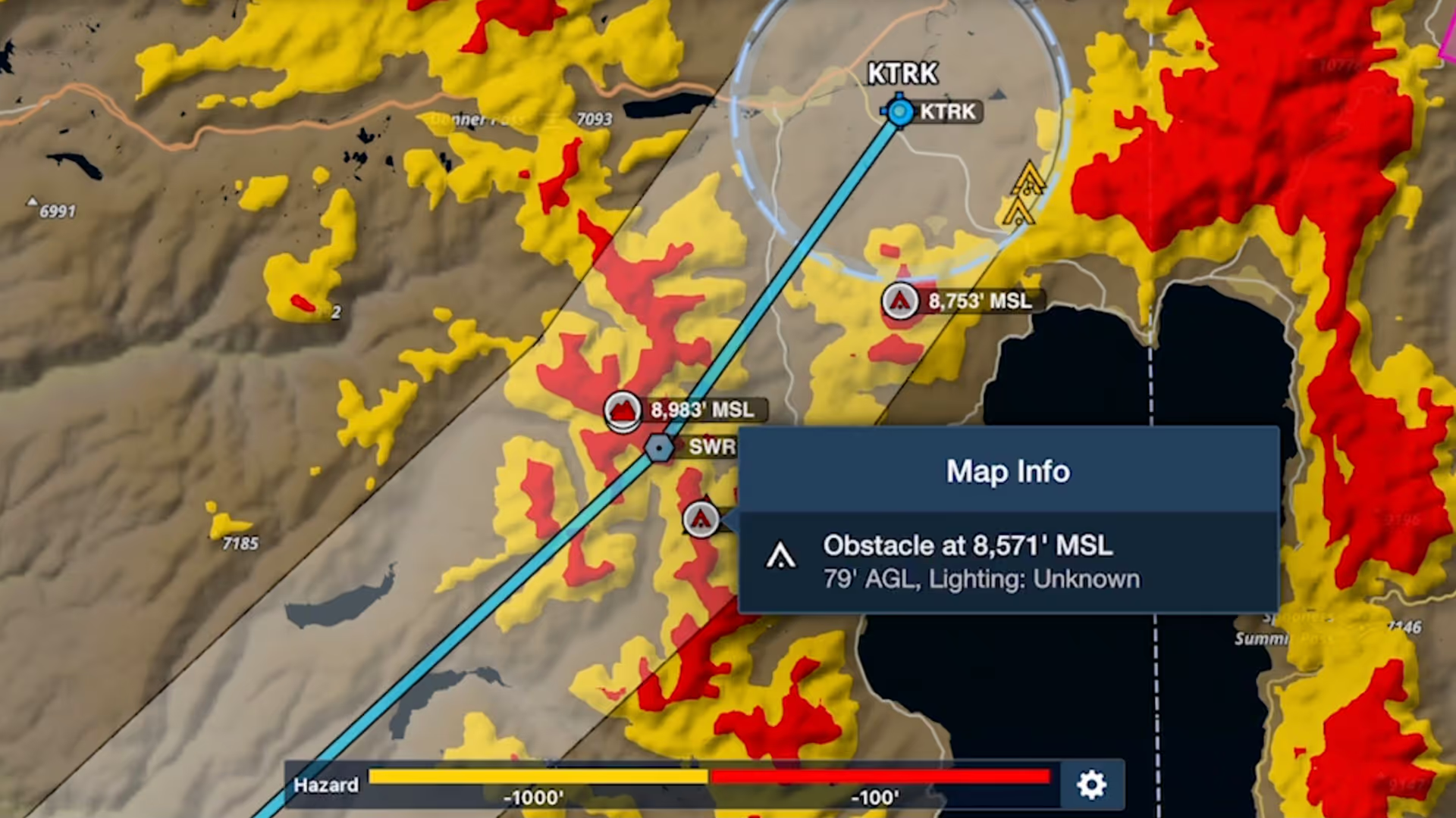
Hazard Alerts in ForeFlight enhance your situational awareness and provide greater peace of mind by warning you of potential hazards ahead.
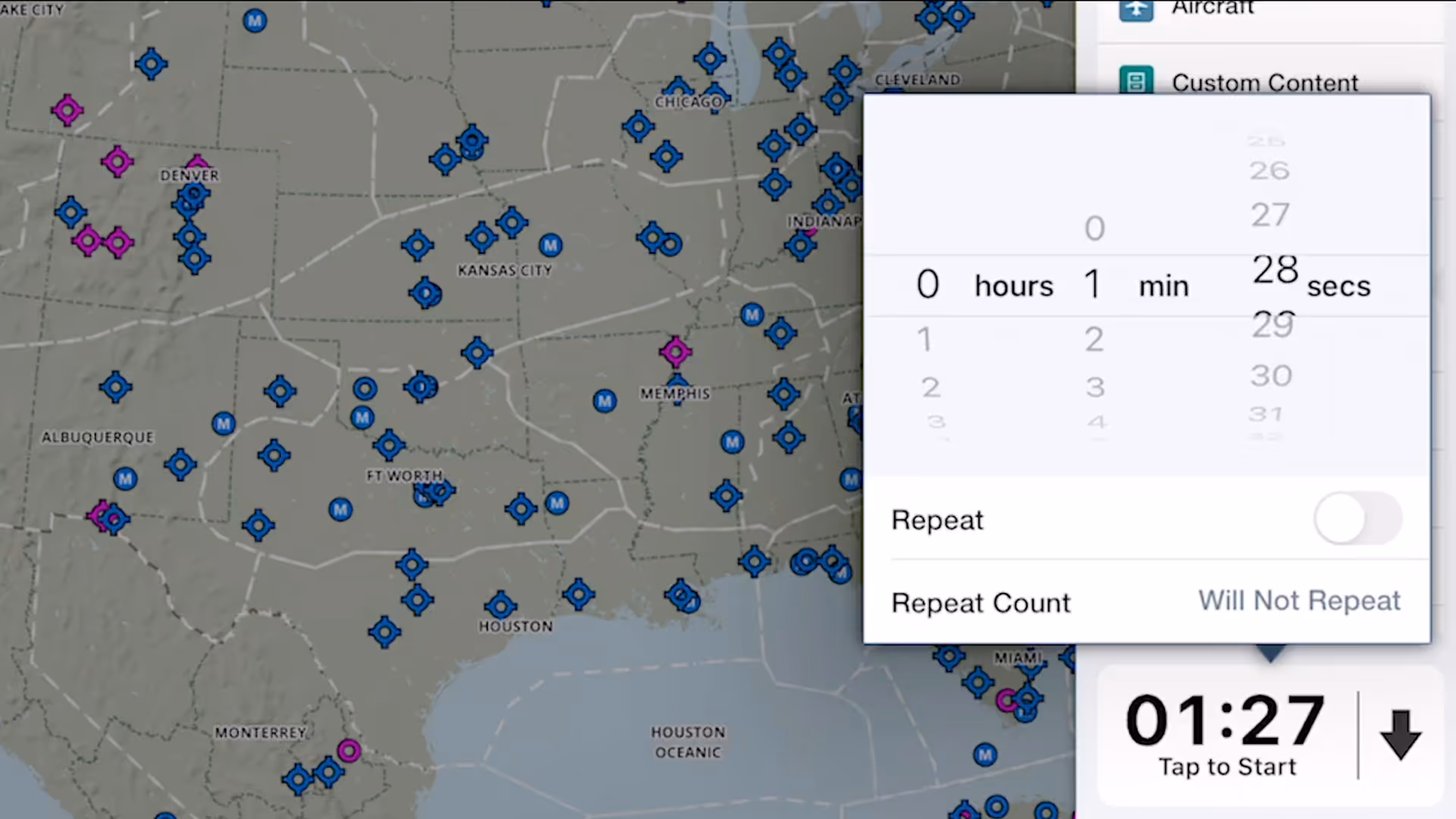
ForeFlight's versatile Multimode Timer is a great way to set inflight reminders for fuel tank switching, time yourself during holds and other procedures, and more.

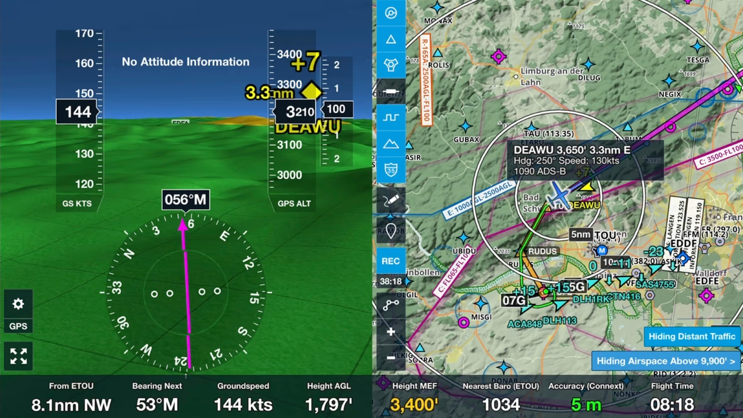
ForeFlight's Synthetic Vision feature now provides even more situational awareness with integrated ADS-B traffic depictions and a 360-degree interactive Glance Mode.
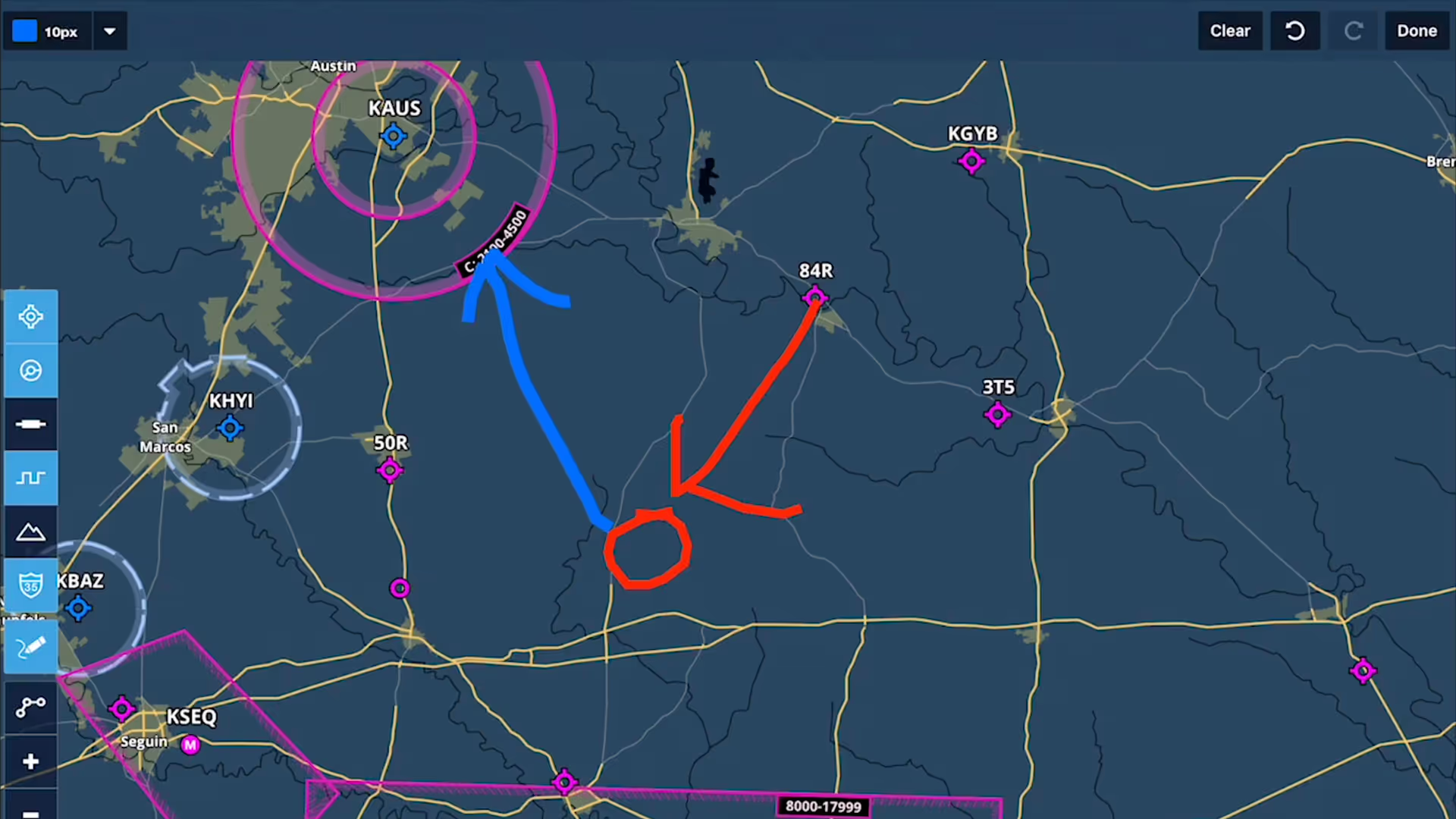
Take notes on the fly and mark up charts using ForeFlight's Map Annotations feature. Tap the Annotations buttons on the Maps view to enter Drawing Mode, and use a finger or stylus to draw on the map.

Manually control Hazard Advisor’s altitude before a flight to find a minimum altitude route around terrain, then revert to Auto mode during a flight to lock Hazard Advisor to your actual altitude.
Bolster your preflight and inflight hazard awareness and get a fresh perspective on Profile View with Profile Corridor, available with ForeFlight’s Pro Plus subscription plan and above.

Plan enroute altitude changes around terrain, weather, or airspace and visualize them in Profile View, with the option to start or end a climb or descent at a specified waypoint.
Join ForeFlight Pilot Support Team member Wolfgang Oestreich to learn how ForeFlight can connect with portable and installed avionics to enhance your inflight workflow
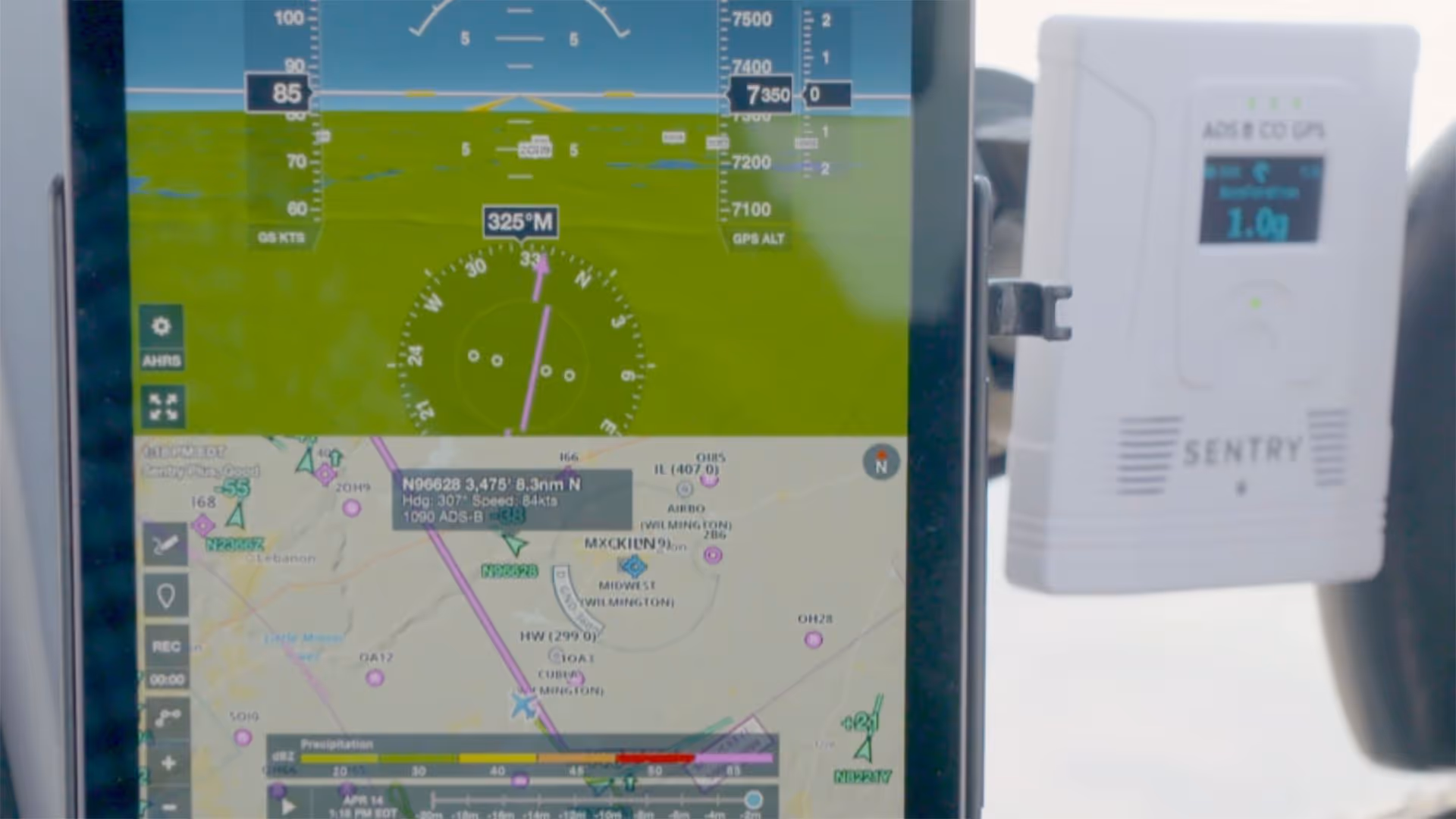
Join Cole Crawford of ForeFlight, John Zimmerman of Sporty’s, and Ryan Braun of uAvionix to learn about Sentry Plus, the latest in portable ADS-B receivers from ForeFlight.
Join Cole Crawford of ForeFlight, John Zimmerman of Sporty’s, and Ryan Braun of uAvionix for an engaging and informative discussion about ForeFlight’s Sentry and Sentry Mini ADS-B receivers