Quick Tips
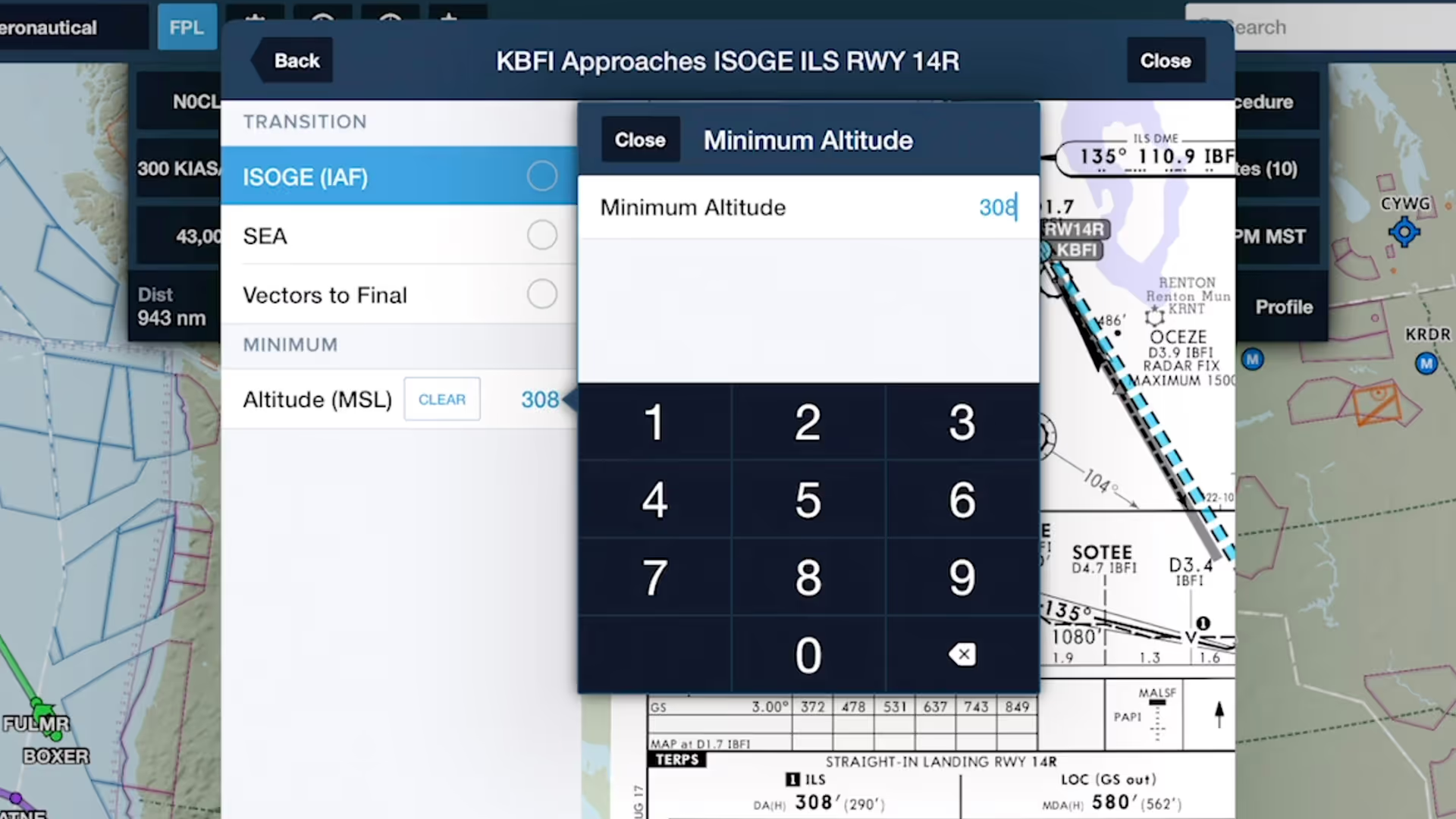
Specify Approach Minimum
Specify an altitude minimum in Procedure Advisor when adding an IFR approach to your route to display the minimum directly on the map for quick reference during final approach.
Plan flights quickly with always-current airport information and helpful routing tools.
Specify an altitude minimum in Procedure Advisor when adding an IFR approach to your route to display the minimum directly on the map for quick reference during final approach.
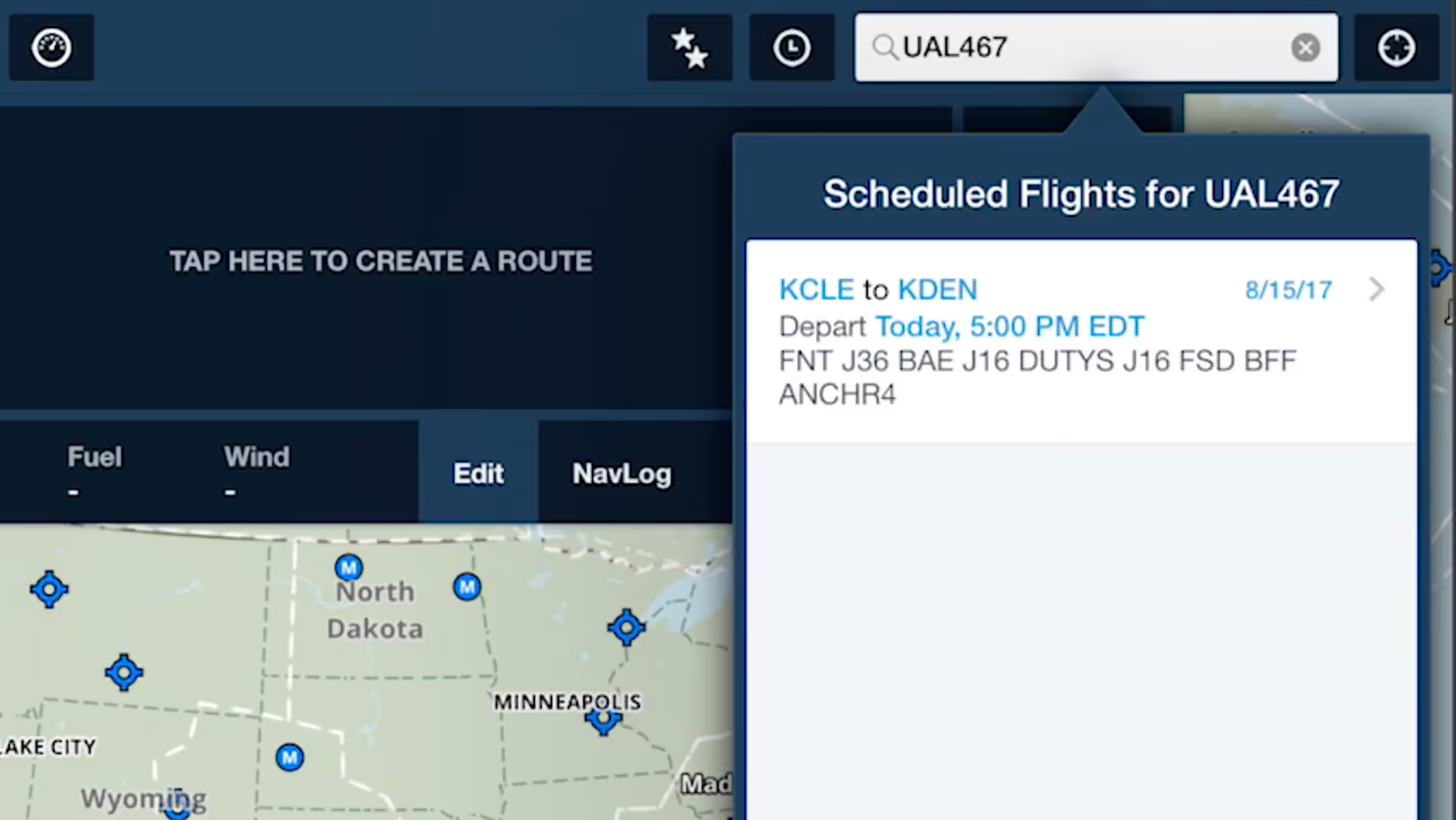
ForeFlight allows you to search for aircraft tail numbers, call signs, and flight numbers on the Maps view to see recently filed flight plans and load them into your route.
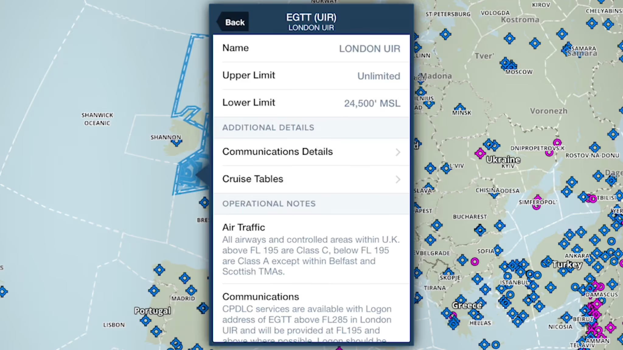
ForeFlight provides advanced global airspace details for FIRs, UIRs, and other airspace types, with important information about frequencies, cruise altitudes, and operational notes.
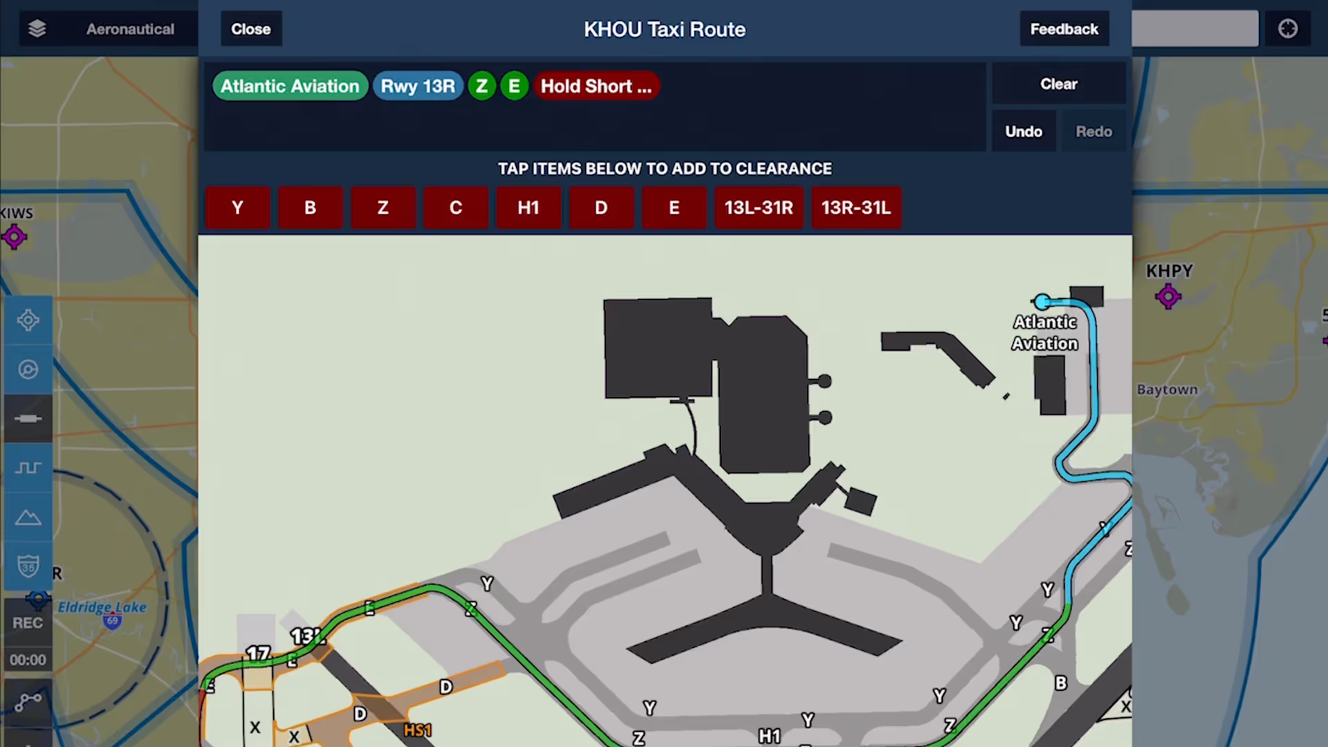
Chart a course to or from the runway with an interactive and contextually-aware Taxi Route editor, available with ForeFlight Performance subscription plans.
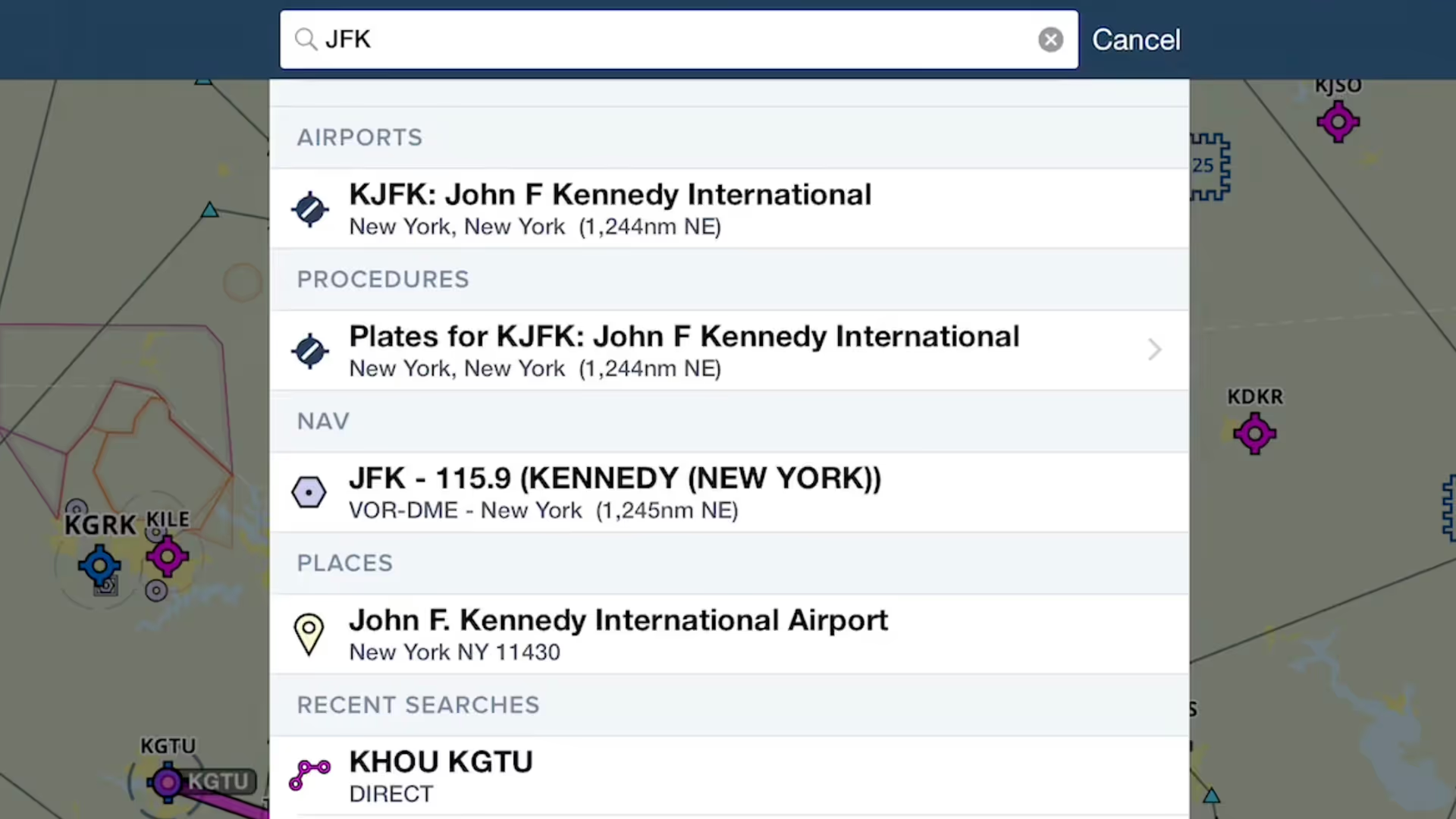
ForeFlight provides an unified search capability that makes it easier and faster to find what you're looking for, and saves past searches for quick access.
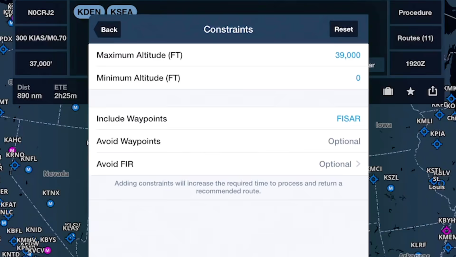
ForeFlight's Route Advisor allows you to customize the Recommended Route using flexible route constraints
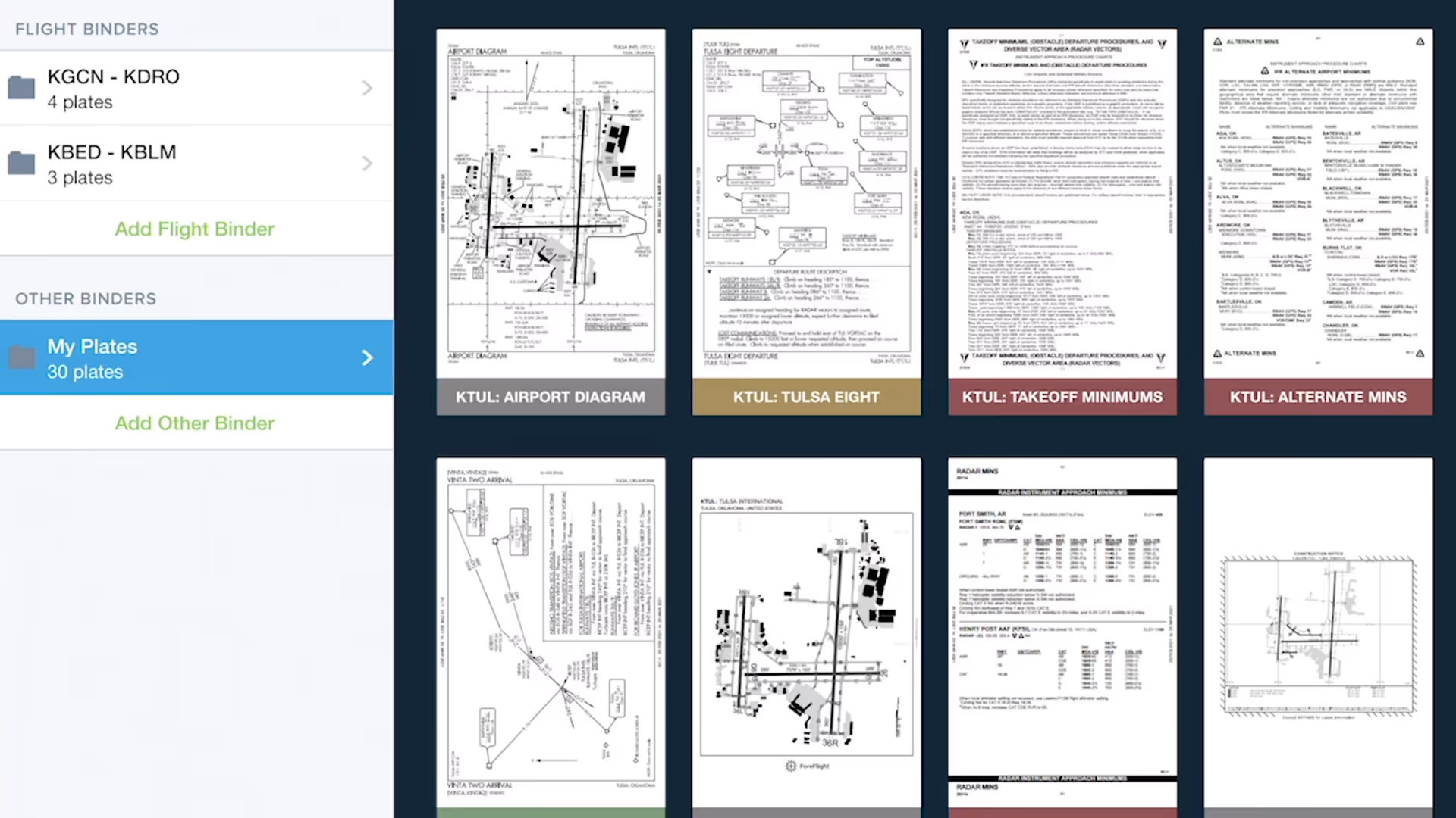
Quickly gather, organize, and access the plates you need for an entire flight using Flight Binders in the Plates view.
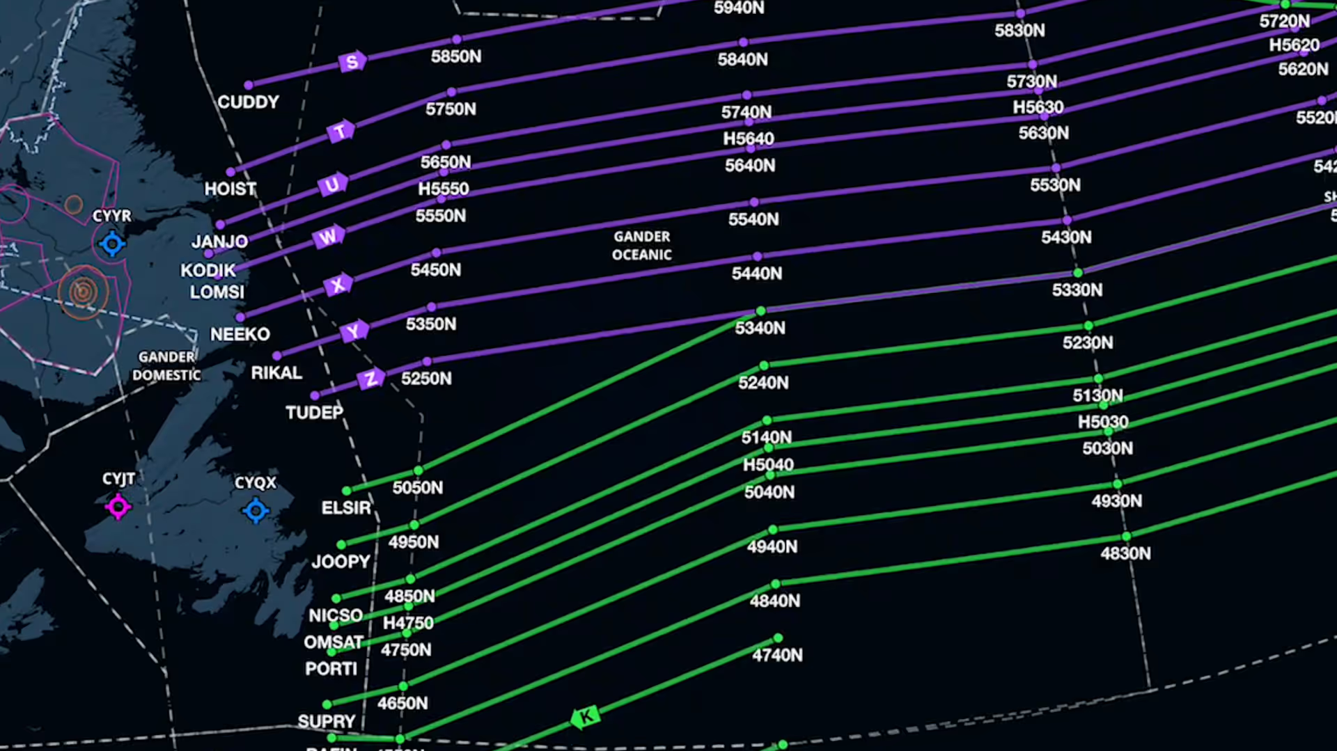
Organized Track depictions in ForeFlight provide a valuable reference for pilots who utilize these track systems.
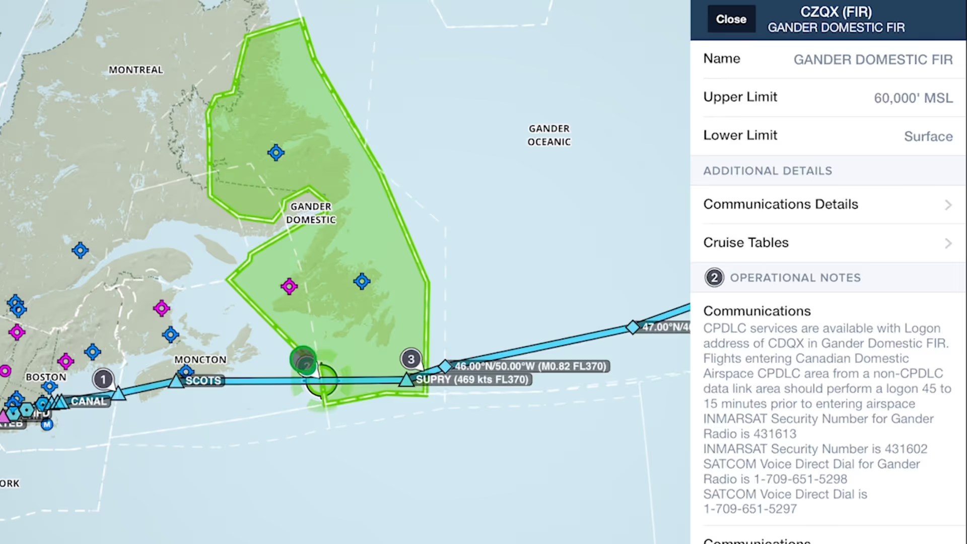
Easily find and review operational notes affecting your route from start to finish with Operational Note Flags

ForeFlight displays FBO fees from AOPA's Airport Directory to help you make more informed flight planning decisions.
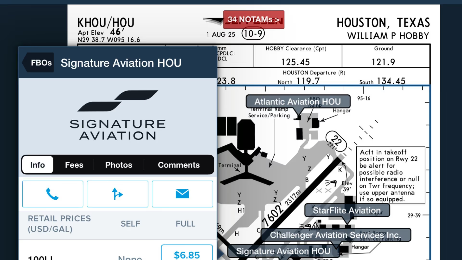
Use this feature to quickly access ForeFlight's FBO Directory information right from the Taxi Chart.

Join Robert MacLeod and Tim Stahl, both members of ForeFlight’s specialized Flight Operations team, as they walk through the simple steps to set up and file US IFR flight plans in ForeFlight.

Graphical enroute NOTAMs are now supported globally with the new NOTAMs map layer. NOTAMs are color-coded based on type, severity, and active times.

This webinar guides new ForeFlight users through a realistic VFR flight, highlighting core features like charts, fuel planning, waypoints, diversions, and enroute tools.

This course, given at EAA AirVenture in Oshkosh, Wisconsin, is designed to prepare you for your first flight in ForeFlight.