
Feature Focus
Graphical NOTAMs
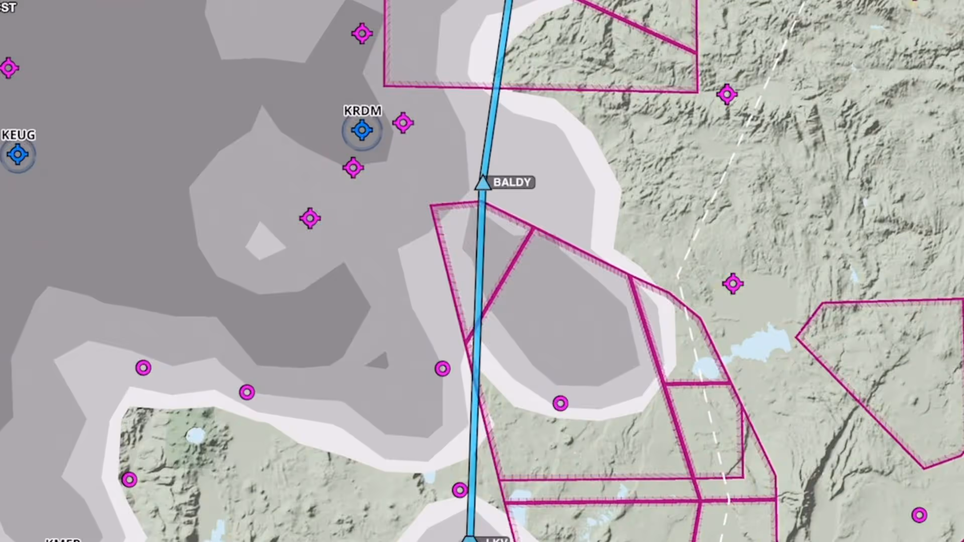
Graphical enroute NOTAMs are now supported globally with the new NOTAMs map layer. NOTAMs are color-coded based on type, severity, and active times.
Plan and fly with charts, maps, weather layers, overlays, and more on a high-performance map
Graphical enroute NOTAMs are now supported globally with the new NOTAMs map layer. NOTAMs are color-coded based on type, severity, and active times.
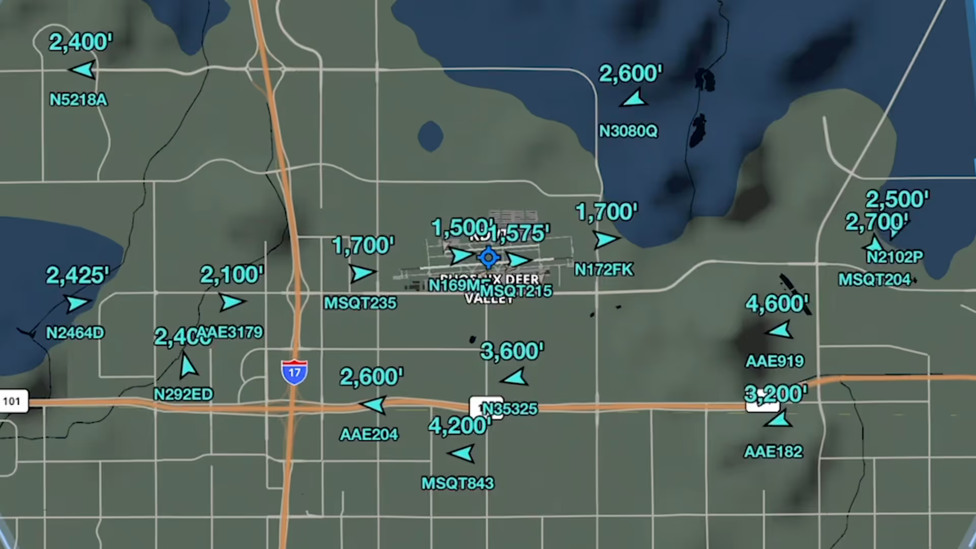
Stream live global aircraft traffic directly in ForeFlight with the Internet Traffic feature
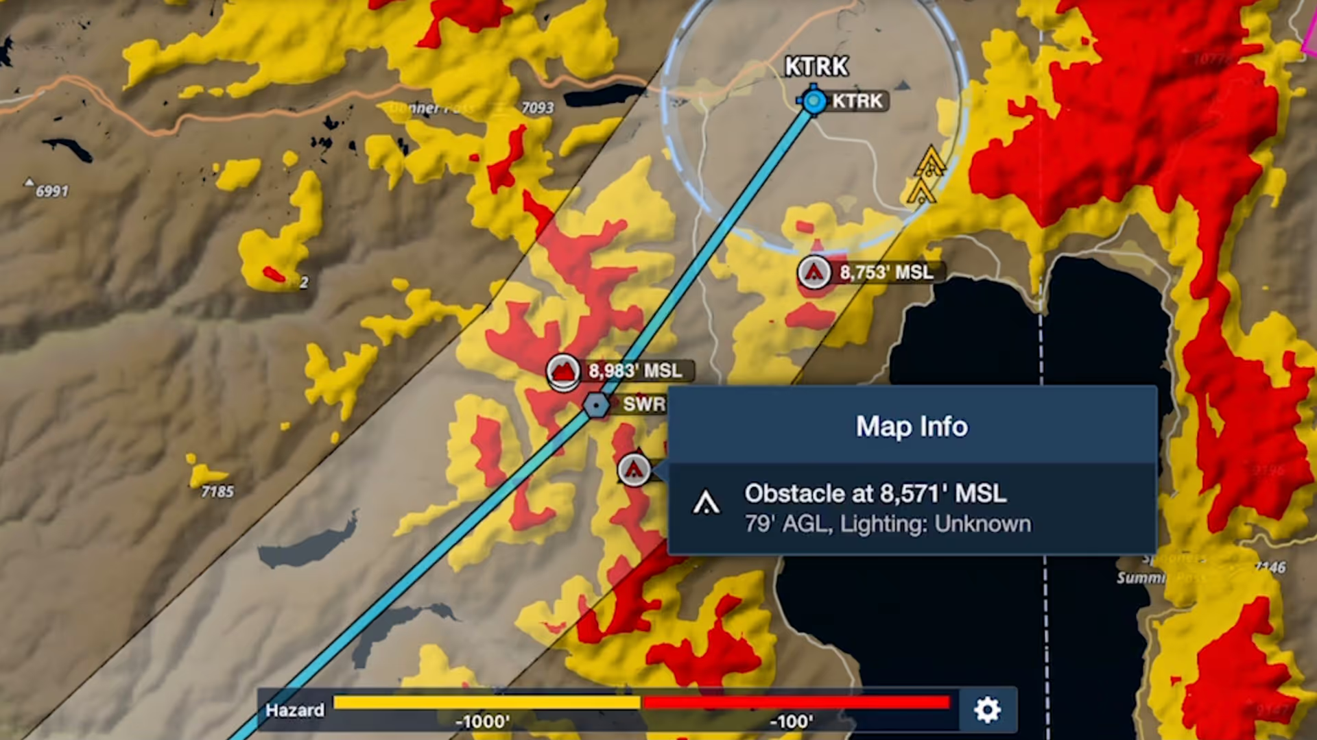
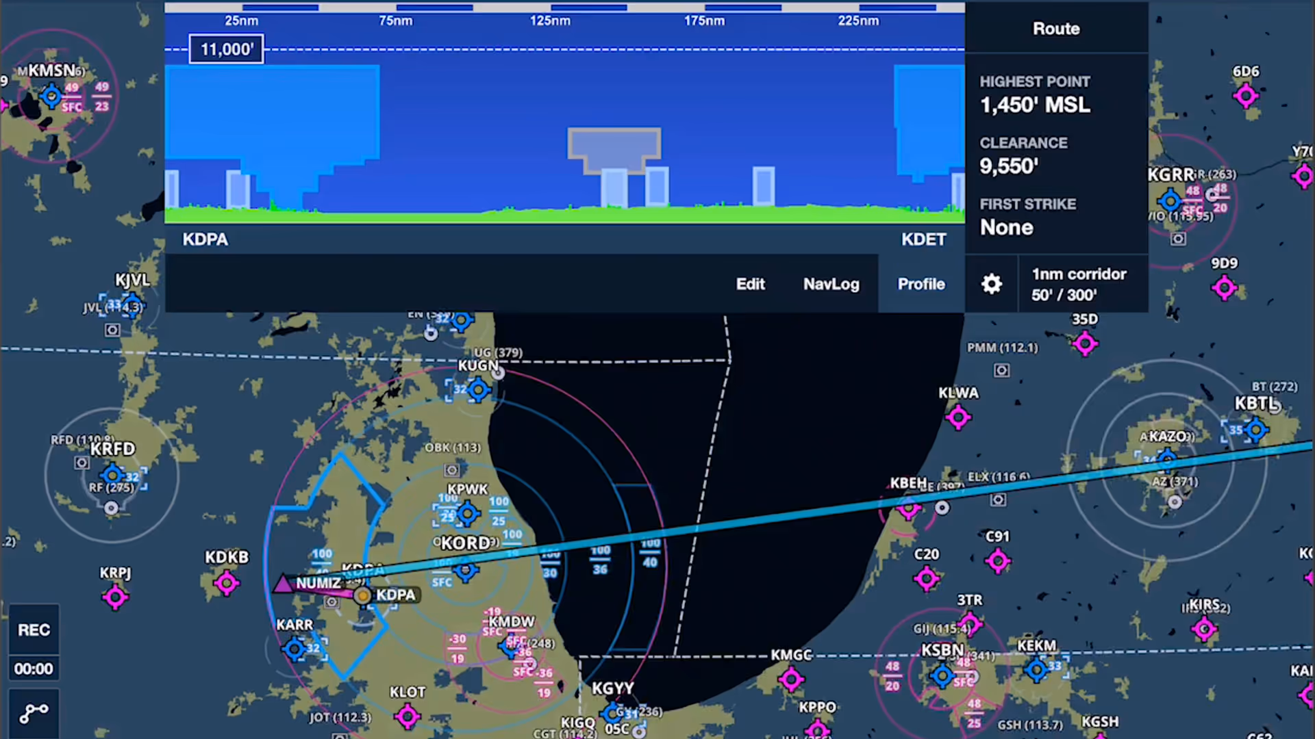
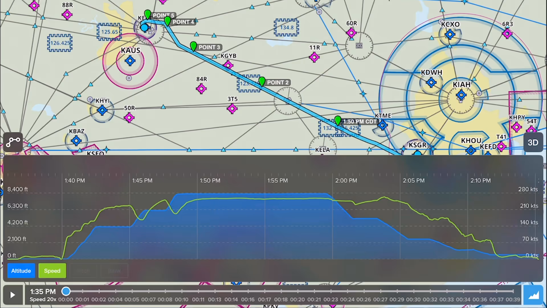
Bolster your preflight and inflight hazard awareness and get a fresh perspective on Profile View with Profile Corridor, available with ForeFlight’s Pro Plus subscription plan and above.
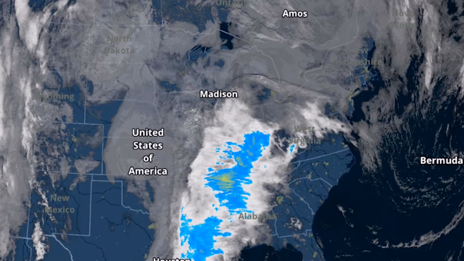
The Color infrared Satellite layer is an alternative to the original satellite layer (now called Enhanced Satellite) that extends ForeFlight's weather planning capabilities.
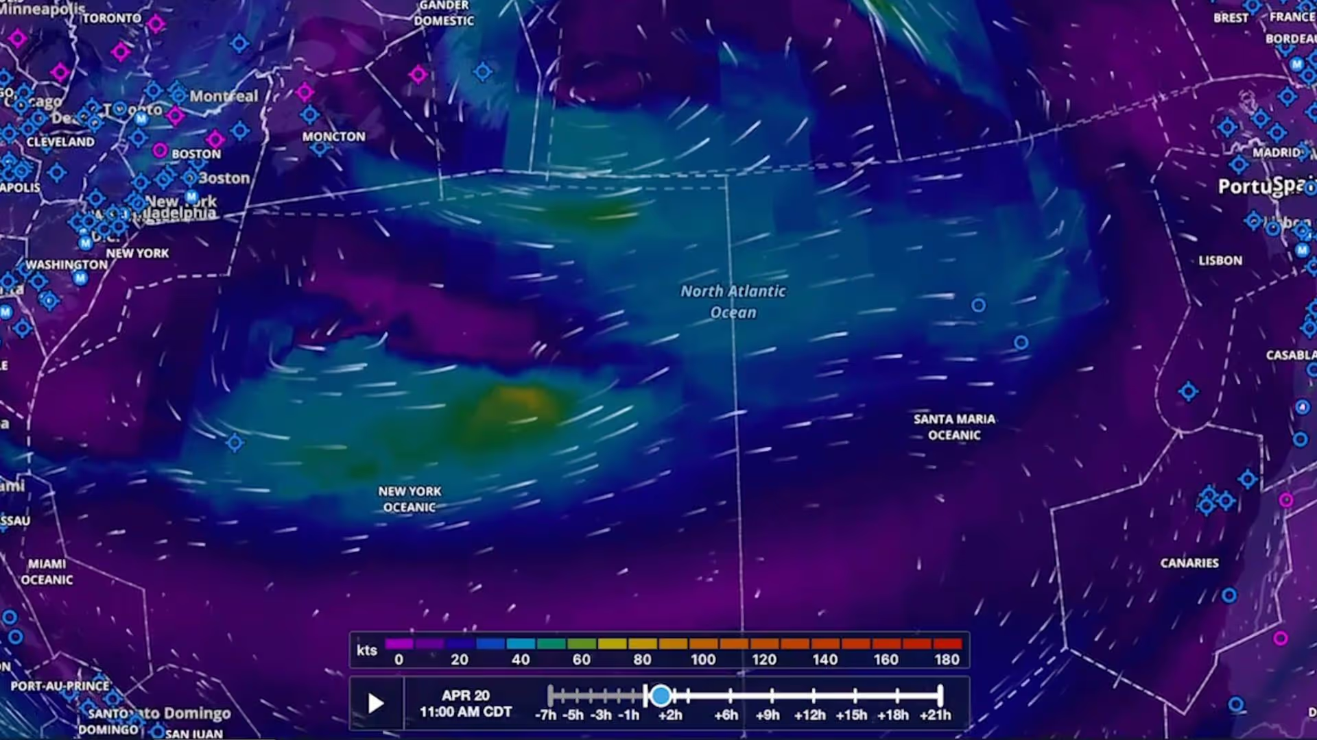
Plan flights with global forecast wind speed, direction and temperatures at multiple altitudes and times using two animated weather layers. Both layers are available with ForeFlight Performance plans.
Plan to steer clear of clouds at any altitude with the Clouds forecast weather layer, available as a map layer for Pro Plus subscription plans and above.
Airspace Highlighting in ForeFlight helps declutter the map and keeps you aware of the airspace affecting your route.
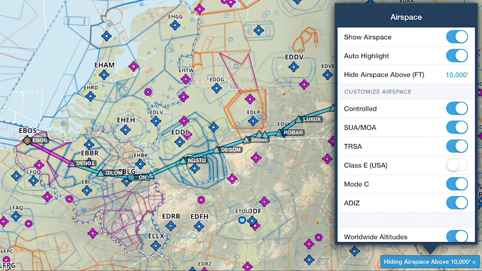
You can declutter ForeFlight's Aeronautical Map by hiding any airspace above a selected altitude, making it easier to focus on airspace closer to you.
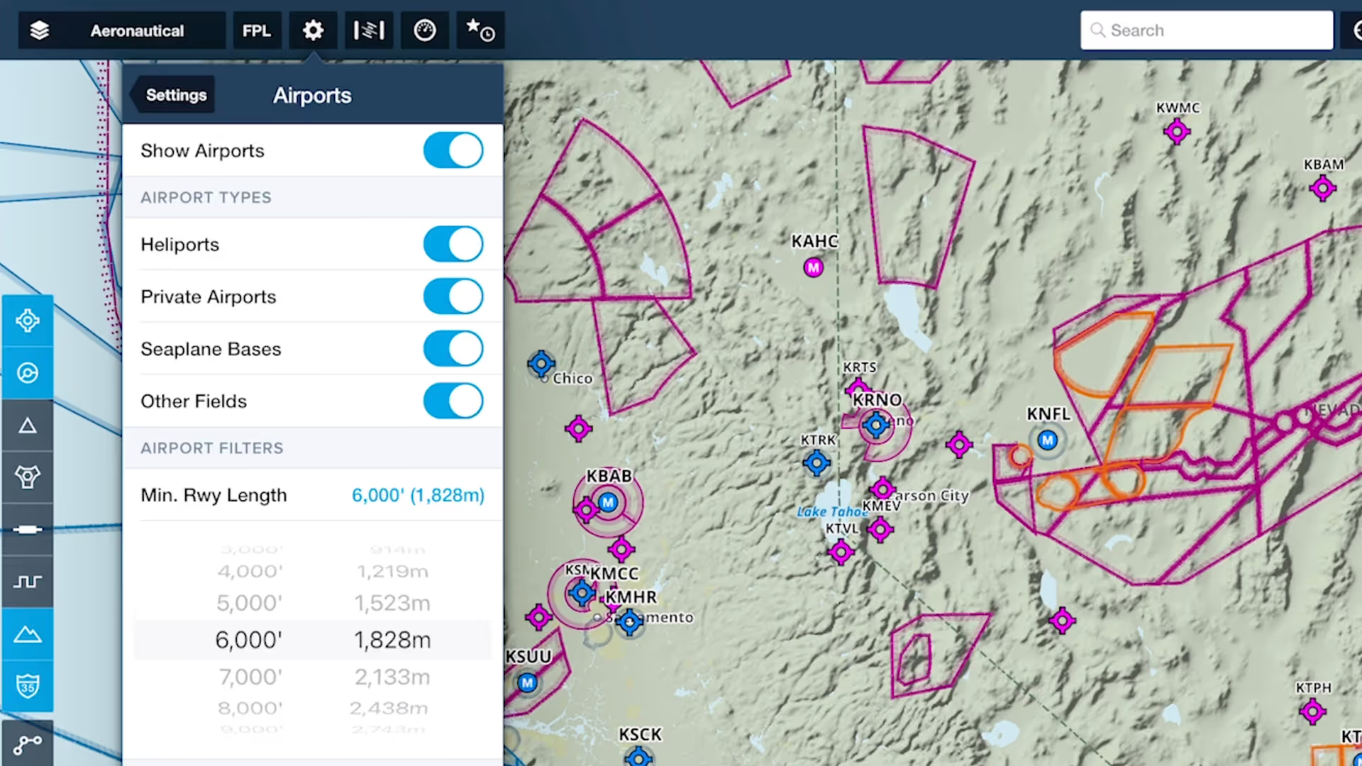
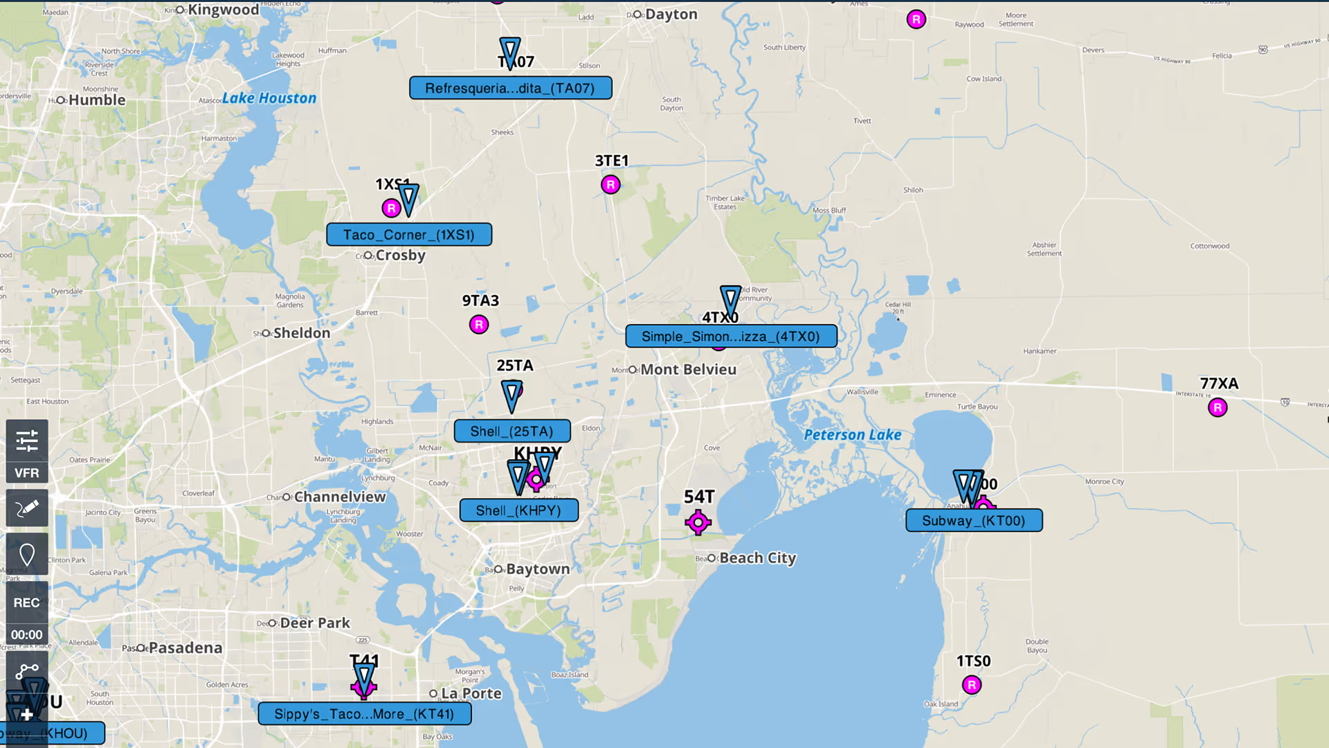
Customize ForeFlight’s Aeronautical Map by hiding airports with runways shorter than a set length with the Minimum Runway Length filter.
Content Packs in ForeFlight provide an easy way to import, use, and share sets of custom content.
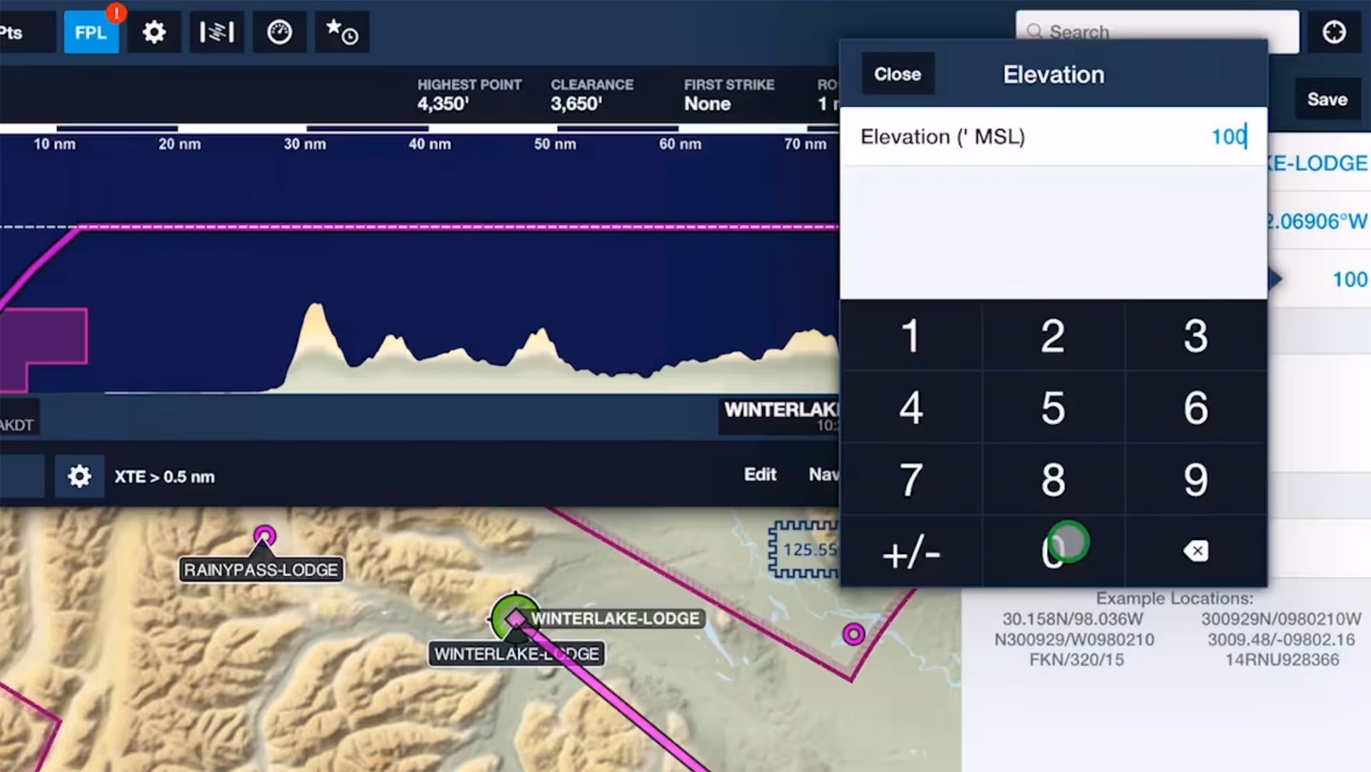
Specify elevations for custom waypoints to plan flights to and from them like you would airports, complete with accurate climb and descent performance calculations and depictions in Profile View.
Drop detailed markers along your route and view or share them after the flight using ForeFlight’s Marked Positions feature.

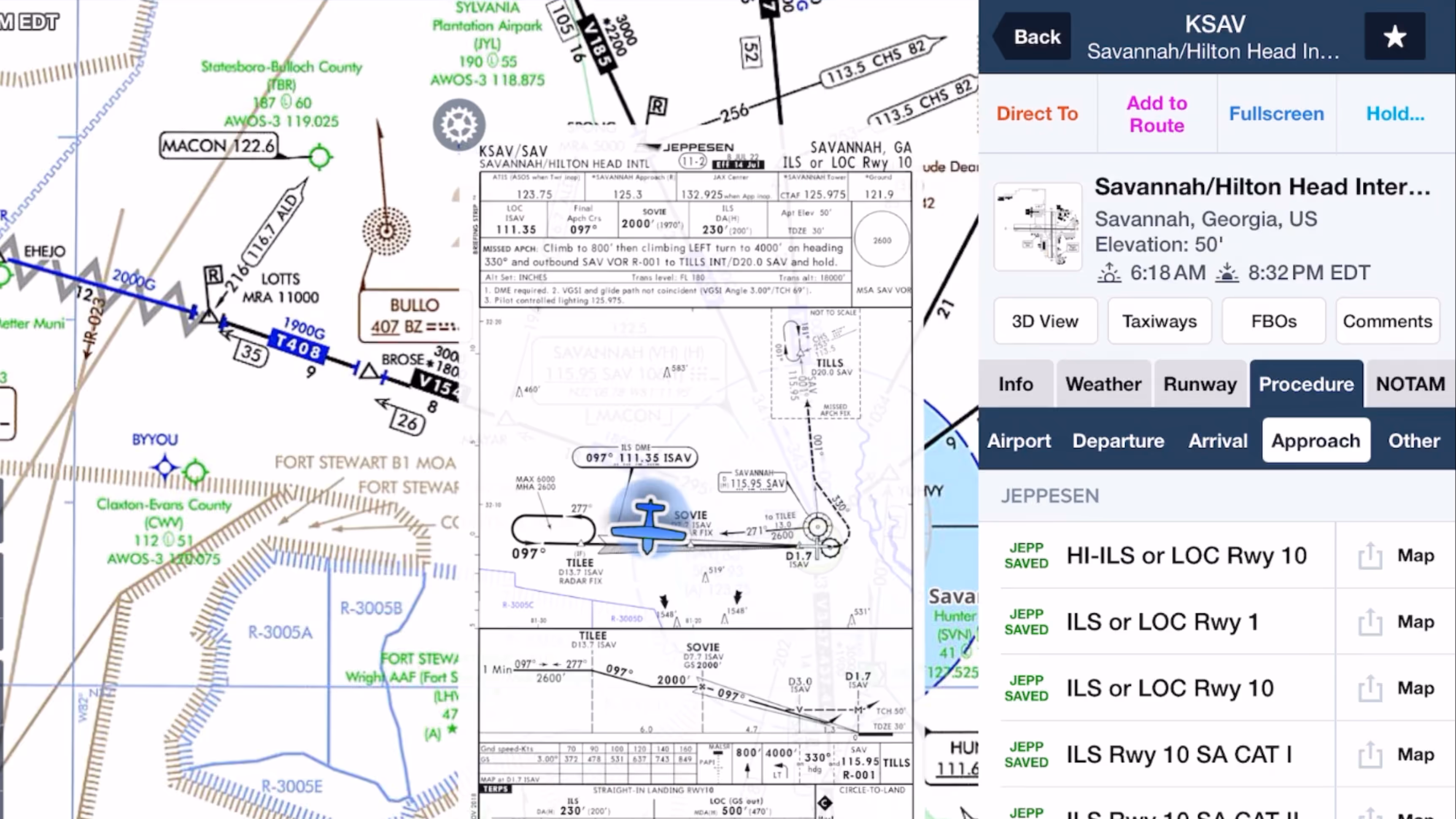
See how easy it is to view and organize Jeppesen procedure plates, airport diagrams, and documents in ForeFlight compared to Jeppesen Mobile FliteDeck (JeppFD).

Discover how Jeppesen charts became the aviation standard, what sets their format apart, and how their features simplify IFR flying for General Aviation pilots in this FlightInsight collaboration.
Why do pro pilots prefer Jeppesen over FAA plates, and what makes them valuable for GA pilots? Find out in this FlightInsight video comparing chart formats and key benefits of Jeppesen plates.