
Feature Focus
AOPA FBO Fees
ForeFlight displays FBO fees from AOPA's Airport Directory to help you make more informed flight planning decisions.
Go from airport selection to filing and takeoff with the best flight planning tools around
ForeFlight displays FBO fees from AOPA's Airport Directory to help you make more informed flight planning decisions.

Graphical enroute NOTAMs are now supported globally with the new NOTAMs map layer. NOTAMs are color-coded based on type, severity, and active times.
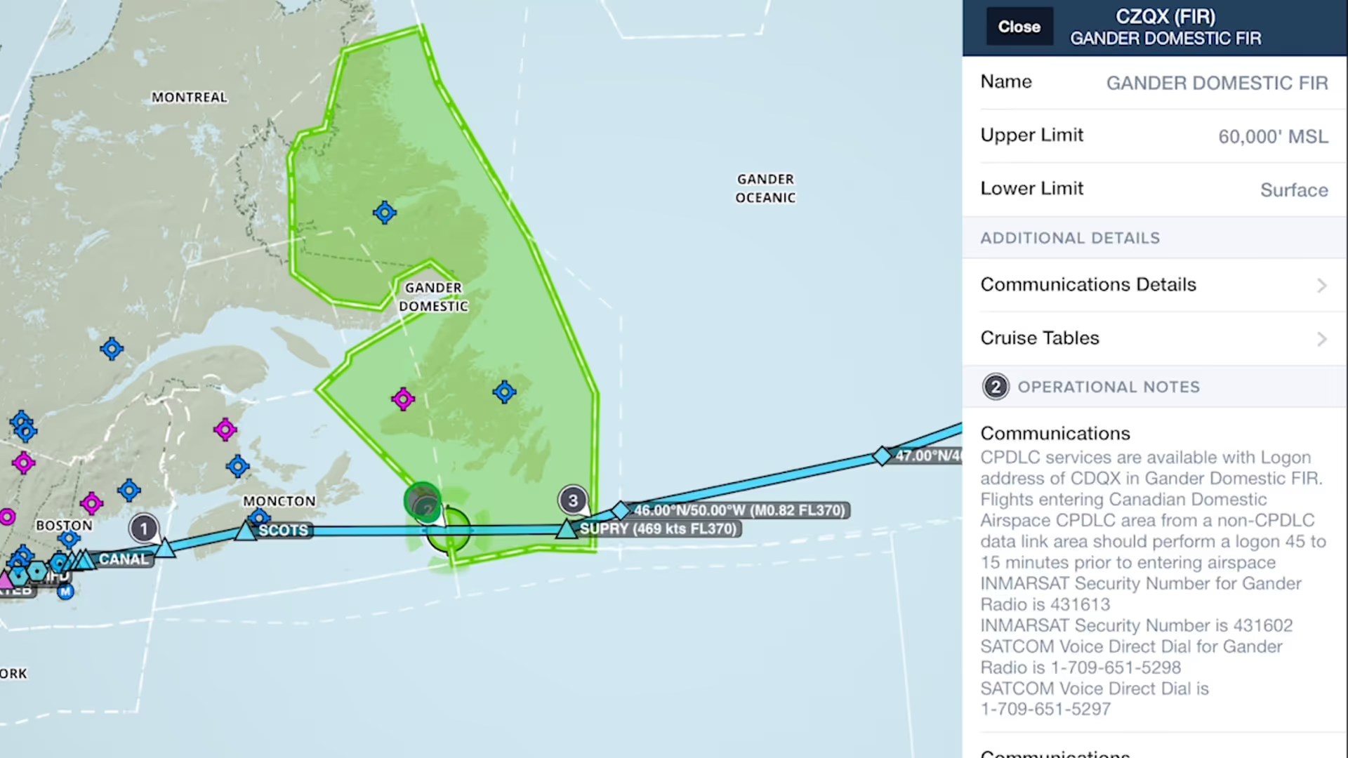
Easily find and review operational notes affecting your route from start to finish with Operational Note Flags
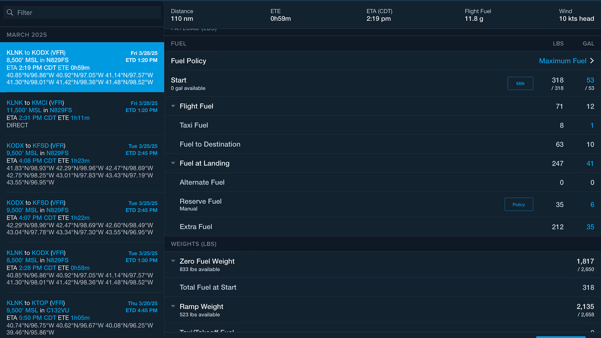
The Fuel Planning section on the Flights view makes it easier to switch between fuel policies and update target values for fast and accurate scenario planning.
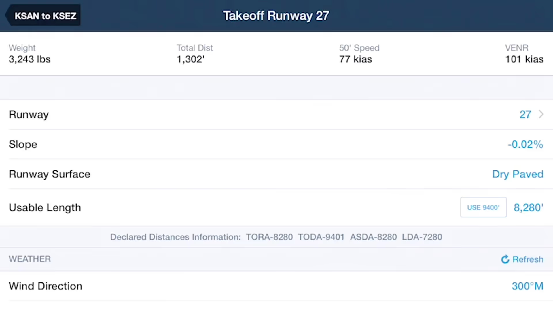
Takeoff and Landing Distances is a powerful flight planning capability that provides safety-enhancing runway performance calculations for supported piston aircraft in seconds.
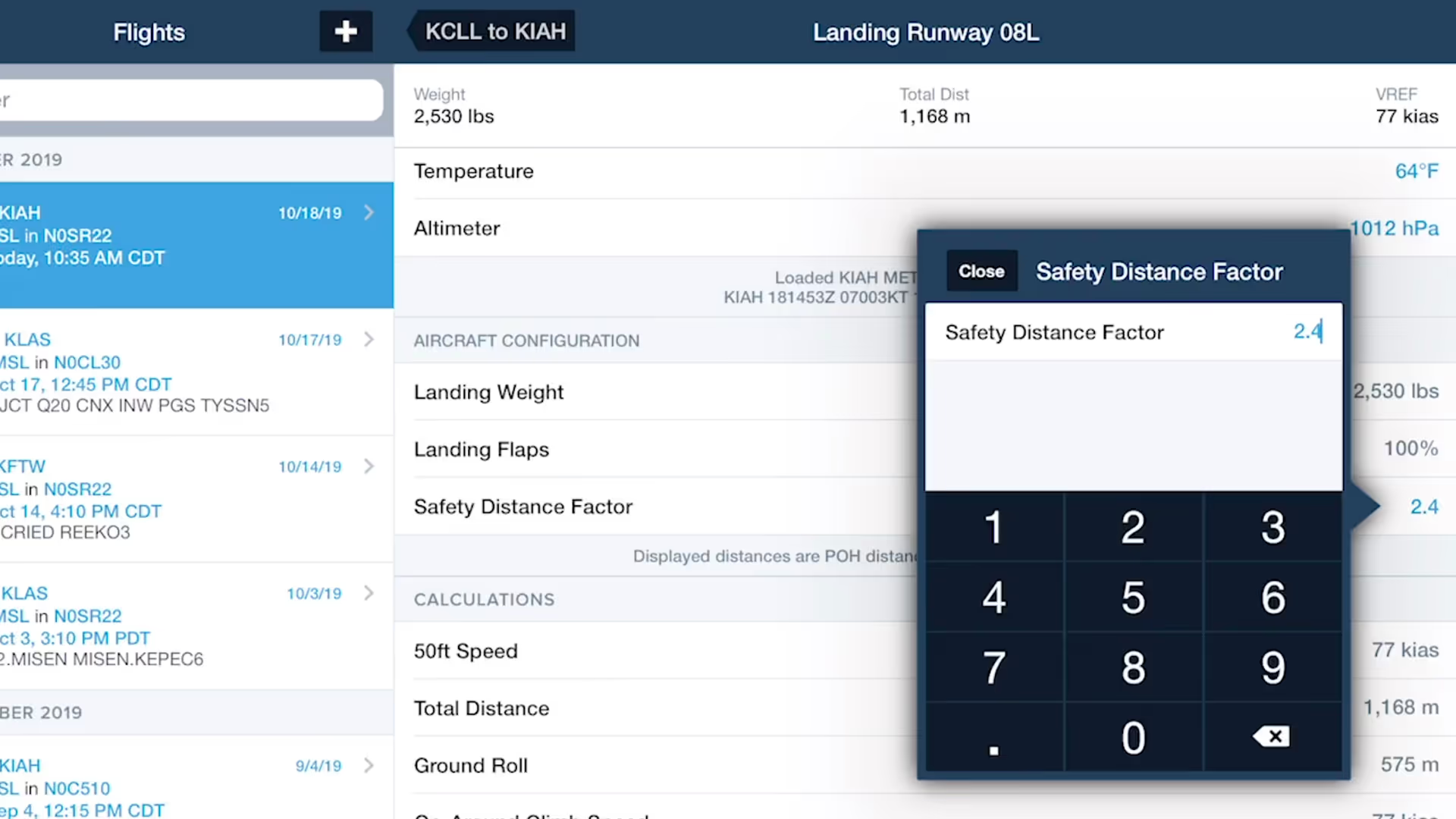
ForeFlight's TOLD feature for pistons allows you to specify a safety distance factor to produce more conservative runway performance calculations in response to runway conditions or other factors.
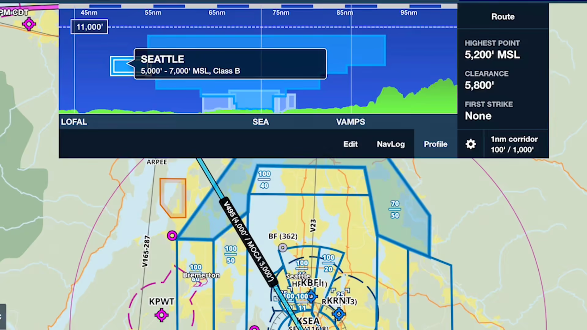
Profile view in ForeFlight now depicts airspace along your route, providing you with valuable information for flight planning and inflight use beyond terrain and obstacle avoidance.
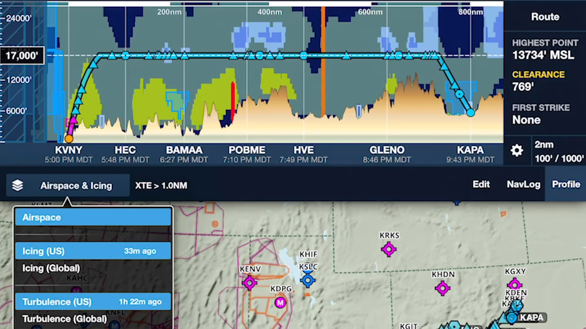
ForeFlight's Profile View includes selectable Icing and Turbulence forecast layers, providing a cross-section of weather in addition to terrain, obstacles, and airspace along your route.

Manually control Hazard Advisor’s altitude before a flight to find a minimum altitude route around terrain, then revert to Auto mode during a flight to lock Hazard Advisor to your actual altitude.
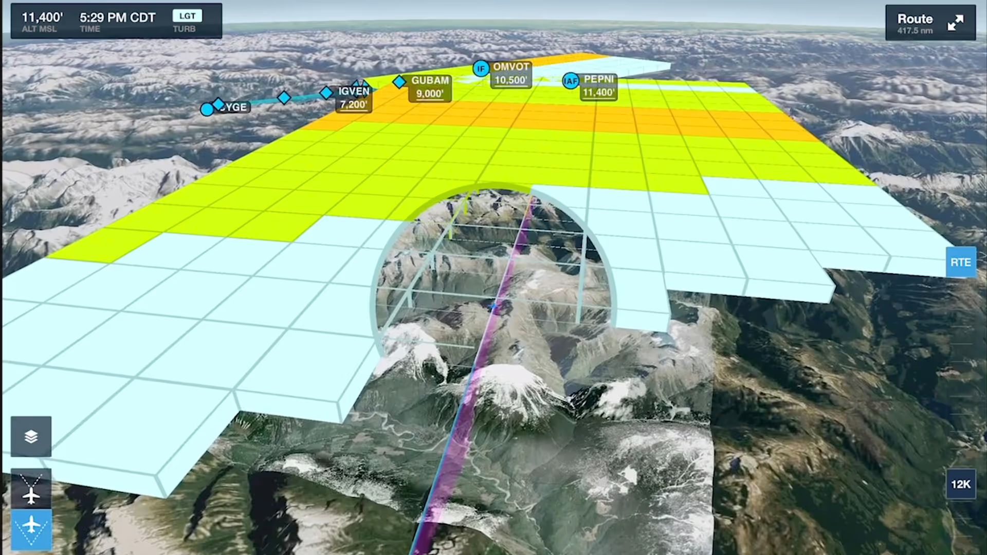
Enhance your preflight weather planning with interactive Icing and Turbulence forecast layers in 3D Preview, available with ForeFlight’s Performance Plus and Business Performance subscription plans.

Follow live approaches, landings, and takeoffs in 3D with FlightAware-sourced Internet Traffic in 3D Airports, available with Performance Plus and Business Performance subscription plans.
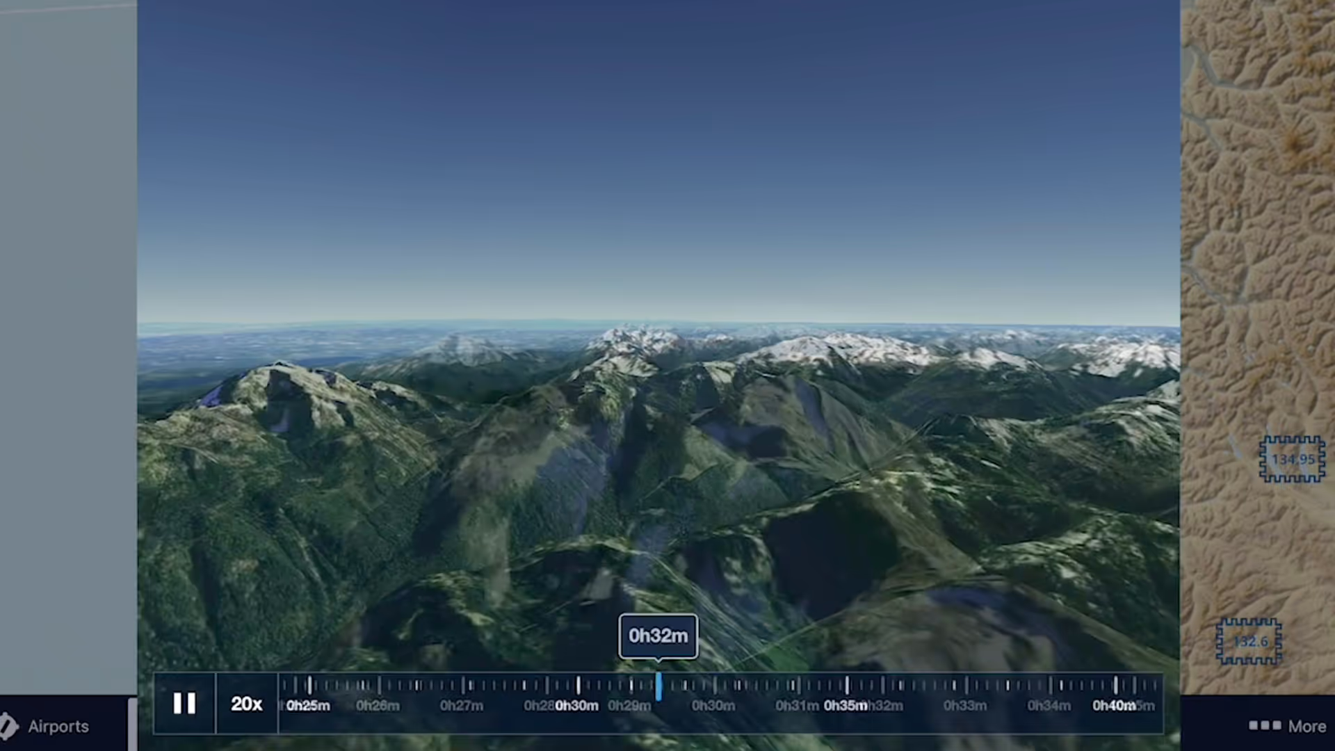
3D Review is a flight planning and debriefing capability that allows you to review planned and recorded flights with immersive 3D terrain and aerial imagery.

ForeFlight’s Documents view has an enhanced layout that makes it easier to find, download, and access documents.
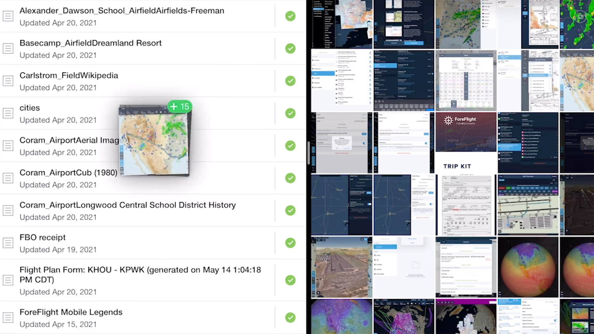
Easily import documents into ForeFlight and add them to custom binders using a dedicated Import button and flexible drag-n-drop gestures from other apps.
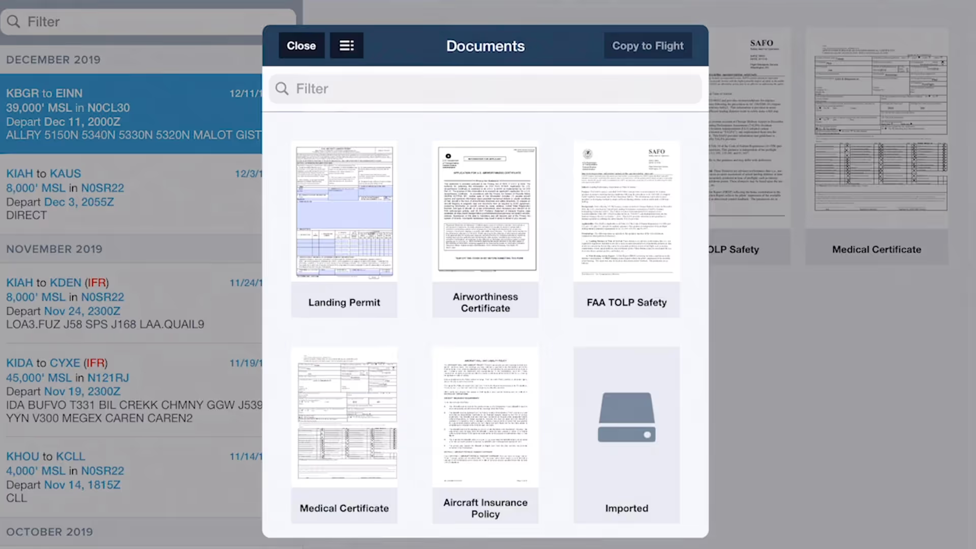
ForeFlight allows you to associate files, documents, and photos with flight plans using the Files in Flights feature, helping you keep important flight resources organized and easily accessible.
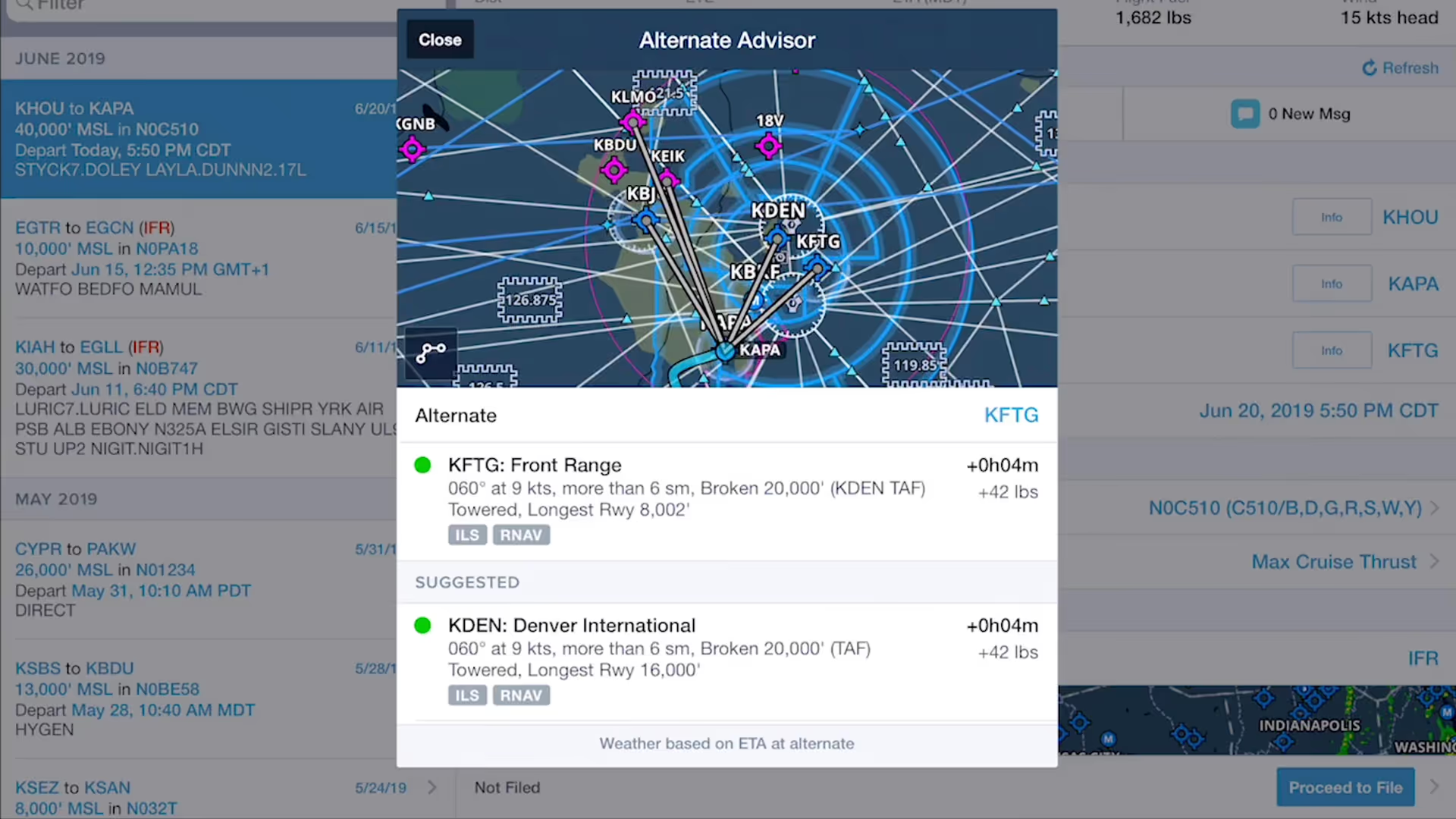
ForeFlight’s Alternate Advisor simplifies the process of choosing a good alternate airport by providing a list of suggestions to help you narrow your options.

ForeFlight now allows you to add a call sign to flight plans. Since most pilots don’t use call signs, the setting is disabled by default; you can enable it in More, Settings, File & Brief.
ForeFlight allows you to associate files, documents, and photos with flight plans using the Files in Flights feature, helping you keep important flight resources organized and easily accessible.
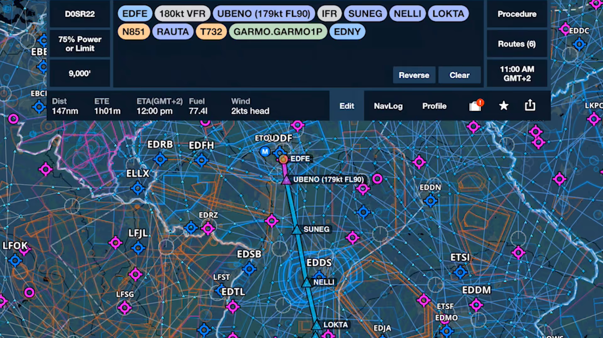
The last video in our Getting Started series for European subscribers shows how to plan a route on the Maps view and more.

Join Robert MacLeod and Tim Stahl, both members of ForeFlight’s specialized Flight Operations team, as they walk through the simple steps to set up and file US IFR flight plans in ForeFlight.

This webinar guides new ForeFlight users through a realistic VFR flight, highlighting core features like charts, fuel planning, waypoints, diversions, and enroute tools.
Join Robert MacLeod and Tim Stahl, both members of ForeFlight’s specialized Flight Operations team, as they walk through the simple steps to set up and file US IFR flight plans in ForeFlight.
This webinar guides new ForeFlight users through a realistic VFR flight, highlighting core features like charts, fuel planning, waypoints, diversions, and enroute tools.
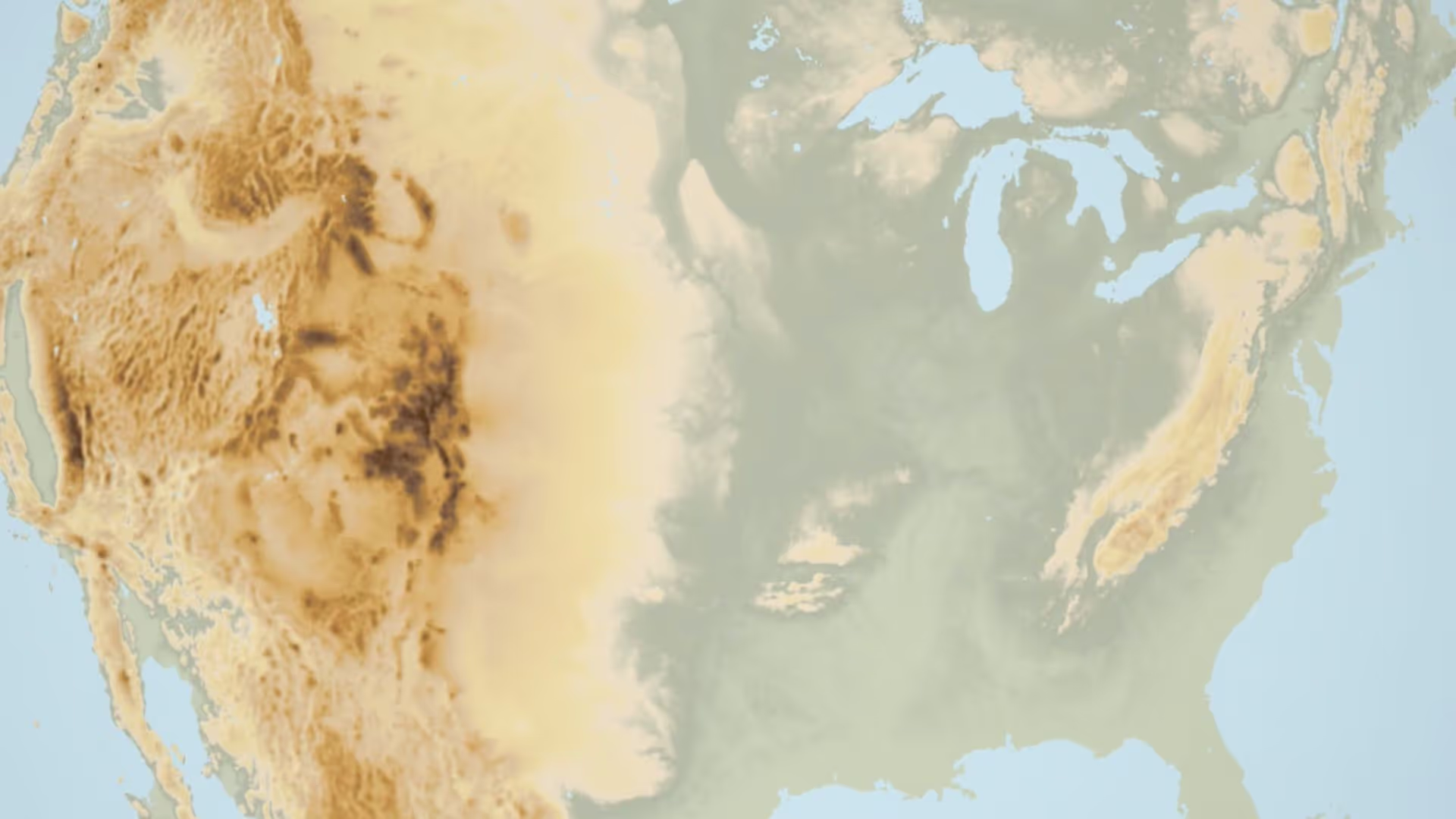
Having trouble finding the Terrain layer in ForeFlight 8? It just moved next door to the Map Settings menu. You can also recreate the World Map from the Map Settings menu by turning on Place Labels.